Jan 192023
 

January 2023

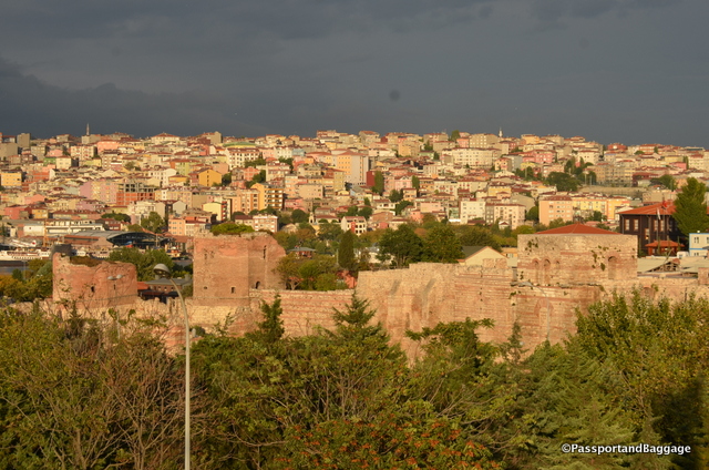
This post is just a placeholder for my memory.  I spent just a few days on this trip in Istanbul as my layover from Oman to home would have included ten hours in the Istanbul airport; I decided to drop in on one of my favorite cities in the world. A city I have visited many, many times and as often as I can.

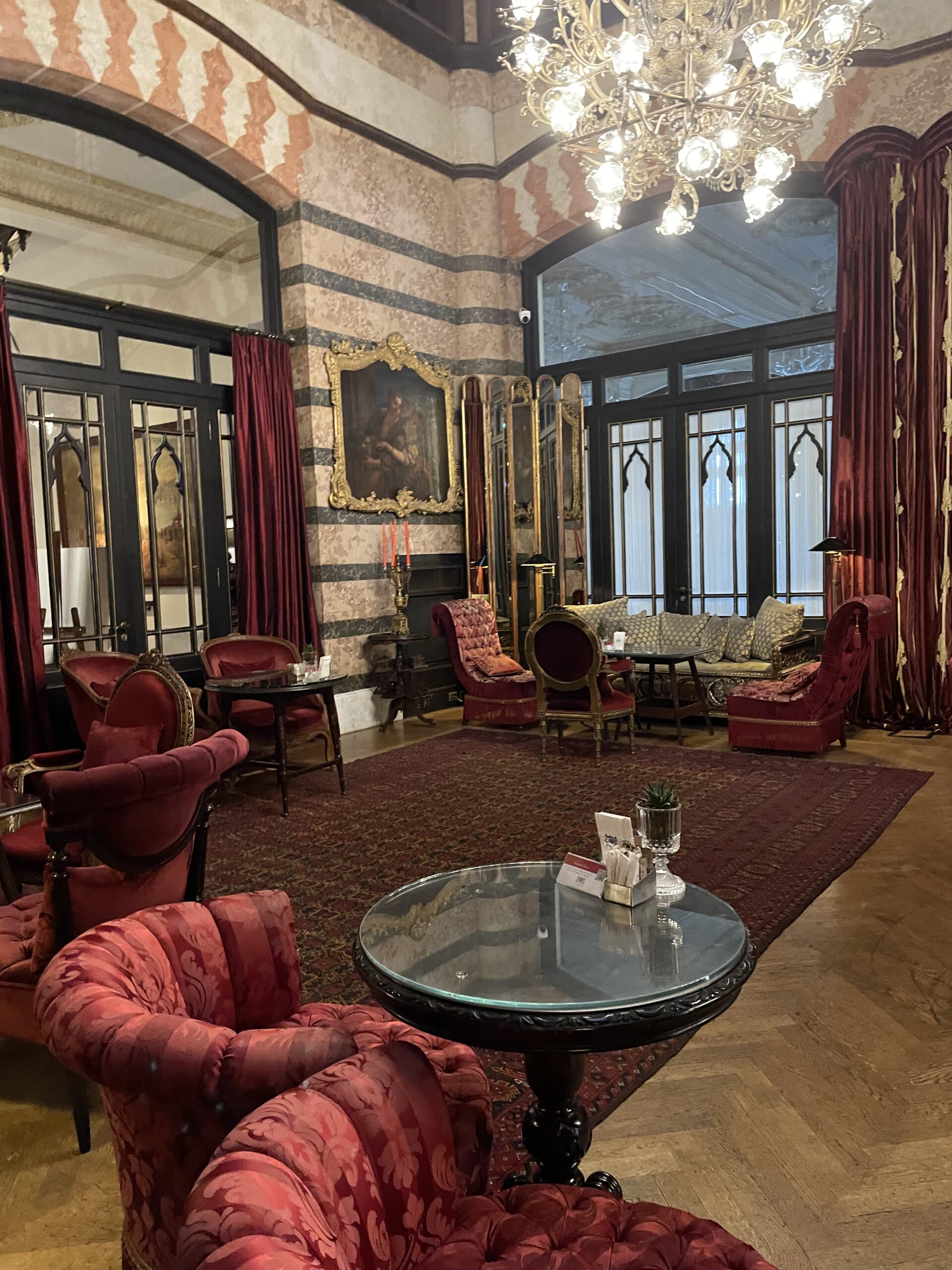
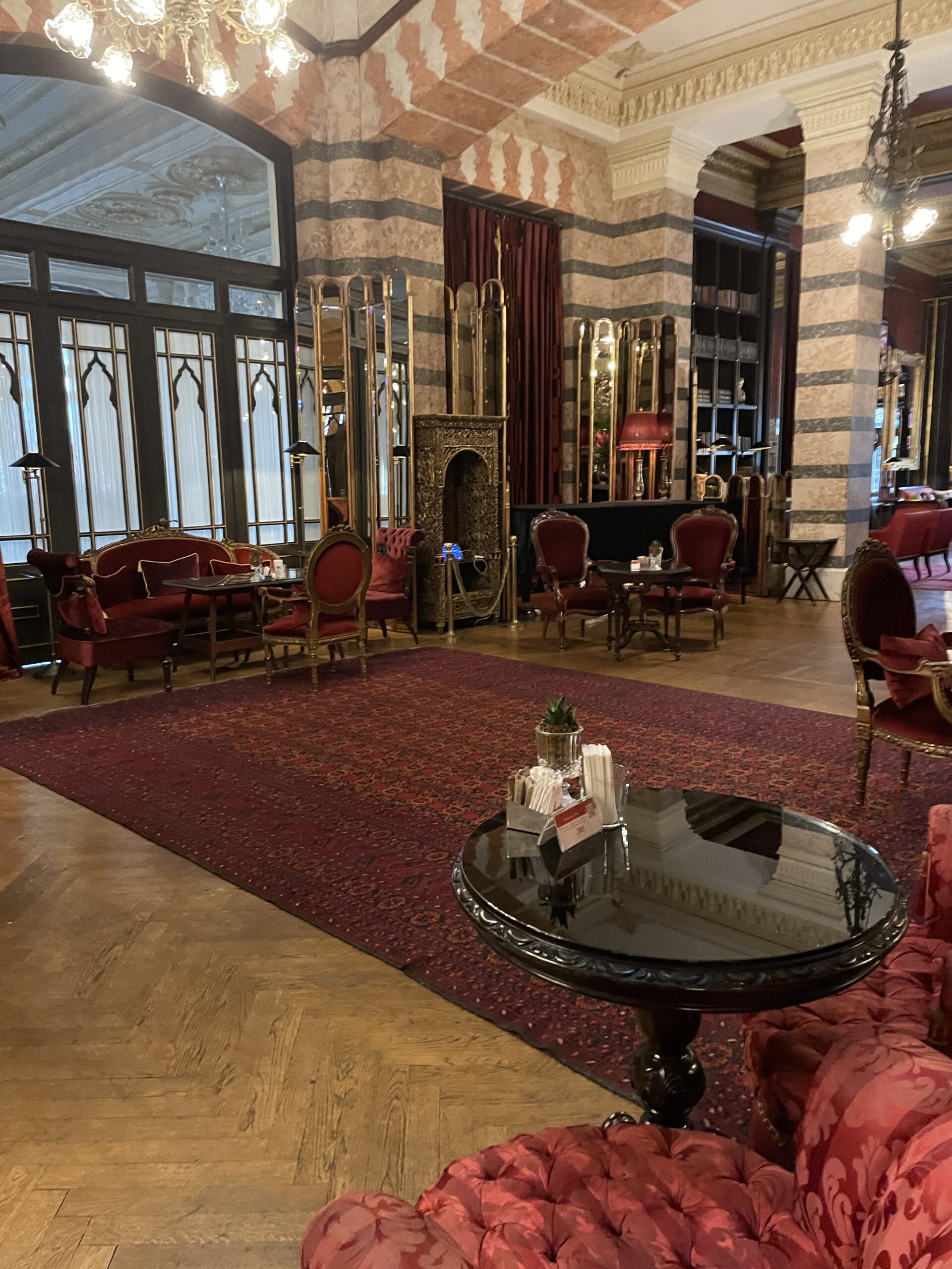
I decided to stay at the Pera Palace, although I was unaware of how famous it is.  Agatha Christie stayed in room 411 when writing  Murder on the Orient Express.  I only learned of the hotel while watching the Netflix show Midnight at the Pera Palace. It was built in 1892 and designed by Alexander Vallaury, a French-Ottoman architect,  to host the passengers of the Orient Express. It holds the title of “the oldest European hotel of Turkey”.

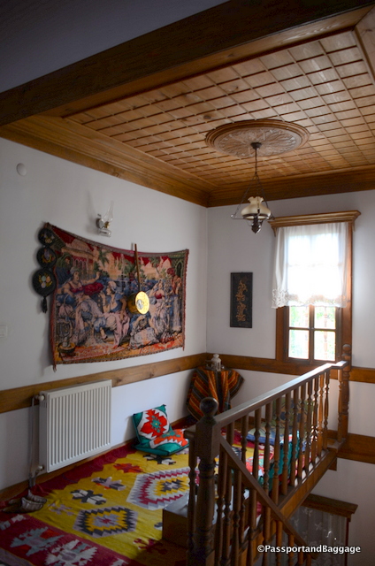
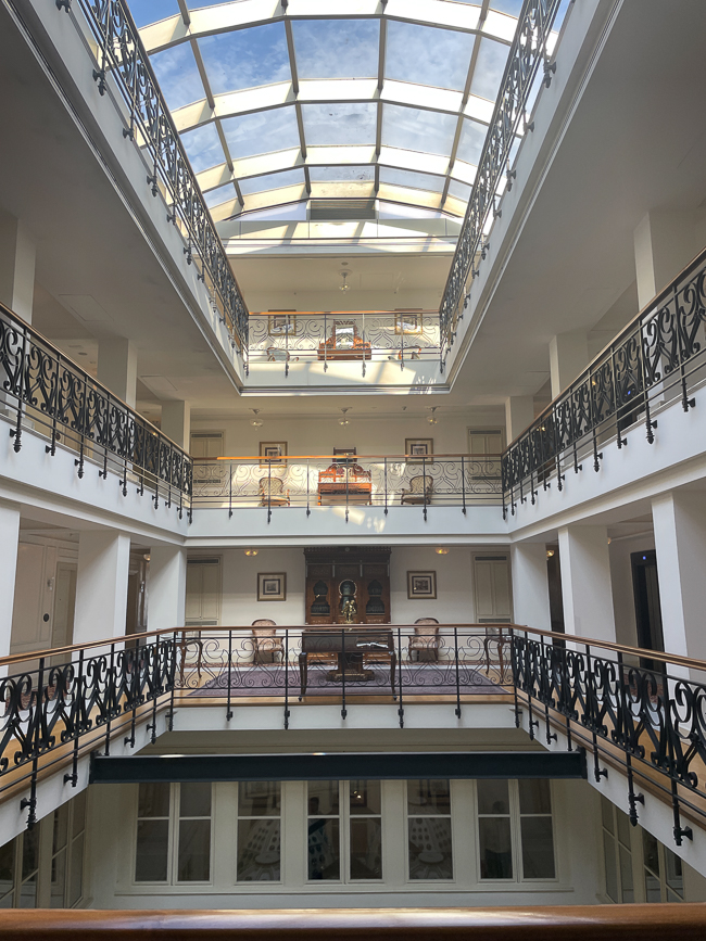
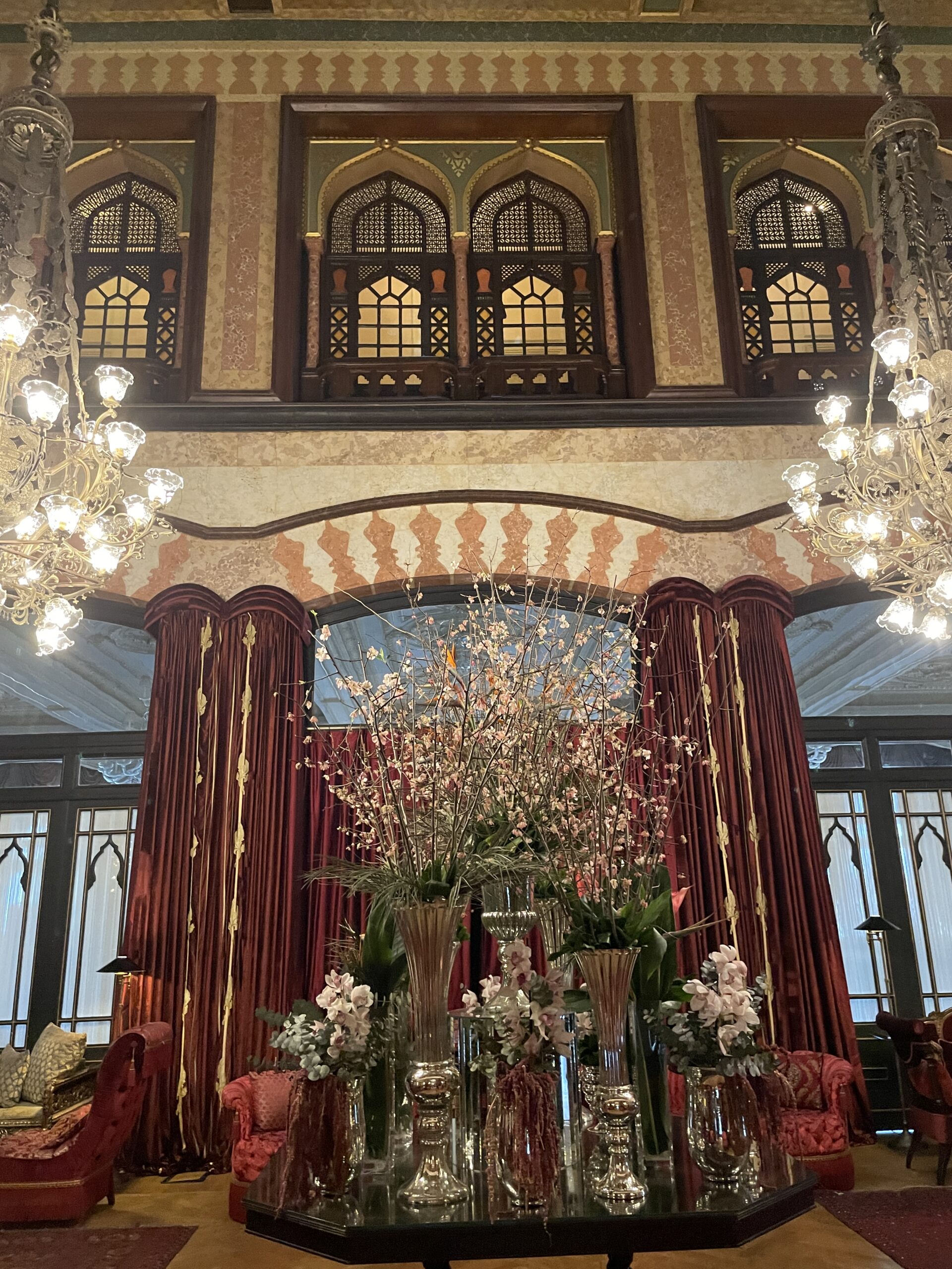
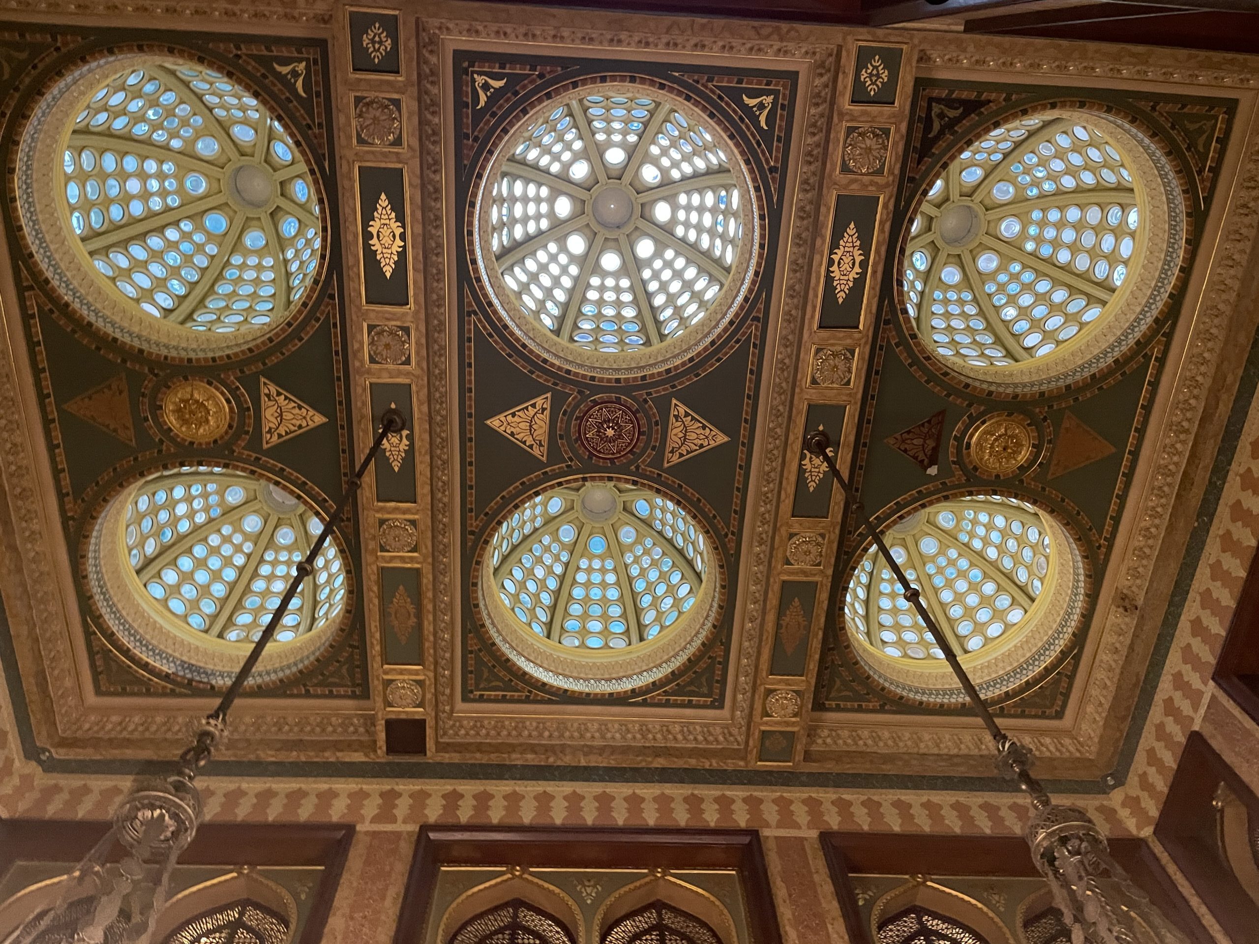
The Interior of the Pera Palace from the 4th floor

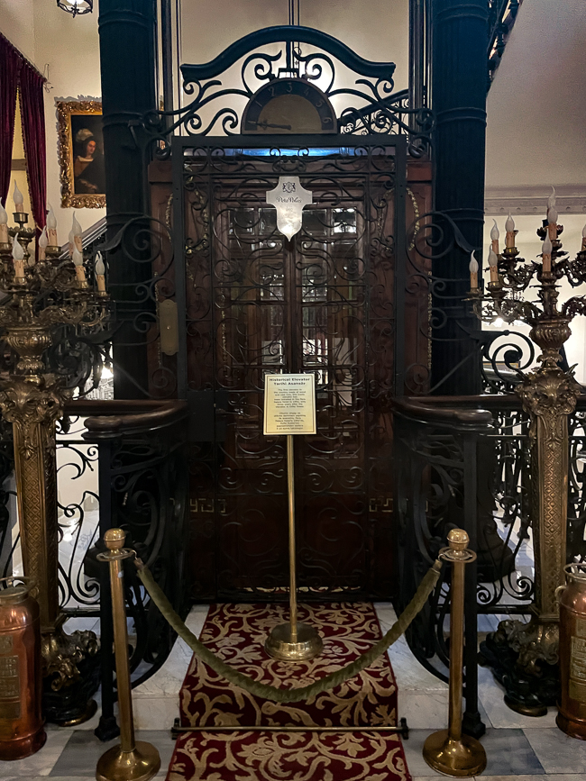
The hotel was the first building in the Ottoman Empire to be powered by electricity, other than the Imperial Palace. It was also the only address in the city to provide hot running water for its guests and was home to the first electric elevator in Constantinople and only the second electric elevator in Europe.

The original Pera Palace elevator


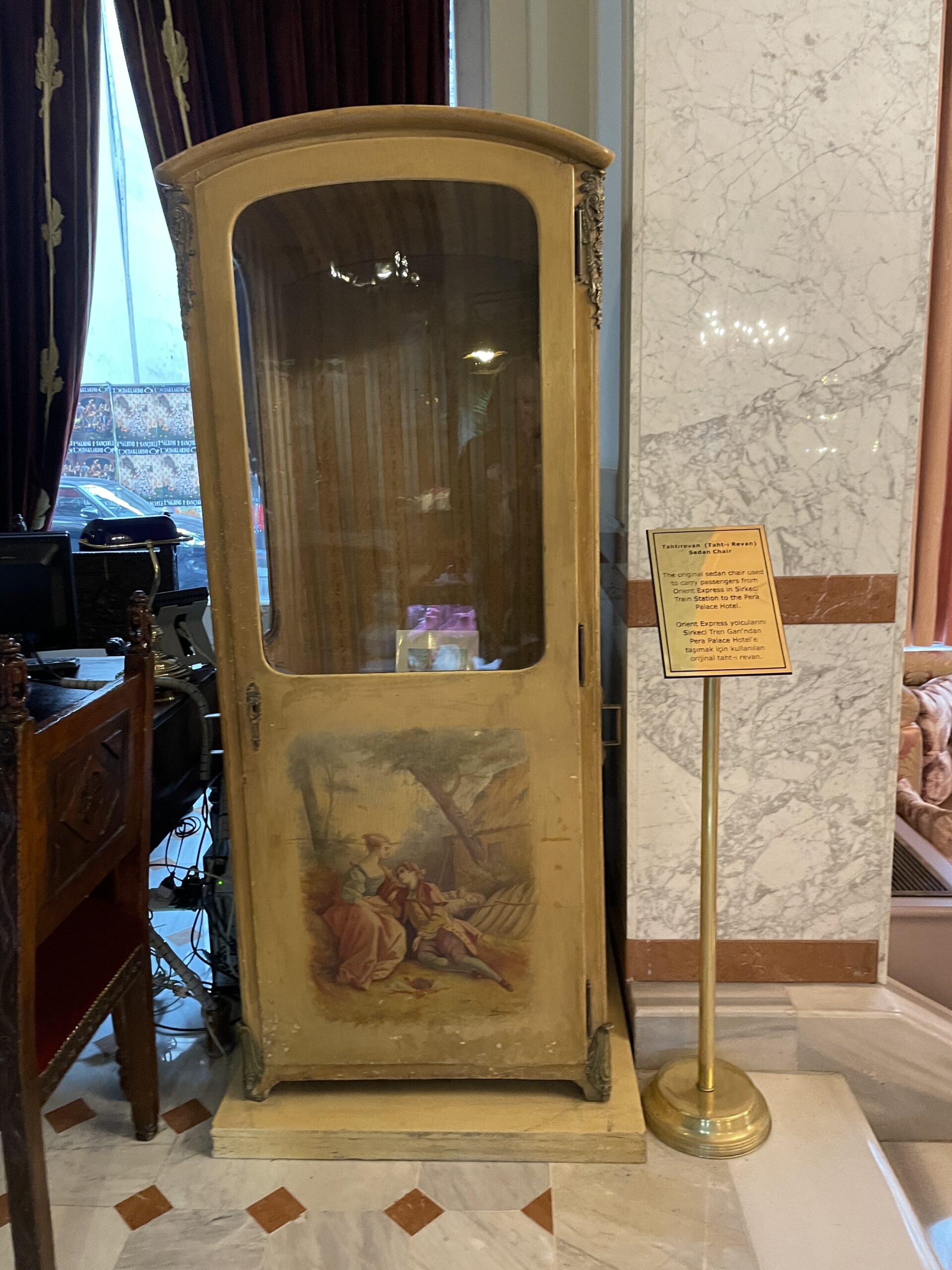
Sedan chair used to transport the guests from the Orient Express to the Pera Palace Hotel

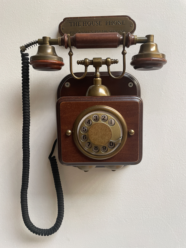
The house phone available in the hallway

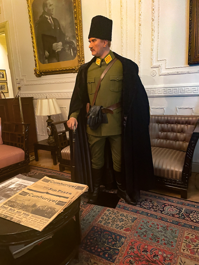
Room 101 is where Mustafa Kemal Atatürk, founder, and first president of the Republic of Turkey, stayed. The room is now a museum, marked with all the furniture and decorations from his 1917 stay.  It also includes some of his personal possessions, including the clock that stopped at the time of his death.  When I visited on a Wednesday, the museum was crowded.  I saw one German couple, and the rest were Turkish students.  The following morning, the museum was once again crowded with students.  I consider this a very good sign.  The history of Atatürk and Erdoğan being so divergent at this time.


I must admit I fell in love with the history of the Pera Palace Hotel.  The location, while once lovely, is now in a rather hectic part of town, and I am not sure it makes sense anymore to stay here, but I could feel the past with every step I took inside the hotel.

*
*

*

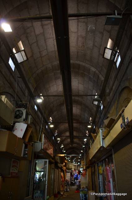
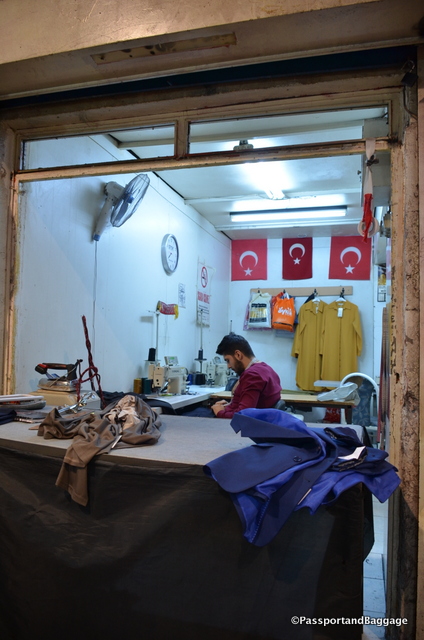
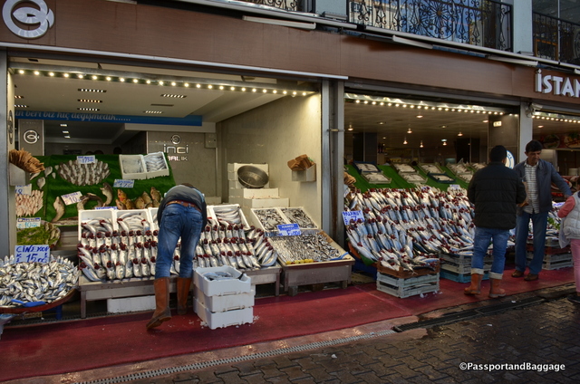
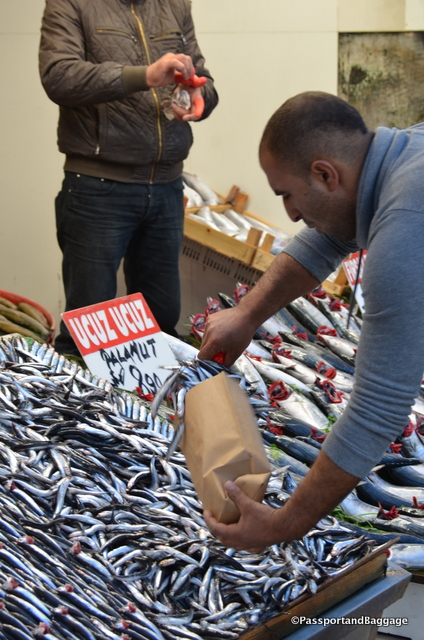
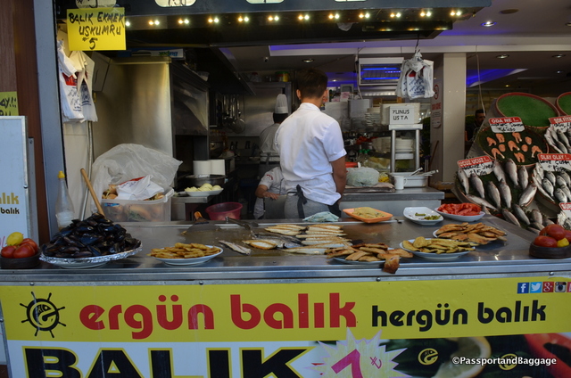
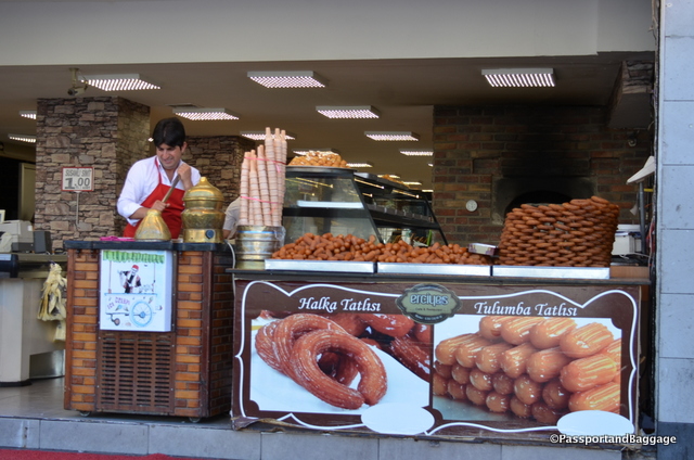
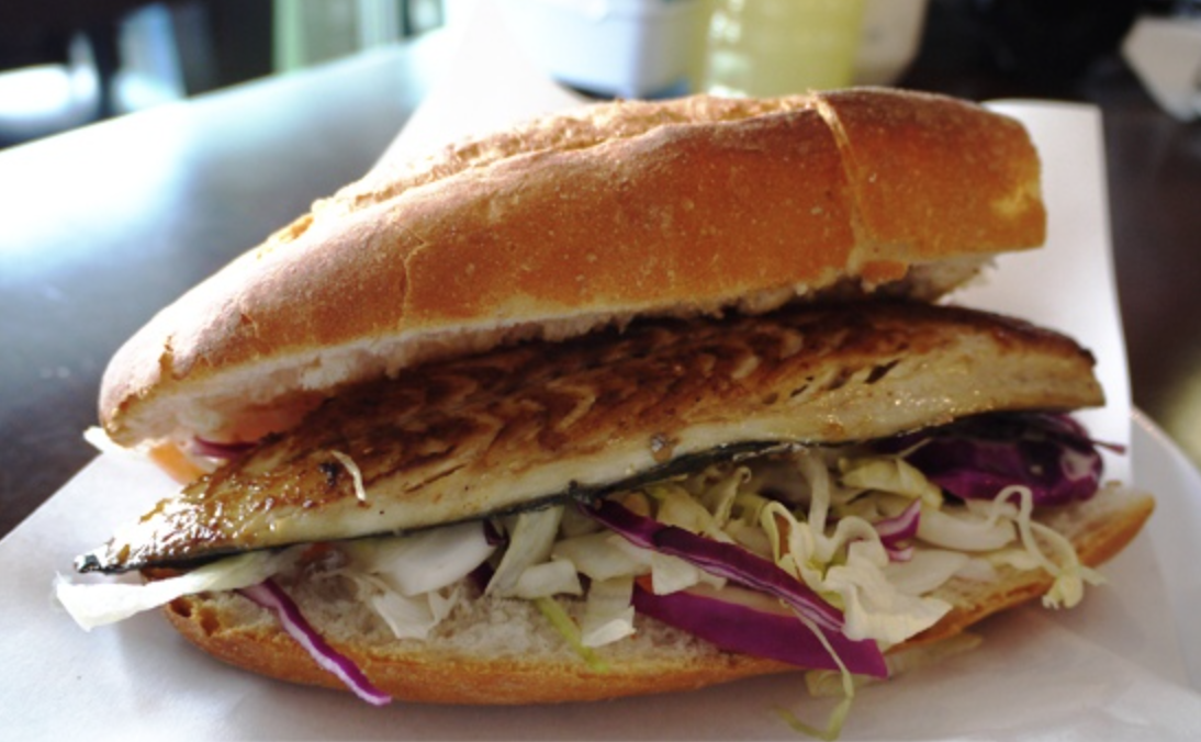
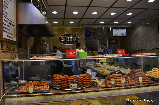
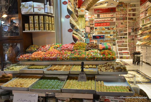
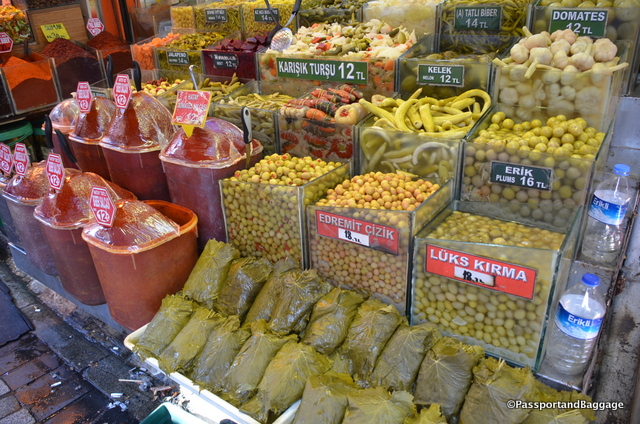
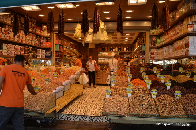
These few days are not so much about sightseeing as unwinding, eating too much lokma, dining on Balik Ekmek under the bridge, and wandering the market.

I snuck in a few other things along the way, however.

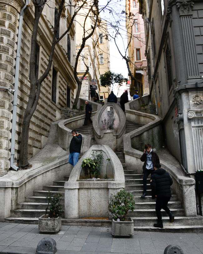
Camondo Stairs

The stairs connect Bankalar Caddesi, the street where all the banks and the Bourse used to be in the late Ottoman period, with Bereketzade Medresesi Sokak, one of the streets that leads straight to Galata Tower.

This staircase was built around 1870-1880 and was financed by Abraham Camondo, a  banker and Sephardic Jew (important because they were run out of Spain, and Constantinople was one of the few places they could find safety). The stairs were supposedly built to facilitate the transport of Camondo’s children to their school and as a shortcut for Camondo to reach Bankalar Caddesi quickly. The hexagonal shape of the staircase was supposedly designed in this way so that if one of the children were to slip, the curved banister would prevent them from falling further.

Flora Hani

Flora Hani

I first visited Istanbul with my late husband in the 1990s.  We walked İstiklal Avenue, historically known as the Grand Avenue of Pera, and took oodles of pictures of the lovely art deco and art nouveau buildings. Buildings that were loaded with quality crafts from Istanbul.  In walking Istiklal today, it is filled with nothing but international name-brand stores and “stuff”.

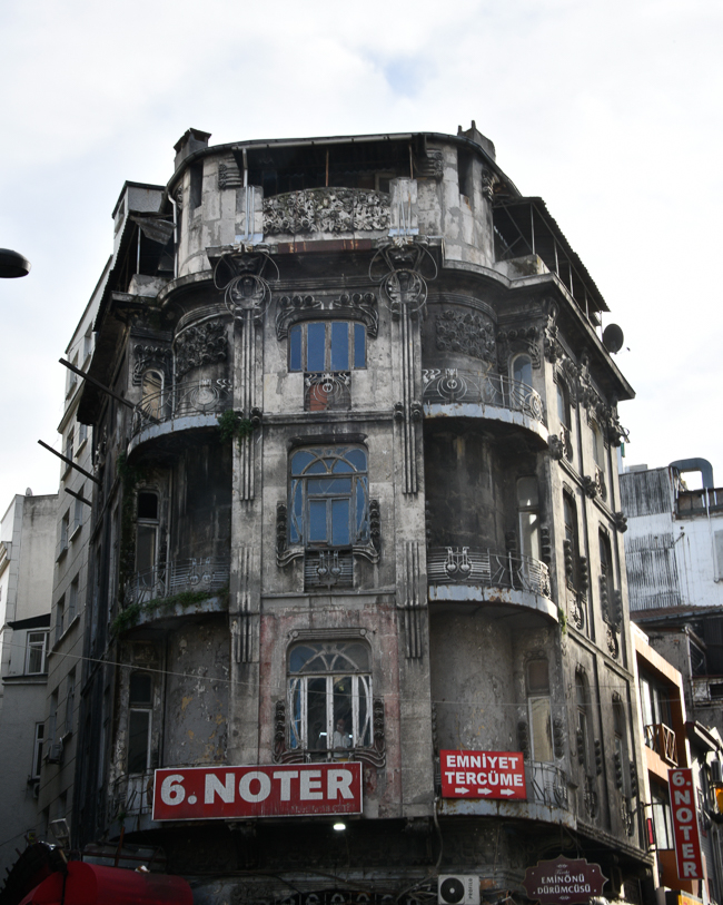
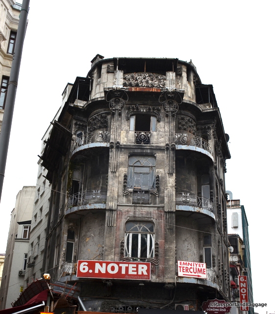
On the other side of the Golden Horn lies this sad creature. Flora Han was built at the beginning of the 20th century to house offices. Its architecture highlights the western influences that crept into the city at a time when the Ottoman court was enthralled with the Art Nouveau styles spreading throughout European cultures. Many of the buildings of this era are the work of Italian architect Raimondo D’Aronco.

Museum of Innocence

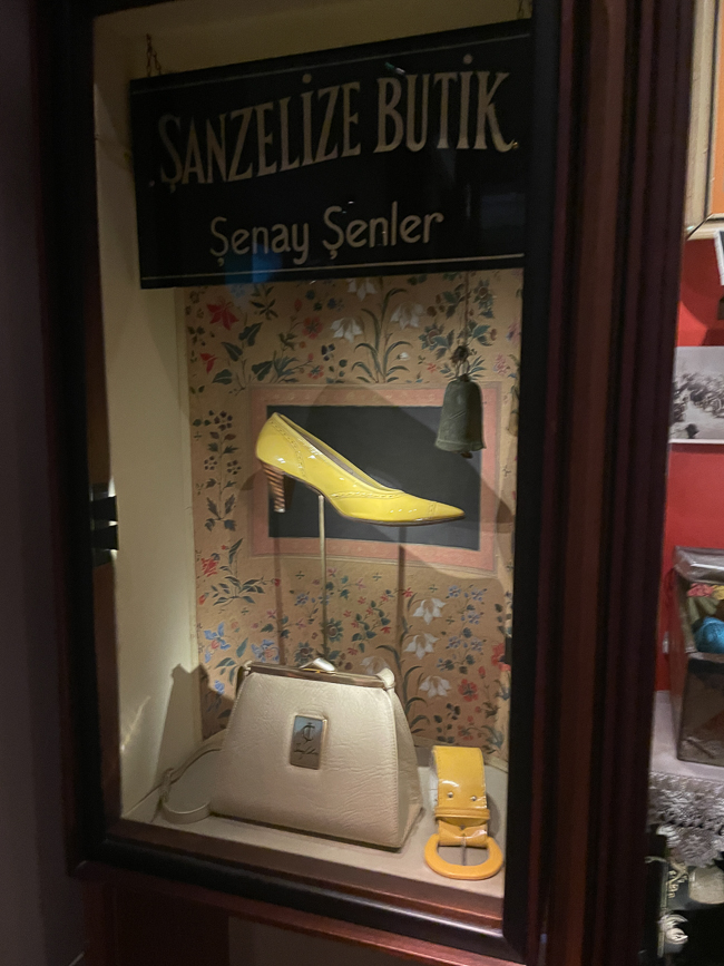
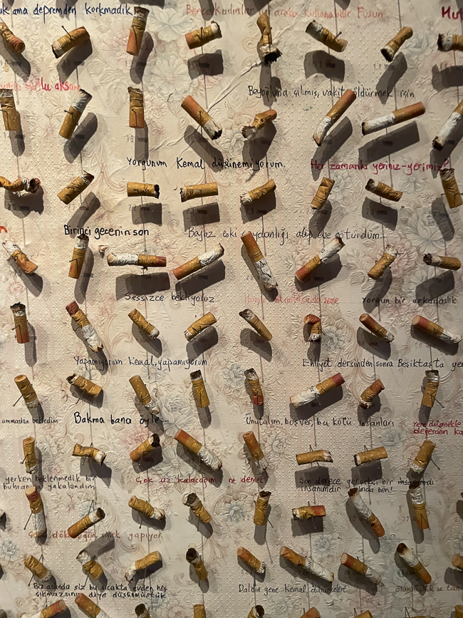
Six years ago, when I was here, I didn’t find the need to visit the Museum of Innocence.  I had read Orhan Pamuk’s book of the same name and, like all of his books I have read, I was mystified by it and why he would create a museum at the same time as writing the book.  This time it was only a few blocks away from my hotel, so I went, and I am glad I did. I was rather intrigued that the museum was very busy, and I am sure I was the only non-Turk visiting. Here are a few pictures that absolutely brought the book back to me.

* *

The rest of my wanderings.

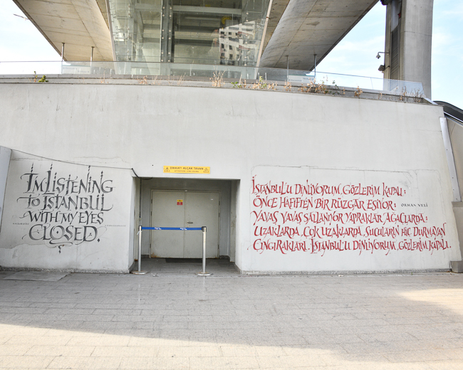
A poem under the Golden Horn Metro Bridge

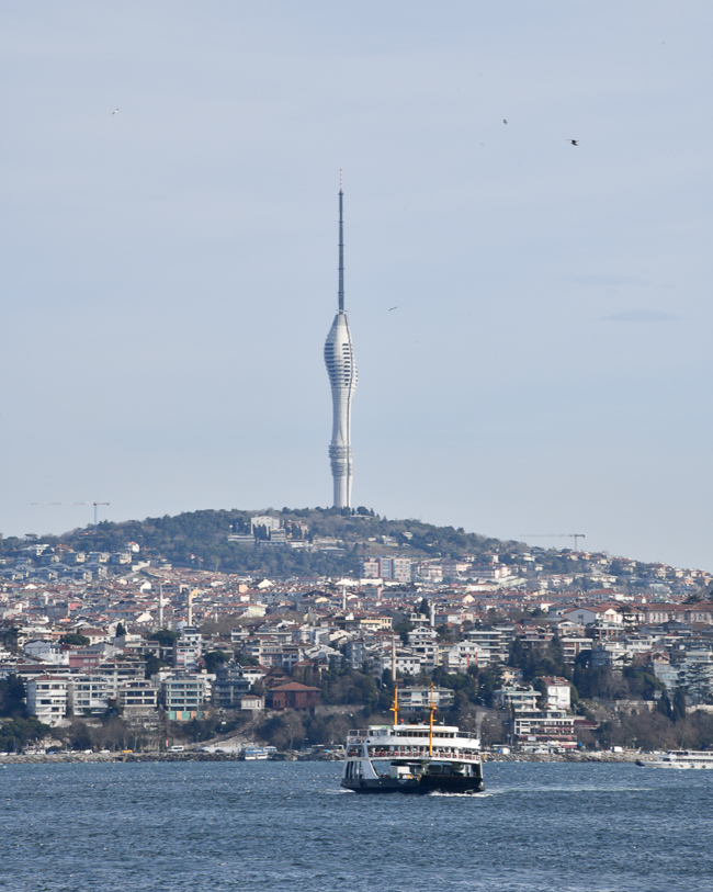
A new communications tower installed in 2021 is now the tallest building in Istanbul.

Designed by the Turkish firm Melike Altinisik Architects. The new communications tower features restaurants, exhibition spaces, meeting areas, a panoramic elevator, and a two-story observation deck looking out over the Bosphorus Strait.

So much of my heart resides in this city, but its overwhelming growth is sucking it dry.  The streets are so crowded with cars that they do not move, incessant honking being the music of the city.  You will never get me to say anything bad about Istanbul, but its growing pains hurt me to watch.

Oct 162016
 

October 15, 2016

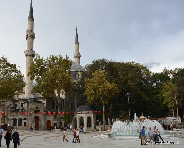
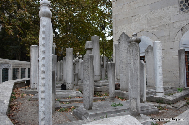
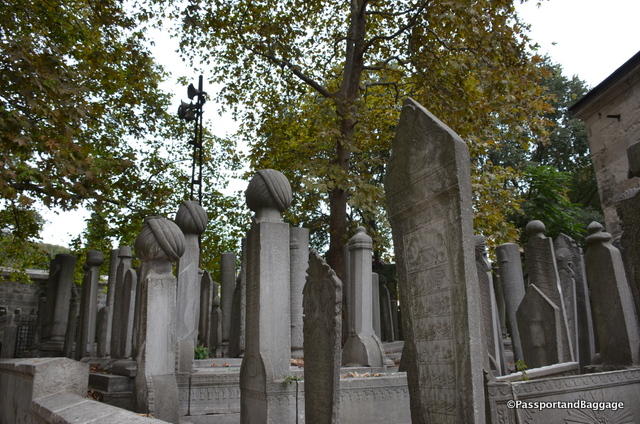
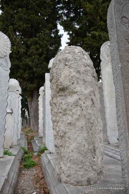
A boat ride up the Golden Horn is worth the trip if you have the time. I have already written about the Eyüp Sultan Mosque and the fascinating gravestones that surround the mosque. A trip to the Pierre Loti Café can be incorporated into the same visit if you plan ahead, if not, a trip to the Pierre Loti Café just for the view is also worth the trip.

Golden Horn of IstanbulIf you are staying in the Sultanahmet you can catch a ferry from Eminönü to Eyüp but if this is your plan, ask someone for very, very specific directions to the Eminönü Ferry landing, it is hidden in an out of the way spot near the bus station.

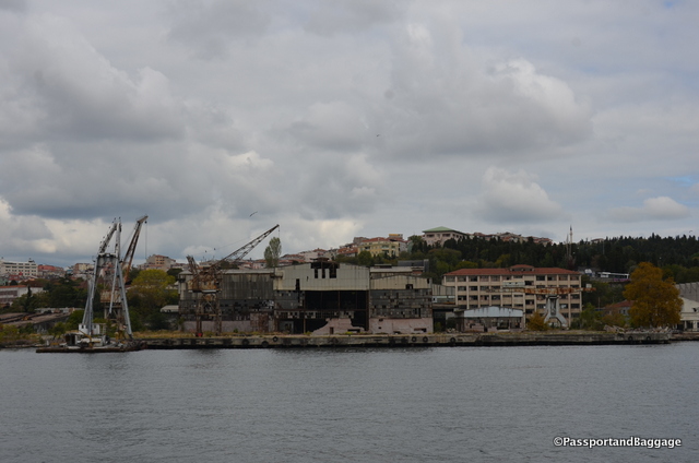
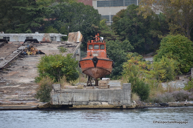
You can see the remnants of the industry that once lined the area.

You can see the remnants of the industry that once lined the area.

The Golden Horn, or Haliç in Turkish, is a horn-shaped fiord fed by two small streams. It is a natural harbor where the Byzantine and Ottoman fleets once anchored.

During the Byzantine period, the entrance was blocked by a huge chain to stop unwanted ships from entering.

At the beginning of 16th century Leonardo da Vinci designed a bridge to be built over the Golden Horn for the sultan, alas it was never built.

Golden HornIn the first half of 18th century the Golden Horn was famous for its tulip gardens where the upper crust came to enjoy the flowers, row their boats, and watch the sunset.

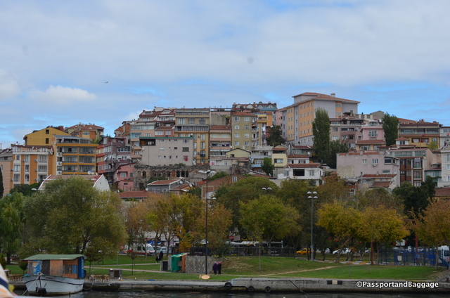
Parks have sprung up along the Golden Horn underneath the sprawling neighborhoods of Istanbul

Parks have sprung up along the Golden Horn underneath the sprawling neighborhoods of Istanbul

With the population explosion in the 1950s, it became an industrial area with industrial waste and serious sewage problems. The 1980s brought clean-up programs and, as one can see, the area is a delightful place to enjoy a boat ride or hop off and enjoy the neighborhoods.

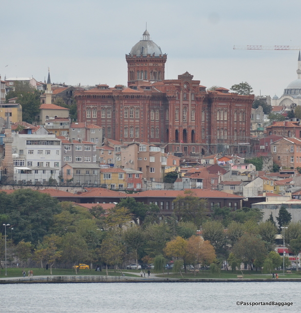
The Red Castle

Phanar Greek College

A structure that you will pass high on the hill is the Phanar Greek Orthodox College the oldest surviving and most prestigious Greek Orthodox school in Istanbul, Turkey. The school, like all minority schools in Turkey at present, is a secular school.

Established in 1454 by Thessalonian Matthaios Kamariotis, the locals call it  The Red Castle or The Red School.

Designed by the Ottoman Greek architect Konstantinos Dimadis, the building was erected between 1881 and 1883 with an eclectic mix of different styles. The large dome at the top of the building is used as an observatory for astronomy classes and has a large antique telescope inside.

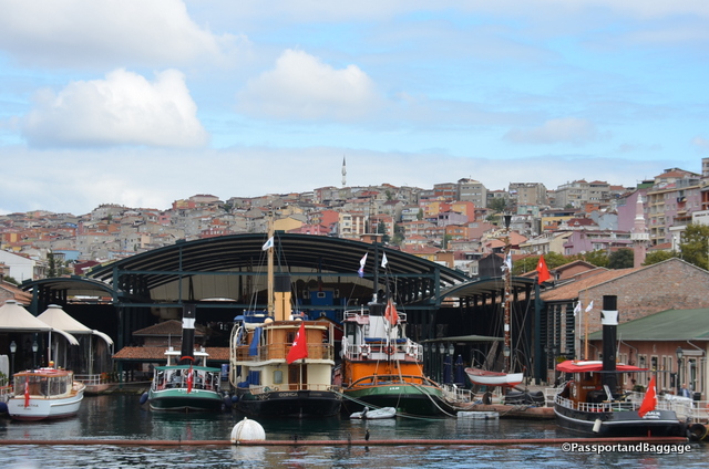
You pass by the Rahmi M. Koç Industrial Museum A typical industry museum showcasing items such as a submarine, classic cars, railway carriages, an out-of-service Bosphorus ferry and a Douglas DC-3 aircraft as well as a re-creation of an old Ottoman cityscape.

Another area you pass is the Rahmi M. Koç Industrial Museum. A typical industry museum showcasing items such as a submarine, classic cars, railway carriages, an out-of-service Bosphorus ferry, and a Douglas DC-3 aircraft as well as a re-creation of an old Ottoman cityscape.

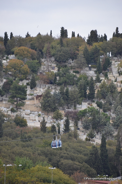
Tram to Eyup Istanbul

The white between the trees are tombstones from the extremely large cemetery of Eyüp Sultan Mosque

When you get off at Eyüp walk just a little way to the bottom of the tram that takes you up to the Pierre Loti Café, for the cost of one transit token.

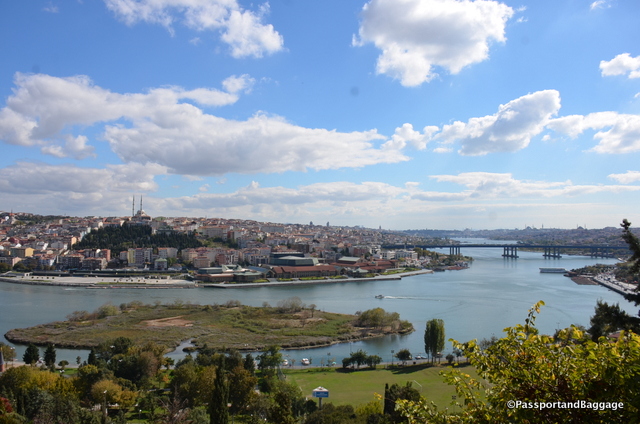
The ride up is not all that spectacular as the glass in the tram bubbles is not real clear, but once you are at the top, you get a wonderful view of the Golden Horn running through the immense city of Istanbul.

You can either ride the tram back down, or you can walk down to the Eyüp Sultan Mosque past many of the newer gravestones.

View from the Tea House

View from the Tea House

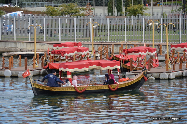
Water taxis abound in Istanbul, for some reasons the ones at Eyup look like Venitian Gondolas

Water taxis abound in Istanbul, for some reasons the ones at Eyüp  look like Venetian Gondolas

Make sure you take the time to have tea at the café, it fits importantly into one of the great myths of Istanbul.

The teahouse is dedicated to French naval officer and novelist Pierre Loti. According to legend during Loti’s stay in Istanbul in 1876, he gazed from this exact location in search of inspiration for his first masterpiece, Aziyadé.

Aziyadé and Le Mariage de Loti were both published anonymously, but their huge success in France propelled Pierre Loti into fame.

Aziyadé is semi-autobiographical, based on a diary Loti kept during a 3-month period as a French Naval officer in Greece and İstanbul in the fall and winter of 1876. It tells the story of the 27-year-old Loti’s illicit love affair with an 18-year-old “Circassian” harem girl named Aziyadé. Although Aziyadé was one of many conquests in the exotic romantic’s life, she was his greatest love, he would wear a gold ring with her name on it for the rest of his life. Forming a love triangle, the book also describes Loti’s “friendship” with a Spanish man servant named Samuel, for which most critics believe, based on Loti’s diary entries, was some sort of homosexual affair. Importantly it also describes Loti’s love affair with Turkish culture which became a central part of his “exotica” persona.

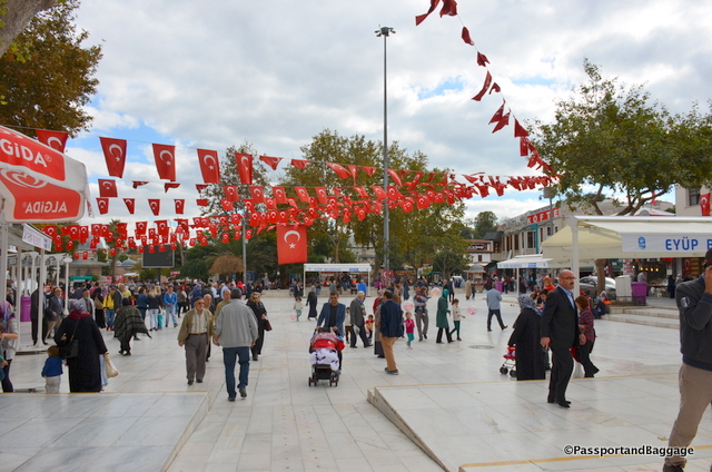
This visit to the mosque was on a Saturday, and the area was very crowded. It makes for a fun and interesting scene for people watching.

Walking the plaza in front of the mosque

Walking the plaza in front of the mosque

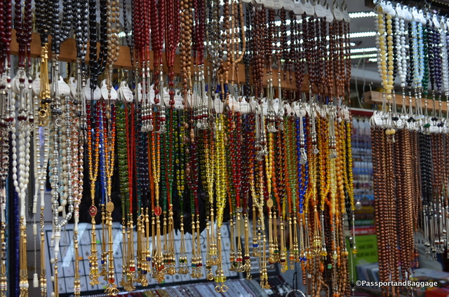
You can buy anything from prayer beads to ice cream

You can buy anything from prayer beads to ice cream

After taking the ferry back, strolling the busy streets of Istanbul on Saturday can be a thrill unto itself.

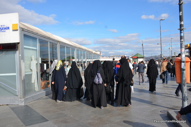
Walking along the waterfront

Walking along the waterfront

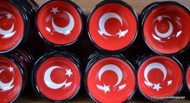
Finding trinkets wherever you go

Finding trinkets wherever you go


Oct 152016
 

October 14, 2016

There are so many places to explore in a city that covers almost 600 square miles with a population of over 14 million people.

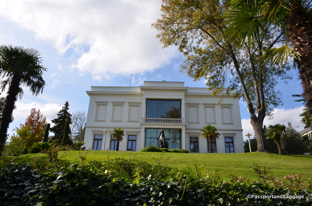
sabanci museum Istanbul One that is worth venturing out for is the Sakip Sabanci Museum. The museum’s permanent collection of the Arts of Calligraphy is comprehensive and stunning. It is comparable and in my opinion slightly superior, to the Calligraphy Museum in Sultanhamet.  Located about 30 minutes by public transportation from the Sultanahmet area of Istanbul, it can be a trek but is worth every moment.

horseIn 1925, Prince Mehmed Ali Hasan of the Hidiv family of Egypt commissioned the Italian architect Edouard De Nari to build the villa, now the museum’s main building, as a family summer house.

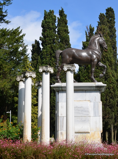
The mansion was purchased in 1951 by industrialist Hacı Ömer Sabancı from the Hidiv family to also be used as a summer residence, at that time it came to be known as Atlı Köşk, “The Mansion with the Horse”, because of the statue of a horse that was installed in the garden; the statue is the 1864 work of the French sculptor Louis Doumas.

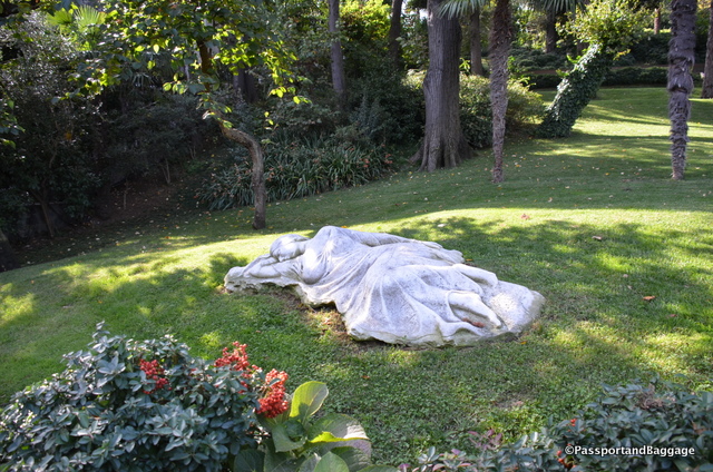
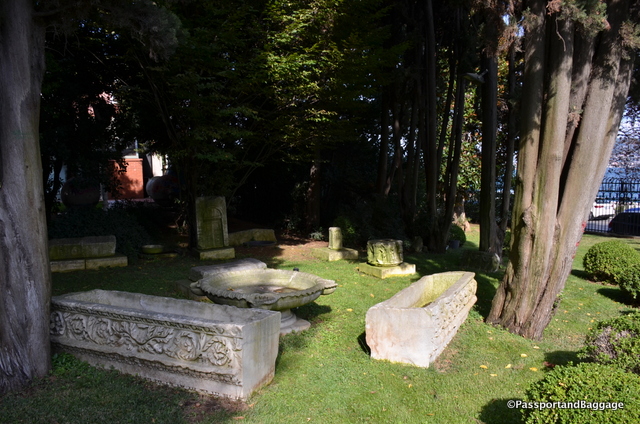
The gardens of the museum are scattered with old ruins.

The gardens of the museum are scattered with old ruins.

sabaci museum istanbul

Do not go to the museum without planning on dining. In the museum is Changa, an award-winning restaurant that is worth seeking out for the food, and then it is accompanied by a view of the Bosphorus to make your day perfect.

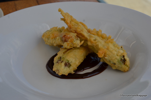
Squash flowers stuffed with a piquant Lado cheese

Squash flowers stuffed with a piquant Lor cheese pine nuts and basil, sitting on a spoonful of Hoisin Sauce

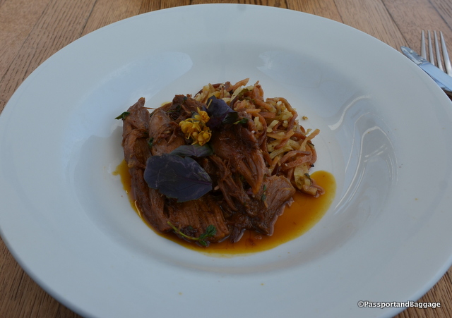
Lamb braised to perfection with home made noodles

Lamb braised to perfection with home made noodles

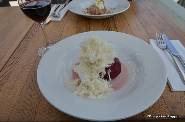
Chili infused poach pears with mastic ice cream and Pişmaniye

Chili infused poach pears with mastic ice cream and Pişmaniye

The view from our table at Changa

The view from our table at Changa

A stroll along the water is a must after such a meal.

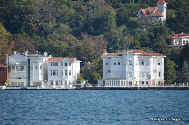
Walking the Bosphorus *Walking the BosphorusYou can view the yali that lines both sides of the Bosphorus. Yali literally means “seashore, beach” and is a house or mansion constructed at the immediate waterside, almost exclusively on the Bosphorus. These were usually built as second homes.

Most date from the 19th century and are finely worked wood construction. The Yali of today are some of the most expensive homes in Istanbul, and a few are listed as the most expensive homes in the world.

An unrestored Yali on the Asian side

An unrestored Yali on the Asian side

Yali

Looking across the Bosphorus to the Yali on the Asian side

Looking across the Bosphorus to the Yali on the Asian side

dsc_8564 *dsc_8557

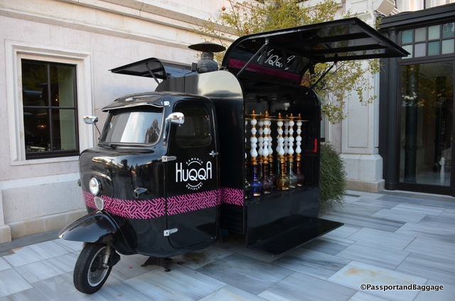
Stop in at one of the four most famous hotels along the Bosphorus for a waterfront cocktail. This fun cart is at the Four Seasons

Stop in at one of the four most famous hotels along the Bosphorus for a waterfront cocktail. This fun cart is at the Four Seasons

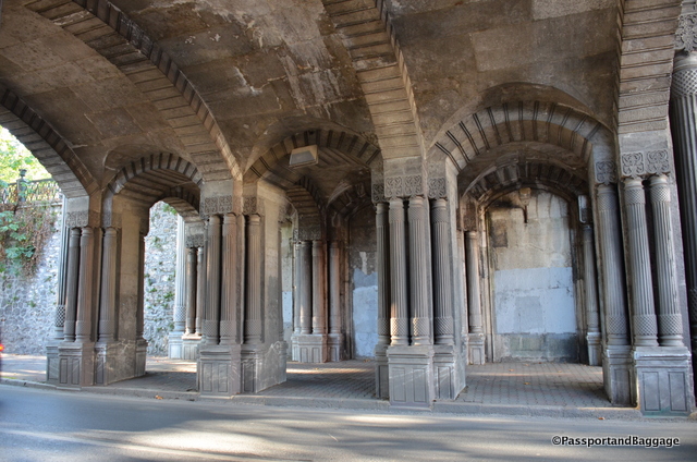
Now an underpass at one time this was part of Çırağan, once an Imperial Ottoman Palace, now the Çırağan Palace Kempinski Hotel

Now an underpass at one time this was part of an Imperial Ottoman Palace, The Çırağan, now the Çırağan Palace Kempinski Hotel.

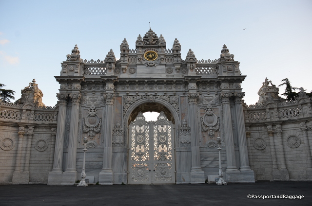
Peek through the gates at the Dolmabahçe Palace, or better yet, go visit.

Peek through the gates at the Dolmabahçe Palace, or better yet, go visit.

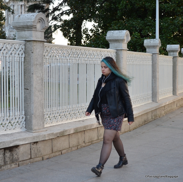
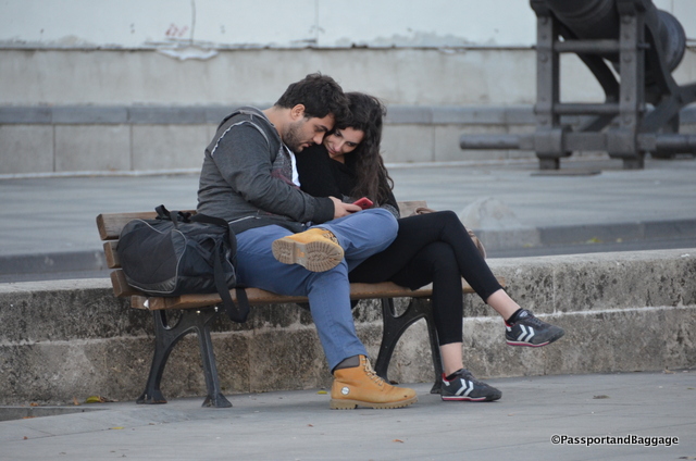
People Watch

People Watch

dsc_8591 *dsc_8588 *dsc_8587

Enjoy the sunset over the Bosphorus

Enjoy the sunset over the Bosphorus

Oct 142016
 

October 13, 2016

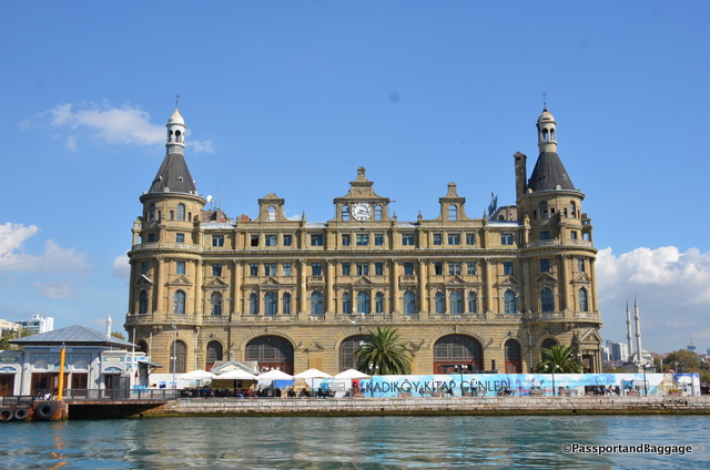
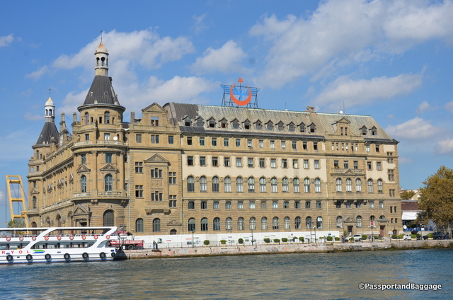
The Istanbul Haydarpaşa Terminal was a major intercity, regional and commuter rail hub as well as the busiest railway station in Turkey until 2012. Found on the Asian side of Istanbul, a ferry ride on the Kadikoy – Eminonu line will take your right past the terminal.

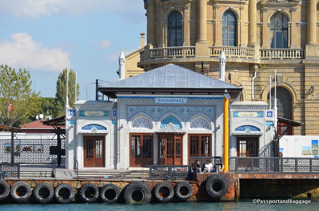
The Hydrapasha Station taken from the ferry

The Haydarpaşa station taken from the ferry.

The closure of the station has been subject to a lot of controversy, many claim that the Turkish government is planning to sell the historic railway station along with the port and turn it into a residence/luxury resort.

Hydrapasha

The lovely tile-adorned station iskele (ferry dock) was designed by noted Turkish architect Vedat Tek

When Istanbul was the capital of the Ottoman Empire, and essentially the center of the world, it had no railway so in 1871 Sultan Abdülaziz ordered a rail line to be built from Haydarpaşa to İzmit.

In 1888 the Anatolian Railway (CFOA) took over the line and the station. Since the station was built next to the Bosphorus, freight trains would unload at Haydarpaşa and the freight would be transferred to ships. The line started carrying passengers in 1890.

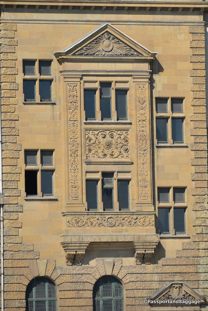
hydrapasha station istanbulIn the early 1900s, the Anatolian Railway hired two German architects, Otto Ritter and Helmut Conu, to build a new building to house the Istanbul terminus for the proposed Berlin to Baghdad rail line. They chose a neo-classical design and construction started in 1906. Its foundation is based on 1100 wooden piles, each 68 feet long, driven into the silty shore by a steam hammer. German and Italian stonemasons crafted the facade embellishments of the terminal.

When World War I broke out in 1914, the Ottoman Empire sided with the Central Powers against the Allied Powers. The Ottomans lost and İstanbul was taken over by the British Empire. Haydarpaşa was under strong military control by the British during the occupation.

The British Empire withdrew from İstanbul in 1923 after Turkey obtained independence and in 1927 the newly formed Turkish State Railways took over the CFOA and the terminal, in an attempt to nationalize all Turkish railways. 1927 the CIWL started a premier train service from Haydarpaşa to Ankara: the Anatolian Express. This all-sleeper train travelled daily between the two cities.

Railway Station ornamentationIn 1940 with the completion of the Baghdad Railway to Baghdad, the Taurus Express began running from Haydarpaşa to Baghdad.

In 1979 a tanker burning on the Bosphorus damaged the terminal building, but it was restored a few months later. In 2010 a fire, during the building’s restoration, destroyed the roof and the 4th floor of the terminal building.

In 2011 the World Monuments Fund, placed the railway terminal on its 2012 Watch, drawing attention to the uncertain future of the historical site.

If you get to the Asian side be sure to visit Ciya Restaurant.  It can be a tad hard to find, but it is on Güneşlibahçe Sokak which is the main street of the Kadıköy Market. The Kadıköy Market is similar to Beyoğlu’s Balık Pazarı (fish market), but with fewer tourists and barkers. The market is a foodie’s heaven! You will find the fish market; a number of excellent şarküteris; shops specializing in dried fruits, tea and coffee; cheese shops and some incredible bakeries and baklava stores.

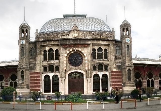
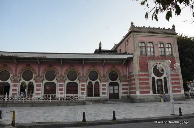
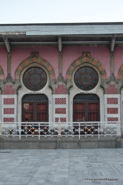
The Sirkeci Terminal

Sirkeci Terminal Station IstanbulThe Sirkeci Terminal was built in 1890 by the Oriental Railway as the eastern terminus of the world-famous Orient Express.

The architect of the project was August Jasmund a Prussian who was sent to Istanbul by the German government in order to study Ottoman architecture. The terminal building covers 13,000 square feet and is one of the most famous examples of European Orientalism. At the time the building was very modern, with gas lighting and heating in the winter, provided by large tile stoves made in Austria. The building is almost always covered in scaffolding and is very difficult to photograph.

Sirkeci TerminalIstanbul *Sirkeci Station Istanbul

Oct 132016
 

October 12, 2016

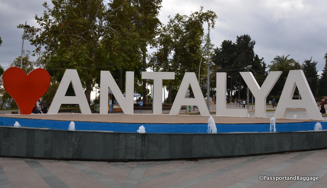
Antalya is an interesting town. The city has a population of almost 2 million people, which almost doubles in the summer time, spread out over an area of 8000 square miles. It is hard to fathom its size, but the heart of Antalya is the walled ancient city of Kaleiçi.

Antalya, TurkeyThe historical architecture of Antalya is located here as the new city was built upon much of the ancient city.

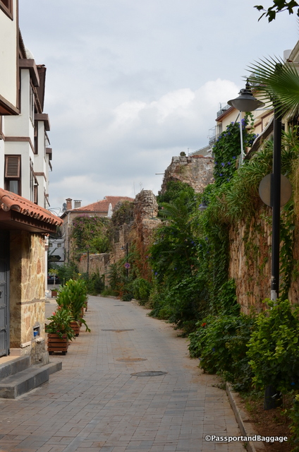
Cobblestone Streets of KalieciKaleiçi, has narrow cobbled streets lined with historic Ottoman era houses. It is also filled with higher end hotels, bars, clubs, restaurants, and shopping. It is surrounded by two walls, one of which is along the seafront, built in a continuous process from Hellenistic to Ottoman times. The historical harbor is located in this part of the city.

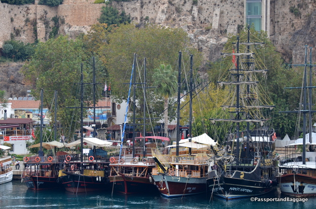
The tour boats, offering tours of the area are garish and ridiculously decorated like pirate theme parks

The tour boats, offering tours of the area, are garish and ridiculously decorated like pirate theme parks

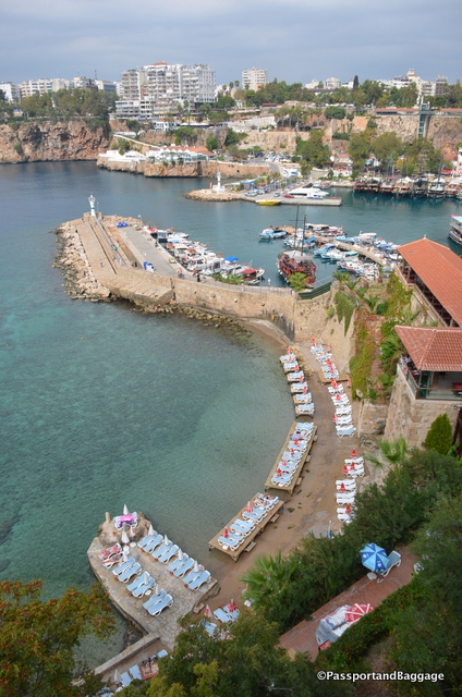
Looking down on the historic harbor

Looking down on the historic harbor and sunbathing area just below the historic city center

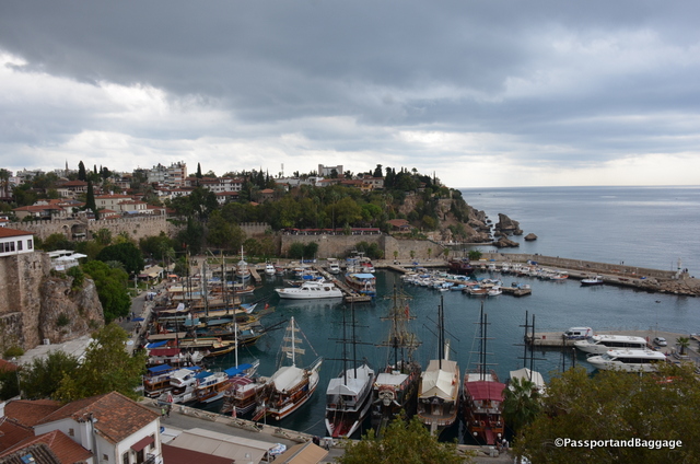
Looking at the historic harbor from the other side

Looking at the historic harbor from the other side

There are sites with traces of Hellenistic, Roman, Byzantine, and Seljuk architecture and cultures throughout Kaleiçi . The historic walls have 80 bastions and inside of the walls, there are approximately 3000 houses with red tile roof.

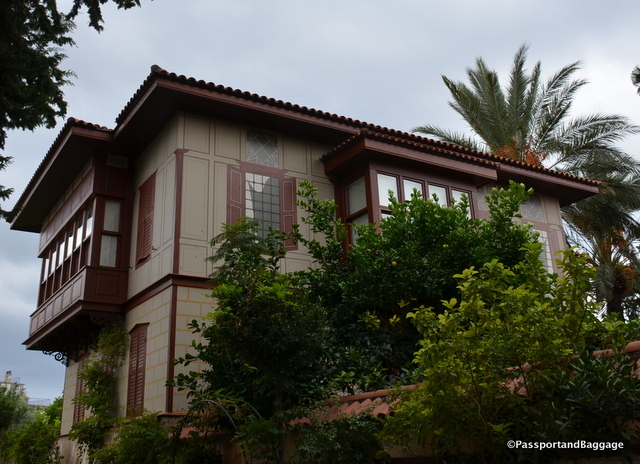
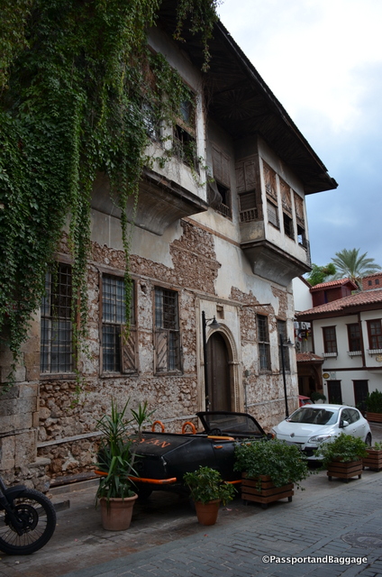
The homes of the Ottoman time were quite possibly painted as this one with faux stones painted over plaster. Even the shutters are painted.

The homes of the Ottoman time were quite possibly painted as this one with faux stones painted over plaster. Even the shutters are faux painted.

Farther out are all-inclusive resorts that line the sandy beaches of this part of the Turkish Riviera.

Turkey is one of the world’s most popular destinations, but terrorism, political turmoil and the war in neighboring Syria are having a devastating impact on tourism. This has been evident all over Turkey, but it is most dramatic in Antalya as the city has doubled its size since 1988 all due to the tourism trade.

The main decline in tourism for Antalya is the Russian market, the four-and-a-half million Russian tourists that normally come to the beach area has fallen by 95%. The trigger was Turkey shooting down a Russian military jet that violated Turkish airspace sparking a diplomatic crisis between the two countries. The Kremlin barred Russian tour companies from selling package deals to Turkey.

King Ata

King Attallus

The city has a long and interesting history. King Attalus II of Pergamon is looked on as founder of the city in about 150 BC, during the Hellenistic period. It was named Attalea or Attalia in his honor.

Attalea became part of the Roman Republic in 133 BC when Attalus III, a nephew of Attalus II bequeathed his kingdom to Rome at his death in 133 BC.

The Seljuk Turks conquered the city and the surrounding region in the early 13th century. Antalya was the capital of the Turkish beylik of Teke (1321–1423) until its conquest by the Ottomans.

The city was occupied by the Italians from the end of the First World War until the founding of the Turkish Republic in 1923.

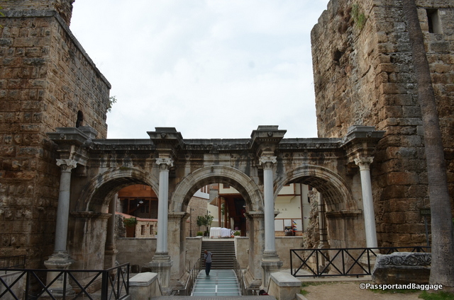
Hadrians Gate is one entry into the old town. The gate is a triumphal arch built in the name of the Roman emperor Hadrian, who visited the city in the year 130.

Hadrians Gate is one entry into the old town. The gate is a triumphal arch built in the name of the Roman emperor Hadrian, who visited the city in the year 130.

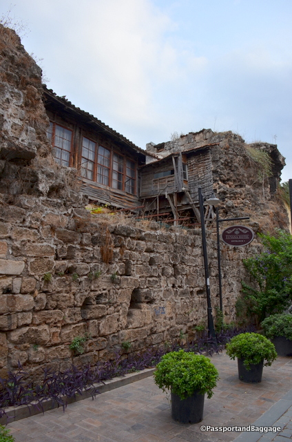
Many of the buildings have yet to be restored and old a charm of their own.

Many of the buildings have yet to be restored and old a charm of their own.

dsc_8451

*

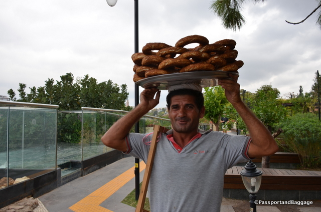
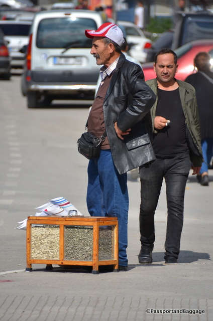
Simit is found everywhere in Turkey. It is a circular bread, typically encrusted with sesame seeds and hails from the Ottoman Empire, and the Middle East. It is typical for simit sellers to carry their load on their head, this gentleman was willing to pose for pictures after I bought a roll.

Simit is found everywhere in Turkey. It is a circular bread, typically encrusted with sesame seeds and hails from the Ottoman Empire. It is typical for simit sellers to carry their load on their head, this gentleman was willing to pose for pictures after I bought a roll. The cost is usually around 1TL or about 33cents

Here are a few random shots of Kaleiçi;

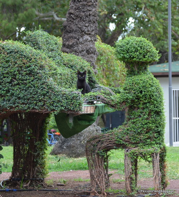
Cats are everywhere, even hidden in the topiary

Cats are everywhere, even hidden in the topiary

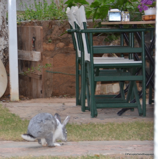
Cats are absolutely everywhere, so running across a bunny rabbit was rather unique.

Cats are absolutely everywhere, so running across a bunny rabbit was rather unique.

Antalya, Turkey

*

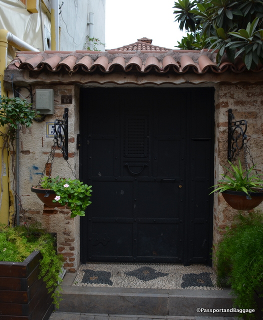
Pebble floors and interesting doors are all a part of Kaleiçi

Pebble floors and interesting doors are all a part of Kaleiçi

Antalya, Turkey

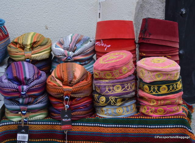
*hats of Turkey

*

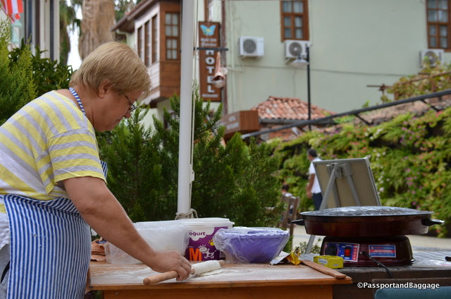
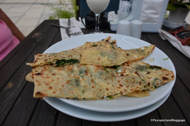
A woman makes Gozleme on the sidewalk

A woman makes Gozleme on the sidewalk

Gauzelike filled with onions, spinach and potatoes and cooked with a lot of butter

Gozeleme filled with onions, spinach and potatoes and cooked with a lot of butter

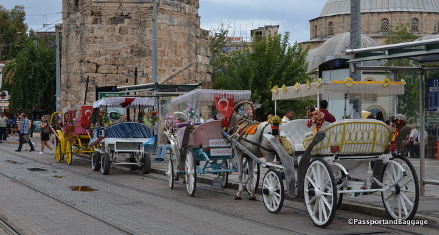
Horse carriages, decorated rather garishly, can be ridden around the newer parts of Antalya

Horse carriages, decorated rather garishly, can be ridden around the newer parts of Antalya

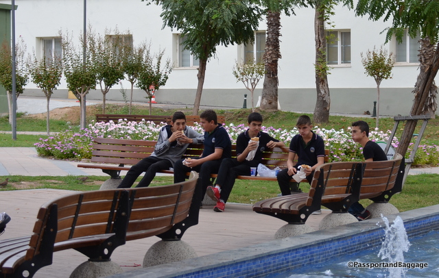
Boys break from school and enjoy kebab

Boys break from school and enjoy kebab

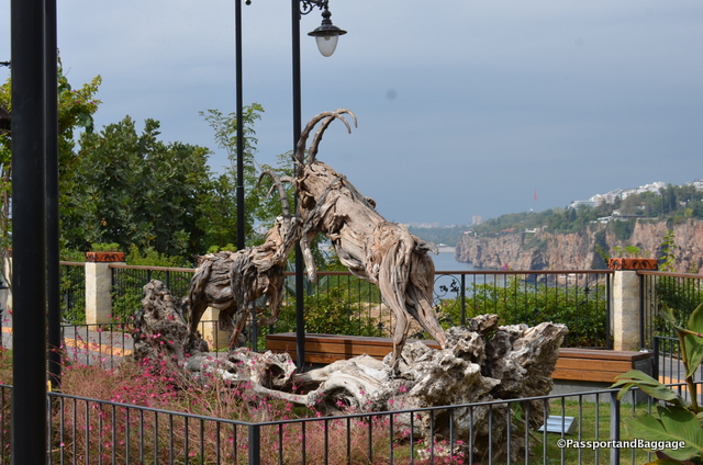
Ibex can be spotted in the Tauras Mountains just outside of Antalya, these are wooden sculptures gracing one of the many public parks within Kaleiçi

Ibex can be spotted in the Taurus Mountains just outside of Antalya, these are wooden sculptures gracing one of the many public parks within Kaleiçi

An old abandoned mosque in Kaleiçi

An old abandoned mosque in Kaleiçi

Wishing Trees are common all over the world, most commonly the Clootie Trees of Scotland and Ireland. In the Anatolya region they are called Dede Trees. Dede literally means “grandfather”. The story goes that nomadic women would never head to the village mosque as the men sometimes did and instead, all of the women would tie little strips of cloth to the dede trees when they came across them. Apparently, the Sarikeçeli nomads (the oldest nomadic group of Anatolya) believe that a dede can fulfill wishes

Wishing Trees are common all over the world, most commonly the Clootie Trees of Scotland and Ireland. In the Anatolya region they are called Dede Trees.
Dede literally means “grandfather”.
The story goes that nomadic women would never head to the village mosque as the men sometimes did and instead, all of the women would tie little strips of cloth to the dede trees when they came across them. Apparently, the Sarikeçeli nomads (the oldest nomadic group of Anatolya) believe that a dede can fulfill wishes

The museum of Antalya is spectacular. It holds most everything found at Perge, an ancient site that was not looted. It is well laid out, full of amazing finds and well worth the visit.

The museum of Antalya is spectacular. It holds most everything found at Perge, an ancient site that was not looted. It is well laid out, full of amazing finds and well worth the visit.

Oct 122016
 

October 12, 2016

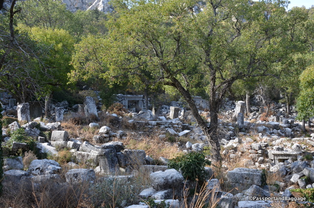
Termessos was built at an altitude of more than ½ mile up Solymos Mountain in the Taurus Mountain Range of Turkey. It sits in Mount Güllük-Termessos National Park. You are able to drive up a little ways, but the rest must be seen after quite a steep walk. It is well preserved, simply by its remote location, and is a wonder to just walk through, unlike any other ancient site on the Mediterranean.

The greeting party at the bottom of the hill

The greeting party at the bottom of the hill

The first time that Termessos appeared in literature was in the Iliad by Homer. He mentions that the mythical founder of the city is Bellerophon.

Bellerophon is a hero of Greek mythology. He was “the greatest hero and slayer of monsters, alongside Cadmus and Perseus, before the days of Heracles”, and his greatest feat was killing the Chimera, a monster that Homer depicted with a lion’s head, a goat’s body, and a serpent’s tail: “her breath came out in terrible blasts of burning flame.”

Bellerophon managed to force the residents of Termessos to surrender by flying over the mountains on Pegasus and throwing stones at the rebels.

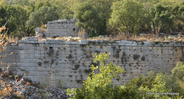
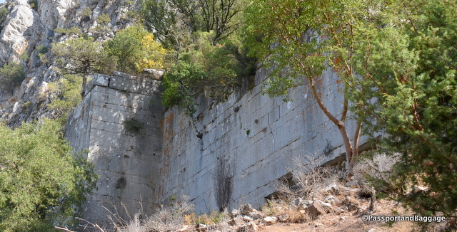
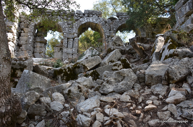
The walls that still stand are an engineering feat worth just standing and admiring

The walls that still stand are an engineering feat worth just standing and admiring

TermessosAccording to Strabo, the inhabitants of Termessos called themselves the Solymi and were a Pisidian people. Pisidia was a region of ancient Asia Minor corresponding roughly to the modern-day province of Antalya in Turkey.

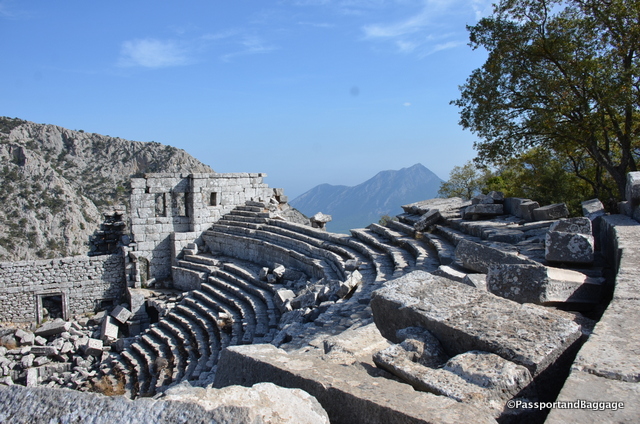
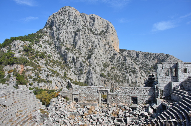
The theater has the most magnificent views, but the camera just can not capture it.

The theater has the most magnificent views, but the camera just cannot capture it.

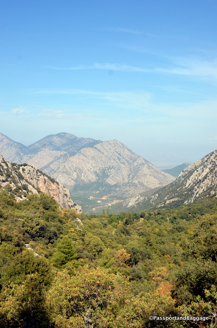
Looking down from the mountain top

Looking down from the mountain top

The name derived from Solymeus, an Anatolian god who in later times became identified with Zeus, giving rise to the cult of Zeus Solymeus (Solim in Turkish). This is evidenced by the coins minted in Termessos with the image of the deity and his name.

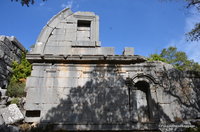
An obviously restored portion of a wall, that gives you a sense of the magnificence of the buildings

An obviously restored portion of a wall, that gives you a sense of the magnificence of the buildings

dsc_8308The first historical mention of Termessos dates back to 334 BC. In this time Alexander the Great arrived in the area with a plan to capture Termessos. However, his failed attempts to conquer the Eagle’s Nest, the name given it by Alexander, turned out to be a rather long and complicated story.

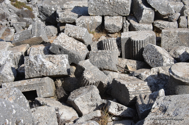
Termessos had a very substantial aqueduct and cistern system, it is theorized that the end of this site occurred after a large earthquake damaged the aqueduct, the year of the destruction is not known. The remnants of what must have been a very violent earthquake can be found by observing the state of the site itself, everywhere are broken columns and walls lying around untouched.

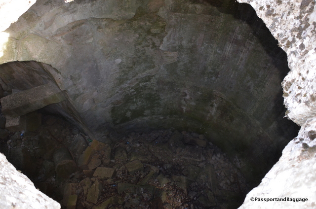
There was a system of 5 large cisterns. This is looking down into one. Knowing that they will have filled with soil over the years, the original depth is just unimaginable

There was a system of 5 large cisterns. This is looking down into one. Knowing that they will have filled with soil over the years, the original depth is just unimaginable

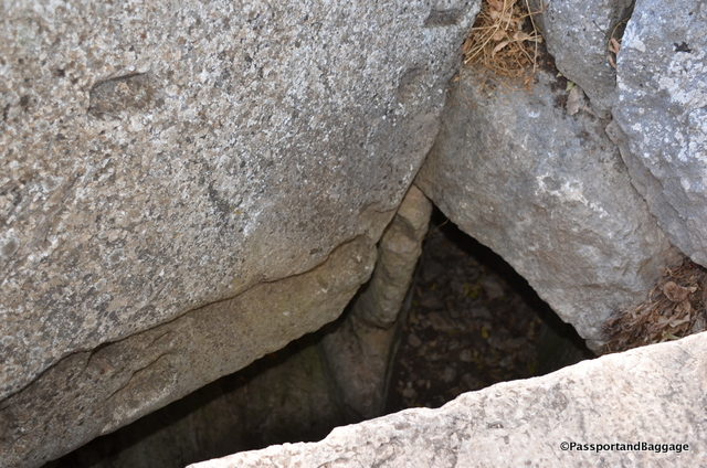
This is looking down into the drainage system, their water system was obviously very advanced

This is looking down into the drainage system, their water system was obviously very advanced

Only surface surveys of the site have been conducted so not much has been learned, even in modern times. In the first half of the 19th century first Europeans, Thomas Abel Brimage Spratt, and Edward Forbes arrived at the site and described their findings in the book “Travels in Lycia”, published in 1847. Charles Fellows, the British archaeologist, also visited Termessos. The results of these first travels were descriptions of the preserved buildings and first plans of the ancient city.

In the 1880s, Termessos was repeatedly visited by the Polish researcher Karol Lanckoroński, who wrote: ”Of all the cities of Pisidia which we have visited, Termessos has the most peculiar and the greatest position: it is, at the same time, a watchtower commanding a distant view and nest buried deeply in a valley, surrounded by a ring of mountains. If its inhabitants indulged in brigandage, they could not find a better hiding place than in this eagle’s nest.”

While I was standing in this magnificent spot, I thought I would just tell the story with photos. Sadly, when I downloaded the photos to the computer I realized the awe-inspiring magnificence of this area just cannot be captured in photos.  Here is an example, but a visit is the only way to realize the wonder of this spot.

Fallen bits and pieces of columns and column capitals.

Fallen bits and pieces of columns and column capitals.

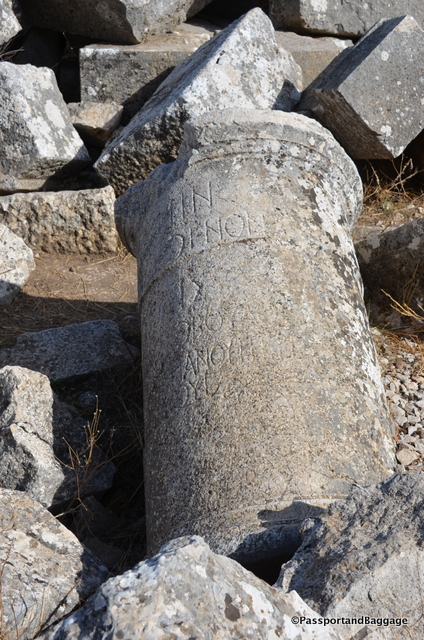
A column with a Greek inscription

A column with a Greek inscription

Thermosses

The theater

Termessos

*Termessos

*Termessos

The bath

The bath

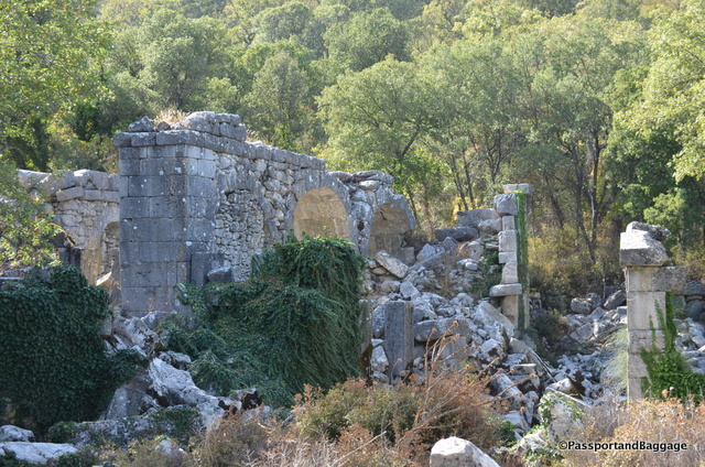
The walls of the Baths

The walls of the Baths

Walls of the baths

Walls of the baths

Termessos

*

Oct 112016
 

October 10, 2016

The town of Kaş is a lovely, unspoiled, tourist town that sits on a hill and runs down to the Turquoise Coast of southwestern Turkey.

Kos, TurkeyIt is filled with fabulous restaurants, quaint shopping and a view from everywhere that is just stupendous.

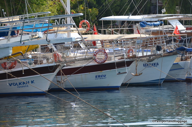
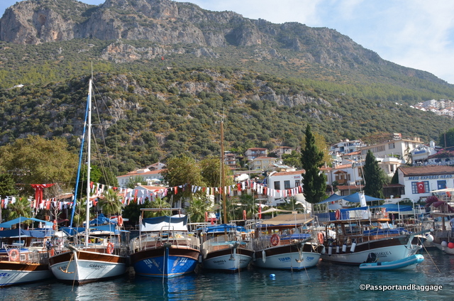
Boats in the harbor at Kaş

Boats in the harbor at Kaş

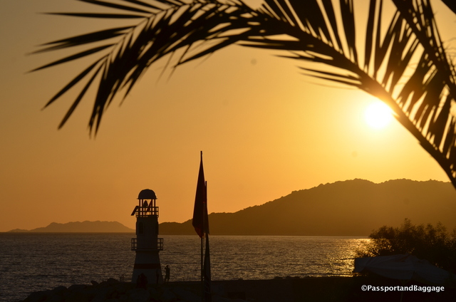
Sunset over the lighthouse of Kaş

Sunset over the lighthouse of Kaş

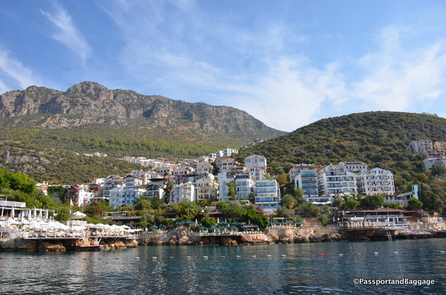
Looking back onto the southern end of the town of Kaş

Looking back onto the southern end of the town of Kaş

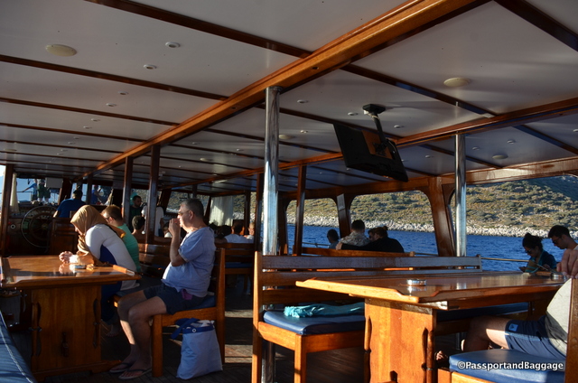
One of the ways that people spend their time in this area is either chartering boats for week long sailing excursions, or going down to the dock and jumping on a group boat for a day motoring around the islands, swimming, and visiting the highlights around the area. Today we decided to ply the Mediterranean Sea via one of these group boats. I have spoken throughout this trip of the lack of tourists due to the political situation in Turkey, this was very evident when taking the boat trip.  There are at least 3 dozen boats, with a capacity of 50 to 100 ready to take tourists around the Mediterranean.  Today we boarded the only boat that was going out and it was filled with only 35 of us, all, with the exception of us, Turkish citizens.  The price, normally 70TL was just 60TL today.

Our very uncrowded boat

Our very uncrowded boat

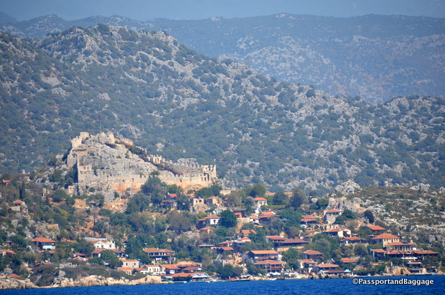
We took this boat trip specifically to visit Simena-Kekova. The ancient city of Simena was once two parts – an island and a coastal part of the mainland.

dsc_8161

The Castle towering over the mainland portion of Simena-Kekova

“Kekova” is Turkish for “plain of thyme”, and women sit all over the walkways of the mainland selling thyme and other herbs to the tourists.

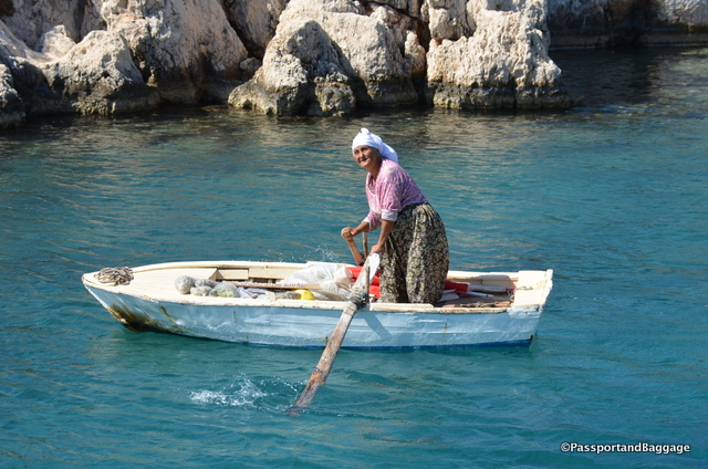
This woman rowed out to the boat to be the first to offer Thyme and other herbs.

This woman rowed out to the boat to be the first to offer Thyme and other herbs.

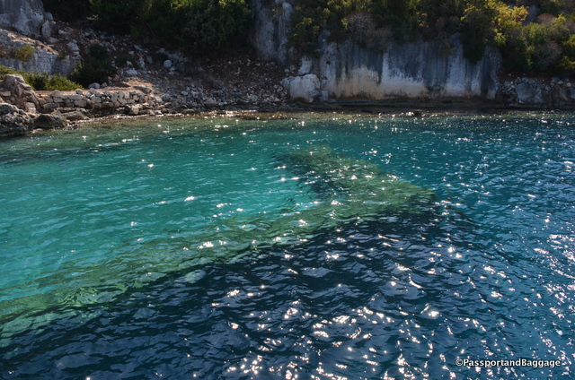
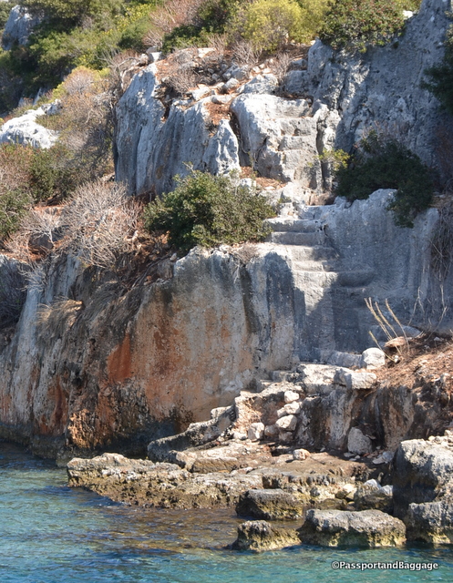
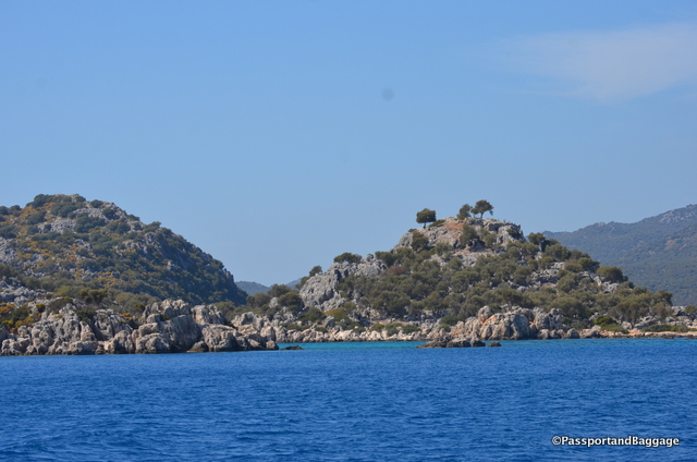
The island portion is 2 square miles, and uninhabited. As you travel near the island you can spot the half-submerged ruins of the residential part of Simena-Kekova. The sinking of this area was caused by the downward shift of land by what most have been horrendous earthquakes of the 2nd century AD. Half of the houses are submerged and you can see staircases descending into the water.

You can see a sunken wall in the clear blue water of the Mediterranean

You can see a sunken wall in the clear blue water of the Mediterranean

Stairways descending into the sea

Stairways descending into the sea

One of the few standing elements on the island

One of the few standing elements on the island

This gentleman was working on the island, at what is not quite clear.

This gentleman was working on the island, at what is not quite clear.

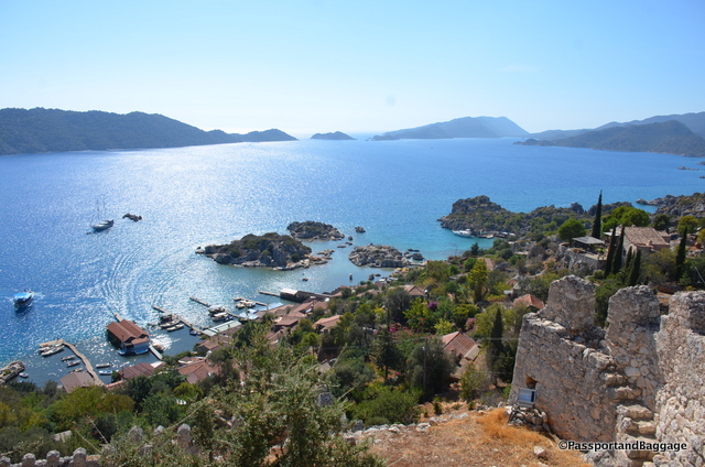
On the mainland portion of Simena-Kekova is the charming fishing village of Kaleköy (“castle village”). A well-preserved castle built by the Knights of Rhodes, partially upon ancient Lycian foundations, dominates the top of the village. Access to the village is possible only by sea.

Looking down onto the mainland town from the Castle

Looking down onto the mainland town from the Castle

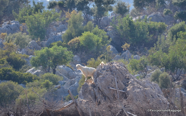
Billy Goats climbing around the hills

Billy Goats climbing around the hills

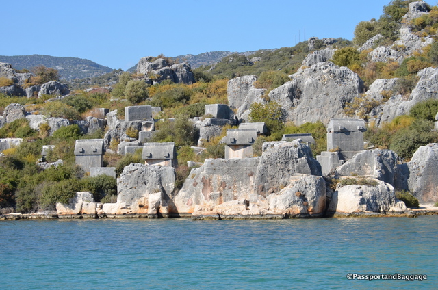
Sarcophagi are spread throughout the side of the hills in the area

Sarcophagi are spread throughout the side of the hills in the area

After the Italian occupation of Kastelorizo, (a Greek island and municipality located just 4 miles from Kaş ) Kekova (which at that time was temporarily inhabited during summer because of wood harvest) was disputed between Italy and Turkey. The 1932 Convention between Italy and Turkey, which defined the sea border between the two powers, assigned all the islets of the small archipelago around Kastellorizo, including Kekova, to Turkey.

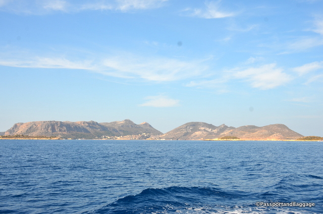
The island of Kastellorizo, otherwise known as Meis, belongs to Greece and yet it is only 30 minutes away by ferry.

The island of Kastellorizo, otherwise known as Meis, belongs to Greece and yet it is only 30 minutes away by ferry.

In 1990 the Kekova region was declared a specially protected area prohibiting diving and swimming. In later years the prohibition was lifted except for the part where the sunken city is.

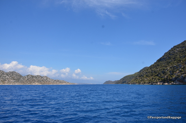
This area is called the Turquoise Coast for a reason, the blues of the water are indescribable.

Turkish Riviers *Turkish Riviera

Here are a few fun shots from around the town of Kaş:

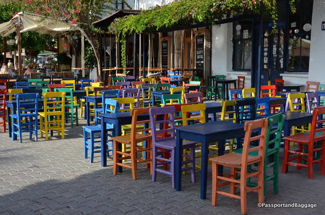
Colorful chairs at a restaurant in the central square.

Colorful chairs at a restaurant in the central square.

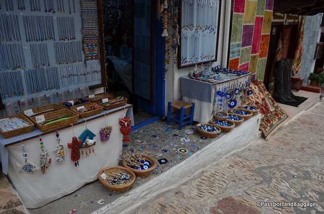
The evil eye is everywhere in Turkey, I loved the use of the eye in the sidewalk

The evil eye is everywhere in Turkey, I loved the use of the eye in the sidewalk

dsc_8016

dsc_8015

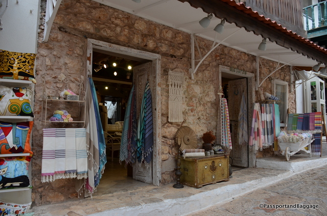
Cotton towels are a specialty of the area.

*

The harbor of Kaş

The harbor of Kaş

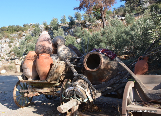
A lovely display of ancient Amphora

A lovely display of ancient Amphora

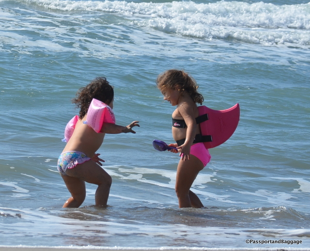
The beach at Patara

The beach at Patara

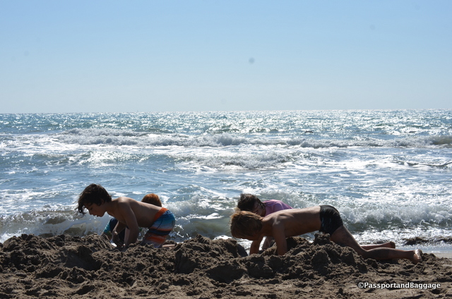
Four very industrious moat builders

Four very industrious moat builders

A few notes on Kaş.

Our hotel, Rhapsody, was lovely.  I had a third floor room with a balcony and a stunning view.  There is no elevator, however, so if you want one that high up, be prepared for a long climb.  The staff is wonderful and the breakfast, which is included, was very, very good.

We had three nights, and three great dinners.  These included

Bahςe Balik at  Andifli, Süleyman Sandıkçı Sk. No:18.  The fish, sold by the ounce, while expensive, was cooked to perfection and delicious.

Bi Lokma or Mama’s Kitchen at Hükümet Cad. No:2. We went for the Manti, but there are many wonderful things on the menu. Manti is an unusual dish for Turkey, and here it is cooked to absolute perfection with a sauce that is befitting the quality of the Manti itself.

Ikbal at Süleyman Sandıkçı Sok. No:6 is a family operation, run by people that love food and want you to love it too.  We had the specials and the fried zucchini, was in fact, something to write home about.  This spot is heavenly!

Oct 102016
 

October 9, 2016

I am on the Mediterranean and have already written about the tombs of Myra. I did so without really addressing the Lycian culture. Now is the time to do so.

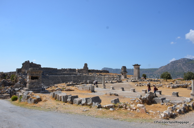
Looking over just a small part of the ancient city of Xanthous

Looking over just a small part of the ancient city of Xanthos a Lycian city.

Lycia was a geopolitical region in Anatoli in what are now the provinces of Antalya and Muğla on the southern Mediterranean coast, and Burdur Province inland from the Mediterranean. Historically it dates to the times of ancient Egypt and the Hittite Empire in the Late Bronze Age (3300-1200 BC).

In 43 AD Lycia was incorporated into the Roman Empire. After the fall of the Byzantine Empire in the 15th century, Lycia was under the Ottoman Empire, and was inherited by the Turkish Republic on the fall of that empire. The Greeks were forcibly removed during the population exchange between Greece and Turkey in 1923.

One of the larger Lycian sites in this area is the city of Xanthos and its accompanying religious site Letoön. The history of Xanthos is rather violent. In 545-546 the Xanthosian men set fire to their women, children, slaves and treasure before making their final doomed attack upon invading Persians who were led by Commander Harpagos. Xanthos grew out of this tragedy but the story repeated itself in 42 BC when Brutus attacked the city during the Roman civil wars in order to recruit troops and raise money. Brutus was shocked by the Lycians’ suicide and offered his soldiers a reward for each Xanthosian saved. Only 150 citizens were rescued.

Xanthos was deserted during the first wave of Arab raids in the 7th century.

The buried site of Xanthos was found in 1838 by Sir Charles Fellows. Like so may explorers of the time, he hauled most of the artifacts to England, they now reside in the British Museum.

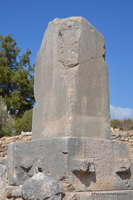
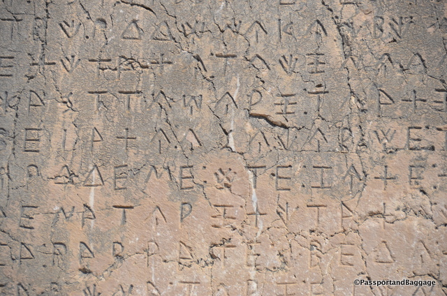
Xanthos, TurkeyWhen one travels the world and sees ruins across our great planet, they tend to run together. However, at most every site something stands out and makes me go WOW. For me, at Xanthos, this moment was gazing upon this large stone with its inscription in Lycean. It is the longest Lycian inscription known, at over 250 lines. Linguistically it falls into three parts; On the south and east side and part of the north side it is written in the normal Lycian language; then there is a poem of twelve lines in Greek; but the rest of the north side and all of the west is in a different form of Lycian found elsewhere, only on a tomb in Antiphellos, a town many miles away.

The Lycian language is not really understood, the inscription, evidently gives a narrative account of a dead hero’s exploits, and is undeciphered. It does apparently contain a number of recognizable proper names, from which the approximate date and some idea of the contents can be garnered.

Lycian LanguageLycian was an Indo-European language, which included cuneiform and hieroglyphics; it had its own alphabet, which was closely related to Greek.

Lycian became extinct around the beginning of the first century BC, replaced by the Ancient Greek language.

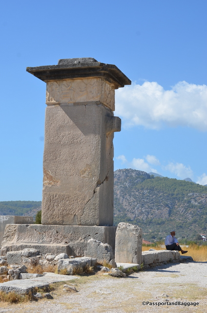
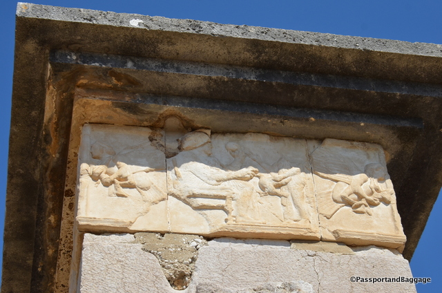
The chamber at the top of this pillar was once marble, decorated with reliefs. Called the "Harpy Tomb"; it was previously believed that the winged women figures in the frieze were harpies (monsters from Greek mythology with the head of a woman and the body of a bird). It is now thought that these figures may depict sirens carrying off the souls of the dead. These are replicas, the originals are in the British Museum.

The chamber at the top of this pillar was once marble, decorated with reliefs. Called the “Harpy Tomb”; it was previously believed that the winged women figures in the frieze were harpies (monsters from Greek mythology with the head of a woman and the body of a bird). It is now thought that these figures may depict sirens carrying off the souls of the dead. These are replicas, the originals are in the British Museum.

The replica at the top of the pillar showing the Harpies.

The replica at the top of the pillar showing the Harpies.

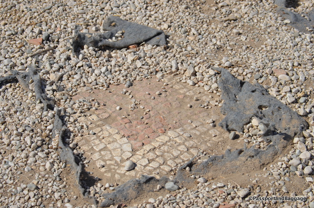
The entire site of Xanthos is covered in mosaics. They have been covered over for their protection.

The entire site of Xanthos is covered in mosaics. They have been covered over for their protection.

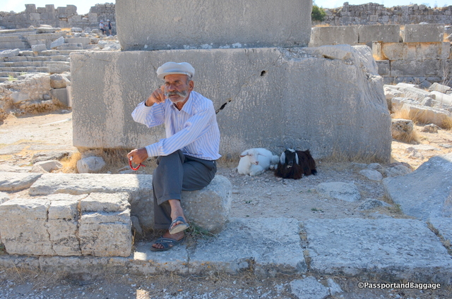
This friendly goat-herder is happy to tell everyone the story of Xanthos.  The only English I understood of his was British Museum, which I heard many, many times over.

This friendly goat-herder is happy to tell everyone the story of Xanthos. The only English I understood of his was British Museum, which I heard many, many times over.

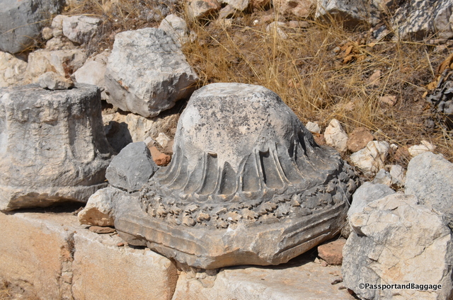
A beautifully carved column capital with oak leaves at Xanthous

A beautifully carved column capital with oak leaves at Xanthos

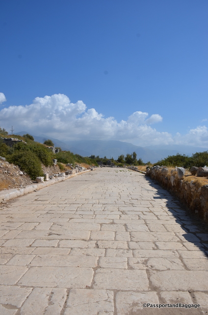
A road in Xanthos, wide enough to handle a Roman Legion

A road in Xanthos, wide enough to handle a Roman Legion

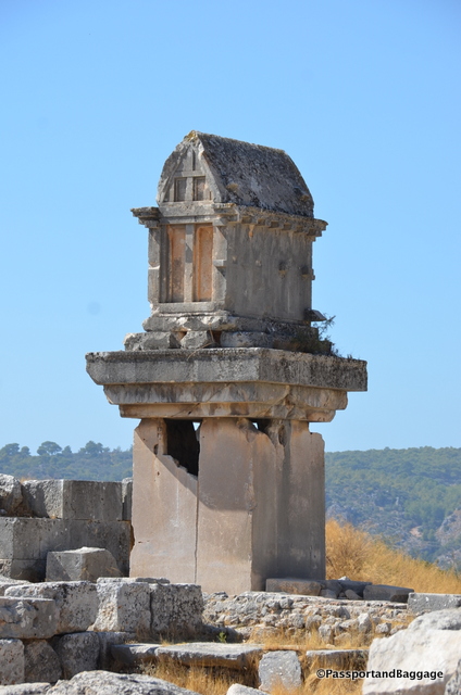
A pillar tomb at Xanthos

A pillar tomb at Xanthos

Just a few miles from Xanthos is Letoön, which dates back to the late sixth century BCE. Letoön, administered by Xanthos, was not an actual city but a religious center and an important political meeting point for the Lycian League, which was the first democratic federation.

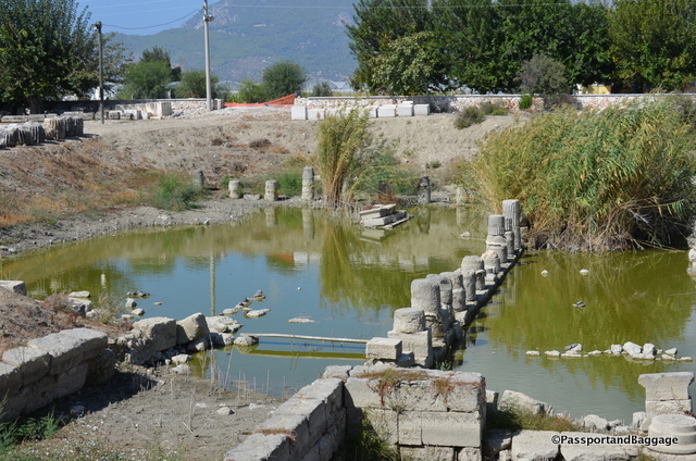
You can find turtles lounging in what was once a sacred pool.

You can find turtles lounging in what was once a sacred pool.

Letoön is home to three temples that have been excavated thus far, one dedicated to Leto, hence the name Letoön. The second is dedicated to Artemis, it is said that the mother of Apollo and  Artemis gave birth to the twins here, while hiding from Hera.  The third temple is dedicated to Apollo.

Letoön was the center of pagan cults until perhaps the 5th century AD when Arabs ravaged Lycia and the area started to silt up with sand brought down by the Xanthos River. It is believed to have been abandoned by the 7th century AD.

During Roman Times, the Emperor Hadrian founded an emperor worship cult at the site. Christianity later replaced pagan beliefs and in the 5th century AD a church was built using stones from the old temples.

The Lycian cult of Leto was one of the many forms of the widespread mother-goddess religion, which originated in ancient Anatolia. Even in those times women could preside over the national assembly that was held each autumn.

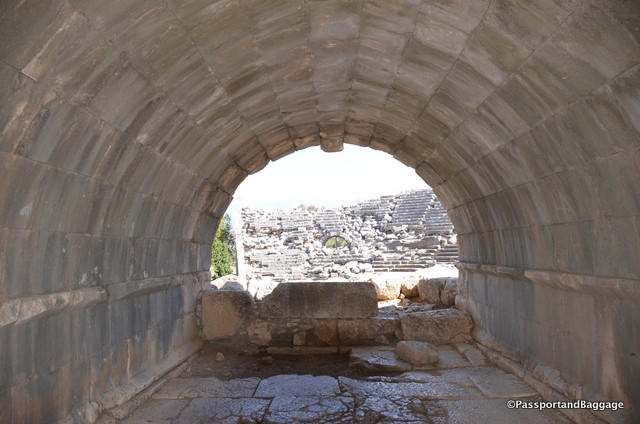
A tunnel leading to the theater at Lentoon

A tunnel leading to the theater at Letoön

A drain spout in the shape of a lion at Letoön

A drain spout in the shape of a lion at Letoön

Temple Ruins at Letoön

Temple Ruins at Letoön

Letoon, Turkey

Oct 092016
 

October 9, 2016

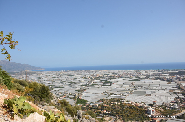
The vegetables of TurkeyYou will find tomatoes and cucumbers at every meal in Turkey; in fact there is a salad on every menu called a shepherd’s salad that is nothing but these two ingredients in one form or another. I would normally be thrilled with this, but the first few I had I realized immediately that the vegetables were hothouse grown and not as tasty and succulent as they look.

When we drove out of Antalya towards Kaş on the Mediterranean Sea, it all became clear.

Turkey began growing food in greenhouses near Anatalya in the 1940s with around 2500 acres throughout the region. The practice grew exponentially until the 1990s, with around 60,000 acres in 2002. Today 83% of all greenhouses in Turkey are in this region.

Looking down towards the Mediterranean and the greenhouses that cover the land

Looking down towards the Mediterranean and the greenhouses that completely cover the available land

In 2000, 1.37 million tons of tomatoes, 1.04 million tons of cucumbers, 0.33 million tons of peppers, 0.18 million tons of eggplant, 0.080 million tons of squash, and 0.04 million tons of bean were produced in greenhouses in Turkey.

This originally began for domestic consumption, but with the increase of all of these greenhouses, growers began pursuing the export market and in 2002 the major crops begin exported were tomatoes and cucumbers for around $63million.

In driving throughout Turkey we have not witnessed any large farms, while I am sure there are some, it is not the norm.

According to the OECD, fragmentation of farmland is the main problem facing Turkish agriculture today. Largely to blame, as in many countries, are the country’s inheritance laws, which stipulate that 25% of a deceased landowner’s property should pass to their spouse, with the rest divided among the children. This means that the average farm is 15 acres.

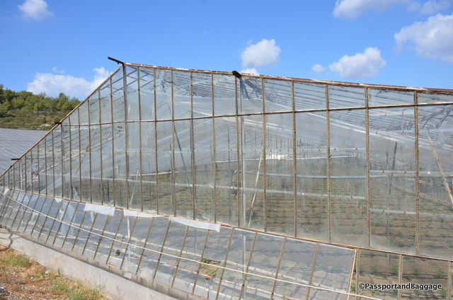
At one time all the greenhouses were glass, this has given way to plastic

At one time all the greenhouses were glass, this has given way to plastic

The greenhouse situation is no different. Greenhouse production is generally carried out by small family-owned farms sitting on just over 3 acres, with greenhouses covering just under 1 acre of that land. Studies have shown that proper crop management and greenhouse construction are both highly flawed in these small operations, creating a need for excess fertilization, creating some severe environmental issues.

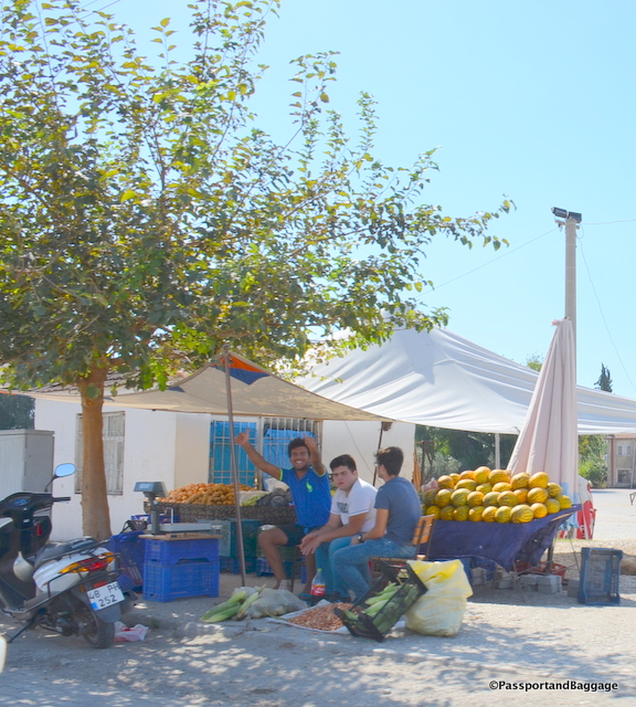
vendors of TurkeyWe have also noticed hundreds of small vendors selling crops along the side of the road, it occurred to us that there was no central co-operative way to sell in Turkey, which was born out by a little research. It is not unusual to drive by trucks containing what appears to be at least one ton or more of pumpkins, potatoes, onions or the like, lined up for a mile or so. It is unfathomable that these people are making any money, or that the amount condensed into one area could possibly sell but a very small quantity of what is in their trucks and roadside stands.

The concept is difficult to grasp but as you drive through the rural farm areas of Turkey and observe the way things are done it is obvious that things are done as they have been for thousands of years. This is born out when you learn that in the farmlands workers are generally poorly educated and low skilled: as much as 15% of agricultural laborers are illiterate and only 78% have a primary education.

While all of this makes for either quaint photos or horrific photos of damage to the environment, it is important to remember that there are people behind all of this. The farmers of Turkey have it very difficult, not only with distribution, but with the price of fuel.

Much of this was being addressed when Turkey was pursuing inclusion into the EU, but where it will go with Turkey in such a state of flux, it is hard to say.

Oct 082016
 

October 8, 2016

Myra was an ancient Greek town in Lycia in the fertile alluvial plain between Alaca Dağ, the Massikytos range and the Aegean Sea.  It now is part of Turkey on the Mediterranean Sea.

dsc_7945 The first known reference to Myra was when it was listed as a member of the Lycian alliance in 168 BC–AD 43.

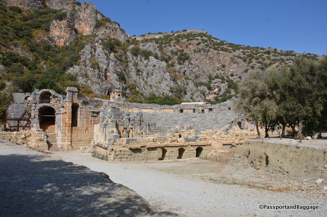
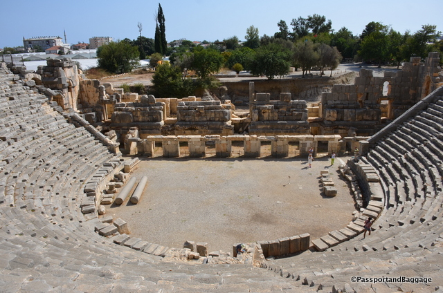
The ruins of the Lycian and Roman town are mostly covered by alluvial silts. Some of the ruins have been partially excavated, including the semi-circular theater that was destroyed in an earthquake in 141, but rebuilt afterwards.

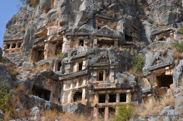
The Sea Necropolis at Myra

The Ocean Necropolis at Myra

The most interesting thing at Myra, and the real reason for our stop here were the rock-cut tombs. These were carved in the cliffs at Myra in the form of temple fronts. There are two sets of these tombs, the river necropolis and the ocean necropolis.

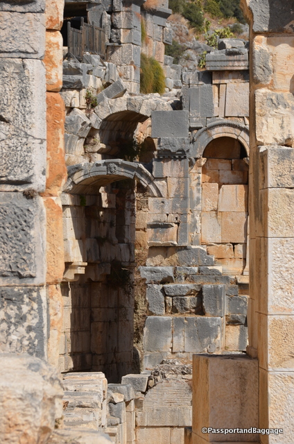
The Theater at Myra

The Theater at Myra

Myra, Turkey

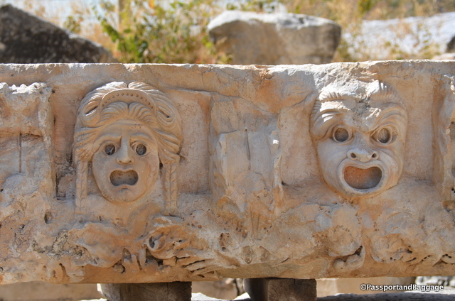
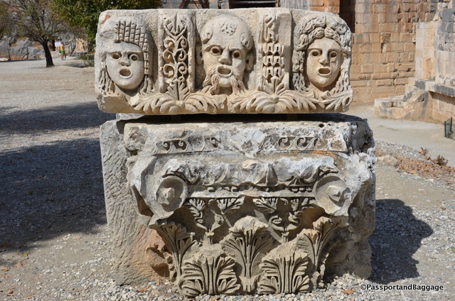
There are many faces, most likely from the theater, scattered around the grounds.

There are many faces, most likely from the theater, scattered around the grounds.

Just a few of the stunning archways in the theater

Just a few of the stunning archways in the theater

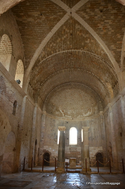
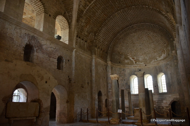
Another reason to visit the town is the Church of St. Nicholas. The church was built in AD 520 on the foundations of an older Christian church where Saint Nicholas served as a bishop. Over time the church was flooded, filled with silt, and buried. In 1862 it was restored by Russian Tzar Nicholas I, who added a tower and made other changes to its Byzantine architecture. The church is regarded as the 3rd most important Byzantine structure in Anatolia.

The main room of the church

The Apse

Saint Nicholas Church, Myra, Turkey

In 1968 the former confessio (tomb) of St. Nicholas was roofed over. The Church is on the tentative list to be a UNESCO World Heritage Site.

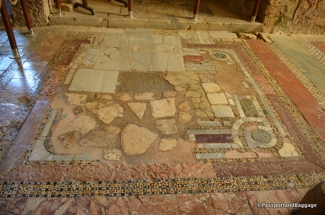
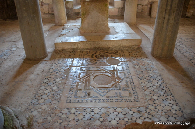
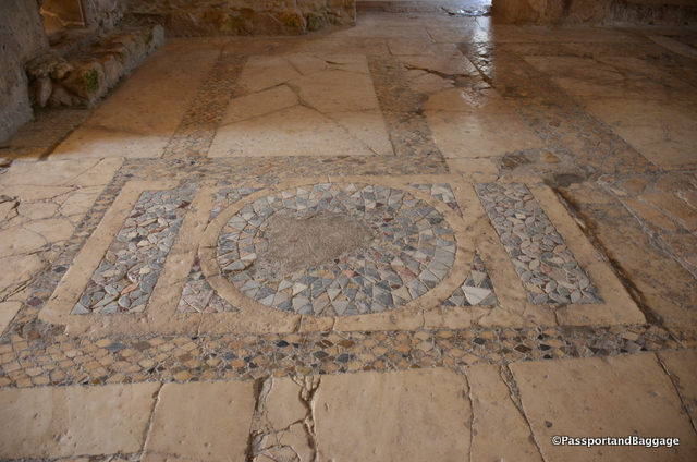
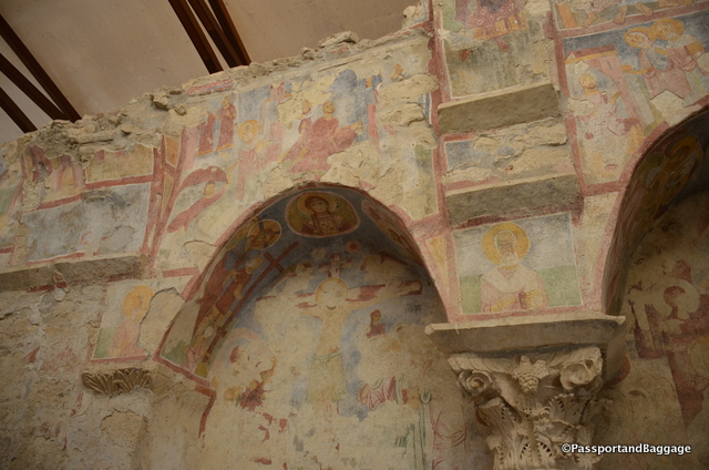
The floor of the church is made of opus sectile, a mosaic of coloured marble, and there are some remains of frescoes on the walls. An ancient Greek marble sarcophagus had been reused to bury the Saint; but his bones were stolen in 1087 by merchants from Bari, and are now held in the cathedral of that city.

The floor of the church varies from room to room, each as spectacular as the next

The floor of the church varies from room to room, each as spectacular as the next

Myra, Turkey

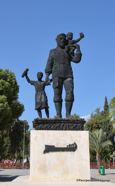
*Church of Saint NicholasSaint Nicholas was born in Patar in the second half of the 3rd century and was the Bishop of Myra. He was beatified after his death and became the most popular Saint of Tsarist Russia, this is the reason for the hordes of Russian tourists, found in more normal times in Turkey. When we visited there was simply a very small bus of Russian tourists, and ourselves.

Saint Nicholas, TurkeySaint Nicholas was also honored in Freiburg, Germany; Bari and Naples of Italy and the whole of Sicily. He is known as Santa Clause in English and Dutch.

Saint Nicholas was especially favored by the sailors of the East Mediterranean, who put pictures and icons of him in all their boats and made a tradition out of the wish “May Saint Nicholas hold your rudder”.

An example of the mosaics found throughout the church:

Frescoes of the Church of St. Nicholas *Frescoes of the Church of Saint Nicholas *Frescoes

Oct 072016
 

October 2016

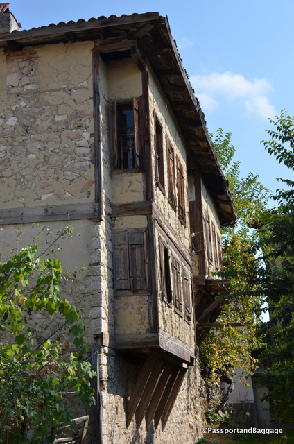
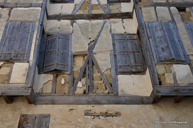
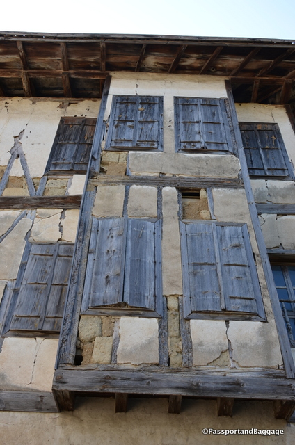
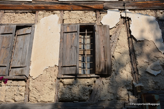
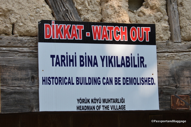
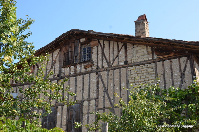
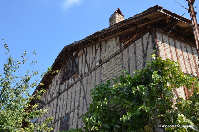
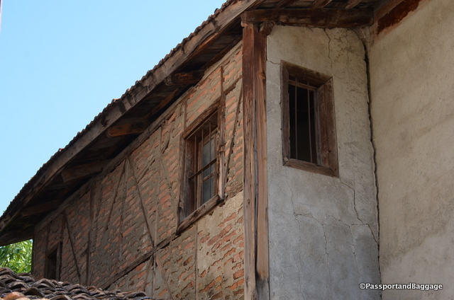
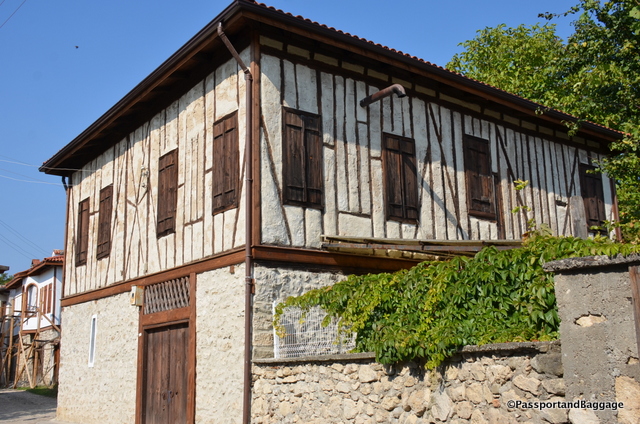
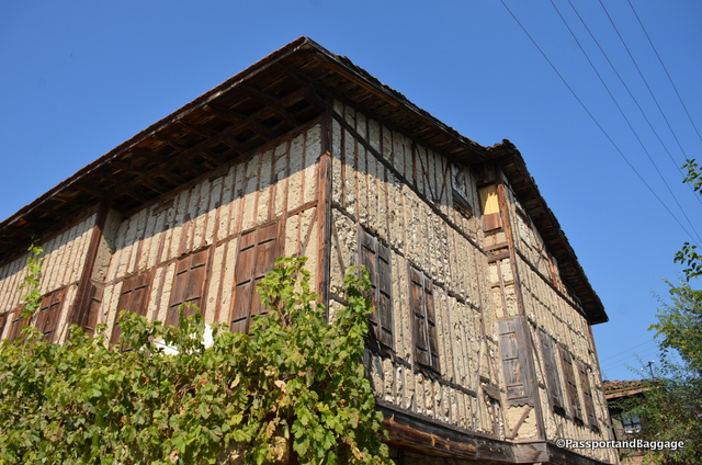
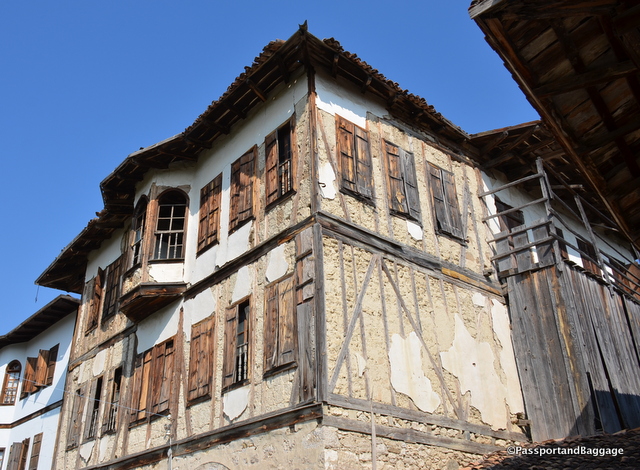
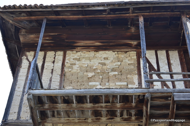
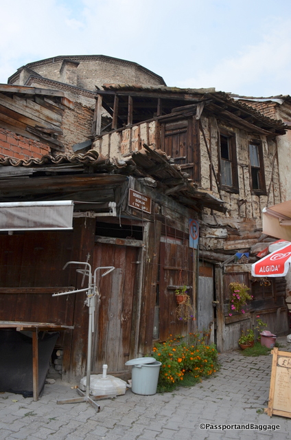
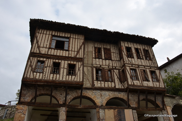
This is really an adjunct to the post on Safranbolu. The town of Yörük Köyü is just a few miles outside of Safranbolu, but has not been restored.  This gives one an excellent chance to see what is underneath the plaster finishes of a completed Ottoman House.  This post will just be photographs, if you are interested in learning more, please read the post on Safranbolu.

 Yörük Köyü

This was one of the taller houses in Yörük Köyü

 Yörük Köyü * Yörük Köyü * Yörük Köyü * Yörük Köyü * Yörük Köyü * Yörük Köyü * Yörük Köyü * Yörük Köyü *Safranbolu, Turkey* Yörük Köyü * Yörük Köyü * Yörük Köyü * Yörük Köyü * Yörük Köyü * Yörük Köyü

Oct 062016
 

October 6, 2016

Safranbolu, TurkeyIn researching about the homes of Safranbolu I came across the Gülevi Safranbolu dissertation on the history, preservation and future of Safranbolu. It is a text worthy of a thesis, and difficult to absorb without having a full understanding of the area. I found it to be a necessary piece of writing, and one that should be heeded in this changing time of Turkey and its heritage. In this post I am going to attempt to condense the article, pull out what would be of interest to my readers, and attach photographs to help tell the story. If you are interested in reading the full report, which I highly suggest, you can find it here.
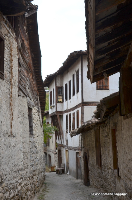
Safranbolu, TurkeySafranbolu is not a solely Ottoman city. It is said to have a cultural heritage that dates back at least 7500 years.

The town was once a wealthy trading town, it was known for its Saffron fields, which is where it got its name.

There are three parts to Safranbolu; the first is Çarşı which is the only area that I visited and the area of which this entire post is going to be about. The others include Bağlar, which displays the Seljuk – Ottoman continuity of architecture, and Kıranköy, which displays Roman-Byzantine-Ottoman continuity of architecture.

The structures that are referred to as Ottoman konaks (mansions) and the structures that I will be showing you are, today actually heritage structures with construction systems dating back to the Hittites.
Safranbolu, TurkeyThe Hellenic Greeks (first millennium BC) called the region where Safranbolu is located, Paphlagonia. Homer mentions the Paphlagonians when describing the Anatolian peoples who went to help Troy.

In his “Book of Travels”, Ibni Batuta who spent a night in Safranbolu in 1334 wrote about Safranbolu saying, “A small town built on a hill. There is a trench at the foot of the hill. At the summit, there is a citadel. We spent the night at a madrasa there.”

While there are not specific Seljuk buildings left in today’s Safranbolu, its layout is typical of a Seljukid City. This means the housing region is formed with dead-end streets, the town is established on a slope, there is no structured street system with squares and all industry can be found at the point where water leaves the city. This makes the city, even with a map in hand, absolutely impossible to navigate.

When visiting it is really important to remember that getting lost is the norm. The town is small enough one never actually gets lost; you simply trip over a new street and a new adventure. But when someone hands you a map in Safranbolu, take it with a very, very big grain of salt.
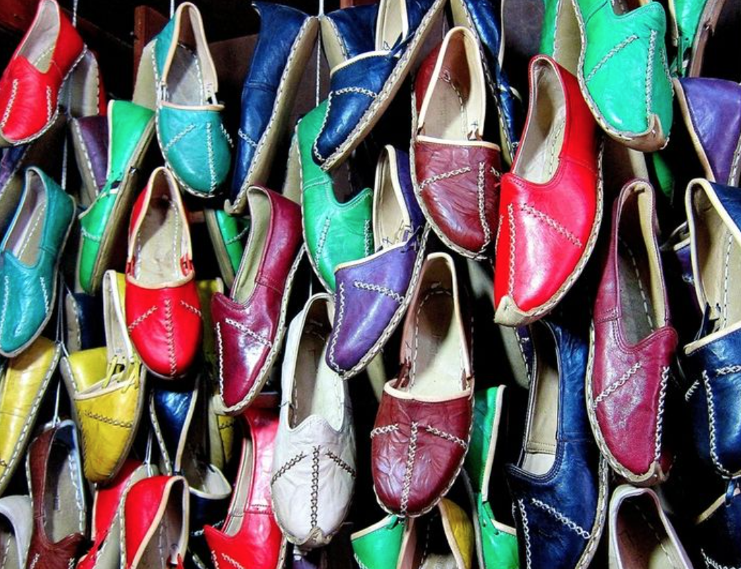
Yemeni Shoes of TurkeyOne of Safranbolu’s past economic activities was leather processing and production of leather goods. There were over 80 tanneries at the edge of town at one time. Safranbolu had artisanal shops spread over the city creating high quality yemeni (light, flat-heeled shoes), saddles and other common leather goods. For those that know this author, yes, I purchased two pair of Yemeni shoes.

Meat processing was also an important source of livelihood as a by-product related to the tanneries.

At one time there was a weaving culture in Safranbolu with over 350 working looms as late as the 1920s.
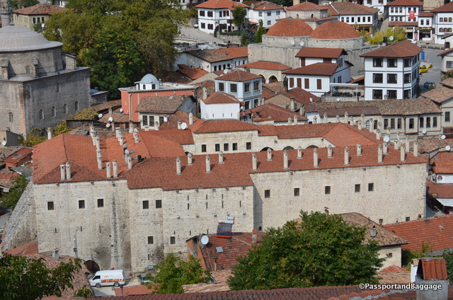
Looking down onto the Caravansary

Looking down onto the Caravansary

Today there are only two of the original economic trades remaining. Cinci Han which is the caravansary, now converted to a hotel and café, and one loan gentleman making shoes.

Safranbolu Houses

While the exteriors of the houses throughout Safranbolu look very similar, there are actually three different types of homes. The winter houses in the Çarşı (Marketplace) district, summerhouses in the Bağlar (Vineyards) district and the Greek Orthodox houses in the Kıranköy district., I am only going to discuss the houses of Çarşı, as that is the only area that I explored.
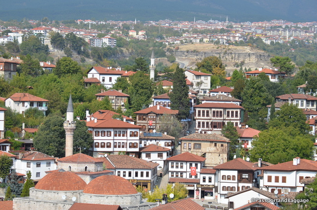
Looking down from one of the hillsides into the center of town

Looking down from one of the hillsides into the center of town

The Çarşı houses mainly belong to the Muslim community, and their functionality shows this. Originally there were specific rooms for women and turnstile type serving niches so women did not mingle with men during meal times. These houses also have no ground floor workshops or artisanal spaces. It is believed that the few houses with these features once belonged to the Greek-Orthodox citizens.
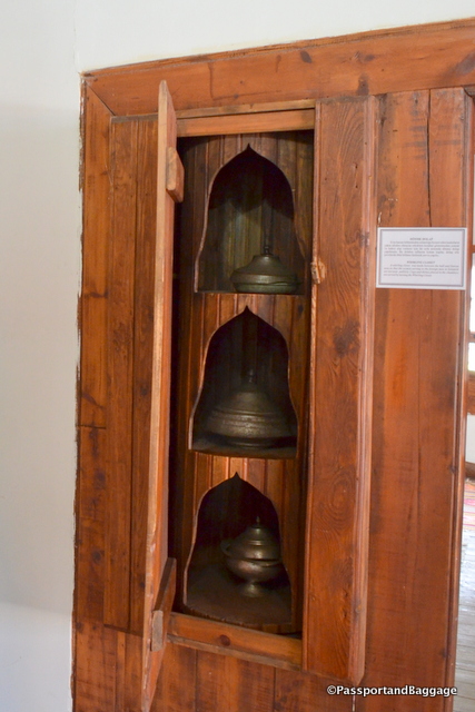
The shelf the three dishes sit on turns so that the food can be placed here and spun to the room with men.

The shelf the three dishes sit on turns so that the food can be placed here by women and then spun to the face the room with men.

The Çarşı area of Safranbolu sits in a very, very narrow canyon. The houses in the district are located on the slope. The soil of this area is barren and not suitable for growing plants, so the soil was carried in by camels and oxcarts and placed into plots held back by rock retaining walls.
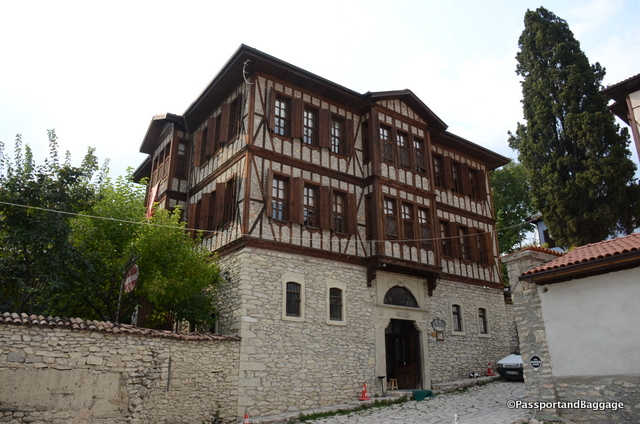
An excellent example of a properly restored Safranbolu house. The wall to the left envelops the garden

An excellent example of a properly restored Safranbolu house. The wall to the left envelops the garden

The houses are built on rubble stonewalls adapted to the slope and usually, have one façade on the street. It limits the relationship with the street on the ground floor so that, walls on the street side continue as high garden walls and provide full privacy.

Until the 18th century, Safranbolu was a settlement of mud filled wooden frame houses over rubble stonewalls placed on the slope of the canyon. The vernacular architecture (architecture without architects) of Safranbolu is entirely made of local materials.

The rubble walls are constructed with clay mortar and little stone pieces called “çivilik”, hammered into gaps between large stones and wooden beams, that are called “sar,” The floors above the ground floor are supported by a wooden frame made of yellow pine timbers and a few black pine timbers. No wooden joints are used, they are all made with wrought iron nails, an important feature since Safranbolu sits of the North Anatolian Fault.
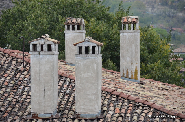
Chimneys of SafranboluThe chimneys are placed atop these stonewalls helping to increase the resistance of the building to lateral forces, especially during earthquakes.

The wooden frame is generally filled with puddled clay and sometimes with wooden pieces. In later years, the wooden frame was filled with pieces of stone and lime mortar between framework timbers nailed from inside and outside on the wooden frame. This application is called “çakatura”.
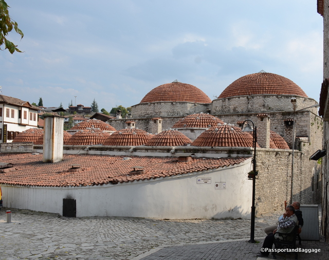
The clay roof of the local Hammam

The clay roof of the local Hammam

The roof of the Safranbolu house was covered with wooden boards called “pedavra” until the 19th century. After a big neighborhood fire, tile-kilns were opened in the region by the order of Abdurrahman Paşa, the governor of Kastamonu of the period, now all roofs are tiled.

Glass in windows was not used until the 19th century. During extreme weather, the “kara-kapak”s (shutters) were kept closed.
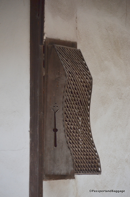
A restored Musbak

A restored muşabak

Originally there would have been muşabaks (lattice windows) so that the women could look out without being seen. These were removed during the formation of the Republic when many laws were enacted to help bring Turkey into the 20th century.
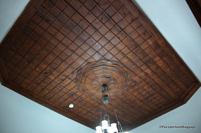
The ornamental wooden ceilings of the houses can be found in most every room

The ornamental wooden ceilings of the houses can be found in almost every room

Safranbolu started to change after World War I, while the town was not really affected by the War of Independence it was responsible for making shoes for the soldiers. The tanneries died out after these shoes were no longer necessary.

Caravan operations that were the most important economic function of Safranbolu lost all of their importance with the completion of the Gerede-Safranbolu Highway in the 1950s

During the population exchange of the 1920s, the Greek-Orthodox community moved to Greece and Muslims from Rhodes were moved into this area. Most of the people that came to settle in Safranbolu at the time were not happy with the environment and left almost immediately.
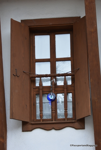
Shutters help regulate the extreme temperatures of this area.

Shutters help regulate the extreme temperatures of this area.

According to the first census conducted in 1927, the population of Safranbolu was 5,218. Safranbolu continued to lose its population into the 1930s with wealthy notables of Safranbolu, who had sold their land to the government, migrated to Istanbul. The population decreased even more in the 1940s when only elderly couples that could not leave Safranbolu and their daughters who were still single remained in the town. The population today is 31,697.
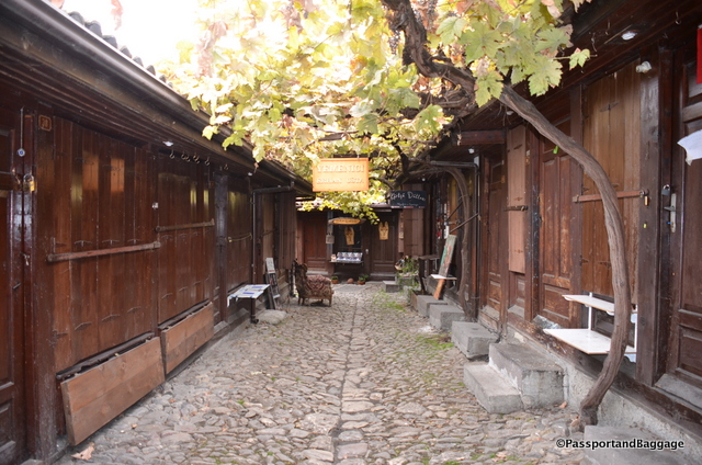
Just one of many dead-end streets that make up Safranbolu

Just one of many dead-end streets that make up Safranbolu.  This is the Arasta or Ottoman Market Hall, now a shopping area, not quite open for business when I took this photo.

In June of 1975, the Safranbolu Town Council declared that “…all restorations and alterations considered should be made as restorations that do not damage the old architecture, especially at the town center…” It took many years, and many conferences and meetings, but after a concerted effort by many organizations Safranbolu became a cultural heritage site. There is a movie shown at the Kaymakamlar House Museum of the 1970s, the photos, in black and white, show a deserted town that would resemble any ghost town of America’s wild west.
SafranboluSafranbolu was made a UNESCO world heritage site in 1994, also putting it on every tourist’s list.

Tourism has not been very kind to the area. It is said that the average stay of most people is 1.65 days. This is about what we are spending here, and truth be told, it is really all that you need. The government has tried to diversify tourism hoping to spread it out equally through the week and months but have not been successful.

One of the most important reasons for Safranbolu being on the UNESCO World Heritage List is the fact that it is “a Living City” under serious threat. Unfortunately, today, even though almost 27 million TL has been spent to restore about 90 historical houses, they are all being operated as hotels. We are in fact staying in one, the Kahveciler Konaği. It is stunning and gives you a wonderful feel for how the people of the past actually lived, however, I understand many are not restored to this caliber, and in fact are cheaply done with no real historical sense.

There are really only two handicrafts still maintained in Safranbolu one is shoemaking; it is being kept alive by a single shoemaker. The other is copper and tin working.  There is an entire area with shops dedicated to this art.
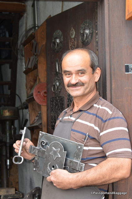
This gentlemen was happy to show his craftsmanship at making the beautiful locks you find around town.

This gentleman was happy to show his craftsmanship at making the beautiful locks you find around town.
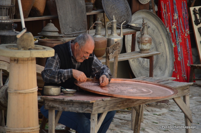
A coppersmith decorating one of the many trays you will find for purchase in the area.

A coppersmith decorating one of the many trays you will find for purchase in the area.

Apparently the making of these “model houses” emerged in the 1990s and became “commodities” that were transformed into poor quality kitsch objects that were copies of copies. If you so desire, you can buy them filled with Turkish Delight, the one thing that is sold absolutely everywhere in this town.
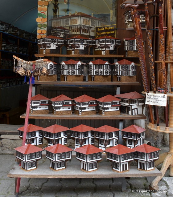
houses of SafranboluUnfortunately, a good heritage area for a tourist may not always be good for the heritage area itself. Especially, as seems to be the case here in Safranbolu, where restorations and services are being shaped according to the wishes and tastes of insensible tourists.

The population of the Çarşı District is aging rapidly. The family heads who are mostly retired complain that the young family members do not want to live in the Çarşı district. The owners of the houses do not have the economic where-with-all to restore the houses. It will be interesting, especially with the falling tourism that has recently occurred, how this town will fare in the future.

Wandering and Exploring the town of Safranbolu
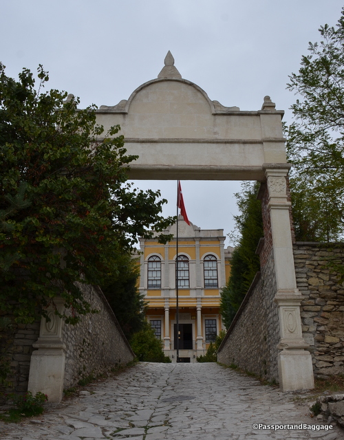
The front of the Old City Hall Mansion

The front of the Old City Hall Mansion

This “mansion” was built by the Kastamonu Regional Governor, Enis Pasha in 1906.  The building was used as a Military, Civilian and Judicial Management Center.
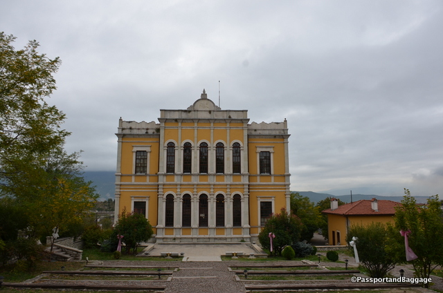
The back of the building shows how very different the architecture was. This would have been due to the fact that it was built in the early 20th century.
The back of the building shows how very different the architecture was. This would have been due to the fact that it was built in the early 20th century.

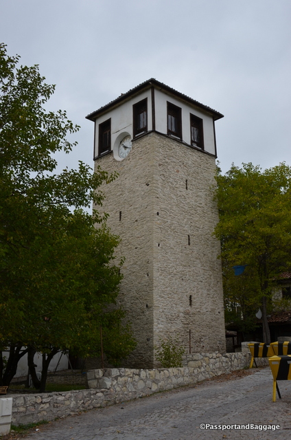
Behind the City History Museum is the Clock Tower. Built in 1797 is was a gift to the town by the Grand Vizer of Selim.

Behind the City History Museum is the Clock Tower. Built in 1797 it was a gift to the town by the Grand Vizer of Selim.

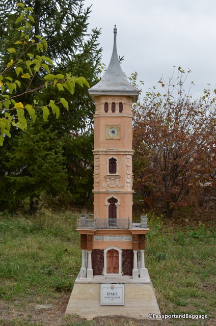
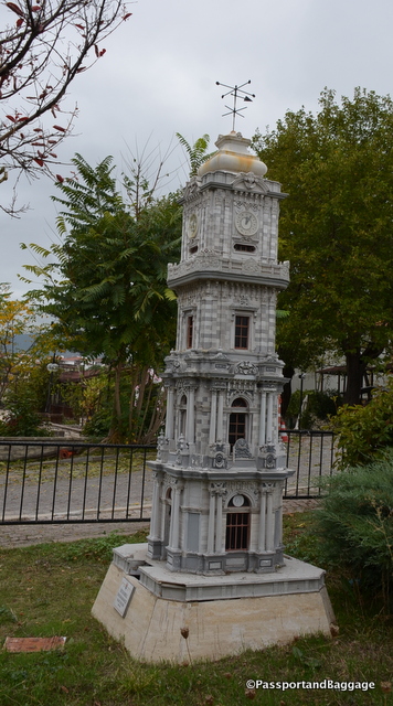
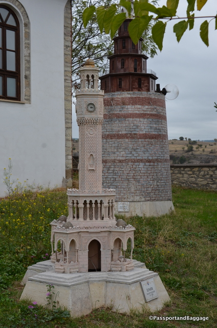
On this same hill as the City History Museum and the Clock Tower is a small park with replicas of clock towers all over Turkey.  They all once kept time, and many were obviously lit, but the park and the towers are in severe disrepair.
dsc_7840

The towers of Izmir and Edirne

dsc_7839

The tower of Izmet

The Tower of Istanbul
The Tower of Istanbul

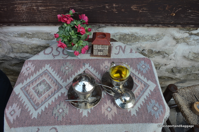
We stopped for Saffron Tea, while it should be common it was difficult to find.

We stopped for Saffron Tea, while it should be common it was difficult to find. It is hot water, saffron, lemon, honey and cloves. Worth seeking out!
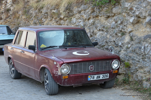
Someone is very patriotic
Someone is very patriotic

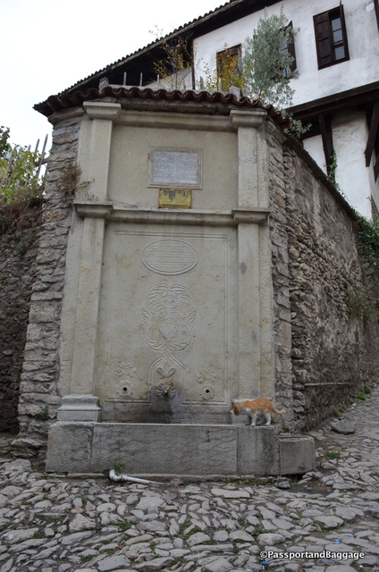
These water spots are everywhere, not only in town but throughout the country. The name of the person that game the money for them is almost always inscribed in the stone.

These water spots are everywhere, not only in town but throughout the country. The name of the person that gave the money for them is almost always inscribed in the stone.
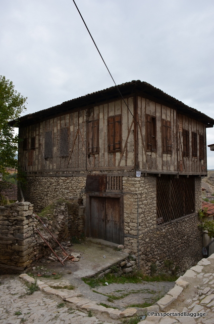
Another dilapidated chic building of the area.
Another dilapidated chic building of the area.

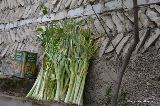
It is leek season
It is leek season

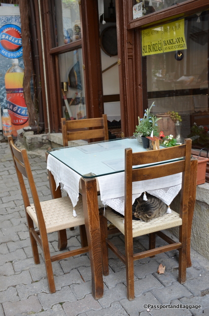
Stray cats and dogs are rampant throughout this part of Turkey, more than one would expect.
Stray cats and dogs are rampant throughout this part of Turkey, more than one would expect.

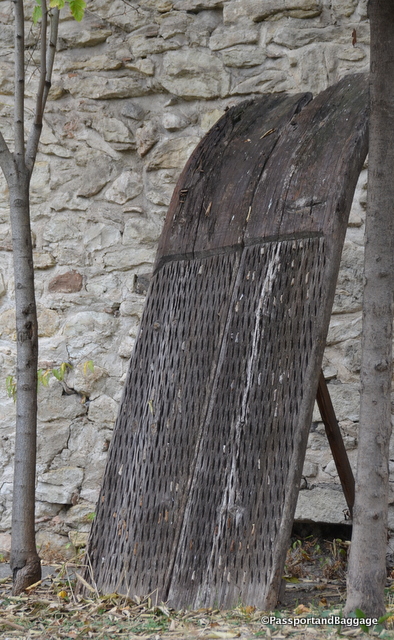
You will find these threshing boards all over Safronbola. They are obsolete farm implements used to separate cereals from their straw. They consist of two or three wooden planks put together and then pierced with several hard and cutting flints crammed into it. Two horses pulled the board while a person stood on it, riding in circles over the cereal that was spread on the threshing floor.
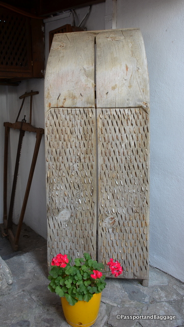
You will find these threshing boards all over Safronbolu. They are obsolete farm implements used to separate cereals from their straw. They consist of two or three wooden planks put together and then pierced with several hard and cutting flints crammed into it. Two horses pulled the board while a person stood on it, riding in circles over the cereal that was spread on the threshing floor.

Thresher

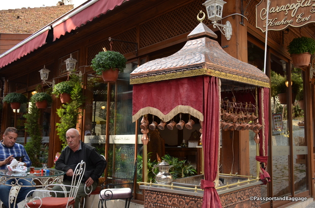
A sidewalk Turkish Coffee Vendor

A sidewalk Turkish Coffee Vendor

One of the sitting rooms in a typical home, this one happens to be in our hotel
One of the sitting rooms in a typical home, this one happens to be in our hotel

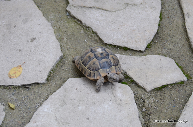
The hotel's tortoise.

The hotel’s tortoise.

Lunch today was at a wonderful spot, in fact we most likely will be returning for dinner, Kadioğlu Şehzade Safrasi.
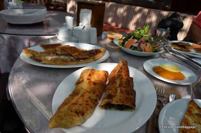
Pide and Bükme
Pide and Bükme

Safranbolu,

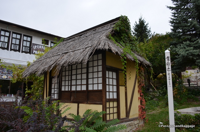
This Japanese style structure sits on the main square of the town. There is a plaque on the building explaining it, but the English translation leaves a lot to be desired. Basically, it is a gift to the town, because of a man, born in Safranbolu, that became a nuclear engineer. He spent time in the US but a better portion of time in Japan, where he made an impression on those he met. He returned to Istanbul but is buried here in Safranbolu, and this is in his honor, I think from the Japanese.

Safranbolu is a marvelous town to visit.  I do not recommend more than one day, but it is the perfect spot to get a good feel for the architecture of Turkey.  Sadly, it is becoming a bit kitschy.  I do hope it survives the tourism downturn and finds a way to continue as a “living town”.

The town of Yörük Köyü lies just a few miles outside of Safranbolu.  The town has not been restored, giving one a chance to see the exterior construction techniques of the Ottoman home in better detail.  You can read about that here.
Oct 052016
 

October 4, 2016

Our day began this morning in the town of Abano. We had driven from Sinop the day before along the coast of the Black Sea. After overnighting in a “resort” hotel with only 6 other guests in this off-season we chose to take the coastal road all the way to Amasra.

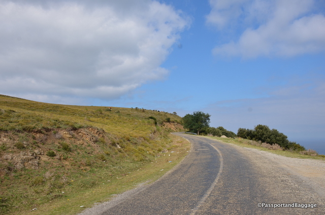
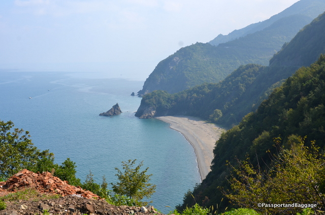
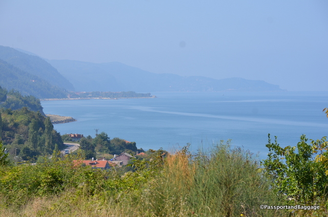
Black Sea RoadsThere is no way to explain this road. It is often only wide enough for two cars if they are both in their own lane and going slowly, it is often only wide enough for one.

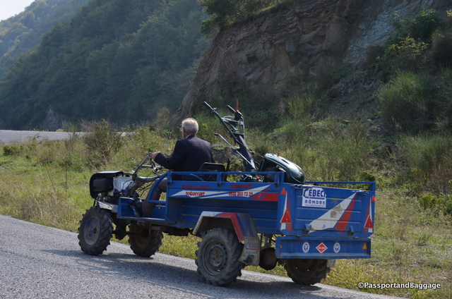
A farmer with a far more practical form of transportation

A farmer with a far more practical form of transportation

The topographical change within each mile is stunning. Seven of every eight turns is a blind curve and is either going at a 10 or 15% grade up or down.

There were many places where the road on the cliff side was undercut with erosion, making you hug the mountain as hard as your imagination would let you.

An absolutely unreachable pristine beach

An absolutely unreachable pristine beach

I would not have missed this drive for anything! I was the driver this day, I almost never got over 45KMH or 30 MPH, and I am an experienced driver with some race course time under my belt. The car is a manual, in other words, a stick-shift, my shoulder was exhausted after hour three, as I was shifting between 2nd and 3rd approximately every 1 minute.

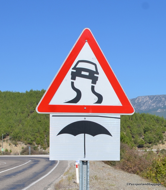
Turkish road signs are some of the best

Turkish road signs are some of the best

The views were amazing, not just of the Black Sea coastline, but of the sheer cliff farm houses and orchards we saw along the way.

I did not take enough photos of this drive, as there just were no places to safely pull over. If you ever do the Black Sea, I highly recommend the drive, but allow much more time than the maps tell you, and I would recommend an automatic.

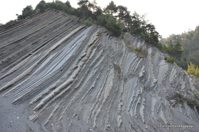
The result of Tectonic Slamming

The result of Tectonic uplift is evident throughout your drive

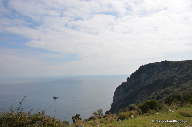
The Pontic Mountains spill into the Black Sea in this area, in some places making it too shear, to actually build roads or live along the coast. These mountains, like the Rockies were formed by plate collisions. In other words, where the tectonic plates slammed against each other creating this uplift of the earth. This made for some stunning views out our windows.

For much of this drive we were in the Kaçkar range, which is the highest point in the Pontic Mountains.

Cape Karambis

Cape Karambis

Very near the town of Doğunyurt is Cape Karambis. The promontory is the nearest point on the Anatolian coast to the Crimean Peninsula and has for centuries served as a nautical landmark for those seeking to cross the Black Sea at its narrowest point.

İNEBOLU

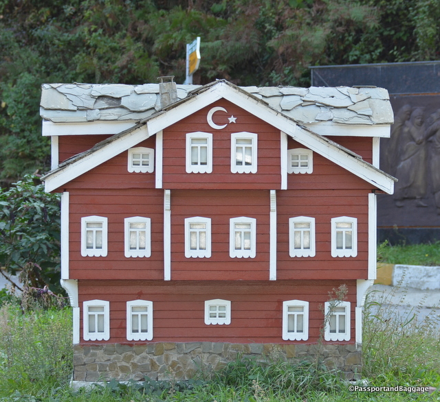
The town of İnebolu is known for its architecture. While we did drive through the town the houses that we had hoped to see are way up in the hills. When getting lost, I found this little model of the homes that the area is famous for. It probably shows them better than any real one would, as the area is densely forested, and homes are hard to see.

A model of the homes of Inobolu

A model of the homes of Inobolu

Architectural descriptions of the homes explain that the ground floor is built of stone and contains a cellar and pantry. Above it are one or two stories, each containing four bedrooms, one antechamber, a kitchen and toilet. Each of the floors is built so that it can easily be converted into one independent flat by closing a single door. This feature allows the married children of families to continue living in the same ancestral home they grew up in. Each floor also has its own separate street access.

The rooms have many windows and each room has a corbel and framework which enables the women to look out onto the street without being seen. The ceilings of the rooms are high and covered in carved art. Hand-rails in the houses are carved from a single piece of wood.

Most of the houses have roofs that are tiled with a special sea-stone called marla. The tiles are wide, thin and heavy, and protect the houses from the strong northeast winds that blow across the Black Sea. The stone also provides an excellent insulation against heat.

Each house has an orchard garden, we saw apples, pears, hazelnuts, chestnuts and walnuts. Apparently every garden has a well, which is used to refrigerate foodstuffs during the hot summer days.

The houses are painted with a special claret mineral pigment known as aşı boyası, which is highly resistant to sunlight and weathering.

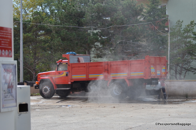
Every gas station has someone that will power wash your vehicle.

Every gas station has someone that will power wash your vehicle.

AMASRA

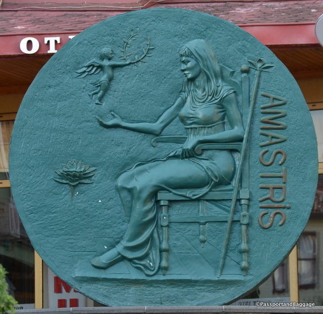
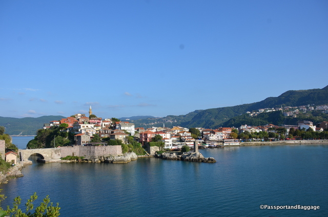
Amastris

Amasra derived its name from Amastris, the niece of the last Persian king Darius III, who was the wife of Dionysius, tyrant of Heraclea

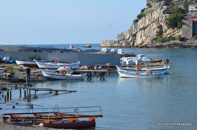
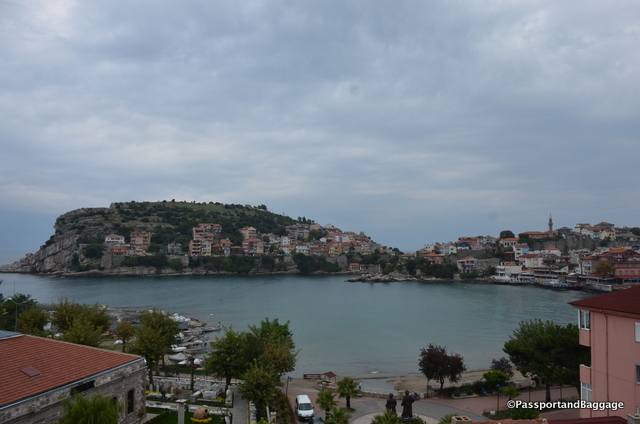
Our day finished in Amasra. It is a wonderful small town sitting on a small bay that just begs for a quiet cup of coffee and a long time to sit and enjoy.

Originally called Amastris by the Greeks, the town today is known for its beaches and natural setting, which has made tourism its biggest business.

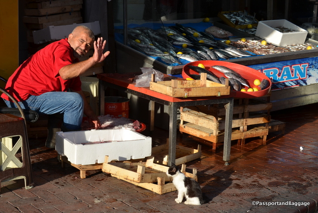
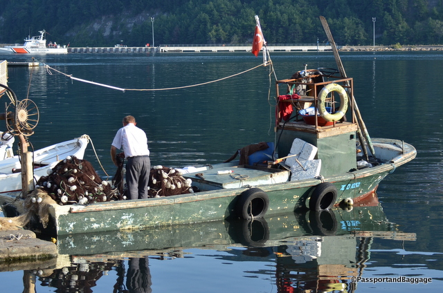
Amasra is a fishing village, and the cats know where their bread is buttered.

Amasra is a fishing village, and the cats know where their bread is buttered.

Amasra

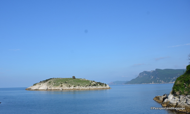
*Amasra TurkeyAmasra has two islands: the bigger one is called Büyük ada (‘Great Island’), the smaller one Tavşan adası (‘Rabbit Island’). You can walk across a very, very short bridge to Great Island and visit its small residential enclave. Rabbit Island is completely barren and is just a stones throw from the mainland and Great Island.

Rabbit Island

Rabbit Island

Grand Island is off to the left

Grand Island is off to the left

The towns history is deep, it was mentioned by Homer in one of his stories. Like most of Turkey it has seen multiple invasions, but it was mentioned by Pliney the Younger during Roman times. In 1261 the city became part of the Republic of Genoa.

Amasra Castle

Amasra Castle

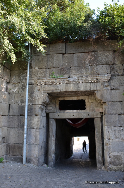
Amasra Castle was built during the Roman period. The walls of the castle were built by the Byzantines. The front walls and gates were built by the Genoese in the 14th and 15th centuries. Though located on a narrow peninsula, a tunnel under the castle leads to a fresh water pool.

One of the many gates of the Amara Castle. The castle is on UNESCO's World Heritage Tentative List

One of the many gates of the Amara Castle. The castle is on UNESCO’s World Heritage Tentative List

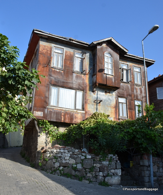
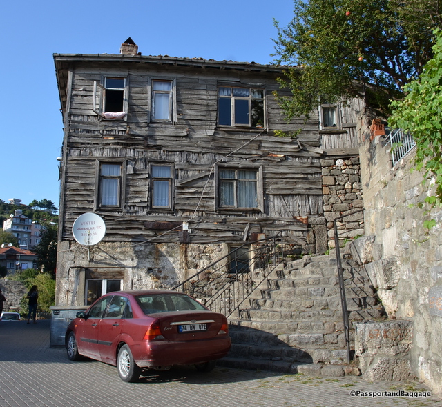
Two old Turkish homes on the Grand Island

Two old Turkish homes on the Great Island

Amasra Turkey

*

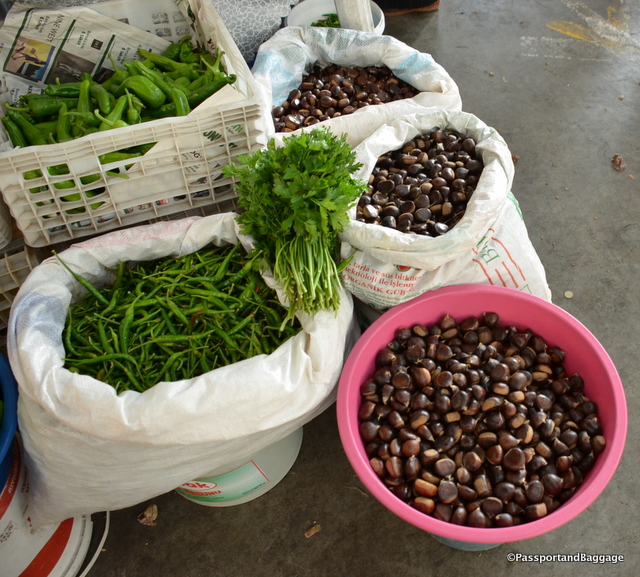
It was market day. This area is famous for its chestnuts.

It was market day. This area is famous for its chestnuts.

Amasra, Turkey

*Amasra Turkey

*Amasra Turkey

The evening ended with a stupendous fried anchovy dinner at Mustafa Amca’nın Yeri – Canlı Balık Restaurant.

fish at Mustafa Amca'nın Yeri - Canlı Balık Restaurant

Oct 042016
 

October 2, 2016

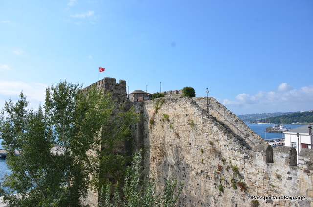
Fortress walls of Sinop, Turkey

Fortress walls of Sinop, Turkey

Our Black Sea journey begins at Sinop and will end in Amasra. Sinop sits on the most northern edge of the Turkish side of the Black Sea coast.

Long used as a Hittite port, the city proper was re-founded as a Greek colony from the city of Miletus in the 7th century BC.. Sinope flourished as the Black Sea port of a caravan route that led from the upper Euphrates valley.

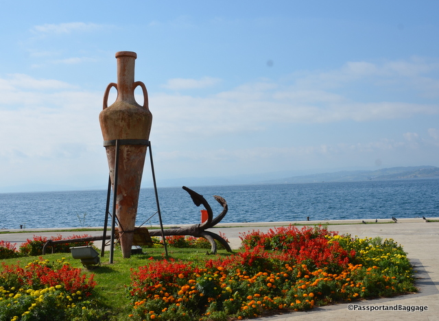
Looking out to the Black Sea from downtown Sinop

Looking out to the Black Sea from downtown Sinop

Sinope escaped Persian domination until the early 4th century BC. In 183 BC it was captured by Pharnaces I and became capital of the Kingdom of Pontus.

The Roman general Lucullus conquered Sinope in 70 BC, it continued to be conquered throughout the ages.

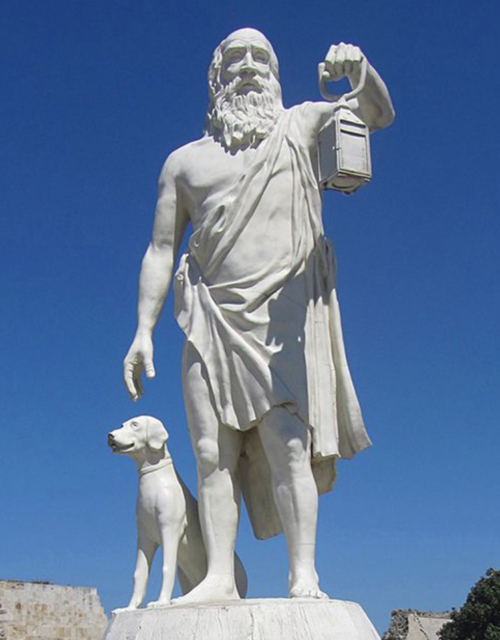
Diogenes always carries a lamp because he is "looking for a good man" and never finding one.

Diogenes always carries a lamp because he is “looking for a good man” and never finding one.

Sinop was the birthplace of Diogenes, a Greek philosopher and one of the founders of Cynic philosophy. My favorite story of Diogenes includes Alexander the Great. It is said that while in Corinth Diogenes was relaxing in the morning sunlight, Alexander, thrilled to meet the famous philosopher, asked if there was any favor he might do for him. Diogenes replied, “Yes, stand out of my sunlight”. Alexander then declared, “If I were not Alexander, then I should wish to be Diogenes”. In another account of the conversation, Alexander found the philosopher looking attentively at a pile of human bones. Diogenes explained, “I am searching for the bones of your father but cannot distinguish them from those of a slave.”

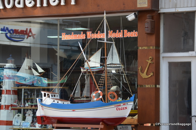
Boat model shops are rather prevalent around downtown Sinop

Boat model shops are rather prevalent around downtown Sinop

On November 30, 1853, the Imperial Russian Navy crossed the Black Sea to Sinop, attacked the Ottoman fleet which was in port there, and utterly destroyed it. The Russian bombardment went on long past when it was clear the Ottomans were defeated, killing many Ottoman sailors who were no longer combatants.

The “massacre of Sinope” was one of the events precipitating the Crimean War (1853-1854) in which Great Britain and France declared war on Russia and fought with the Ottoman Empire.

Sites around the town of Sinop, Turkey

Sites around the town of Sinop, Turkey

SynopSinop hosted a US military base used to gather intelligence during the cold war era. The US base was closed in 1992.

Our hotel was Zinos, our fish dinner in the hotel was sublime.

A view of the Black Sea between Sinop and Arabo

A view of the Black Sea between Sinop and Abano

We drove out of Sinop and through the Pontic mountains for about three hours, on our way to the town of Abano. The coastline we are driving over, during the days we are in the Black Sea area, is one of the least frequently traveled sections of Turkey, partly because until very recently no road existed along the shore. There is really nothing here, we just wanted to drive the coast at a leisurely pace.

The Black Sea

Throughout the countryside we ran across many of these houses, completely covered in tiles with small mirrors in the center of the patterns.

Throughout the countryside we ran across many of these houses, completely covered in tiles with small mirrors in the center of the patterns.

As we have been driving around Turkey it has been difficult to grasp the inner workings of the Turkish culture and economy.  Regarding the economy, their GDP grew considerably and then took a dive in 2015. According to one US study “Mounting political turmoil in Turkey will drag on business sentiment going forward. This situation, coupled with security concerns in the country, will impact growth.” It is very obvious that tourism has taken a real hit in Turkey, how that will play out overall, only time will tell.

The birth rate of Turkey is also on the decline.  Like most every country in Europe this is obvious in the countryside where the young are very rarely seen.  However, I have been rather amazed at the amount of families we have encountered on this trip, especially in the “tourist” areas and in the big cities.  The government is attempting to give incentives for birth, but they are nominal and not practical.  However, the government does hope that refugees living in Turkey could help solve the issue. Turkey currently hosts nearly 3 million Syrian refugees, aand more than 1 million of them are children, according to the Directorate General of Migration Management of the Turkish Interior Ministry.

One cannot discuss Turkey without addressing several moments of Genocide in their history.  These subjects are forbidden to discuss in Turkey itself, leading to a massive wiping out of collective and historical memory.

I met a wonderful Kurdish gentleman that said his friends do not even know he is Kurdish, as they would treat him differently or simply stop being his friend should they know.  It is against the law to speak the Kurdish language in Turkey even though Kurds in Turkey are the largest ethnic minority in the country. According to various estimates, they compose between 15% and 20% of the population of Turkey, and are primarily concentrated in the east and southeast.  According to NEO “It won’t be an exaggeration to state that Turkey’s president, Recep Tayyip Erdogan, is systematically exterminating Kurds throughout Turkey which constitutes an act of genocide.”

Then there is the Armenian Genocide. The Armenian Genocide began with the forced deportation of the majority of the Ottoman Armenian population between 1915 and 1917. Further massacres and deportations occurred during the closing stages and immediate aftermath of World War I. The modern Turkish government has always denied the fact that the massacres of the Armenians during the Ottoman period constituted genocide.

Regarding the movement to a more radical form of Islam in the country, W. Robert Pearson  U.S. ambassador to Turkey from 2000 to 2003 and currently a scholar at the Middle East Institute and his colleague Gregory Kist graduate of the London School of Economics and Political Science state that “much has happened since the Arab Spring to challenge (President) Erdogan’s domestic and foreign policies. Domestically, while he has won a new mandate to seek the constitutional change to cement his political control, he has done so at the cost of a growing Kurdish insurgency and the elimination of media freedom. His disregard for institutional controls on government and belief in populist justification for authoritarian rule has deepened internal tensions.

Regionally, his missteps in Syria — from which Turkey is now experiencing the consequences — compare unfavorably with Turkey’s historically pragmatic approach and highlight risky and ideological tactics that are failing. His devotion to his original philosophy has brought him great political successes, but the costs continue to mount for him, for the Turkish people and for stability in the region.”

I have experienced this in seeing many, many more women dressed in more conservative Islamic required dress than ever before in Turkey, and women’s rights are eroding as well.

In addition to all of this the government has fired 10,000 teachers and has ordered the closure of 102 media outlets, including 45 newspapers, 16 TV channels, three news agencies, 23 radio stations, 15 magazines and 29 publishing houses. Arrest warrants have been issued for more than 100 journalists.

There is a vast change occurring in Turkey, but where it will go is impossible to know.  I will say that I have only been greeted by the most wonderful, accommodating, helpful and kind people wherever I have gone. I have not experienced any anti-American sentiment either, despite all that I read in the papers before I left.

Oct 032016
 

October 2, 2016

Amasya, TurkeyOur last day in Central Anatolia was spent in Amasya. Amasya is on the short list to become a world heritage sight for Mount Harşena and the rock-tombs of the Pontic Kings. This centuries old city lines the Yeşilırmak River.

Walls of the Ancient Fortified Town

Walls of the Ancient Fortified Town

You can still see parts of the fortified ancient city of Amasya on the hills. It has a long history as a wealthy provincial capital, producing kings and princes, artists, scientists, poets and thinkers. This includes the kings of Pontus, Strabo the geographer, (a Greek geographer, philosopher, and historian who lived during the transitional period of the Roman Republic into the Roman Empire), and many generations of the Ottoman imperial dynasty.

Statues of important Ottomans line the river walk

Statues of important Ottomans line the river walk

During the early Ottoman rule, it was customary for young Ottoman princes to be sent to Amasya to govern and gain experience. Amasya was also the birthplace of the Ottoman sultans Murad I and Selim I, making the town very important in terms of Ottoman history.

Amasya, TurkeyTraditional Ottoman houses near the Yeşilirmak and the other main historical buildings are being restored and many are now cafes, restaurants, and hotels.

Waterwheels of AmasyaThere are five bridges crossing the river and these interesting water wheels, once used to lift water out of the river for irrigation, scattered near the pedestrian bridge.

The Sultan Beyazit Mosque and Theological College.

The Sultan Beyazit Mosque and Theological College.

The Sultan Beyazit mosque, built in 1486, is covered in scaffolding, and from what I have read; it has been in this state for quite a while. The garden around the mosque is truly lovely with trees, they say, are as old as the mosque.

Paintings on the interior roof of the adulation station. These paintings were in several mosques around Amasya

Paintings on the interior roof of the ablution area. These paintings were in several mosques around Amasya

This little mosque, tucked away deep in the city, is the Yürgüç Pasa mosque, it was built in 1428.

This little mosque, tucked away deep in the city, is the Yürgüç Pasa mosque, it was built in 1428.

The interior of the Blue Seminary with its Seljuk architecture

The interior of the Blue Seminary with its Seljuk architecture

The Blue Seminary is a theological complex dating from 1267; it is typical of Seljuk architecture. It takes its name from the blue tiles found in small quantities both inside and outside, what is now a mosque. Within the complex is the 1272 tomb of the Seljuk governor and founder of the seminary Emir Torumtay.

The interior blue tile of the Blue Seminary

The interior blue tile of the Blue Seminary

The exterior blue tile of the Blue Seminary

The exterior blue tile of the Blue Seminary

Tombs inside the Blue Seminary

Tombs inside the Blue Seminary

The tombs of the Pontic Kings are best seen from down below while in town, they date from 333 BC to 44 BC.

Pontic King Tombs of Amasya

Pontic King Tombs of Amasya

These five big tombs are the archaeological remains of the Kingdom of Pontos, and nearly all that remains of the Kingdom.

Amasya was the capital of the dynasty of the Mithridatids of Pontos for about a century, between about 281 and 180 BC. The five kings MithridatesI, II and III, Ariorbarzanes and Pharnakes I all ruled here.

The Burmali Minare Mosque ("Burmali Minare" means Spiral Minaret in Turkish) was built between 1237 and 1247 by the Seljuks.

The Burmali Minare Mosque (“Burmali Minare” means Spiral Minaret in Turkish) was built between 1237 and 1247 by the Seljuks.

An archway in the old market area of Amasya

An archway in the old market area of Amasya

As phone booths around the world disappear, these two in Amasya were very fun to trip across.

phone in Amasya

Amasya takes but a few hours to explore.  We began our drive to the Black Sea around noon, some sights along the way:

Logging trucks were everywhere.

Logging trucks were everywhere.

We drove along the The Kizilirmak for a goodly portion of our drive. The Kizilirmak (Turkish for “Red River”), is the longest river entirely within Turkey. It is a source of hydroelectric power and is not used for navigation.

Red River of TurkeyThe Hittites called it the Maraššantiya. It formed the western boundary of Hatti, the core land of the Hittite empire. In Classical Antiquity, it was the boundary between Asia Minor and the rest of Asia, and also the boundary between Pontos and Paphlagonia. As the site of the Battle of Halys or Battle of the Eclipse on May 28, 585 BC, it was the border between Lydia to the west and Media to the east until Croesus of Lydia crossed it to attack Cyrus the Great in 547 BC.

The Red RiverThe river water is used to grow rice and in some areas water buffalo are kept, but it is very, very sparsely populated making for a relaxing and stunning drive.

The signs along the road amused me greatly.

The signs along the road amused me greatly. Sadly, a few miles past this sign we came across an Anatolyan wild boar that had been killed by a car, making us realize you don’t take these signs lightly.

Turkish road signs


It is difficult to explain how vast the center of Anatolya is.  You travel for miles and miles without seeing a thing but farmland or open land.  Every once in a while you will trip across a very, very large town, that seems to have no purpose other than a population center.

large Turkish Town

The total land area of Turkey is slightly larger than the state of Texas with a population of around 80 million.

Oct 022016
 

October 1, 2016

The reason to drive nearly 200 miles across Central Anatolia is to visit the center of the Hittite civilization.

Overlooking Boğakale

Overlooking Boğakale

No one is certain about the origins of the Hittites, or for that matter, how they got to Anatolia, but it is clear they arrived sometime before the 2nd millennium BC. The Hittites were the first powerful empire to arise in Anatolia and its capital was Hattuşuş, now called Boğakale.

The Lion's Gate was on the south-west wall of the city fortifications.  It has two parabola shaped stones that once held a pair of wooden doors.  The lions, like all of the gates at this site, have been removed to museums and these are reproductions.

The Lion’s Gate was on the south-west wall of the city fortifications. It has two parabola shaped stones that once held a pair of wooden doors. The lions, like all of the gates at this site, have been removed to museums and these are reproductions.

The Hittite language was written in both cuneiform script and hieroglyphics and is though to be the oldest of the Indo-European languages, it was only deciphered in 1915.

This Lion Basin stood at the entry to a temple in the Lower City

This Lion Basin stood at the entry to a temple in the Lower City

The Hittites were an advanced civilization with knowledge of forging iron. This made them a powerful military force.

This is called Hieroglyphic Chamber #2. On the left side is the King as a warrior with a bow, spear and sword.  On the back wall is an unnamed god in a long cloak with a winged sun disc above his head.  He carries a sign similar to the Egyptian Ank, meaning life, in his hand.  It the inscription on the right wall the king reports various conquests.

This is called Hieroglyphic Chamber #2. On the left side is the King as a warrior with a bow, spear and sword. On the back wall is an unnamed god in a long cloak with a winged sun disc above his head. He carries a sign similar to the Egyptian Ank, meaning life, in his hand. It the inscription you see in the photo above, on the right wall, the king reports various conquests.

Their cuneiform texts reveal a complex legal system and a fair treatment of criminals and prisoners.

King Anitta conquered a large part of central Anatolia and increased the kingdom. However, this also led to decentralization and the empire splintered into city states. It was reunited under King Huzziya. One of King Huzziya’s successors Labarna Hattushili I is considered to be the founder of the Old Hittite Empires. One of Huttushili I’s grandsons finally managed to conquer Babylon around 1530 with the empire reaching its peak around 1260 BC when Hattushili III and Ramses II (ruler of Egypt) signed an agreement of peace and friendship.

At the top of the city is this long tunnel of large boulders. It is an absolute feat of engineering.

At the top of the city is this long tunnel of large boulders. It is an absolute feat of engineering.

It is thought that this treaty was signed after what might have been the largest chariot-battle ever fought. It is said that some 5000 chariots were involved in a battle between Ramses II and the soldiers of Hattusili II.

Atop the tunnel is the Sphinx Gate, these are reproductions of the originals.

Atop the tunnel is the Sphinx Gate, these are reproductions of the originals.

The treaty, written in both Egyptian hieroglyphics and in Akkadian, using cuneiform script, declares that both peoples and their gods want peace.

This is the Kings Gate. The approach to the gate from the outside was by way of a ramp that was protected by a separate outer wall and bastion.

This is the Kings Gate. The approach to the gate from the outside was by way of a ramp that was protected by a separate outer wall and bastion.

It may be the world’s first known peace treat. In fact a copy hangs at the entrance to the Security Council chamber at United Nations headquarters, while the original is in the Istanbul Archeological Museum.

It is not known exactly what caused the fall of the Hittite Empire but written texts discuss famine and a rise of the power of Syria.

The next people to live in this area were the Phrygians from around 500 – 900 BC. The Phrygians fell to the Cimmerians in the 7th century BC until Alexander the Great conquered Anatolia in 330 BC.

Yazilikaya

Just up the road from Boğakale is a sacred spot of Hattusha. There are 2 temples with carved reliefs worked into the mountain.

The hidden entry to Tomb #2

The hidden entry to Tomb #2

In the first are rows of figures in relief, gods on one side and goddesses on the other. On the main façade is the meeting of the Tempest God and his wife the Sun Goddess plus their children. On another wall is King Tuthalia I.

Tombs

King

King Tuthalia

Tombs

The Passage of Tomb #1 with carvings on both sides.

The Passage of Tomb #1 with carvings on both sides.

dsc_7534

Tomb #1

TombsIn the second temple are the Twelve Gods and the Sword King Nergal carved into the rocks. In this temple you will also find Sharruma, the Protector God.

Alacahöyük

After a long drive through barren countryside you arrive at Alacahöyük. You enter through the Sphinx gate to a very large city. The items of note in this town are the “Alacahöyük Bronze Age King Graves”.

These sun disks are encircled with bullhorns, the sacred animal of the period and apparently the served a cultic function.  They were found throughout the tombs

These sun disks are encircled with bullhorns, the sacred animal of the period and apparently they served a cultic function. They were found throughout the tombs

These thirteen “Royal Tombs” once contained the dead in the fetal position facing south. They were richly adorned with gold fibulae, diadems, and belt buckles and repoussé gold-leaf figures. The graves are deep rectangular burial structures, containing a floor of pebbles, walls of rubble masonry, and a roof constructed of wooden planks. The wooden planks were adorned with the heads and legs of sacrificed sheep. These wooden planks have since been replaced with plexiglass.

The museum at Alacahöyük is excellent. Many of the items found throughout these sites are at the museum in the town of Corem, we just ran out of time to visit it.

This is the Sphinx gate of

This is the Sphinx gate of Alacahöyük

Carved cunieiforms/ heiroglyphics at

Carved cunieiforms/ heiroglyphics at Alacahöyük

Inside the Royal Tombs

Inside the Royal Tombs

Here is a video of Boğakale to give you an idea of its vastness and its remotness.

Oct 012016
 

September 29, 2016

The Church of Archangels, just one of the many frescoes

The Church of Archangelos, just one of the many frescoes

The Keslik Monastery sits just on the outskirts of Taşkinpasa. The Monastery held about 250 people and had two cave churches. The first one is Archangelos church and the other one Saint Stefanos church.

There are wonderful frescoes in the Archangelos church, but they are so badly covered with soot that you need the resident guide and his flashlight to see them.

TurkeyDue to many robbers and military conflicts in the region, the monks had a safe room and when they were in need, they could close the door by a big and heavy millstone and escape in a tunnel under the monastery and garden. As these stones are hard to find, this is an excellent chance to see one in-situ.

Refectory

The refectory in this monastery is one of the more intact ones of the area

One of the many tile floors at Sobessos

One of the many tile floors at Sobessos

Not far from Taşkinpasa is Sobessos, the only late-Roman/early-Byzantine settlement in Cappadocia. Originally a Roman settlement from the 4th century to 5th century A.D., it was discovered by chance in 1963 by a farmer clearing a field.

He reported his discovery to the local museum, but they ignored him. It was not until 2002 that the museum took action and started excavations that are still going on.

A corrugated-iron roof protects the 4000 square foot meeting hall, the main attraction of which is the mosaic flooring. In a later time a chapel had been built on top of some of the finer mosaics inside the meeting hall. According to the coin that was found during the excavation, the chapel dates back to the middle of the 6th century.

SobessosA grave was found in the north part of the main room and belongs to the same period as the chapel.

A Roman Cross lying within the ruins

A Roman Cross lying within the ruins

Further excavation uncovered the bath complex that you find at the entry, as well as an apoditorium (dressing room) and  a caldorium (steam room).

Wandering the ruins makes you realize how little is understood, or known about the development of Cappadocia. It is known that Christians were hiding out from Roman soldiers, but there has never been any evidence of a full-scale Roman settlement in the area. One leaves this site with more questions than answers.

An abandoned Greek home of some substance and wealth

An abandoned Greek home of some substance and wealth in Mustafapşa.

Our last stop of the day was Mustafapaşa. It is difficult to discuss Mustafapasha without at least touching on the horrendous political policies taken on by the Turkish government at the beginning of the Republic’s formation.

The former name of Mustafapaşa during the Ottoman Empire era was Sinasos. It had a mixed population. Greeks and Karamanlides (Turkish speaking Christians) constituted the majority of the population and Muslim Turks constituted the rest. The small town had many elaborate houses built by the wealth coming from İstanbul.

Entryway that has been altered from Greek To Islamic in its decorations

Entryway that has been altered from Greek To Islamic in its decorations

This Greek portion of this town was devastated during the 1923 Population Exchange and the town has never economically recovered.

Older Greek doorways, still hold their charm

Older Greek doorways, still hold their charm

Mustapasha Turkey

The 1923 population exchange between Greece and Turkey stemmed from the “Convention Concerning the Exchange of Greek and Turkish Populations” signed at Lausanne, Switzerland, on January 30, 1923, by the governments of Greece and Turkey. It involved approximately 2 million people (around 1.3 million Anatolian (Turkish) Greeks and 500,000 Muslims in Greece), most of whom were forcibly made refugees and de fact denaturalized from their homelands.

Stairways to an old bell tower than now holds the signs of a new religion

Stairways to an old bell tower than now holds the signs of a new religion

By the end of 1922, the vast majority of native Asia Minor Greeks had fled the recent Greek genocide (1914–1922) and Greece’s later defeat in the Greco-Turkish War (1919–1922). The Greek genocide, part of which is known as the Pontic genocide, was the systematic genocide of the Christian Ottoman Greek population from its historic homeland in Anatolia (Turkey) during World War I and its aftermath (1914–22).

The Church of Constantine and Helen From the 18th Century

The entry to the Church of Constantine and Helen From the 18th Century

The abandoned interior of the Church of Constantine and Helen

The abandoned interior of the Church of Constantine and Helen

According to some calculations, around 900,000 Greeks had arrived in Greece. The population exchange was envisioned by Turkey as a way to formalize, and make permanent, the exodus of Greeks from Turkey, while initiating a new exodus of a smaller number of Muslims from Greece, to supply settlers for the newly depopulated regions of Turkey. Greece saw it as a way to supply its masses of new property-less Greek refugees from Turkey with lands to settle from the exchanged Muslims of Greece.

Walking the streets of Mustafapaşa

Walking the streets of Mustafapaşa

This major compulsory population exchange, or agreed mutual expulsion, was based not on language or ethnicity, but upon religious identity, and involved nearly all the Orthodox Christian citizens of Turkey, including its native Turkish-speaking Orthodox citizens, and most of the Muslim citizens of Greece, including its native Greek-speaking Muslim citizens.

More street scenes of Mustafapaşa:

Mustafapasa Turkey *

Mustafapasa, Turkey

*Mustafapasa, Turkey

It is pumpkin harvest time in Turkey.  The Turks only raise the pumpkins for their seeds, the rest is set along the roads or tossed in the fields for animals, or, as far as I could see, simply tossed out.

Pumpkins in the fields ready for harvesting

Pumpkins in the fields ready for harvesting

Seeded pumpkins tossed out for the animals

Seeded pumpkins tossed out for the animals

The seeds are removed by hand, and then raked out for drying.

The seeds are removed by hand, and then raked out on sheets of tarp or plastic for drying.

Cappadocia and Central Anatolia are both so large and full of history and civilizations stacked upon each other, it is very hard to grasp a good picture of what actually took place when it history.  The area is a large farming area and the terrain takes your breath away each and every time you see it.

Sep 302016
 

September 30, 2016

SoganliOur day began in the Soğanlı Valley, (The Valley of Onions). This is about off the beaten path as you can get, not only due to the drive, but the remoteness of the valley itself.

Around the sixth century the Christian inhabitants of this region created a vast network of tunnels into the soft volcanic rock. These tunnels extend as deep as 275 feet on eight different levels, in which several thousands of people lived.

The purpose of visiting the valley is to see this cave city, which is said to be older than Cappadocia with its churches and frescoes. We have spent much time speculating why there are so many churches in these valley’s and have been unable to come up with a theory.

Stairs up to the

Stairs up to Tokali kilise

Your first stop is the Tokalı kilise (Buckle church). It is up a steep, slippery, much-eroded stairway cut into the rock, we did not attempt this stairway.

After you pay your entry fee you can drive up a small road to the Yılanlı kilise (Church of the Snake).

Church of the Snake

Church of the Snake

The dome in the Church of the Snake

The dome in the Church of the Snake

On the other side of the carpark, with a slight walk up the hill you will encounter the Kubbeli kilise (Church with a dome) and Saklı kilise (Hidden church). You instantly see the cylindrical dome of the Kubbeli as you walk up. The Hidden church is hidden behind the Church with a Dome.

The interior of the Church with a Dome

The interior of the Church with a Dome

The Dome of the Church

The Dome of the Church

The interior columns of the Church with a Dome

The interior columns of the Church with a Dome

Church with a Dome

Church with a Dome

Looking back on the entire hill that holds the Church with a Dome

Looking back on the entire hill that holds the Church with a Dome

The Hidden Church

The Hidden Church

All around the area you will see small holes with white paint around them. These pigeon houses were built by monks to entice pigeons so they could collect their guano. The monks collected these droppings for use as fertilizer for their sweet-wine grapes.

Pigeon holes

Pigeon holes

At each stop were ladies selling the Soğanlı doll. Local women have been making rag dolls for many years now, using very simple but specific Anatolian patterned fabrics to earn a living. A popular story about the doll’s origin tells about a mother who lost her baby and to relieve her grief, made a rag doll to replace her. However, the real story of the doll is not as dramatic. It started 50 years ago when a local woman Hanife made a doll for her granddaughter Döndü as part of her school task. While Döndü was going to school, she met some travellers who loved the pretty handmade rag doll and wanted to buy it. This gave the women of the village the idea to make and sell the dolls to tourists. Sadly, it now looks like the ladies buy the rag dolls, as their faces are printed not embroidered, and then, they may in fact, make the clothes.

One of the "dolls" welcoming you to a tea house.

One of the “dolls” welcoming you to a tea house. He is a bit larger than the real things.

We stopped at Soğanlı Kapadoka Restaurant or the “Hidden Apple Garden”.  It is not only gorgeous but the food is absolutely wonderful, and the people are so delightful.

The "Hidden Apple Garden" is a wonderful place to sit in the garden and enjoy a leisurely lunch

The “Hidden Apple Garden” is a wonderful place to sit in the garden and enjoy a leisurely lunch


Sep 302016
 

September 29, 2016

Standing on the ridge looking down into the valley. From here it is 300 steps down to the valley floor.

Standing on the ridge looking down into the valley. From here it is 300 steps down to the valley floor.

The Ihlara Valley sits near Mount Hasan and Mount Melendiz, two of the three volcanoes of Cappadocia.  The valley  is a canyon about 300 feet deep, and was formed by the Melendiz River.

In the Agacalti Church the Frescoes date to the 9th - 11th centuries.

In the Agacalti Church the Frescoes date to the 9th – 11th centuries. This is the domed ceiling.

Due the valley’s plentiful supply of water and hidden places, this was the first settlement of the first Christians escaping from Roman soldiers. It is believed that the valley housed more than four thousand dwellings and a hundred Byzantine period cave churches decorated with frescoes. Around eighty thousand people once lived in Ihlara Valley.

These interesting arches are the entrance to the Dark Castle Church

These interesting arches are the entrance to the Dark Castle Church

dsc_7215

The Interior of the Dark Castle Church

The Interior of the Dark Castle Church

Of the one hundred churches only 10 are available to visit today.  We stopped in just a few to enjoy the frescoes.

The valley is 9 miles long, but it is set up for shorter walks, with tea houses interspersed for resting and just enjoying this stunning river walk.

The frescoes of the Kokar Church

The frescoes of the Kokar Church

The walk is peppered with lovely little wood bridges that cross back and forth across the river.

dsc_7224

*dsc_7208

*dsc_7236Along the way it appears that some people may still be living in the valley

dsc_7232

A woman preparing food at one of the tea houses

A woman preparing food at one of the tea houses

There are little private tables for tea that sit in the river

There are little private tables for tea that sit in the river

Tea houses of the Ihlara Valley

The meandering trail

The meandering trail

Fun and unexpected sights along the way

Fun and unexpected sights along the way

There are 4 entrances to Ihlara valley. The first one is at the start of the valley in Ihlara Village. The second one starts about 2.5 miles up the valley and is the most popular with its 300 steps down to the valley. The third entrance is at Belisirma village, is easily accessible by car and is located in the middle of the valley.  The last is at the end of the valley near the Selime Church.

Our walk began at the 2nd entrance and we ended at Belisirma Valley.  The walk is truly beautiful, the park is very well maintained with trash bins everywhere and the evidence that someone sweeps the trail several times a day.

This, as most tourists areas around the world require an entrance fee.  I suggest you purchase an all Turkey Museum pass on your first day.  They sell for 45 TL and are good for 72 hours and as many entries as you can accomplish in that period of time.

Sep 292016
 

September 29, 2016

A look at the top of the mountain, taken from halfway up

A look at the top of the mountain, taken from halfway up

The Selimi Cathedral is not a highly visited area, mainly because the walk is extremely difficult. If you are going to do the walk to the top of this mountain I suggest very good shoes. It can be confusing, but important to understand that the entire mountain is called Selime Cathedral. There were many other types of rooms throughout the mountain, not just the Cathedral.

The cathedral dates from the Byzantine period and served as a significant center for religious activities and teachings.

It also served as an important military base. The local people would use the cathedral as a castle to defend themselves when needed.

The area for worship sits at the very top of the mountain and consists of ten rooms that connect via tunnels. As this area is not as well visited, the tunnels are not lit so if you want to go exploring be sure to take your own flashlight.

The columns inside the worship area

The columns inside the worship area

The interior of the area of worship

The interior of the area of worship

The frescoes are very hard to see due to the soot from caravansary fires

The frescoes are very hard to see due to the soot from caravansary fires

Looking out from the area of worship is just as magical

Looking out from the area of worship is just as magical

Inside the actual cathedral are beautiful large columns dividing the church into three sections. There are frescoes dating to the 10th and 11th century. At one time this cave was turned into a caravansary and so the frescoes are not easily visible due to the smoke covered walls and ceilings.

A room marked Monastery is one that is connected to the worship area via tunnels.

A room marked Monastery is one that is connected to the worship area via tunnels.

There was once a bazaar in Selime and caravans were frequently taken to the middle of the mountain for security. It is hard to imagine how camels climbed up to this area, I must assume some massive amounts of erosion have taken place since those days.

An example of the rough walking terrain

An example of the rough walking terrain, and this is the easy area to walk

The entry to Mother Mary church

The entry to Mother Mary church taken from 100s of yards away, is easy to see

The beautiful frescoes of the Mother Mary Church

The beautiful frescoes of the Mother Mary Church

dsc_7300

*

Inside the Mother Mary Church

Inside the Mother Mary Church

On the backside of the mountain is Mother Mary Church. The exquisite entry to this church sits way up on the mountain and is simple to spot from the ground but impossible to actually find without the aid, in our case, of the parking lot attendant and a 5TL tip. There are quite a few frescoes inside this church. They are not in great shape, but accessible none-the-less.

Fairy Chimneys

Fairy Chimneys

This entire area is covered in fairy chimneys that have a more pyramidal shape than the ones found in the Goereme area.

For Star Trek fans, the Selimi Cathedral was used for stock photo shots. It would be difficult to imagine using it for anything else, as negotiating the hill requires a very fit person and a strong faith that your shoes will hold on the steep terrain.

Selime


Sep 292016
 

September 29, 2016

Caves of CappadociaDerinkuyu (Deep Well) is just one of many, many underground cities lying underneath Cappadocia. In fact they believe there are at least 36 underground cities in the area, only a few have been excavated.  It is really difficult to describe how claustrophobic the spaces are, how one has to stoop over for long distances to go through the tunnels, and more importantly how in the world anyone actually lived their entire lives like this.  You must also keep this in mind when looking at the pictures, they just can not capture what you are actually experiencing.

Underground Caves of CappadociaThe caves may have initially been built by the Phrygians, in the 8th–7th centuries B.C.. When the Phrygian language died out in Roman times, replaced with its close relative, the Greek language, the inhabitants, now Christian, expanded their underground caverns adding the chapels and Greek inscriptions.

The city at Derinkuyu was fully formed in the Byzantine era, when it was heavily used as protection from Muslim Arabs during the Arab–Byzantine wars (780-1180).

Underground caves of CappadociaSome artifacts discovered in these underground settlements belong to the Middle Byzantine Period, between the 5th and the 10th centuries A.D.

These cities continued to be used by the Christian natives as protection from the Mongolian incursions of Timur in the 14th century.

After the region fell to the Ottomans, the cities were used as refuges from the Turkish Muslim rulers. As late as the 20th century the locals, called Cappadocian Greeks, were still using the underground cities to escape periodic waves of Ottoman persecution.

Underground Caves of CappadociaWhen the Christian inhabitants of the region were expelled in 1923 in the population exchange between Greece and Turkey the tunnels were abandoned

Derinkuyu was rediscovered by a local person digging in their backyard in 1963, they were opened to visitors in 1969 and about half of the underground city is currently accessible to tourists.

Underground Caves of CappadociaIt is thought that at least 20,000 people lived in Derinkuyu. It is at least eight levels deep, or about 200 feet. It is thought that there was a tunnel linking Derinkuyu to Kaymakli, which is over 6 miles away.

The area that visitors can see includes a stable, a wine press area, a large open area.  As you descend you come upon living quarters, what the state as a kitchen and a church.

Underground Caves of CappadociaThe reason we chose this particular cave is that I was fascinated with the wheels that roll to block off tunnels in times of siege.


Sep 282016
 

September 28, 2016


Fairy Chimneys of Cappadocia. In the past pigeons would roost in these tall pieces of stones, their cooing would cause a sound that made the locals think that the pillars were inhabited by fairies.

Fairy Chimneys of Cappadocia. In the past pigeons would roost in these tall pieces of stones, their cooing would cause a sound that made the locals think that the pillars were inhabited by fairies.

Cappadocia is a large region that includes many towns, named by the Persians it means beautiful horses. Today I am in Göreme. The time that the Göreme was first settled is unclear, but it could date back as the Hittite era, between 1800 and 1200 B.C. The location was central between rivaling empires, such as the Greeks and Persians, leading the natives to tunnel into the rock to escape the political turmoil. Today the rocks and caves make for perfect tourism restaurants and hotels.

Everywhere you go you see signs of people having lived in caves carved in the mountains

Everywhere you go you see signs of people having lived in caves carved in the mountains

I am staying at the Aren Cave Hotel in Göreme, and I can not sing its praises high enough. Cappadocia did not become a tourist attraction until the 1980s, so most of the hotels in the area were once homes. When tourism moved in, those that could afford to, purchased the older homes and turned them into hotels. The price of a home shot from around $100,000 to $500,000 in this period.

There were once lovely columns carved in this pillar

There were once lovely columns carved in this pillar

Göreme is a district of the Nevşehir Province in Turkey. After the eruption of Mount Erciyes about 2,000 years ago, ash and lava formed soft rocks in the Cappadocia Region, covering a region of about 12,000 square miles. The softer rock was eroded by wind and water, leaving the hard cap rock on top of pillars, forming the present-day fairy chimneys. People of Göreme realized that these soft rocks could be easily carved out to form houses, churches, monasteries.

dsc_7112Within walking distance of downtown Göreme is the Göreme Open Air Museum. This area, which is now a museum, is a lovely concentration of the churches of the era. These Christian sanctuaries contain many examples of Byzantine art from the post-iconoclastic period. These frescoes that are unique to the period and the area. Sadly, photographs are not allowed of the frescoes, the ones I captured were before I was scolded for photographing.

Church frescoes in the outdoor museum of Goereme

Church frescoes in the outdoor museum of Goereme

dsc_7114 *goereme turkey

Wandering the town of Göreme

It is pumpkin harvest time in Turkey

It is pumpkin harvest time in Turkey

Carpets are big all over Turkey, but especially in this area

Carpets are big all over Turkey, but especially in this area

dsc_7100

*

Kebab Testi is Kebob in a clay pot, someone has a lot of fun with the left over clay pots.

Kebab Testi is Kebob in a clay pot, someone has a lot of fun with the left over clay pots.

The evil eye is a superstition in much of this area, why hanging thousands of them in a dead tree is a mystery to me, but makes for a fabulous art statement

The evil eye is a superstition in much of this area, why hanging thousands of them in a dead tree is a mystery to me, but makes for a fabulous art statement

The area is known for its red clay, and red clay pots, how fun to hang them from trees

The area is known for its red clay, and red clay pots, how fun to hang them from trees

A large dining hall in Goereme

A large dining hall in the Goereme Open Air Museum

Exterior decorations of churches of Goereme

Exterior decorations of churches of Goereme

dsc_7120

dsc_7112 *dsc_7108*

Balloon flights are a big tourist attraction of the area.

Balloon flights are a big tourist attraction of the area.

This place is magical and I will never have the words to do it justice.

Dinner was at a lovely spot called Pumpkin.  The owner had worked in restaurants and hotels around town for many years and went out on his own.  If you get a chance, it is a set menu that changes every night.  The food is wonderful, and importantly, the service and people are delightful.  Service in restaurants in this area can be very mixed, often verging on the very poor.

Sep 282016
 

September 27, 2016

Karakuş Tümülüsü or the Tomb of Karakus

Karakuş Tümülüsü or the Tomb of Karakus.  This eagle sits on the Eastern Column of the tomb.

There are several important historical sites with Nemrut Daği.  One of these is the Tomb of Karakus, located on Karadag Mountain. Antiochis was the second daughter of King Antiochus I Theos of Commagene and Queen Isias Philostorgos. Unfortunately very little is known about Antiochis. The identity of her husband is unknown however, she did have a daughter called Aka, also known as Aka I of Commagene.

She appeared to have died of unknown causes sometime between the late 30s or early 20s BC. Antiochus was buried along with her mother and her daughter here at Karakus, also called The Black Bird. This burial sanctuary was constructed and built by her brother King Mithridates II of Commagene.

A lion and bull once sat on the eastern column

A lion and bull once sat on the eastern column

A relief, now too worn to see once held a relief showing King Mithridatees II having hands with his sister Laodike

A relief, now too worn to see, once held a relief showing King Mithridatees II shaking hands with his sister Laodike

Looking down into the valley from the tomb

Looking down into the Euphrates valley and Euphrates River from the Tomb of Karakus.

The Severan Bridge is a late ancient Roman bridge located near Mount Nemrut.

The Severan Bridge is a late ancient Roman bridge located near Mount Nemrut.

A few miles away from the Tomb of Karakus is the Severan bridge. It is constructed of 92 stones, each weighing about 10 tons, creating a simple, unadorned, single, majestic arch reaching from two rocks at the narrowest point of the river. A 112 feet clear span, the structure is quite possibly the second largest extant arch bridge built by the Romans. It is 390 feet long and 23 feet wide. Roads, as well as bridges, had to handle a marching Roman army, the standard spacing of a Roman army legion is usually given at 3′ for each man. Allowing 1 foot between the edge of the road, marches required a minimum road width of 18 feet.

Severan BridgeThe bridge was built by four Commagenean cities in honor of the Roman Emperor Lucius Septimius Severus (193–211), his second wife Julia Domna, and their sons Caracalla and Publius Septimius Geta to whom the four columns of the bridge were dedicated. However,  Geta’s column was removed after Caracalla had his brother Geta murdered and had his memory damned or declared damnatio memoriae. This is the Latin phrase literally meaning “condemnation of memory”, stating that a person must not be remembered. A common practice of rulers throughout the ancient kingdoms.

Geta's column is gone on the Severan Bridge

Geta’s column is gone on the Severan Bridge

Roman inscriptions on the column

Roman inscriptions on the column

The most important find at Arsemia was this relief of the King shaking the hand of Hercules

The most important find at Arsemeia was this relief of the King shaking the hand of Hercules

Another site within Nemrut Daği is Arsemeia. Arsemeia was the summer capital of the Commagene Kingdom built by King Antiochus I Theos Dikaios Epiphanes Philoromaios Philhellen of Commagene in honor of his father King Mithridates I Callinicus. Its mountain location soon became a military stronghold and the site of a mausoleum and religious center.

You go to Arsemeia to see the bas relief depicting a meeting between King Mithradates and Hercules, carved in about 50 B.C. This area contains the oldest known images of two people shaking hands.

The largest rock inscription in all of Anatolya

The largest rock inscription in all of Anatolia sits just below the bas relief of the King and Hercules.  The entire flat surface is covered with writing. The cave is thought to be a temple, possibly to worship Hades, but it is not truly known. The water trough beside it may have been used for religious ablutions.

Some of the writing at Artemsia

Some of the writing at Arsemeia

The largest rock inscription in Anatolia tells of the political intentions and the religious beliefs of the Commagene Kingdom, that Arsemeia was its capital and that Mithridates, the father of Antiochus I, was buried there.

Another relief showing hand shaking, sadly the second person is missing

Another relief showing handshaking, sadly the second person is missing.

All of Anatolia is so rich with the history of kingdoms, and people, throughout all of history.  It is quite a task to understand them, their interactions with other kingdoms and history itself.

Sep 272016
 

September 27, 2016

The day begins with sunrise on the top of the mountain

The day begins with sunrise on the top of the mountain

The Kingdom of Commagene was an ancient Armenian kingdom of the Hellenistic period (between 323 and 31 BC). Commagene has been characterized as a “buffer state” between Armenia, Parthia (northeastern Iran), Syria, and Rome.

The headless bodies on the Eastern Ridge

The headless bodies on the Eastern Terrace

Little is known of the region of Commagene prior to the beginning of the 2nd century BC. However, the Kingdom of Commagene maintained its independence until 17 AD, when it was made a Roman province by Emperor Tiberius. It reemerged as an independent kingdom when Antiochus IV of Commagene was reinstated to the throne by order of Caligula, then deprived of it by that same emperor (of course, Caligula was truly crazy and unstable, so granting and taking away kingdoms would have been normal for him).  The king was restored to his throne a couple of years later by Caligula’s successor, Claudius. The re-emergent state lasted until 72 AD when Emperor Vespasian finally and definitively made it part of the Roman Empire.

The Eastern Terrace with the heads shown near their respective bodies

The Eastern Terrace with the heads shown near their respective bodies

One of the kingdom’s most lasting visible remains is the archaeological site on Mount Nemrut, a sanctuary dedicated by and to King Antiochus Theos, (ruler of Commagene between 64 and 38 BC) (and obviously, quite an egotist). It holds a statue of the king himself, a number of Greco-Iranian deities and the deified land of Commagene.

The God Zeus

The God Zeus

Mount Nemrut is situated in Eastern Anatolia. It is famous for its large head statues. These statues were once seated, with names of each god inscribed on them. The heads of the statues have at some stage been removed from their bodies, and they are now scattered throughout the site.

Apollo-Mithras The Gods were listed in the inscriptions with both their Greek and Carregene names

Apollo-Mithras The Gods were listed in the inscriptions with both their Greek and Persian names

The pattern of damage to the heads (notably to noses) suggests that they were deliberately damaged as a result of iconoclasm. The statues have not been restored to their original positions, although on the Eastern side they have been uprighted and arranged in front of their bodies. The site also preserves stone slabs with bas-relief figures that are thought to have formed a large frieze. These slabs display the ancestors of Antiochus, who included Armenians, Greeks, and Persians.

nemrut

The eagle is the symbol of power in the sky

The site was excavated in 1881 by Karl Sester, a German engineer, while he was out assessing transport routes for the Ottomans, but it was not fully documented until the 1990s.

The bas-relief figures that are thought to have formed a large frieze.

The bas-relief figures that are thought to have formed a large frieze.

nemrut

The entire top of the hill is man made and thought to hold the tomb of Antiochus. However, subsequent excavations (one of which included dynamiting parts of the hill) have failed to reveal the tomb of Antiochus, it is nevertheless still believed to be the site of his burial.

In 1987, Mount Nemrut was made a World Heritage Site by UNESCO.

dsc_7023 *dsc_7020

The inscriptions on the back of the seated figures

The inscriptions on the back of the seated figures

The lion is the symbol of power on earth

The lion is the symbol of power on earth

Nemrut

*Nemrut

*

This woman wanted a picture with me, I thought it only fair I got one to. There were only 6 of us there to watch the sunrise, she and I, the only women. Believe me the climb was not easy in a skirt with our female shoes.

This woman wanted a picture with me, I thought it only fair I got one too. There were only 6 of us there to watch the sunrise, she and I, the only women. Believe me, the climb was not easy in a skirt with our female shoes.

Sep 262016
 

September 26, 2016

Turkey is a vast country with lots and lots of open space between its cities. I am off to visit Mount Nemrut, but it is not easy, it includes long drives through the same scenery for hours.

A typical large town of Turkey with its high rise nondescript condos and apartments

A typical large town of Turkey with its high rise nondescript condos and apartments

The day began at 9:00 in the morning with a long drive from Kayseri. A stop for a fabulous fish lunch on a river, sitting on a boat, right next to the fish farm.

The boat crossed the 10 feet to the moored boat for lunch.

The flat bottomed boat crossed the 10 feet to the moored boat where lunch was served.

Lunch of trout cooked in a clay dish - It was perfect.

Lunch of trout cooked in a clay dish – It was perfect.

Our next stop was in the town of Marash for ice cream. This ice cream is different than anything you have encountered, and is specific to this region of Turkey.

First, it is made from goats milk. Second it is mixed with orchid root. The goats milk is not really noticeable unless you get the plain flavor, and then it has a touch of goat cheese flavor, if you have any other flavor, it is just a rich and creamy ice cream.

Advertising for the special ice cream of

Advertising for the special ice cream of Marash

The orchid root, however, changes the texture a bit. It gives it a slight gelatinous texture, and therefore keeps the shape of the ice cream considerably longer, so much longer in fact, that you need a knife and fork to eat it.

More ice cream street art

More ice cream street art

According to the Marash website: Many years ago, a natural food enthusiast from a mountainous village of Kahramanmaraş, Turkey, was attempting to make his own Salep, a popular Eastern European milky drink made from the powdered root of the orchid flower. He combined the roots of wild orchids together with the nutrient rich milk of the local mountain goats, and left it to cool. Alas, the Salep didn’t taste quite right but in its place, this creative connoisseur realized that he had in fact invented a new dessert all of its own! Refreshing, healthy, and strangely stretchy, the great taste and originality of this dessert soon spread across the country.
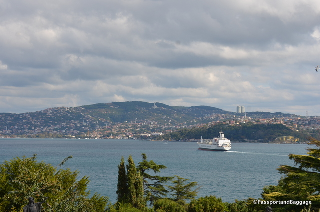
Plain ice cream served with Baklava

Plain ice cream served with Baklava. The ice cream, coincidentally is called Marash.

Caramel Ice Cream

Caramel Ice Cream

The countryside of Eastern Anatolya is similar to the central valley of California. It has its basis in a volcanic formation with rich soil and flat valleys leading up to copper oxide rich foothills and then mountains.

The entire area is agricultural and barely populated. There are a few large industrial cities as you travel along, but for the most part your hours of driving are spent looking at mother earth in various stages of farm or fallow.

We passed pistachios, tobacco, pumpkins (grown only for their seeds), potatoes, sugar beets, and obviously many other crops I did not recognize, as well as a substantial amount of sheep and cattle.

The entry to the caravansary

The entry to the caravansary

The one thing that this area has that California does not is Caravansaries. They were situated approximately every 25 miles and were there to protect the camel herds that carried all the goods traded along the spice routes, basically they served as Bed and Breakfast’s for you, your entourage and your camels, complete with a security system.

Most typically a caravanserai was a building with a square or rectangular walled exterior, with a single portal wide enough to permit large or heavily laden beasts such as camels to enter. The courtyard was almost always open to the sky, and the inside walls of the enclosure were outfitted with a number of identical stalls, bays, niches, or chambers to accommodate merchants and their servants, animals, and merchandise.
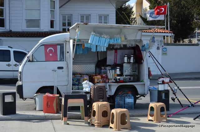
Caravanserais provided water for human and animal consumption, washing, and ritual ablutions. Sometimes they had elaborate baths. They also kept fodder for animals and had shops for travelers where they could acquire new supplies. In addition, some shops bought goods from the traveling merchants.

Notice the snakes over the doorway.

Notice the snakes over the doorway.

A few shots of the countryside

Turkish Countryside

*Turkish Countryside

*

Grape Molasses for sale at a roadside stand

Grape Molasses for sale at a roadside stand

*

Roadside stand, nuts and grapes with a small fruit that tastes just like an apple

Roadside stand, nuts and grapes with a small fruit that tastes just like an apple

Raisins for sale

Raisins for sale

Sep 252016
 

September 25, 2016

The Citadel, built by Emperor Justinian in the 6th century. The structure originally had 195 bastions.

The Citadel, built by Emperor Justinian in the 6th century originally had 195 bastions.

Kayseri surprised me, I had read some article that gave me the impression it was a very small and backward city. That is absolutely not the case.

Kayseri is one of the more conservative cities of Turkey, but it is far from small or backward. It is, in fact, a large and industrialized city.

Mount Ericiyes

Mount Ericiyes

Kayseri is located at the foot of the extinct volcano Mount Erciyes that can be glimpsed here and there through the new high rises. The city is often cited in the top Turkish cities that fit the definition of Anatolian Tigers, (a term internationally used in the context of the Turkish economy to refer to and to explain the phenomenon of a number of cities in Turkey which have displayed impressive growth records since the 1980s). As of 2011 the city of Kayseri had a population of 844,656.

Much of the citadel wall is still standing and dominates the old part of town

Much of the citadel wall is still standing and dominates the old part of town

The city has been continuously inhabited since perhaps c. 3000 BC with the establishment of the ancient Hittite trading colony at Kultepe (Ash Mountain). The city has always been a vital trade center as it is located on major trade routes, particularly along the Great Silk Road.

The older portion of town is dominated by the 1500-year-old citadel, built initially by the Byzantines, and expanded by the Seljuks and Ottomans. The short-lived Seljuk rule left a large number of historic landmarks.

The Hunad Hatun Mosque complex is now a lovely dining and high end shopping spot.

The Hunad Hatun Mosque complex has a lovely dining and high end shopping spot.

The Hunat Hatun complex, built in 1238 by Mahperi Huand Hatun  is one of the most important complexes in Kayseri.  It consists of a mosque, a madras, a Turkish bath, as well as the tomb of Mahperi Huand Hatun, wife of Alaeddin I Keykubad a prolific builder and a Seljuk sultan.

The interior arch of the Hunat Hatun Mosque Complex

The interior arch of the Hunat Hatun Mosque Complex

The Mosque Ulu

The Mosque Ulu c. 1140

The Mosque Ulu was commissioned by Melik Mehmet Gazi (1134-1143), the third governor of the Danishmenid principality (before the Seljuks were in power in Kayseri). According to a plaque on the wall, the mosque collapsed in an earthquake in the 18th century (1720-1730) and was rebuilt.  The original wood roof was restored in the 1960s.

The restored wooden roof of the Mosque Ulu

The restored wooden roof of the Mosque Ulu

The dome of the Mosque Ulu

The dome of the Mosque Ulu

There are three bazaars in Kayseri, all somehow connected together to create a labyrinth of shops. The first thing you notice is the lack of barkers, as in the Istanbul bazaar.  While this is the second largest bazaar in Turkey, it is for the local people and not for the tourists, making for a much quieter experience.   The three bazaars are Kapili Çarsi built in 1859, and Bedesten and Vizir Han that date from the 15th and 16th century.
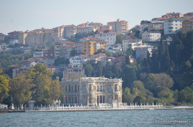
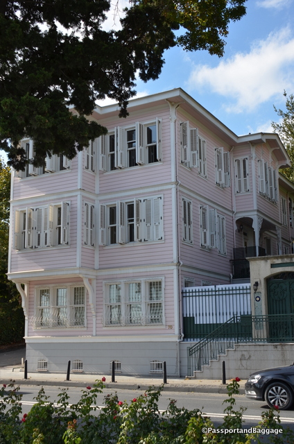
The ceiling of one of three grand bazaars in Kayseri

The ceiling of one of three grand bazaars in Kayseri

Male tailors, ironing and sewing can be seen throughout the bazaar. It was Sunday so there were not so many working

Male tailors, ironing and sewing can be seen throughout the bazaar. It was Sunday so there were not very many people working.

These baby carriages caught my eye in the bazaar

These toy baby cribs caught my eye in the bazaar

The bazaar of Kayseri

The bazaar of Kayseri

The caravanserai (where merchant traders gathered before forming a caravan) dates from around 1500.

The caravanserai (where merchant traders gathered before forming a caravan) dates from around 1500, and is connected by a few feet of open walkway to the bazaars.

The caravansari is undergoing a restoration, and much is not accessible.

The caravansarai is undergoing a restoration, and much is not accessible.

The town's older districts (which were filled with ornate mansion-houses mostly dating from the 18th and 19th centuries) were subjected to wholesale demolitions starting in the 1970s.

The town’s older districts (which were filled with ornate mansion-houses mostly dating from the 18th and 19th centuries) were subjected to wholesale demolitions starting in the 1970s, like so much of the world.

The city is famous for its carpet sellers like Savaş Imamoĝlu. Savaş waylaid me outside of the market. I am usually very good at getting away, but no such luck. It was worth it however, as he took me inside the mosque, through the caravansary on the way to, you guessed it, his rug store.

Savas' family is in the wool business, they then contract with women around Turkey to turn their wool into Kilim carpets

Savas’ family is in the wool business, they then contract with women around Turkey to turn their wool into Kilim carpets

Since I was taking notes, he assumed I was a reporter, so I learned quite a bit from him. His family has been in the business for over 90 years, and he is the third generation. He proceeded to tell me he would be the last, as no one in Turkey wants carpets anymore. In the past they had been used as dowries, but that is an dying custom as well.  The women brought carpets to the marriage in exchange for the husband giving her family goats. Despite Savaş’ lamentations about the likelihood of his business dying, like every other rug salesman in Turkey, he could sell sand to a beach community, and I doubt they will ever really go out of business.

This iilim has the scorpion pattern in the middle which signifies strong friendship and the border is the family pattern represented by the cityscape

This Kilim has the scorpion pattern in the middle which signifies strong friendship and the border is the family pattern represented by the cityscape.

The tomb of Seyid Burhanetin

The tomb of Seyid Burhanetin

In wondering the town I stumbled across a very large cemetery in the middle of town.  At the entry was the tomb of Seyid Burhanetin an important scholar in his time (1165-1244). This tomb, constructed over his grave was built in 1894. The cemetery takes Seyid’s name, but the most information I could find about it was that it has a Facebook page.

dsc_6905

So many of the gravestones have been completely worn away, giving a fair indication of the age, but there were also some contemporary graves in the cemetery as well.
dsc_6906

*cemetery

*

Octagonal tomb of Döner Kümbert was constructed around 1250 and is the final resting place of Şah Chan Hatun, a Seljuk princess

Octagonal tomb of Döner Kümbert was constructed around 1250 and is the final resting place of Şah Chan Hatun, a Seljuk princess

Everywhere you wandered you could charge your phone, for a fee

Everywhere you wandered you could charge your phone, for a fee

The city even has a bike share program

The city even has a bike share program

I ran across these fellows twice, they were chanting something, in a football team sort of way

I ran across these fellows twice, they were chanting something, in a football team sort of way

It was Sunday and everyone was out enjoying the day

It was Sunday and everyone was out enjoying the day

The fish markets were doing a booming business

The fish markets were doing a booming business

Who ever thought to buy fresh fish by the sack full

Who ever thought to buy fresh fish by the sack full

You could get a great fish sandwich if you weren't inclined to cook them yourself at home.

You could get a great fish sandwich if you weren’t inclined to cook them yourself at home.

Top your stroll off with sweets. This gentleman is making ice-cream

Top your stroll off with sweets. This gentleman is making ice-cream

A Pastirma Shop

A Pastirma Shop

Kayseri is famous for its Pastirma and there are various stories about its origin, but none well documented.

According to the mainstream of the modern linguistic research, the word derives from the Turkish bastırma or “pressed meat” in modern Turkish.

One story says it originated in the city of Kayseri, where there was a Byzantine dish called pastón, which would be translated as “salted meat” and was apparently eaten both raw and cooked in stews.

Pastırma is prepared by salting the meat, then washing it with water and letting it dry for ten to 15 days. After that the blood and salt is squeezed out of the meat which is then covered with a cumin paste made with crushed cumin, fenugreek, garlic, and hot paprika, followed by thorough air-drying.

I had it cooked for breakfast, it was delicious.  I also bought several links of it for the rest of the trip to eat as hors d’oeuvres with beer, when I can find beer. Having had a bit while writing this, I can assure you it is delicious, albeit, very, very rich.
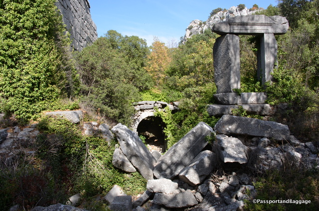
An interesting recycle bin

An interesting recycle bin

I found these bins around town, and found them rather ingenious.  I also witnessed a young boy toss something on the ground, his father stopped, yelled at him to pick it up.  I was so impressed.

Sep 242016
 

September 24, 2016

LaodiciaJust a short bus ride from Denizli is the ancient city of Laodicea. Established between 263 and 261 BC, the city was built on the river Lycus. It was located in the Hellenistic regions of Caria and Lydia, which later became the Roman Province of Phrygia Pacatiana.

Laodicea contained one of the seven churches of Asia mentioned in the Book of Revelation.

The main road with its ruts from thousands of years of carts moving down the street

The main road with its ruts from thousands of years of carts moving down the street

Towards the end of the Roman Republic and under the first emperors, Laodicea became one of the most important and flourishing commercial cities of Asia Minor, it served as a major financial center and had a large trade in black wool.

This is the West Theater. It functioned from the Hellenistic period through to the big earthquake of 602-610
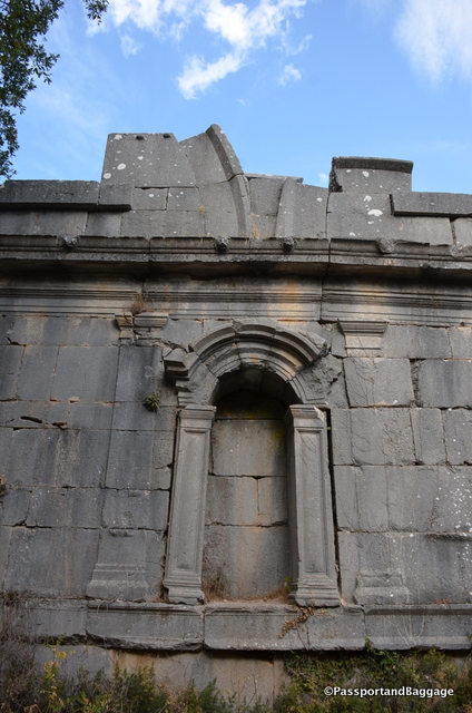
This is the West Theater. It functioned from the Hellenistic period through to the big earthquake of 602-610
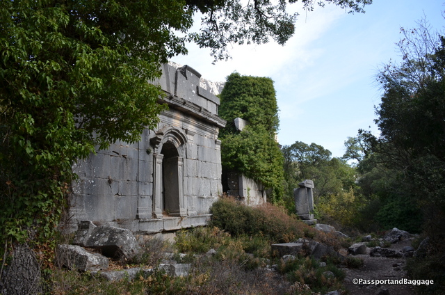
The area often suffered from earthquakes, and Laodicea was completely destroyed in a major quake during the reign of Nero (60 AD), as was its sister city up the hill Hierapolis.

This is the north theater, and was built when the town grew to big for the West Theater. Built in the 2nd century AD it could hold about 12,000 people. It stayed in use until the 7th century

This is the north theater, and was built when the town grew to big for the West Theater. Built in the 2nd century AD it could hold about 12,000 people. It stayed in use until the 7th century

Unlike Hierapolis, Laodicea rebuilt on her own funds after the great quake and became a Roman Free City. The city was eventually destroyed during the invasions of the Turks and Mongols.

The ruins are well preserved and as of 2012 are being substantially renovated. The site also continues to be an active dig.

The site is still an active dig, as can be witnessed by the stockpiling of materials as they are found

The site is still an active dig, as can be witnessed by the stockpiling of materials as they are found

Laodicia

*

This is possibly a game board, similar to chess

This is possibly a game board, similar to chess

Mosaics are also being uncovered.

Mosaics are also being uncovered.

Repair of marble columns so they can be placed in-situ

Repair of marble columns so they can be placed in-situ

The Temple

The Temple

A marble patterned floor

A marble patterned floor

Laodicia

Sep 242016
 

September 24, 2016

Pamukkale, TurkeyPamukkale means “cotton castle” in Turkish. The area contains hot springs and terraces of carbonate minerals left by flowing water.

The ancient Greco-Roman and Byzantine city of Hierapolis was built on top of the white “castle” which is 8,860 feet long, 1,970 feet wide and 525 feet high, and too awe inspiring to capture in words or photos.

Spigots for controlling the flow of water

Spigots for controlling the flow of water

It is difficult to completely understand how one gets travertine from this flow of water, but I am going to try. The water comes out of the ground at 95 degrees F, and contains a high concentration of calcium carbonate. When that comes in contact with oxygen it forms carbon dioxide and carbon monoxide gases, which then evaporate and leave deposits of calcium carbonate. Initially the deposits are like soft jelly and then harden over time forming what is called travertine.

PamukkaleIn 1988, together with the ruins of Hierapolis, Pamukkale became a protected UNESCO World Heritage Site. However, before the designation the terraces were in danger of being destroyed through a combination of neglect and commercial development. Hotels were built at the top of the site, partly obscuring ruins of Hierapolis, and wear and tear from the feet and shoes of visitors had scarred and turned many of the pools brown.

The efforts to protect the delicate natural phenomenon have dramatically changed the area. The hotels have been demolished, and in an effort to allow the pools natural white appearance to be maintained, access to the pools is tightly restricted, and water released from the spring is controlled and only distributed to a few pools at a time.

Another reason for the controlled water flow is that if a large amount of water is allowed to flow on a certain area for too long it leads to moss formation and darkening of the color of the travertine.

PamukkaleArtificial pools for bathing tourists have been added.

Most of us know Travertine as the Italian building material. It is a form of limestone deposited by mineral springs around the world, such as Pamukkale. Travertine has a fibrous or concentric appearance and exists in white, tan, cream-colored, and even rusty varieties.

Mining Travertine

Travertine is not mined at Pamukkale, it is to valuable an area as a tourist spot, but mining Travertine is very similar to mining marble.

The underground volcanic activity, which causes the hot springs, also forced carbon dioxide into a cave, which was called the Plutonium, which in this case, means “place of the god Pluto”. Priests of Cybele, who found ways to appear immune to the suffocating gas, used this cave for religious purposes. The Plutonium can be found just below the theater in Hieropolis, and just above the pools of Pamukkale.

The Plutonium at Hierapolis

The Plutonium at Hierapolis

You can see Pamukkale for miles, it is simply too large to comprehend in one fell swoop.

Pamukkale as seen from several miles away at the Archeological site Laodicea

Pamukkale as seen from several miles away at the Archeological site Laodicean.

Some more shots from the Cotton Castle:

dsc_6674

*dsc_6672

*Pamukkale

*Pamukkale

*Pamukkale

*Pamukkale

You can see the water flowing from one pool to another

You can see the water flowing from one pool to another

Sep 232016
 

Hieropolis is a fascinating place to visit as there are only a few historical facts known about the origin of the city. The Phrygians built a temple, probably in the first half of the 3rd century BC and this temple would eventually form the center of Hierapolis.

In the necropolis lies many sarchophogi lost in the various earthquakes. This particular one mentions the occupant Aelios Apollinarios and his wife Neratia Apollonis

The necropolis contains many sarchophagi lost in the various earthquakes. This particular one mentions the occupant Aelios Apollinarios and his wife Neratia Apollonis

In 133 BC Attalus III bequeathed his kingdom to Rome and Hierapolis became part of the Roman province of Asia. Then in AD 17, during the rule of the emperor Tiberius, a major earthquake destroyed the city.

The city rebuilt and continued to expand until the year 60, during the rule of Nero, when an even more severe earthquake left the city completely in ruins.

A quick look at how large the city was

After that the city was rebuilt in the Roman style with imperial financial support. During this period it grew to look as it does today.

The theater is one of the more stunning spots in all of Hierophoy

The theater is one of the more stunning spots in all of Hieropolis

A close up of the stage of the theater

A close up of the stage of the theater

dsc_6654

The theatre was built in 129 for a visit by the emperor Hadrian. It was renovated under Septimius Severus (193–211). (It was destroyed during subsequent earthquakes and what you see today is a reconstruction taken place in modern times. )

During this golden ear of Hierapolis, thousands of people came to take the medicinal properties of the hot springs and so new building projects were started: two Roman baths, a gymnasium, several temples, a main street with a colonnade, and a fountain at the hot spring.

The city was too large to comprehend, these walls are on a hill very far away from the main road

The city is too large to comprehend, these walls are on a hill very far away from the main road

Hierapolis became one of the most prominent cities in the Roman Empire in wealth and its  population of 100,000.

During the 4th century, the Christians entered and filled Pluto’s Gate (the Plutonium) with stones as a way of subjugating the religion of the time and propagating Christianity. At the same time the Roman baths were transformed to a Christian basilica.

dsc_6694

Sarchaphogi in the museum

Sarchaphogi in the museum

In the early 7th century, the town was devastated first by Persian armies and then by another destructive earthquake.

In the 12th century, the area came under the control of the Seljuk sultanate of Konya before falling to crusaders under Frederick Barbarossa and their Byzantine allies in 1190. About thirty years later, the town was abandoned. In 1354, the great Thracian earthquake toppled the remains of the ancient city and the ruins were slowly covered with a thick layer of limestone.

Hierapolis was first excavated by the German archaeologist Carl Humann in 1887 and excavations still continue today.

The vaulted ceiling of the baths are incomprehensible in their vastness and the quality and skill of their engineering

The vaulted ceiling of the baths are incomprehensible in their vastness and the quality and skill of their engineering

The exterior of the baths

The exterior of the baths

The Ploutonion "Place of Pluto"; Latin: Plutonium) or Pluto's Gate was a ploutonion (a religious site dedicated to the god Pluto) (another name for the god Hades). The site is built on top of a cave which emits toxic gases, hence its use as a ritual passage to the underworld. Ritual animal sacrifices were common at the site.

The Ploutonion “Place of Pluto” or Pluto’s Gate was a a religious site dedicated to the god Pluto (another name for Hades). The site is built on top of a cave which emits toxic gases, hence its use as a ritual passage to the underworld. Ritual animal sacrifices were common at the site.

The north Byzantine gate was built at the end of the 4th century AD.

The north Byzantine gate was built at the end of the 4th century AD.

The latrine of Hieropolis was found in a state of collapse from an earthquake. The room is divided longitudinally by a row of columns that supported a roof composed of travertine. Along the two long sides ran a drain sluicing the liquids into the cloaca beneath Frontons Street. Along the perimeter walls were seats with holes and a small channel with clean running water. The construction is dated to the end of the 1st century AD

The latrine of Hieropolis was found in a state of collapse from an earthquake and was reconstructed in modern times. The room is divided longitudinally by a row of columns that supported a roof composed of travertine. Along the two long sides ran a drain sluicing the liquids into the cloaca beneath Frontinus Street. Along the perimeter walls were seats with holes and a small channel with clean running water. The construction is dated to the end of the 1st century AD.

Frontons Street was the principal street of Heklj;; It was built in the 1st century AD

Frontinus Street was the principal street of Hieropolis. It was built in the 1st century AD.

Tombs in one of two necropoli

Tombs in one of two necropoli

Inscriptions can be found on stones throughout Hieropolis

Inscriptions can be found on stones throughout Hieropolis

This is a tumulus. A low cylindrical drum made of travertine slabs supporting an earthen cone. It is another form of tomb and dates to the 2nd century AD with an inscription to its last occupant Lucius Salvias Paolinus

This is a tumulus. A low cylindrical drum made of travertine slabs supporting an earthen cone. It is another form of tomb and dates to the 2nd century AD with an inscription to its last occupant Lucius Salvias Paolinus.

One of the few buildings being taken over by the carbonite materials of the mineral pools of Pamukkale

One of the few buildings being taken over by the carbonite materials of the mineral pools of Pamukkale

Sep 232016
 

I chose to stay in the town of Denizli for this leg of my trip.  I cannot recommend my hotel, or the town for that matter, but I have not met anyone that can recommend a hotel or the town either.  It is possible it would have been better to have stayed up the mountain in the town of Karahyit, but I am not sure that would have been an improvement.

Denizli is one hour from the airport and “25 minutes” from the sites I came to see. In this part of the country you make the best of what you can.

Everywhere in the valley pomegranates were ripening on the trees and found on the streets as fruit or fresh squeezed juice

Everywhere in the valley pomegranates were ripening on the trees and found on the streets as fruit to purchase or fresh squeezed juice

I headed to bay 76 of the bus station in the town of Denizli, to catch the bus to Pamukkale and Hierapolis and that is where the adventure began.  I am assuming that this entire thing would have been much easier if there were tourists, but keep in mind, there are no tourists in Turkey right now, they have been scared away by a) “the coup” and b) the bombings.  So there is no reason to assume that the only woman on the bus dressed in western clothing with a giant camera around her neck wants to get off at the one tourist destination on the entire bus route, and there is also no way for this woman to have known that there are absolutely no signs at the stop she wants to get off on, and no one that speaks a word of English to tell her to get off, even though she was very explicit to the driver as to where she was going.

The town of K seems to be a gathering space for the countryside around it as the local market and center of society.

The town of Karahyit seems to be a gathering space for the countryside around it as the local market and center of society.

I do not blame the driver, I do not blame anyone, this is just life.  My adventure begins when, after boarding the bus and ensuring that he understands I want to get off at Pamukkale, I sit back.  We reach the end of the line and I ask Pamukkale? thinking I would get pointed where I am going.  Instead, I got that look of, stupid tourist, this is Karahyit, your stop was 3 miles back, but not to worry, I will tell the next driver and he will take you back for free.

Beans soaking in oil and olive oil are a big seller on the main street.

Beans soaking in oil and olive oil are a big seller on the main street.

The next driver arrives, yes I understand, no problem so I sit on the bus waiting for it to depart.  By now I have figured out where I should have gotten off and stand as he drives right past it at 60 miles an hour.  I tap him on the shoulder, he does the universal slap on the head, I am so stupid, I am so sorry look and takes me to the next stop, drops me off and says, driver will come, no charge.

A husband and wife discussing the merits of bloomers

A husband and wife discussing the merits of bloomers

In the interim, he has me wait in the van of a somewhat questionable character that is chain smoking.  The next bus comes, and he says no problem, one stop away.  THAT is when I realize, stupid me, I had left my purse on the chain smokers bus.  Now remember, no one speaks English and Turkish is, sadly, one of those languages I have yet to master even one word of.  I grabbed the woman’s purse next to me and pointed backwards.  The bus driver understood, got on the radio and all was saved.

The kind bus driver that took care that my purse was returned and bought me tea while we waited for its delivery

The kind bus driver that took care that my purse was returned and bought me tea while we waited for its delivery

This fine gentleman even bought me a cup of tea (çai) while we waited for the third bus, with my purse to arrive.  The adventure only took 2 hours, and a handful of truly lovely and honest people that cared enough to help, and did it willingly, as far as I could tell.

The fruit in the market was just fabulous

The fruit in the market was just fabulous

I wish I could explain the bus system.  It seems so simple, one departs every 25 minutes from the train station and stops along the way until it arrives at Karahyit. Then it does the same in reverse.  However, it isn’t quite that simple.  I do not know if these buses are owned individually and then they pay a fee to the government or what, but the route is more of one a family van my take on a very, very busy school day.  Everyone hops on and says where they want to go, and instinctively know how much to pay.  Mom goes to pick up daughter at school.  One rider was coming from hang gliding class 7 blocks off the main road.  One woman needed to go see her father about 12 blocks off the main road in what appeared to be a completely different town, in the meantime it is social hour on the bus. The men sit in the front seat with the driver and talk non-stop, while the women sit in the back and talk non-stop.  If it is full, people sit where they can or stand and hold on for dear life.  I do wish I spoke some of the language to have enjoyed the gossip.

You can also buy anything dried, I assume for use in the winter

You can also buy anything dried, I assume for use in the winter

It also has a strange system of hierarchy.  The bus that arrives then goes into a queue and how they chose who drives back down the mountain remains a mystery to me.  They don’t sit in their van as though they are next, they park the van and take off, knowing a call will come on their cellular.

The bus is 4TL for the entire route, and I have no idea how much if you only go three blocks, but 4TL is $1.34 US, so this was the best entertainment ever for under $3.00.

Walking the streets of K

Walking the streets of Karahyit

The joy of Turkey, is that everything moves at its own pace, so I did not miss one thing I had set out to see that day, and got a lot of local color to boot.

This area is a large agricultural spot and a center for carpet production, as well as one of Turkey’s major textile towns, specializing in Aegean cotton. I don’t think they care if their hotels are good or not, or if tourists come to see the sites, they have better ways to make money.

This is the Denizli Rooster, the symbol of the city founded in the 2nd Century AD. It is said that the sonorous crow of the rooster of Denizli accompanies visitors on their excursions around the city.

This is the Denizli Rooster, the symbol of the city founded in the 2nd Century AD. It is said that the sonorous crow of the rooster of Denizli accompanies visitors on their excursions around the city.

Sep 222016
 

September 22, 2016

I wanted to write about a few things to wrap up this part of my Istanbul trip. This is also a great place for me to post some pictures that have no rhyme nor reason.

One of the shop owners on my street, they are all suffering badly from the lack of tourism

One of the shop owners on my street, they are all suffering badly from the lack of tourism

Turkey is changing, for good or bad is not my place to say. I had an opportunity to talk to a few people about Erdoğan’s “New Turkey”. One gentleman that spoke no English uttered “crazy” I laughed and said yes, that emboldened him, and he finished the conversation with “hate”.

I visited cemeteries one day, this is what a non-muslim cemetery looks like in town.

I visited cemeteries one day, this is what a non-muslim cemetery looks like in town.

A gentleman in his mid 20s told me, while he did not want to sound prejudiced, he was tired of seeing women draped in black with their faces covered. He was especially angry that his favorite bar in the airport, where he says goodbye to his overseas girlfriend, had been closed. He was sure it was because Erdoğan is trying to make Turkey a total Muslim country. I could not disagree, it is what I am seeing also.

A fisherman in the town of Camakkale

A fisherman in the town of Camakkale

If you are unaware of Turkish history I suggest you read about the founder of the Republic of Turkey, Mustafa Kemal Atatürk. Following WWI Atatürk embarked upon a program of political, economic, and cultural reforms, seeking to transform the former Ottoman Empire into a modern and secular nation-state. Under his leadership, many good things occurred, especially the fact that women were given equal civil and political rights. In 1924 Turkey outlawed the Mogul symbol, the Fez, veiling of women was discouraged, and western clothing for men and women were encouraged.

The headscarf was never officially banned by Atatürk, but with a constitutional principle of official secularism, the Turkish government has traditionally banned women who wear headscarves from working in the public sector. The ban applies to teachers, lawyers, parliamentarians and others working on state premises.

In 2007 Prime Minister Erdoğan campaigned with a promise of lifting the longstanding ban on headscarves in public institutions. This was not a very popular concept.

In June 2008, after much back and forth in parliament, Turkey’s Constitutional Court ruled that removing the ban was against the founding principles of the constitution. The highest court’s decision to uphold the headscarf ban cannot be appealed.  Erdogan, however, has managed to circumvent the Constitutional Court by throwing everyone out and appointing his own people.  The head scarf is not accepted in government offices and in the military.  It will be interesting to see when it becomes mandatory, and how long until that is the only covering women will be wearing.

The Trojan horse, a sales gimmick, at the dig site of Troy.

The Trojan horse, a sales gimmick, at the dig site of Troy.

I feel fortunate to be here at this time. The Turkish people are some of the most accommodating, and kind people. Their economy is suffering and it is not their fault. Tourism has dropped off remarkably. So many places I have visited I was told that, had I come last year I would be in a crowd of thousands, when I visited Troy, I was the only person in the entire park.

I stayed at the Sirkeci Mansion at Taya Hatun Sokak #5. The hotel is absolutely perfectly located, the rooms are just divine and the staff could not have been nicer or more accommodating, I cannot recommend them enough.

Saffron Zerde Turkish dessertMy dear friend Bing suggested I lunch at Nar Lokanta on the roof of the Armaggan building, a very, very chic store. I had intended to, but as is common in Istanbul, I got lost. I asked for directions and I got even more lost. Sadly I had a plane to catch. I did, however, make it in time to have the dessert that Bing had recommended, or maybe not, as he couldn’t remember the name. What I did have was Safranlı zerde, that with a cup of Turkish coffee, was absolutely worth the effort to find the place, next time I will leave enough time to do a full meal.

Fish Sandwich in IstanbulSince I did not get to eat lunch I asked if my driver would stop at the Galata bridge so I could run under the bridge and get a fish sandwiches. If you do not know what I am talking about, on the European side, under the bridge are restaurants, at the end are sidewalk stands selling nothing but grilled fish on a white bread roll with shredded cabbage. There is nothing else on the sandwich and it is such an Istanbul experience I would never leave without having had one. Thanks to my very accommodating driver, and I mean that, what he did was completely illegal, i.e. stopping on the bridge while I ran, I scored my sandwich.

Looking down onto the town from one of the seven hills

Looking down onto the town from one of the seven hills

This is my second trip to Istanbul so I had the luxury of time, and therefore the chance to get farther than the Sultanahmet and Beyoğlu. This is when I realized how huge Istanbul is. It is a town of 14 million people, and with that it has traffic and humanity everywhere.

Istanbul has one of the finest, most inexpensive and most understandable transit systems in the world, but you still need to take a bus, driver or cab from the airports and this is where you get to see the traffic situation first hand.

It takes one hour to go from the Sultanahmet to the domestic airport, about the same time it takes to get to the International airport. I realized if I ever wanted to rent a car, I would find someplace outside of the town to do so, as once you leave the city the country is wide-open spaces.

One last comment, after the bombings and the “coup” many people were concerned about my being here. I feel as safe as ever. I walked everywhere as a single woman with a camera around my neck and never felt threatened. Yes the storeowners will follow you for blocks trying to get your business, but that is a completely different type of “hassle”.

Sitting in the evening, sipping on a beer and enjoying the atmosphere

Sitting in the evening, sipping on a beer and enjoying the atmosphere

It has been raining, but fortunately never enough to be a bother, the temperatures have been hovering in the mid to high 70s, perfect weather.

An abandoned art deco building in the center of town

An abandoned art deco building in the center of town

Sep 212016
 

September 21, 2016

The city of Cammekale bought the Trojan Horse from the Brad Pitt Movie Troya to promote tourism

The city of Çannakale bought the Trojan Horse from the Brad Pitt Movie Troya to promote tourism


Did you know that the story of the Trojan Wars was told in a set of 12 narratives titled the Epic Cycle, which possibly dates from the eighth to the sixth centuries BCE. The Illiad and the Odyssey are the only complete works remaining. Regarding Troy, I would like to quote from Eric H. Cline’s book The Trojan War, A Very Short Introduction.

Is Homer’s story convincing? “Certainly the heroes, from Achilles to Hector, are portrayed so credibly that it is easy to believe the story. But is it truly an account based on real events, and were the main characters actually real people? Would the ancient world’s equivalent of the entire nation of Greece really have gone to war over a single woman, however beautiful, and for ten long years at that? Could Agamemnon really have been a king of kings able to muster so many men for such an expedition? And, even if one believes that there once was an actual Trojan War, does that mean that the specific events, actions, and descriptions in Homer’s Iliad and Odyssey, supplemented by additional fragments and commentary in the Epic Cycle, are historically accurate and can be taken at face value? Is it plausible that what Homer describes took place and in the way that he says it did?”

While the people of Troy were called Trojans, the city itself had two names Troy and Ilios. Ilios is used six times in the Epic Cycle, and the words are interchangeable. The Wilusa is the Hittite name for Troy, they occupied Anatolya in 1600 BC

While the people of Troy were called Trojans, the city itself had two names Troy and Ilios. Ilios is used six times in the Epic Cycle, and the words are interchangeable. The Wilusa is the Hittite name for Troy, they occupied Anatolya in 1600 BC

Most Turks have yet to forgive Schliemann for smuggling Trojan treasures out of the country. The Turkish government is still trying to retrieve the hoard from the Pushkin Museum in Moscow.

Most Turks have yet to forgive Schliemann for smuggling Trojan treasures out of the country. The Turkish government is still trying to retrieve the hoard from the Pushkin Museum in Moscow.

There are scholars that have been studying this for eons, and while there is interesting proof, without a time machine, we may never understand the true picture.

What we do know is that the town of Troy does exist and that some of the most important figures in history have walked through it.

In 480 BC, the Persian king Xerxes sacrificed 1,000 cattle at the sanctuary of Athena Ilias while marching through the Hellespontine region towards Greece.

Alexander the Great visited the site in 334 BC and there made sacrifices at tombs associated with the Homeric heroes Achilles and Patroclus.

In 399 BC, the Spartan general Dercylidas expelled the Greek garrison at Ilion who were controlling the city on behalf of the Lampsacene dynasts.

The city was destroyed by the Roman general Fimbria, in 85 BC following an eleven-day siege.

In 20 BC, Emperor Augustus visited Ilion and stayed in the house of a leading citizen, Melanippides son of Euthydikos.

Heinrich Schliemann's excavations were condemned by later archaeologists as having destroyed the main layers of the real Troy. Kenneth W. Harl in the Teaching Company's Great Ancient Civilizations of Asia Minor lecture series sarcastically claims that Schliemann's excavations were carried out with such rough methods that he did to Troy what the Greeks couldn't do in their times, destroying and leveling down the entire city walls to the ground. Other scholars agree that the damage caused to the site is irreparable. After Schliemann, the site was further excavated under the direction of Wilhelm Dörpfeld (1893–94) and later Carl Blegen (1932–38). These excavations have shown that there were at least nine cities built, one on top of each other, at this site.

Heinrich Schliemann’s excavations were condemned by later archaeologists as having destroyed the main layers of the real Troy. Kenneth W. Harl in the Teaching Company’s Great Ancient Civilizations of Asia Minor lecture series sarcastically claims that Schliemann’s excavations were carried out with such rough methods that he did to Troy what the Greeks couldn’t do in their times, destroying and leveling down the entire city walls to the ground. Other scholars agree that the damage caused to the site is irreparable.  After Schliemann, the site was further excavated under the direction of Wilhelm Dörpfeld (1893–94) and later Carl Blegen (1932–38). These excavations have shown that there were at least nine cities built, one on top of each other, at this site.

The odeon dates to the Roman Troy IX and was renovated by Hadrian in 124 AD.

The odeon (theater)  dates to the Roman Troy IX and was renovated by Hadrian in 124 AD.

The ancient walls of Troy

The ancient walls of Troy

The Northeast Bastion, or guard tower is from Troy VI

The Northeast Bastion or guard tower is from Troy VI 17th-15th Centuries BC

Original Foundation Stones belonging to Troy II and III - 2500 BC

Original Foundation Stones belonging to Troy II and III – 2500 BC

The Ramp is part of Troy II, possibly to overcome elevation changes.

The Ramp is part of Troy II, possibly to overcome elevation changes.

The Sanctuary where Xerxes sacrifice "1000" cows, possibly dates to the 7th century BC

The Sanctuary where Xerxes sacrificed “1000” cows, possibly dates to the 7th century BC

A future museum of Troy, being built on "Turkish Time" I must think that it, like the Acropolis Museum in Athens, is being built in the hopes that the treasures will return one day.

A future museum of Troy, being built on “Turkish Time”, I must think that it, like the Acropolis Museum in Athens, is being built in the hopes that the treasures will return one day.

Amphora and water pipes of ancient Troy

Amphora and water pipes of ancient Troy

The area surrounding Troy is fertile and beautiful

The area surrounding Troy is fertile and beautiful

To reach Troy you must take a ferry to the fishing town of Cerewe and then drive a few miles through the countryside.

To reach Troy you must take a ferry across the Dardanelles to the fishing town of Çannakale and then drive a few miles through the countryside.

dsc_6572

Fishing in Cannakale

Cannakale

dsc_6588

Photo opportunities on the Ferry

dsc_6580

Directly across the Narrows of the Dardanelles, Çannakale Boğazi in Turkish, lies the magnificent fortress of Kilitbahir, the Lock of the Sea. Like Çimenlik Castle at Çanakkale, Kilitbahir was built by Sultan Mehmet II, the Conqueror, in 1452. The two fortresses guarded the Narrows from any fleet coming from Europe to assist Constantinople (Istanbul) then under siege by Mehmet.

Directly across the Narrows of the Dardanelles, Çannakale Boğazi in Turkish, lies the fortress of Kilitbahir, the Lock of the Sea. Kilitbahir was built by Sultan Mehmet II, the Conqueror, in 1452.

One of many monuments to the Gallipoli Campaign, also known as the Dardanelles Campaign. The Battle of Gallipoli was a campaign of World War I that took place on the Gallipoli peninsula in the Ottoman Empire during WWI between April of 1915 and January 1916. The campaign was one of the greatest Ottoman victories during the war. In Turkey, it is regarded as a defining moment in the nation's history: a final surge in the defense of the motherland as the Ottoman Empire crumbled.

One of many monuments to the Gallipoli Campaign, also known as the Dardanelles Campaign. The Battle of Gallipoli was a campaign of World War I that took place on the Gallipoli peninsula in the Ottoman Empire during WWI, between April of 1915 and January 1916. The campaign was one of the greatest Ottoman victories during the war. In Turkey, it is regarded as a defining moment in the nation’s history: a final surge in the defense of the motherland as the Ottoman Empire crumbled.

dsc_6596


It is thought that there were at nine Troys, built on top of each other, seven of these have been documented.


Sep 202016
 

September 20, 2016

The Grand Bazaar needs no words, photos will do all my talking. You might like a little history however, so here goes. The Grand Bazaar (Kapalıçarşı) in Istanbul is one of the largest covered markets in the world with 60 streets and 5,000 shops, and attracts between 250,000 and 400,000 visitors daily. In 2014, it was listed No.1 among world’s most-visited tourist attractions with 91,250,000 annual visitors. the Grand Bazaar is often regarded as one of the first shopping malls of the world.

The bazaar has been an important trading center since 1461 and its labyrinthine vaults feature two domed buildings, the first of which was constructed between 1455 and 1461 by the order of Sultan Mehmed the Conqueror. The bazaar was vastly enlarged in the 16th century, during the reign of Sultan Suleiman the Magnificent, and in 1894 underwent a major restoration following an earthquake.

The complex once housed two mosques, four fountains, two hamams, and several cafés and restaurants. In the center is the high domed hall of the Cevahir Bedesten.

dsc_6387

Buy a scale to keep the merchants honest

The Grand Bazaar Istanbul

Brooms

Chess boards of every color and size

Chess boards of every color and size

The tea pot shop

The tea pot shop

Sieves of every size and shape

Sieves of every size and shape

Skewers for Kabob

Skewers for Kabob

dsc_6380

The paper stop

The paper stop

Bread and Pastries

Bread and Pastries

Candy

Candy

Olives

Olives

dsc_6373

Spices

Spices

Fish

Fish

dsc_6365

Have your shoes shined

dsc_6364

Hot roasted chestnuts

dsc_6362

Even the men’s mannequins are unique

Jewelry

Jewelry

Lamps

Lamps

The center hall

The center hall

dsc_6348

Potpourri

dsc_6346

The juice stand

dsc_6328

This is a unique form of kebab in a jar

dsc_6327

Roasted corn dripping in butter

Hope you enjoyed!

Sep 202016
 

September 20, 2016

This is not my first time in Istanbul, so if you are looking for a rundown on the highlights, such as the Blue Mosque and Hagia Sophia, I am sorry.

The symbol of Istanbul

The emblem of the town of Istanbul was designed by Metin Edremit, after winning a 1968 contest put on by the Municipal Administration.

The lower part of the emblem represents the Bosphorus, the river that separates Istanbul into two parts, Europe and Asia. The city walls of the historical town are shown on each side. The major draw for tourists is said to be the famous mosques and their minarets, those are shown as Istanbul’s skyline.  These sit atop seven triangles representing the seven hills on which Istanbul was built.

You will find the symbol everywhere, including in this wrought iron fence along the metro

You will find the symbol everywhere, including in this wrought iron fence along the metro

The walls of ConstantinopleYou are still able to see parts of the old city walls, or The Walls of Constantinople, built when Istanbul was Constantinople and the capital of the Roman Empire under Constantine the Great. They were the last great fortification system of antiquity, and one of the most complex and elaborate systems ever built.

Theodosian Walls of IstanbulThe walls surrounded the city on all sides, protecting it against attack from both land and sea.

A double walled portion of the wall was built by Theodosius II in AD 412-22. The famous double line of the Theodosian Walls contained 11 fortified gates, 192 towers and four miles of wall. It was built of red tile alternating with limestone blocks.

Entry through the Walls of ConstantinopleAlthough the other sections of the walls were less elaborate, when well-manned, they were almost impregnable for any medieval besieger, saving the city, and the Byzantine Empire with it, during sieges from the Avars, Arabs, Rus’, and Bulgars, among others.

Theodossian Walls of IstanbulThe walls were largely maintained intact during most of the Ottoman period until sections began to be dismantled in the 19th century, as the city outgrew its medieval boundaries. More of the wall was demolished in the 1950s to make way for a roadway. Despite the subsequent lack of maintenance, as you can see, many parts of the walls are still standing. A large-scale restoration program has been underway since the 1980s.

Eyup, Istanbul

Eyup Sultan Mosque

Eyup Sultan Mosque

It is impossible to describe how many grave sights are in this area, they go on forever.

It is impossible to describe how many grave sights are in this area, they go on forever.

The Eyüp Sultan Cemetery is one of the oldest and largest Muslim cemeteries in Istanbul, it hosts graves of Ottoman sultans and court members, grand viziers, high-ranked religious authorities, civil servants and military commanders as well as intellectuals, scientists, artists, and poets.

Eyup Sultan MosqueThe cemetery was very popular to the Ottoman people, who wanted to be buried next to the tomb of Abu Ayyub al-Ansari (576–circa 672 or 674) a close companion of Prophet Muhammad. After the Conquest of Constantinople by the Ottoman Turks in 1453, a tomb was constructed above his grave and the mosque, Eyüp Sultan Mosque, was built in his honor. From that time on, the area now known as Eyüp has become sacred, and many prominent people request burial in the proximity of Abu Ayyub.

I was told this was the grave of an executioner, I do not know if that is actually true.

I was told this was the grave of an executioner, I do not know if that is actually true.

Among the most interesting graves are of those of the Ottoman-era public executioners who were not allowed to be buried in public cemeteries. A separate burial ground, called the “Executioner Cemetery” existed on the Karyağdı Hill aside the Eyüp Cemetery. Their burial took place only in two cemeteries in Istanbul, and secretly during the night. The headstones were blank without any name and date in order to avoid retaliation by the relatives of the executed persons. Unfortunately, only a few executioner graves have survived up to date.

An what is a cemetery without a few thousand cats?

An what is a cemetery without a few thousand cats?

If you get to the mosque, make sure you take the time to visit the Pierre Loti Cafe, which I did on a separate day, and you can read all about here.

Fatih District of Istanbul

The Valens Aqueduct, a Roman aqueduct, was the major water-providing system of the then Eastern Capital of Rome, Constantinople. Completed by Roman Emperor Valens in the late 4th century AD, it was maintained and used by the Byzantines and later the Ottomans.

Aqueduct of IstanbulThe construction of a water supply system for the city (then still called Byzantium) had already begun under the Roman emperor Hadrian. Under Constantine I, when the city was rebuilt and increased in size, the system was expanded.

Valens AqueductThe Valens Aqueduct was merely one of the terminal points of this system of aqueducts and canals – which eventually reached over 160 miles in total length.

The exact date that construction on the aqueduct began is uncertain, but it was completed in 368 AD.

Istanbul AqueductThe first row of arches is built with well-squared stone blocks; the upper row is built with four to seven courses of stones alternated with a bed of smaller material with iron clamps. The width of the aqueduct bridge is approximately 25 feet. The pillars are approximately 122 feet thick, and the arches of the lower order are around 13 feet wide. A survey performed in 2009 showed that the pillar’s foundations were about 20 feet below where they are today.

The Sehzade Mosque

The Sehzade Mosque

The Sehzade Mosque sits next to the ancient aqueduct and has an impressive series of mausoleums as well. There are five in the funerary garden to the south of the mosque. The earliest and largest is that of Şehzade Mehmed. The interior walls are covered with multi-colored unglazed Iznik tiles, and the windows have stained glass. An unusual feature and something that made photographing difficult is the rectangular wooden throne over Mehmed’s sarcophagus, which symbolized his status as the heir apparent.

The tomb of Shezad Memed

The tomb of Shezad Memed

A close up of the windows in the tomb of Shezad Mehmid

A close up of the windows in the tomb of Shezad Mehmed

The tomb of Grand Vizier Rüstem Pasha

The tomb of Grand Vizier Rüstem Pasha

Tomb of Grand Vizier Ibrahim Pasha, son-in-law of Murat III, who died in 1601

Tomb of Grand Vizier Ibrahim Pasha, son-in-law of Murat III, who died in 1601

To the south of the Şehzade mausoleum is the tomb of Grand Vizier Rüstem Pasha. Rüstem Pasha was the son-in-law of Suleiman the Magnificent.

An example of grave stones scattered outside of the mausoleums.

An example of gravestones scattered outside of the mausoleums.

This was an unusual day spent visiting sites that are well off of the beaten path.  This day required an over 12-mile walk and at least 8 tram tokens.

Tram tokens are used every time you get on a tram, when you leave the tram, even to make a connection, you must buy another token.  Tokens at this time are 4TL or $1.34.