Oct 012016
 

September 29, 2016

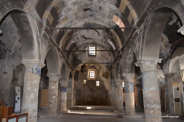
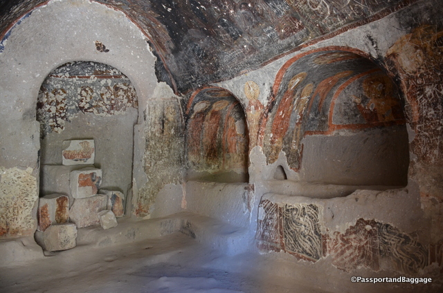
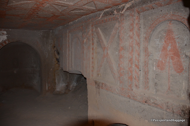
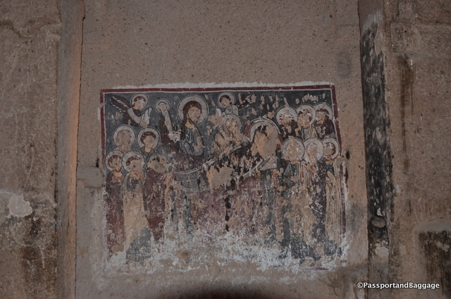
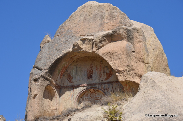
The Church of Archangels, just one of the many frescoes

The Church of Archangelos, just one of the many frescoes

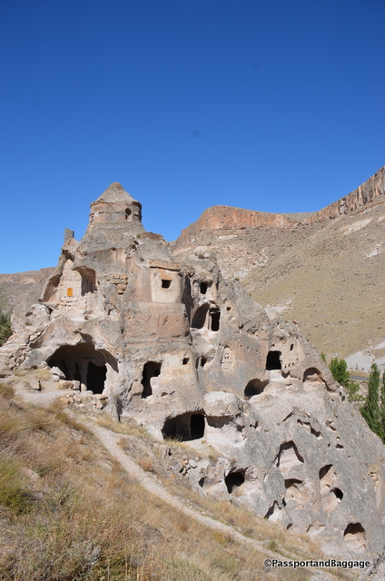
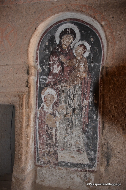
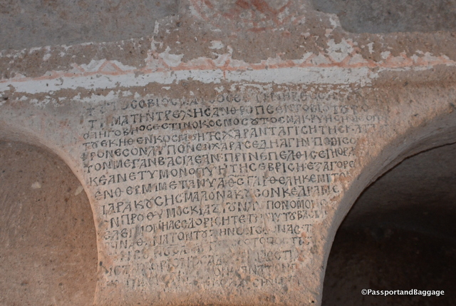
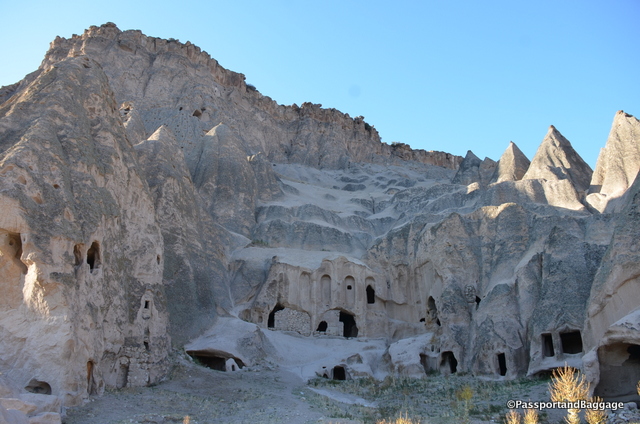
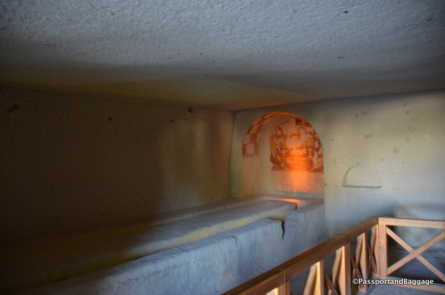
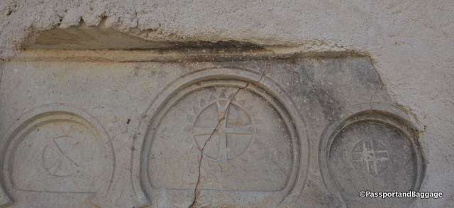
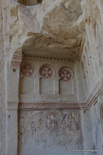
The Keslik Monastery sits just on the outskirts of Taşkinpasa. The Monastery held about 250 people and had two cave churches. The first one is Archangelos church and the other one Saint Stefanos church.

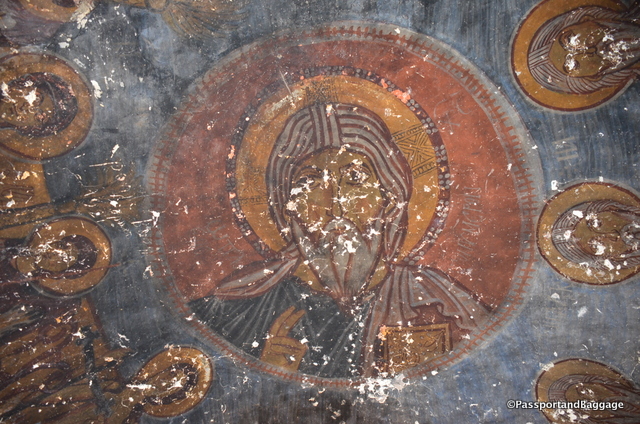
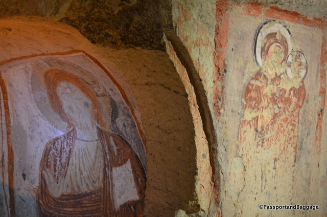
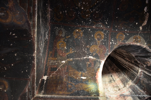
There are wonderful frescoes in the Archangelos church, but they are so badly covered with soot that you need the resident guide and his flashlight to see them.
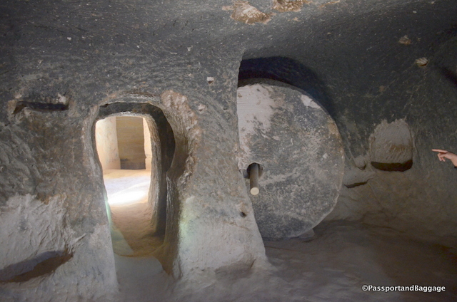
TurkeyDue to many robbers and military conflicts in the region, the monks had a safe room and when they were in need, they could close the door by a big and heavy millstone and escape in a tunnel under the monastery and garden. As these stones are hard to find, this is an excellent chance to see one in-situ.

Refectory

The refectory in this monastery is one of the more intact ones of the area

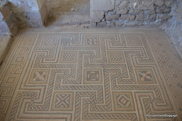
One of the many tile floors at Sobessos

One of the many tile floors at Sobessos

Not far from Taşkinpasa is Sobessos, the only late-Roman/early-Byzantine settlement in Cappadocia. Originally a Roman settlement from the 4th century to 5th century A.D., it was discovered by chance in 1963 by a farmer clearing a field.

He reported his discovery to the local museum, but they ignored him. It was not until 2002 that the museum took action and started excavations that are still going on.

A corrugated-iron roof protects the 4000 square foot meeting hall, the main attraction of which is the mosaic flooring. In a later time a chapel had been built on top of some of the finer mosaics inside the meeting hall. According to the coin that was found during the excavation, the chapel dates back to the middle of the 6th century.
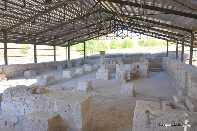
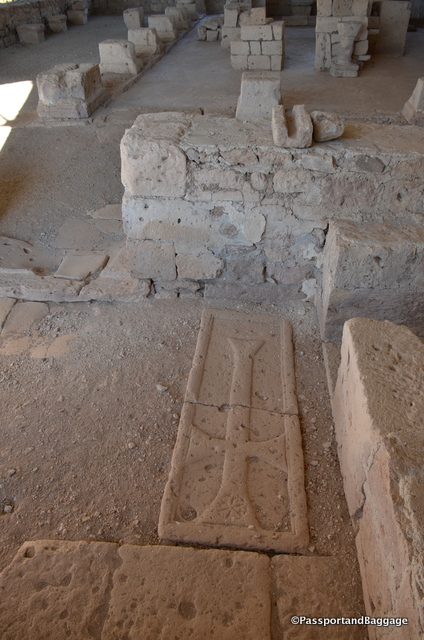
SobessosA grave was found in the north part of the main room and belongs to the same period as the chapel.

A Roman Cross lying within the ruins

A Roman Cross lying within the ruins

Further excavation uncovered the bath complex that you find at the entry, as well as an apoditorium (dressing room) and  a caldorium (steam room).

Wandering the ruins makes you realize how little is understood, or known about the development of Cappadocia. It is known that Christians were hiding out from Roman soldiers, but there has never been any evidence of a full-scale Roman settlement in the area. One leaves this site with more questions than answers.

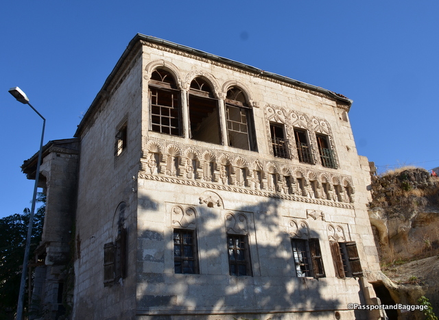
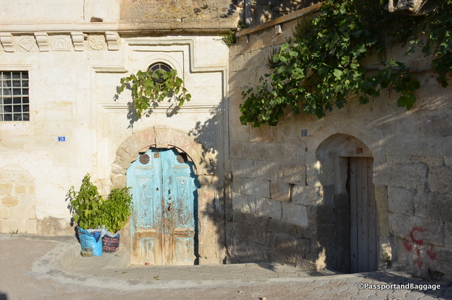
An abandoned Greek home of some substance and wealth

An abandoned Greek home of some substance and wealth in Mustafapşa.

Our last stop of the day was Mustafapaşa. It is difficult to discuss Mustafapasha without at least touching on the horrendous political policies taken on by the Turkish government at the beginning of the Republic’s formation.

The former name of Mustafapaşa during the Ottoman Empire era was Sinasos. It had a mixed population. Greeks and Karamanlides (Turkish speaking Christians) constituted the majority of the population and Muslim Turks constituted the rest. The small town had many elaborate houses built by the wealth coming from İstanbul.

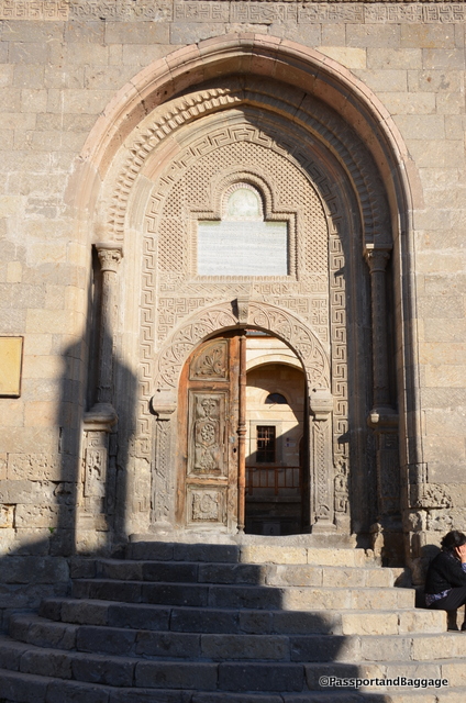
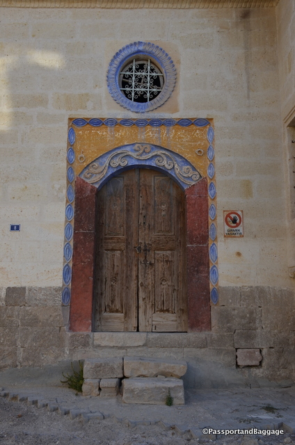
Entryway that has been altered from Greek To Islamic in its decorations

Entryway that has been altered from Greek To Islamic in its decorations

This Greek portion of this town was devastated during the 1923 Population Exchange and the town has never economically recovered.

Older Greek doorways, still hold their charm

Older Greek doorways, still hold their charm

Mustapasha Turkey

The 1923 population exchange between Greece and Turkey stemmed from the “Convention Concerning the Exchange of Greek and Turkish Populations” signed at Lausanne, Switzerland, on January 30, 1923, by the governments of Greece and Turkey. It involved approximately 2 million people (around 1.3 million Anatolian (Turkish) Greeks and 500,000 Muslims in Greece), most of whom were forcibly made refugees and de fact denaturalized from their homelands.

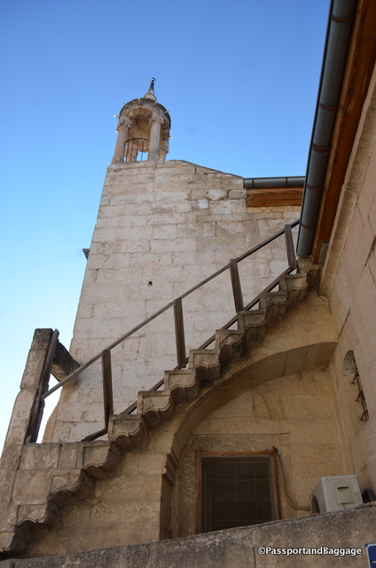
Stairways to an old bell tower than now holds the signs of a new religion

Stairways to an old bell tower than now holds the signs of a new religion

By the end of 1922, the vast majority of native Asia Minor Greeks had fled the recent Greek genocide (1914–1922) and Greece’s later defeat in the Greco-Turkish War (1919–1922). The Greek genocide, part of which is known as the Pontic genocide, was the systematic genocide of the Christian Ottoman Greek population from its historic homeland in Anatolia (Turkey) during World War I and its aftermath (1914–22).

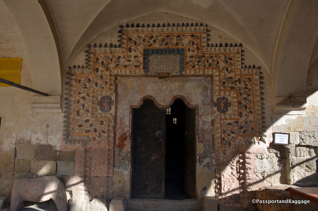
The Church of Constantine and Helen From the 18th Century

The entry to the Church of Constantine and Helen From the 18th Century

The abandoned interior of the Church of Constantine and Helen

The abandoned interior of the Church of Constantine and Helen

According to some calculations, around 900,000 Greeks had arrived in Greece. The population exchange was envisioned by Turkey as a way to formalize, and make permanent, the exodus of Greeks from Turkey, while initiating a new exodus of a smaller number of Muslims from Greece, to supply settlers for the newly depopulated regions of Turkey. Greece saw it as a way to supply its masses of new property-less Greek refugees from Turkey with lands to settle from the exchanged Muslims of Greece.

Walking the streets of Mustafapaşa

Walking the streets of Mustafapaşa

This major compulsory population exchange, or agreed mutual expulsion, was based not on language or ethnicity, but upon religious identity, and involved nearly all the Orthodox Christian citizens of Turkey, including its native Turkish-speaking Orthodox citizens, and most of the Muslim citizens of Greece, including its native Greek-speaking Muslim citizens.

More street scenes of Mustafapaşa:

Mustafapasa Turkey *

Mustafapasa, Turkey

*Mustafapasa, Turkey

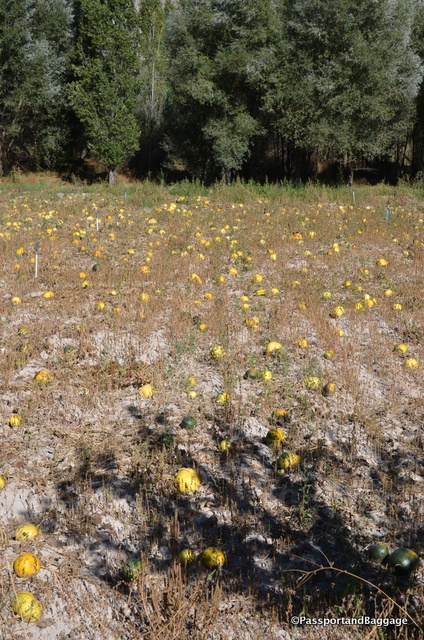
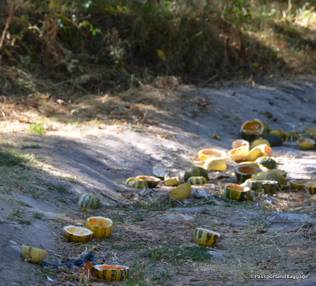
It is pumpkin harvest time in Turkey.  The Turks only raise the pumpkins for their seeds, the rest is set along the roads or tossed in the fields for animals, or, as far as I could see, simply tossed out.

Pumpkins in the fields ready for harvesting

Pumpkins in the fields ready for harvesting

Seeded pumpkins tossed out for the animals

Seeded pumpkins tossed out for the animals

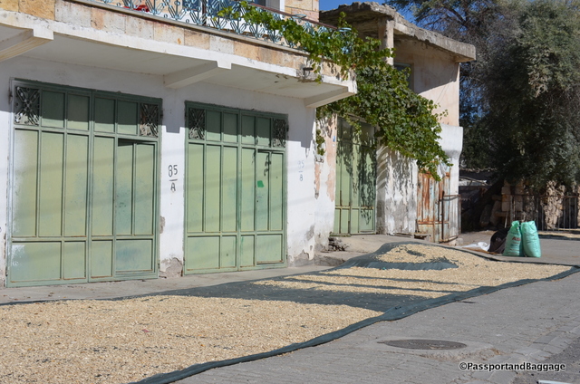
The seeds are removed by hand, and then raked out for drying.

The seeds are removed by hand, and then raked out on sheets of tarp or plastic for drying.

Cappadocia and Central Anatolia are both so large and full of history and civilizations stacked upon each other, it is very hard to grasp a good picture of what actually took place when it history.  The area is a large farming area and the terrain takes your breath away each and every time you see it.
Sep 302016
 

September 30, 2016

SoganliOur day began in the Soğanlı Valley, (The Valley of Onions). This is about off the beaten path as you can get, not only due to the drive, but the remoteness of the valley itself.

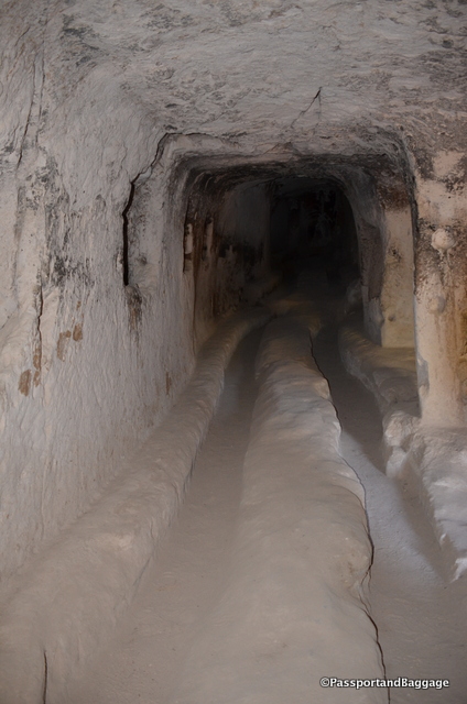
Around the sixth century the Christian inhabitants of this region created a vast network of tunnels into the soft volcanic rock. These tunnels extend as deep as 275 feet on eight different levels, in which several thousands of people lived.

The purpose of visiting the valley is to see this cave city, which is said to be older than Cappadocia with its churches and frescoes. We have spent much time speculating why there are so many churches in these valley’s and have been unable to come up with a theory.

Stairs up to the

Stairs up to Tokali kilise

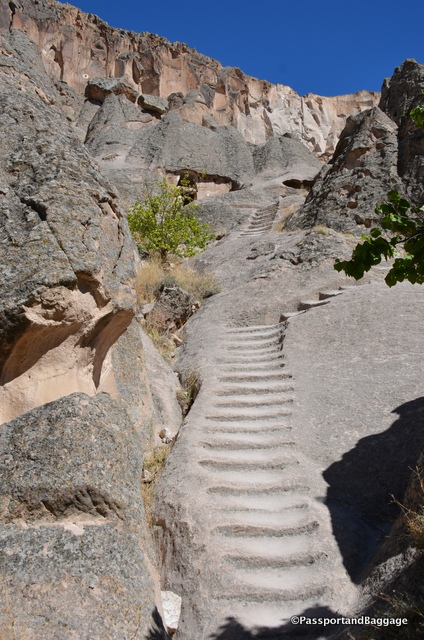
Your first stop is the Tokalı kilise (Buckle church). It is up a steep, slippery, much-eroded stairway cut into the rock, we did not attempt this stairway.

After you pay your entry fee you can drive up a small road to the Yılanlı kilise (Church of the Snake).

Church of the Snake

Church of the Snake

The dome in the Church of the Snake

The dome in the Church of the Snake

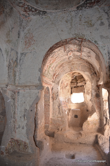
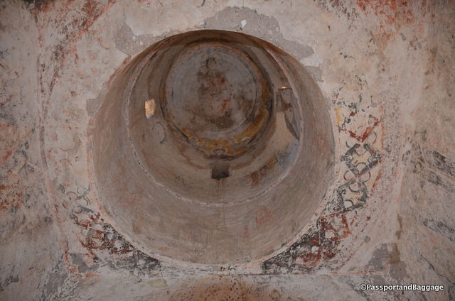
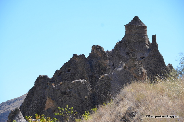
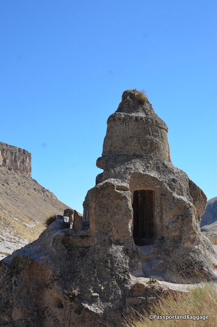
On the other side of the carpark, with a slight walk up the hill you will encounter the Kubbeli kilise (Church with a dome) and Saklı kilise (Hidden church). You instantly see the cylindrical dome of the Kubbeli as you walk up. The Hidden church is hidden behind the Church with a Dome.

The interior of the Church with a Dome

The interior of the Church with a Dome

The Dome of the Church

The Dome of the Church

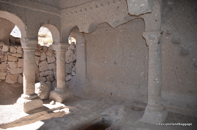
The interior columns of the Church with a Dome

The interior columns of the Church with a Dome

Church with a Dome

Church with a Dome

Looking back on the entire hill that holds the Church with a Dome

Looking back on the entire hill that holds the Church with a Dome

The Hidden Church

The Hidden Church

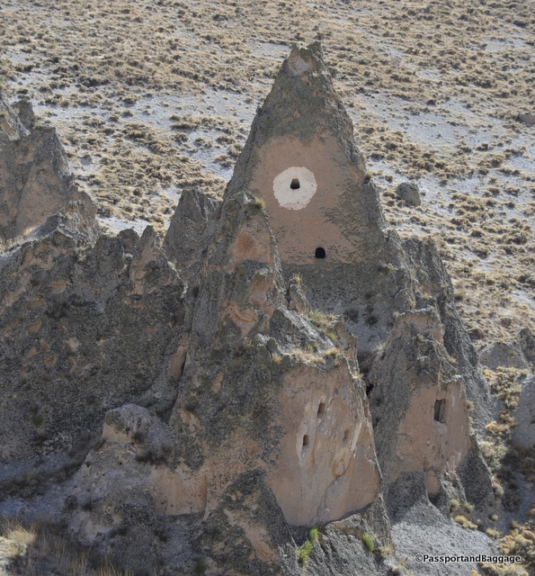
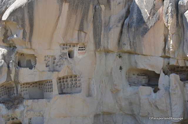
All around the area you will see small holes with white paint around them. These pigeon houses were built by monks to entice pigeons so they could collect their guano. The monks collected these droppings for use as fertilizer for their sweet-wine grapes.

Pigeon holes

Pigeon holes

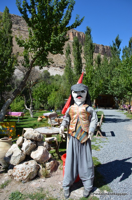
At each stop were ladies selling the Soğanlı doll. Local women have been making rag dolls for many years now, using very simple but specific Anatolian patterned fabrics to earn a living. A popular story about the doll’s origin tells about a mother who lost her baby and to relieve her grief, made a rag doll to replace her. However, the real story of the doll is not as dramatic. It started 50 years ago when a local woman Hanife made a doll for her granddaughter Döndü as part of her school task. While Döndü was going to school, she met some travellers who loved the pretty handmade rag doll and wanted to buy it. This gave the women of the village the idea to make and sell the dolls to tourists. Sadly, it now looks like the ladies buy the rag dolls, as their faces are printed not embroidered, and then, they may in fact, make the clothes.
One of the "dolls" welcoming you to a tea house.

One of the “dolls” welcoming you to a tea house. He is a bit larger than the real things.

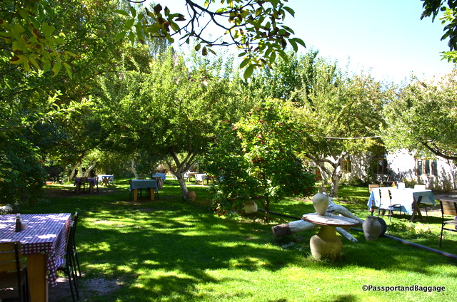
We stopped at Soğanlı Kapadoka Restaurant or the “Hidden Apple Garden”.  It is not only gorgeous but the food is absolutely wonderful, and the people are so delightful.

The "Hidden Apple Garden" is a wonderful place to sit in the garden and enjoy a leisurely lunch

The “Hidden Apple Garden” is a wonderful place to sit in the garden and enjoy a leisurely lunch


Sep 302016
 

September 29, 2016

Standing on the ridge looking down into the valley. From here it is 300 steps down to the valley floor.

Standing on the ridge looking down into the valley. From here it is 300 steps down to the valley floor.

The Ihlara Valley sits near Mount Hasan and Mount Melendiz, two of the three volcanoes of Cappadocia.  The valley  is a canyon about 300 feet deep, and was formed by the Melendiz River.

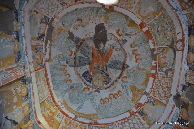
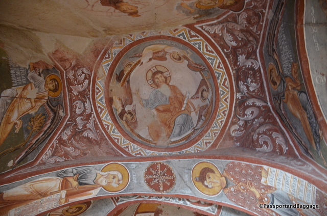
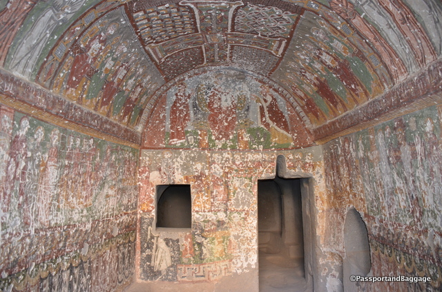
In the Agacalti Church the Frescoes date to the 9th - 11th centuries.

In the Agacalti Church the Frescoes date to the 9th – 11th centuries. This is the domed ceiling.

Due the valley’s plentiful supply of water and hidden places, this was the first settlement of the first Christians escaping from Roman soldiers. It is believed that the valley housed more than four thousand dwellings and a hundred Byzantine period cave churches decorated with frescoes. Around eighty thousand people once lived in Ihlara Valley.

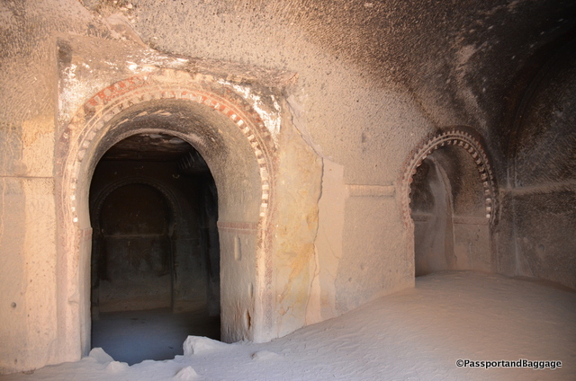
These interesting arches are the entrance to the Dark Castle Church

These interesting arches are the entrance to the Dark Castle Church

dsc_7215

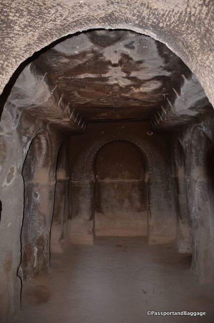
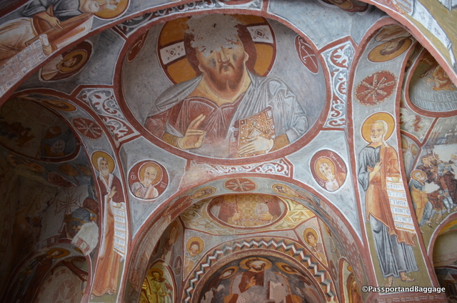
The Interior of the Dark Castle Church

The Interior of the Dark Castle Church

Of the one hundred churches only 10 are available to visit today.  We stopped in just a few to enjoy the frescoes.

The valley is 9 miles long, but it is set up for shorter walks, with tea houses interspersed for resting and just enjoying this stunning river walk.

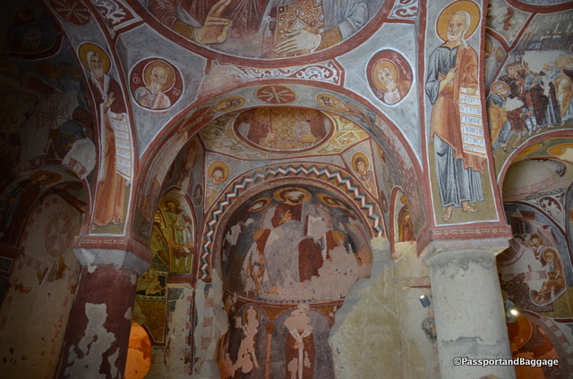
The frescoes of the Kokar Church

The frescoes of the Kokar Church

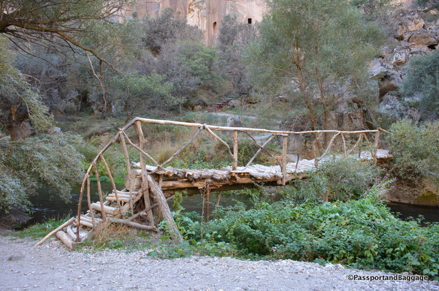
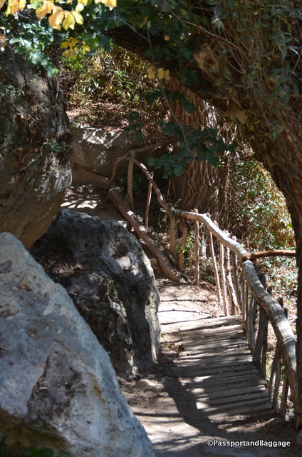
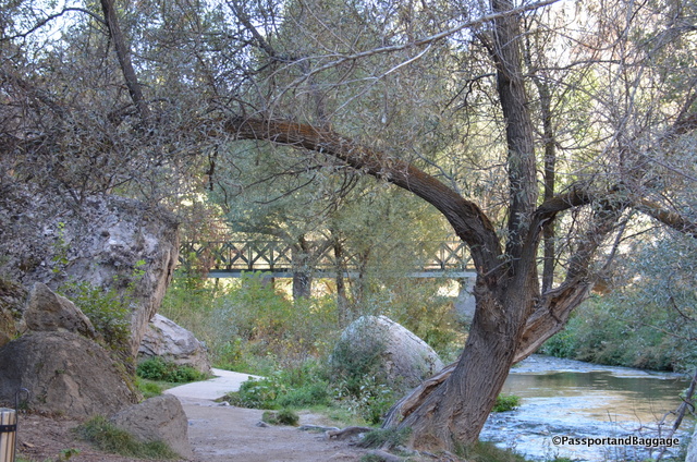
The walk is peppered with lovely little wood bridges that cross back and forth across the river.

dsc_7224

*dsc_7208

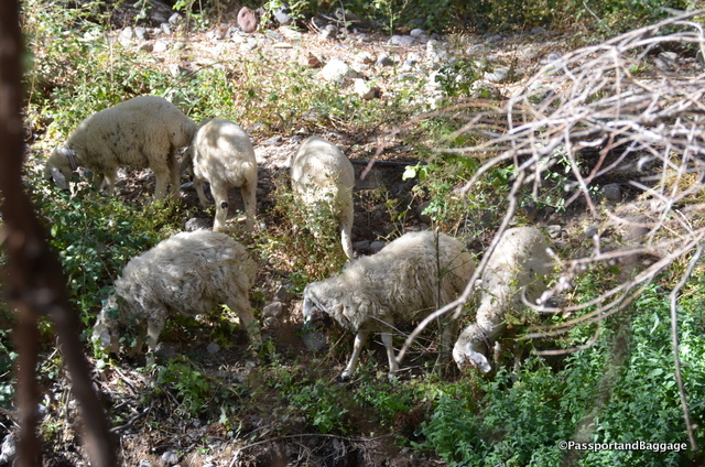
*dsc_7236Along the way it appears that some people may still be living in the valley

dsc_7232

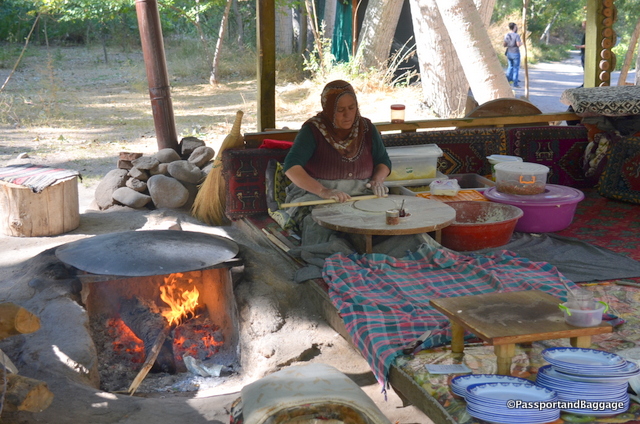
A woman preparing food at one of the tea houses

A woman preparing food at one of the tea houses

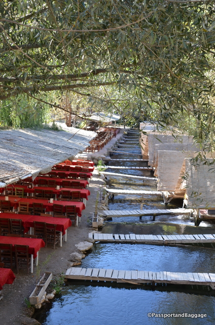
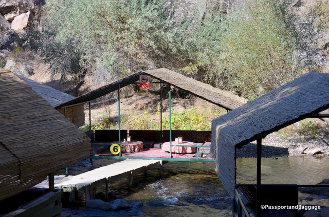
There are little private tables for tea that sit in the river

There are little private tables for tea that sit in the river

Tea houses of the Ihlara Valley

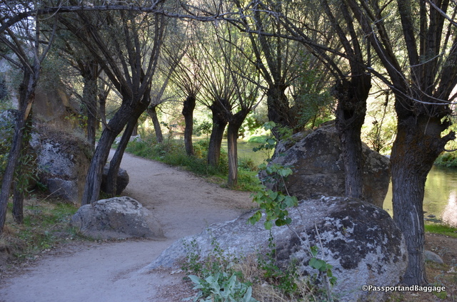
The meandering trail

The meandering trail

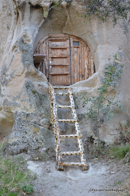
Fun and unexpected sights along the way

Fun and unexpected sights along the way

There are 4 entrances to Ihlara valley. The first one is at the start of the valley in Ihlara Village. The second one starts about 2.5 miles up the valley and is the most popular with its 300 steps down to the valley. The third entrance is at Belisirma village, is easily accessible by car and is located in the middle of the valley.  The last is at the end of the valley near the Selime Church.

Our walk began at the 2nd entrance and we ended at Belisirma Valley.  The walk is truly beautiful, the park is very well maintained with trash bins everywhere and the evidence that someone sweeps the trail several times a day.

This, as most tourists areas around the world require an entrance fee.  I suggest you purchase an all Turkey Museum pass on your first day.  They sell for 45 TL and are good for 72 hours and as many entries as you can accomplish in that period of time.

Sep 292016
 

September 29, 2016

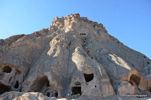
A look at the top of the mountain, taken from halfway up

A look at the top of the mountain, taken from halfway up

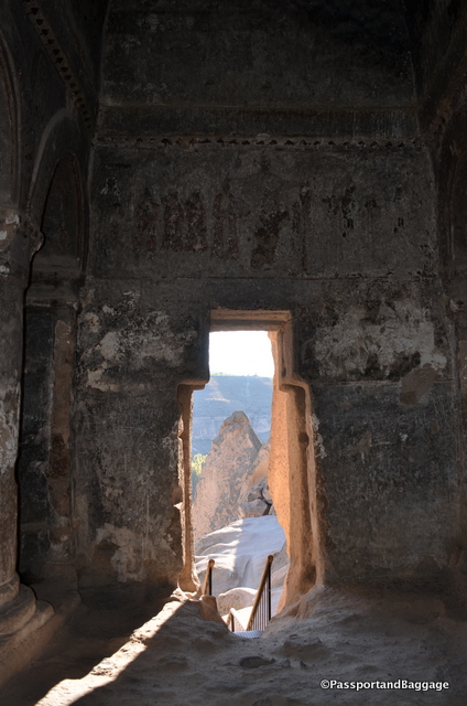
The Selimi Cathedral is not a highly visited area, mainly because the walk is extremely difficult. If you are going to do the walk to the top of this mountain I suggest very good shoes. It can be confusing, but important to understand that the entire mountain is called Selime Cathedral. There were many other types of rooms throughout the mountain, not just the Cathedral.
The cathedral dates from the Byzantine period and served as a significant center for religious activities and teachings.

It also served as an important military base. The local people would use the cathedral as a castle to defend themselves when needed.

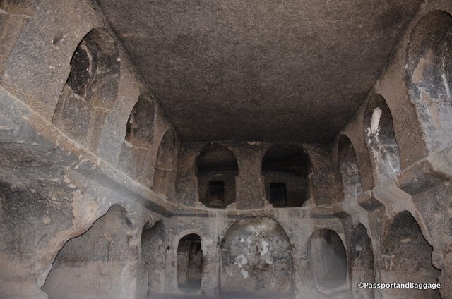
The area for worship sits at the very top of the mountain and consists of ten rooms that connect via tunnels. As this area is not as well visited, the tunnels are not lit so if you want to go exploring be sure to take your own flashlight.

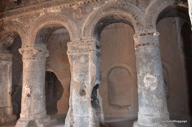
The columns inside the worship area

The columns inside the worship area

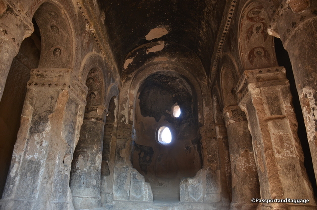
The interior of the area of worship

The interior of the area of worship

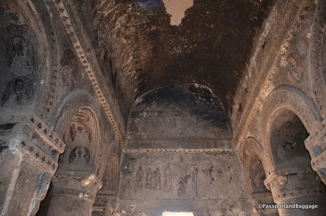
The frescoes are very hard to see due to the soot from caravansary fires

The frescoes are very hard to see due to the soot from caravansary fires

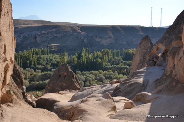
Looking out from the area of worship is just as magical

Looking out from the area of worship is just as magical

Inside the actual cathedral are beautiful large columns dividing the church into three sections. There are frescoes dating to the 10th and 11th century. At one time this cave was turned into a caravansary and so the frescoes are not easily visible due to the smoke covered walls and ceilings.

A room marked Monastery is one that is connected to the worship area via tunnels.

A room marked Monastery is one that is connected to the worship area via tunnels.

There was once a bazaar in Selime and caravans were frequently taken to the middle of the mountain for security. It is hard to imagine how camels climbed up to this area, I must assume some massive amounts of erosion have taken place since those days.

An example of the rough walking terrain

An example of the rough walking terrain, and this is the easy area to walk

The entry to Mother Mary church

The entry to Mother Mary church taken from 100s of yards away, is easy to see

The beautiful frescoes of the Mother Mary Church

The beautiful frescoes of the Mother Mary Church

dsc_7300

*

Inside the Mother Mary Church

Inside the Mother Mary Church

On the backside of the mountain is Mother Mary Church. The exquisite entry to this church sits way up on the mountain and is simple to spot from the ground but impossible to actually find without the aid, in our case, of the parking lot attendant and a 5TL tip. There are quite a few frescoes inside this church. They are not in great shape, but accessible none-the-less.

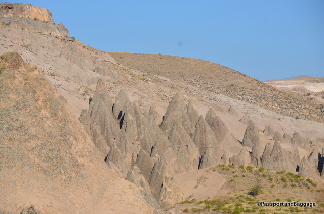
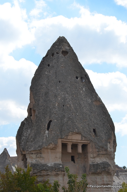
Fairy Chimneys

Fairy Chimneys

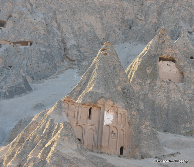
This entire area is covered in fairy chimneys that have a more pyramidal shape than the ones found in the Goereme area.

For Star Trek fans, the Selimi Cathedral was used for stock photo shots. It would be difficult to imagine using it for anything else, as negotiating the hill requires a very fit person and a strong faith that your shoes will hold on the steep terrain.

Selime


Sep 292016
 

September 29, 2016

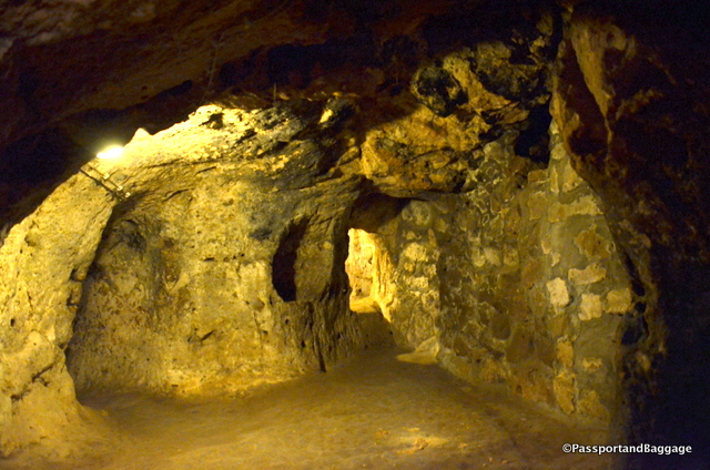
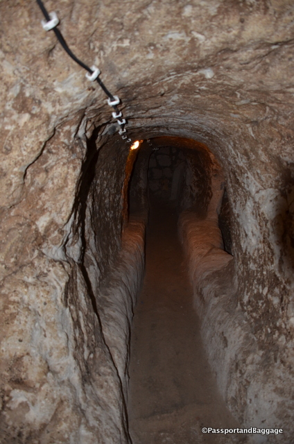
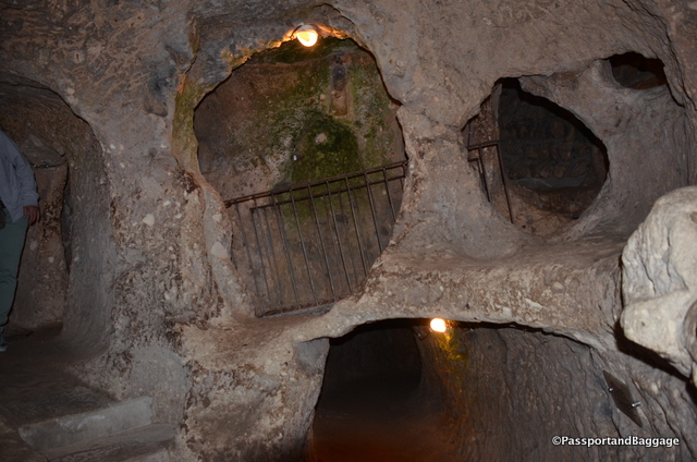
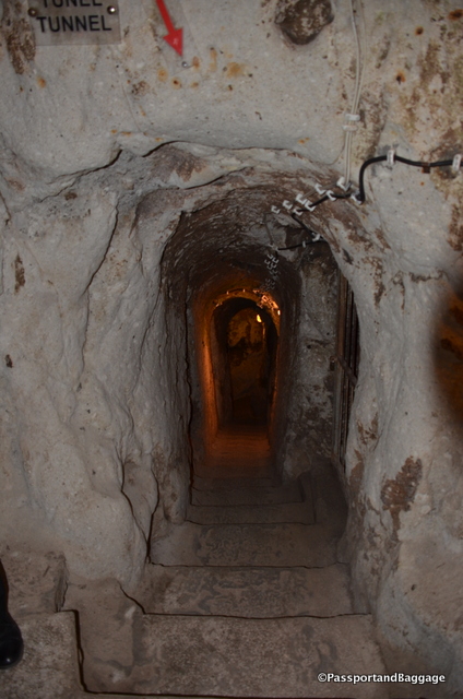
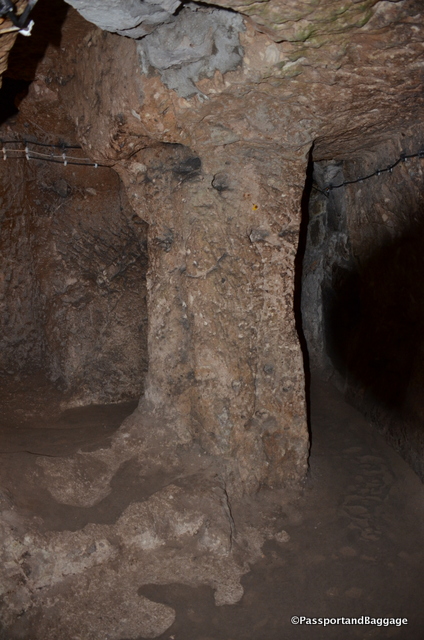
Caves of CappadociaDerinkuyu (Deep Well) is just one of many, many underground cities lying underneath Cappadocia. In fact they believe there are at least 36 underground cities in the area, only a few have been excavated.  It is really difficult to describe how claustrophobic the spaces are, how one has to stoop over for long distances to go through the tunnels, and more importantly how in the world anyone actually lived their entire lives like this.  You must also keep this in mind when looking at the pictures, they just can not capture what you are actually experiencing.

Underground Caves of CappadociaThe caves may have initially been built by the Phrygians, in the 8th–7th centuries B.C.. When the Phrygian language died out in Roman times, replaced with its close relative, the Greek language, the inhabitants, now Christian, expanded their underground caverns adding the chapels and Greek inscriptions.

The city at Derinkuyu was fully formed in the Byzantine era, when it was heavily used as protection from Muslim Arabs during the Arab–Byzantine wars (780-1180).

Underground caves of CappadociaSome artifacts discovered in these underground settlements belong to the Middle Byzantine Period, between the 5th and the 10th centuries A.D.

These cities continued to be used by the Christian natives as protection from the Mongolian incursions of Timur in the 14th century.

After the region fell to the Ottomans, the cities were used as refuges from the Turkish Muslim rulers. As late as the 20th century the locals, called Cappadocian Greeks, were still using the underground cities to escape periodic waves of Ottoman persecution.

Underground Caves of CappadociaWhen the Christian inhabitants of the region were expelled in 1923 in the population exchange between Greece and Turkey the tunnels were abandoned

Derinkuyu was rediscovered by a local person digging in their backyard in 1963, they were opened to visitors in 1969 and about half of the underground city is currently accessible to tourists.

Underground Caves of CappadociaIt is thought that at least 20,000 people lived in Derinkuyu. It is at least eight levels deep, or about 200 feet. It is thought that there was a tunnel linking Derinkuyu to Kaymakli, which is over 6 miles away.

The area that visitors can see includes a stable, a wine press area, a large open area.  As you descend you come upon living quarters, what the state as a kitchen and a church.

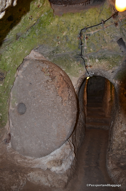
Underground Caves of CappadociaThe reason we chose this particular cave is that I was fascinated with the wheels that roll to block off tunnels in times of siege.


Sep 282016
 

September 28, 2016


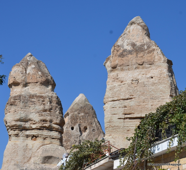
Fairy Chimneys of Cappadocia. In the past pigeons would roost in these tall pieces of stones, their cooing would cause a sound that made the locals think that the pillars were inhabited by fairies.

Fairy Chimneys of Cappadocia. In the past pigeons would roost in these tall pieces of stones, their cooing would cause a sound that made the locals think that the pillars were inhabited by fairies.

Cappadocia is a large region that includes many towns, named by the Persians it means beautiful horses. Today I am in Göreme. The time that the Göreme was first settled is unclear, but it could date back as the Hittite era, between 1800 and 1200 B.C. The location was central between rivaling empires, such as the Greeks and Persians, leading the natives to tunnel into the rock to escape the political turmoil. Today the rocks and caves make for perfect tourism restaurants and hotels.

Everywhere you go you see signs of people having lived in caves carved in the mountains

Everywhere you go you see signs of people having lived in caves carved in the mountains

I am staying at the Aren Cave Hotel in Göreme, and I can not sing its praises high enough. Cappadocia did not become a tourist attraction until the 1980s, so most of the hotels in the area were once homes. When tourism moved in, those that could afford to, purchased the older homes and turned them into hotels. The price of a home shot from around $100,000 to $500,000 in this period.

There were once lovely columns carved in this pillar

There were once lovely columns carved in this pillar

Göreme is a district of the Nevşehir Province in Turkey. After the eruption of Mount Erciyes about 2,000 years ago, ash and lava formed soft rocks in the Cappadocia Region, covering a region of about 12,000 square miles. The softer rock was eroded by wind and water, leaving the hard cap rock on top of pillars, forming the present-day fairy chimneys. People of Göreme realized that these soft rocks could be easily carved out to form houses, churches, monasteries.

dsc_7112Within walking distance of downtown Göreme is the Göreme Open Air Museum. This area, which is now a museum, is a lovely concentration of the churches of the era. These Christian sanctuaries contain many examples of Byzantine art from the post-iconoclastic period. These frescoes that are unique to the period and the area. Sadly, photographs are not allowed of the frescoes, the ones I captured were before I was scolded for photographing.

Church frescoes in the outdoor museum of Goereme

Church frescoes in the outdoor museum of Goereme

dsc_7114 *goereme turkey

Wandering the town of Göreme

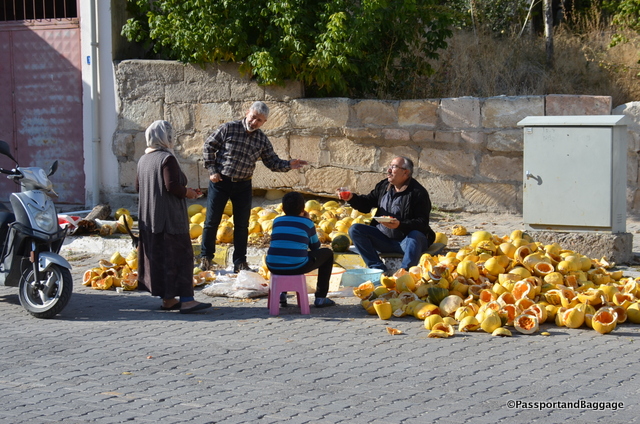
It is pumpkin harvest time in Turkey

It is pumpkin harvest time in Turkey

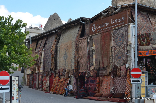
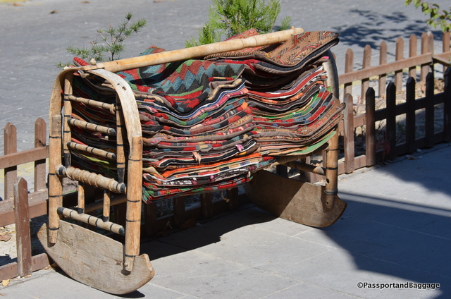
Carpets are big all over Turkey, but especially in this area

Carpets are big all over Turkey, but especially in this area

dsc_7100

*

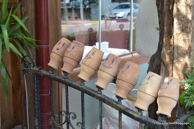
Kebab Testi is Kebob in a clay pot, someone has a lot of fun with the left over clay pots.

Kebab Testi is Kebob in a clay pot, someone has a lot of fun with the left over clay pots.

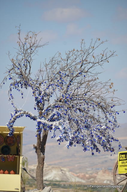
The evil eye is a superstition in much of this area, why hanging thousands of them in a dead tree is a mystery to me, but makes for a fabulous art statement

The evil eye is a superstition in much of this area, why hanging thousands of them in a dead tree is a mystery to me, but makes for a fabulous art statement

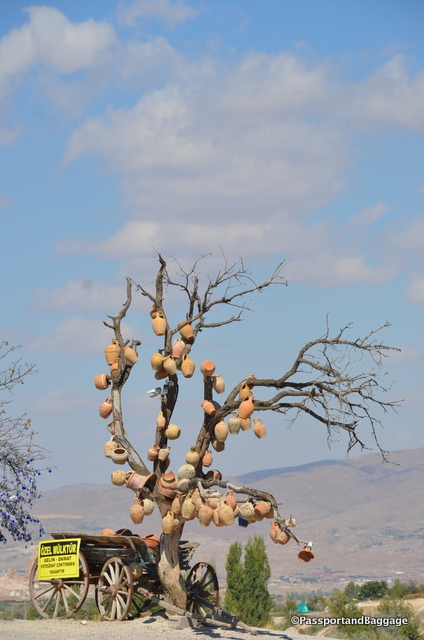
The area is known for its red clay, and red clay pots, how fun to hang them from trees

The area is known for its red clay, and red clay pots, how fun to hang them from trees

A large dining hall in Goereme

A large dining hall in the Goereme Open Air Museum

Exterior decorations of churches of Goereme

Exterior decorations of churches of Goereme

dsc_7120

dsc_7112 *dsc_7108*

Balloon flights are a big tourist attraction of the area.

Balloon flights are a big tourist attraction of the area.

This place is magical and I will never have the words to do it justice.

Dinner was at a lovely spot called Pumpkin.  The owner had worked in restaurants and hotels around town for many years and went out on his own.  If you get a chance, it is a set menu that changes every night.  The food is wonderful, and importantly, the service and people are delightful.  Service in restaurants in this area can be very mixed, often verging on the very poor.