Oct 142016
 

October 13, 2016

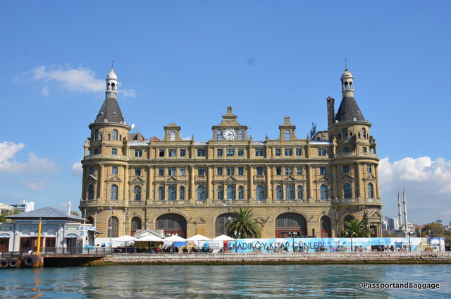
The Istanbul Haydarpaşa Terminal was a major intercity, regional and commuter rail hub as well as the busiest railway station in Turkey until 2012. Found on the Asian side of Istanbul, a ferry ride on the Kadikoy – Eminonu line will take your right past the terminal.

The Hydrapasha Station taken from the ferry

The Haydarpaşa station taken from the ferry.

The closure of the station has been subject to a lot of controversy, many claim that the Turkish government is planning to sell the historic railway station along with the port and turn it into a residence/luxury resort.
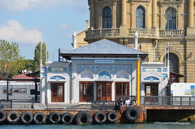
Hydrapasha

The lovely tile-adorned station iskele (ferry dock) was designed by noted Turkish architect Vedat Tek

When Istanbul was the capital of the Ottoman Empire, and essentially the center of the world, it had no railway so in 1871 Sultan Abdülaziz ordered a rail line to be built from Haydarpaşa to İzmit.

In 1888 the Anatolian Railway (CFOA) took over the line and the station. Since the station was built next to the Bosphorus, freight trains would unload at Haydarpaşa and the freight would be transferred to ships. The line started carrying passengers in 1890.
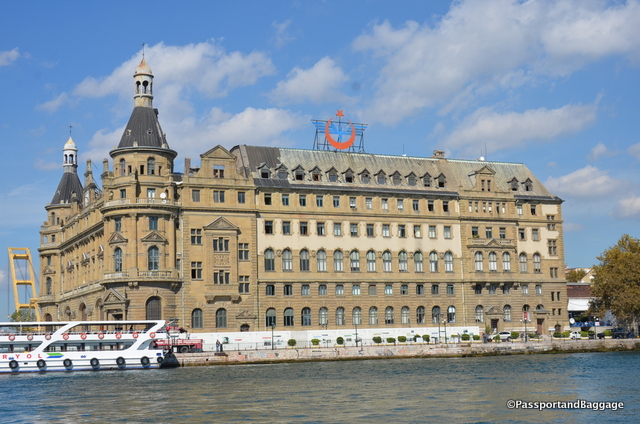
hydrapasha station istanbulIn the early 1900s, the Anatolian Railway hired two German architects, Otto Ritter and Helmut Conu, to build a new building to house the Istanbul terminus for the proposed Berlin to Baghdad rail line. They chose a neo-classical design and construction started in 1906. Its foundation is based on 1100 wooden piles, each 68 feet long, driven into the silty shore by a steam hammer. German and Italian stonemasons crafted the facade embellishments of the terminal.

When World War I broke out in 1914, the Ottoman Empire sided with the Central Powers against the Allied Powers. The Ottomans lost and İstanbul was taken over by the British Empire. Haydarpaşa was under strong military control by the British during the occupation.

The British Empire withdrew from İstanbul in 1923 after Turkey obtained independence and in 1927 the newly formed Turkish State Railways took over the CFOA and the terminal, in an attempt to nationalize all Turkish railways. 1927 the CIWL started a premier train service from Haydarpaşa to Ankara: the Anatolian Express. This all-sleeper train travelled daily between the two cities.
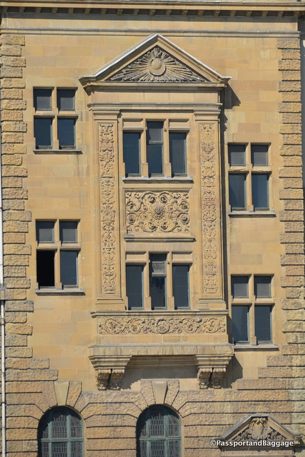
Railway Station ornamentationIn 1940 with the completion of the Baghdad Railway to Baghdad, the Taurus Express began running from Haydarpaşa to Baghdad.

In 1979 a tanker burning on the Bosphorus damaged the terminal building, but it was restored a few months later. In 2010 a fire, during the building’s restoration, destroyed the roof and the 4th floor of the terminal building.

In 2011 the World Monuments Fund, placed the railway terminal on its 2012 Watch, drawing attention to the uncertain future of the historical site.

If you get to the Asian side be sure to visit Ciya Restaurant.  It can be a tad hard to find, but it is on Güneşlibahçe Sokak which is the main street of the Kadıköy Market. The Kadıköy Market is similar to Beyoğlu’s Balık Pazarı (fish market), but with fewer tourists and barkers. The market is a foodie’s heaven! You will find the fish market; a number of excellent şarküteris; shops specializing in dried fruits, tea and coffee; cheese shops and some incredible bakeries and baklava stores.

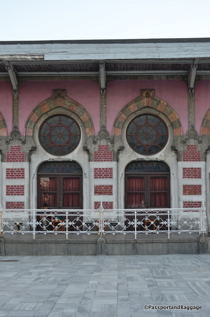
The Sirkeci Terminal
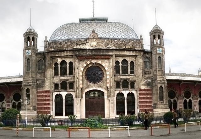
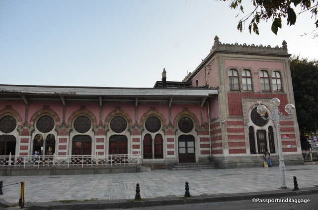
Sirkeci Terminal Station IstanbulThe Sirkeci Terminal was built in 1890 by the Oriental Railway as the eastern terminus of the world-famous Orient Express.

The architect of the project was August Jasmund a Prussian who was sent to Istanbul by the German government in order to study Ottoman architecture. The terminal building covers 13,000 square feet and is one of the most famous examples of European Orientalism. At the time the building was very modern, with gas lighting and heating in the winter, provided by large tile stoves made in Austria. The building is almost always covered in scaffolding and is very difficult to photograph.
Sirkeci TerminalIstanbul *Sirkeci Station Istanbul

Oct 132016
 

October 12, 2016

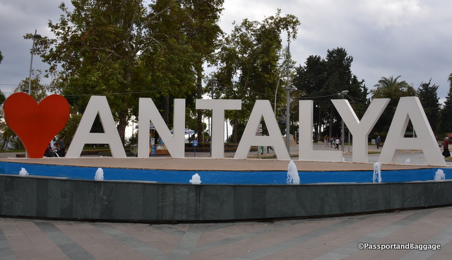
Antalya is an interesting town. The city has a population of almost 2 million people, which almost doubles in the summer time, spread out over an area of 8000 square miles. It is hard to fathom its size, but the heart of Antalya is the walled ancient city of Kaleiçi.

Antalya, TurkeyThe historical architecture of Antalya is located here as the new city was built upon much of the ancient city.

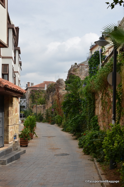
Cobblestone Streets of KalieciKaleiçi, has narrow cobbled streets lined with historic Ottoman era houses. It is also filled with higher end hotels, bars, clubs, restaurants, and shopping. It is surrounded by two walls, one of which is along the seafront, built in a continuous process from Hellenistic to Ottoman times. The historical harbor is located in this part of the city.

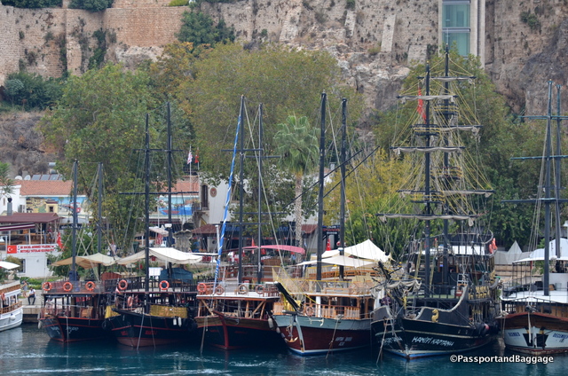
The tour boats, offering tours of the area are garish and ridiculously decorated like pirate theme parks

The tour boats, offering tours of the area, are garish and ridiculously decorated like pirate theme parks

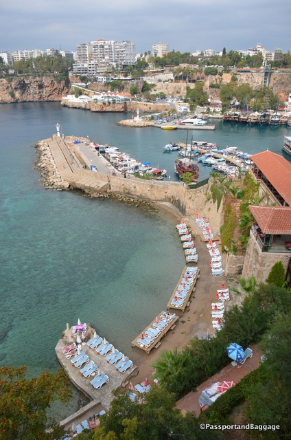
Looking down on the historic harbor

Looking down on the historic harbor and sunbathing area just below the historic city center

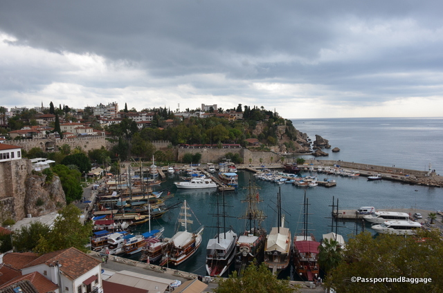
Looking at the historic harbor from the other side

Looking at the historic harbor from the other side

There are sites with traces of Hellenistic, Roman, Byzantine, and Seljuk architecture and cultures throughout Kaleiçi . The historic walls have 80 bastions and inside of the walls, there are approximately 3000 houses with red tile roof.

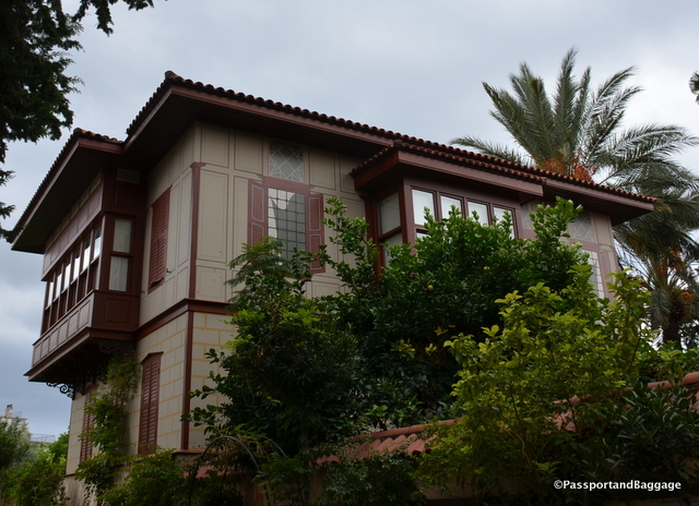
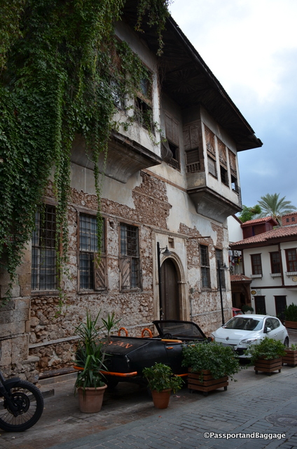
The homes of the Ottoman time were quite possibly painted as this one with faux stones painted over plaster. Even the shutters are painted.

The homes of the Ottoman time were quite possibly painted as this one with faux stones painted over plaster. Even the shutters are faux painted.

Farther out are all-inclusive resorts that line the sandy beaches of this part of the Turkish Riviera.

Turkey is one of the world’s most popular destinations, but terrorism, political turmoil and the war in neighboring Syria are having a devastating impact on tourism. This has been evident all over Turkey, but it is most dramatic in Antalya as the city has doubled its size since 1988 all due to the tourism trade.

The main decline in tourism for Antalya is the Russian market, the four-and-a-half million Russian tourists that normally come to the beach area has fallen by 95%. The trigger was Turkey shooting down a Russian military jet that violated Turkish airspace sparking a diplomatic crisis between the two countries. The Kremlin barred Russian tour companies from selling package deals to Turkey.

King Ata

King Attallus

The city has a long and interesting history. King Attalus II of Pergamon is looked on as founder of the city in about 150 BC, during the Hellenistic period. It was named Attalea or Attalia in his honor.

Attalea became part of the Roman Republic in 133 BC when Attalus III, a nephew of Attalus II bequeathed his kingdom to Rome at his death in 133 BC.

The Seljuk Turks conquered the city and the surrounding region in the early 13th century. Antalya was the capital of the Turkish beylik of Teke (1321–1423) until its conquest by the Ottomans.

The city was occupied by the Italians from the end of the First World War until the founding of the Turkish Republic in 1923.

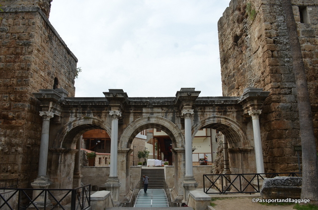
Hadrians Gate is one entry into the old town. The gate is a triumphal arch built in the name of the Roman emperor Hadrian, who visited the city in the year 130.

Hadrians Gate is one entry into the old town. The gate is a triumphal arch built in the name of the Roman emperor Hadrian, who visited the city in the year 130.

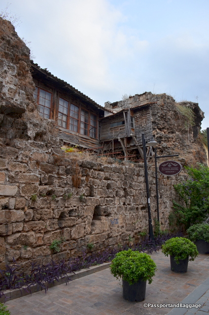
Many of the buildings have yet to be restored and old a charm of their own.

Many of the buildings have yet to be restored and old a charm of their own.

dsc_8451

*

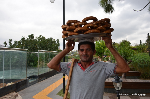
Simit is found everywhere in Turkey. It is a circular bread, typically encrusted with sesame seeds and hails from the Ottoman Empire, and the Middle East. It is typical for simit sellers to carry their load on their head, this gentleman was willing to pose for pictures after I bought a roll.

Simit is found everywhere in Turkey. It is a circular bread, typically encrusted with sesame seeds and hails from the Ottoman Empire. It is typical for simit sellers to carry their load on their head, this gentleman was willing to pose for pictures after I bought a roll. The cost is usually around 1TL or about 33cents

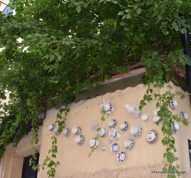
Here are a few random shots of Kaleiçi;

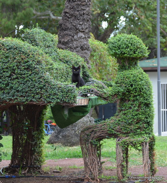
Cats are everywhere, even hidden in the topiary

Cats are everywhere, even hidden in the topiary

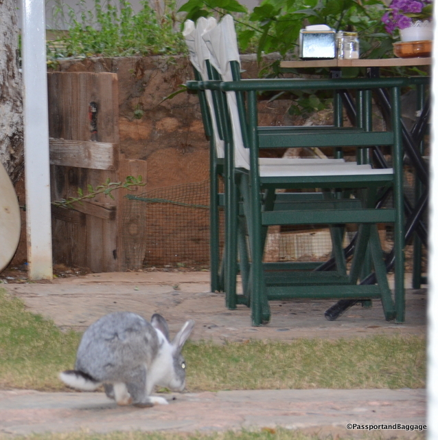
Cats are absolutely everywhere, so running across a bunny rabbit was rather unique.

Cats are absolutely everywhere, so running across a bunny rabbit was rather unique.

Antalya, Turkey

*

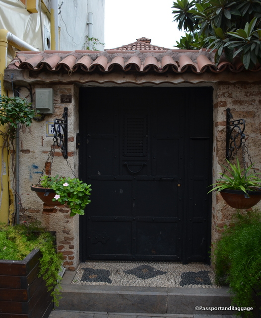
Pebble floors and interesting doors are all a part of Kaleiçi

Pebble floors and interesting doors are all a part of Kaleiçi

Antalya, Turkey

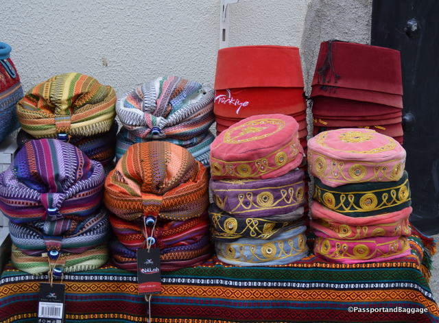
*hats of Turkey

*

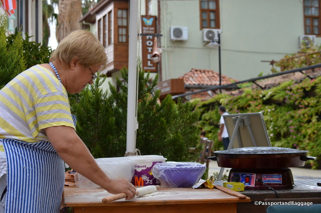
A woman makes Gozleme on the sidewalk

A woman makes Gozleme on the sidewalk

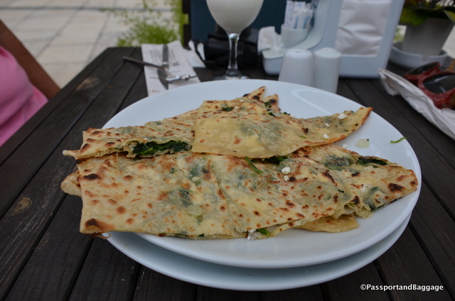
Gauzelike filled with onions, spinach and potatoes and cooked with a lot of butter

Gozeleme filled with onions, spinach and potatoes and cooked with a lot of butter

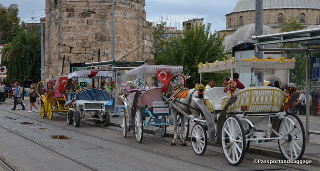
Horse carriages, decorated rather garishly, can be ridden around the newer parts of Antalya

Horse carriages, decorated rather garishly, can be ridden around the newer parts of Antalya

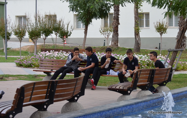
Boys break from school and enjoy kebab

Boys break from school and enjoy kebab

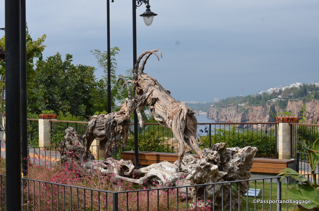
Ibex can be spotted in the Tauras Mountains just outside of Antalya, these are wooden sculptures gracing one of the many public parks within Kaleiçi

Ibex can be spotted in the Taurus Mountains just outside of Antalya, these are wooden sculptures gracing one of the many public parks within Kaleiçi

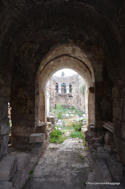
An old abandoned mosque in Kaleiçi

An old abandoned mosque in Kaleiçi

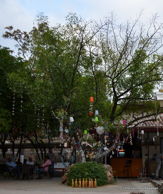
Wishing Trees are common all over the world, most commonly the Clootie Trees of Scotland and Ireland. In the Anatolya region they are called Dede Trees. Dede literally means “grandfather”. The story goes that nomadic women would never head to the village mosque as the men sometimes did and instead, all of the women would tie little strips of cloth to the dede trees when they came across them. Apparently, the Sarikeçeli nomads (the oldest nomadic group of Anatolya) believe that a dede can fulfill wishes

Wishing Trees are common all over the world, most commonly the Clootie Trees of Scotland and Ireland. In the Anatolya region they are called Dede Trees.
Dede literally means “grandfather”.
The story goes that nomadic women would never head to the village mosque as the men sometimes did and instead, all of the women would tie little strips of cloth to the dede trees when they came across them. Apparently, the Sarikeçeli nomads (the oldest nomadic group of Anatolya) believe that a dede can fulfill wishes

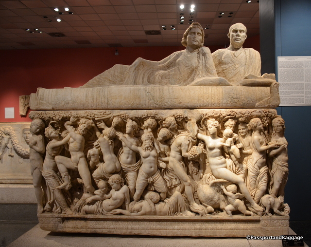
The museum of Antalya is spectacular. It holds most everything found at Perge, an ancient site that was not looted. It is well laid out, full of amazing finds and well worth the visit.

The museum of Antalya is spectacular. It holds most everything found at Perge, an ancient site that was not looted. It is well laid out, full of amazing finds and well worth the visit.

Oct 122016
 

October 12, 2016

Termessos was built at an altitude of more than ½ mile up Solymos Mountain in the Taurus Mountain Range of Turkey. It sits in Mount Güllük-Termessos National Park. You are able to drive up a little ways, but the rest must be seen after quite a steep walk. It is well preserved, simply by its remote location, and is a wonder to just walk through, unlike any other ancient site on the Mediterranean.

The greeting party at the bottom of the hill

The greeting party at the bottom of the hill

The first time that Termessos appeared in literature was in the Iliad by Homer. He mentions that the mythical founder of the city is Bellerophon.

Bellerophon is a hero of Greek mythology. He was “the greatest hero and slayer of monsters, alongside Cadmus and Perseus, before the days of Heracles”, and his greatest feat was killing the Chimera, a monster that Homer depicted with a lion’s head, a goat’s body, and a serpent’s tail: “her breath came out in terrible blasts of burning flame.”

Bellerophon managed to force the residents of Termessos to surrender by flying over the mountains on Pegasus and throwing stones at the rebels.

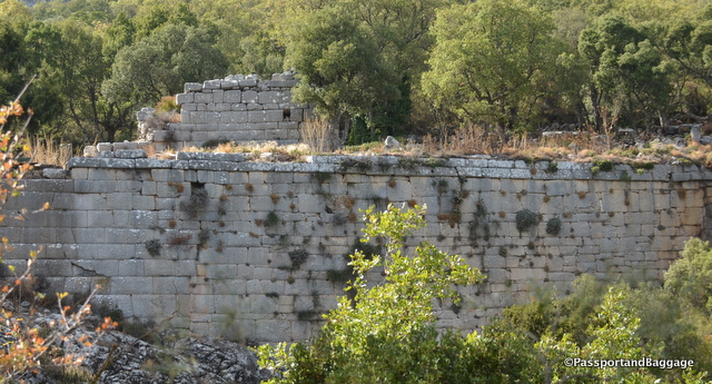
The walls that still stand are an engineering feat worth just standing and admiring

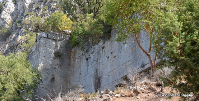
The walls that still stand are an engineering feat worth just standing and admiring

TermessosAccording to Strabo, the inhabitants of Termessos called themselves the Solymi and were a Pisidian people. Pisidia was a region of ancient Asia Minor corresponding roughly to the modern-day province of Antalya in Turkey.

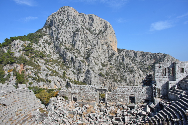
The theater has the most magnificent views, but the camera just can not capture it.

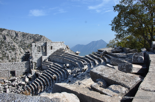
The theater has the most magnificent views, but the camera just cannot capture it.

Looking down from the mountain top

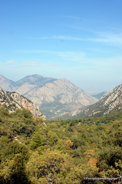
Looking down from the mountain top

The name derived from Solymeus, an Anatolian god who in later times became identified with Zeus, giving rise to the cult of Zeus Solymeus (Solim in Turkish). This is evidenced by the coins minted in Termessos with the image of the deity and his name.

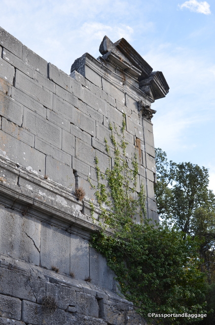
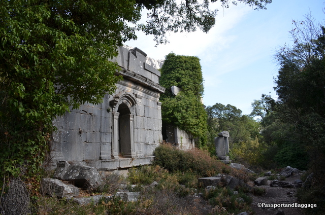
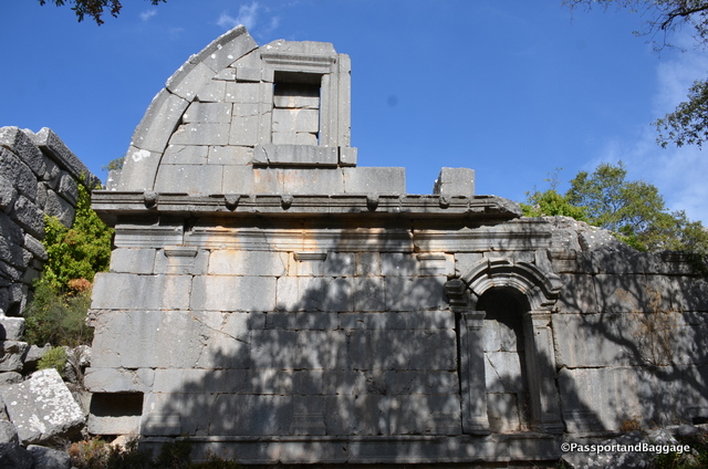
An obviously restored portion of a wall, that gives you a sense of the magnificence of the buildings

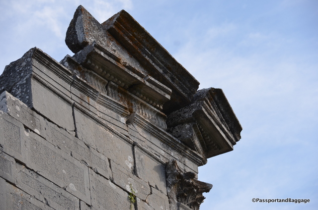
An obviously restored portion of a wall, that gives you a sense of the magnificence of the buildings

dsc_8308The first historical mention of Termessos dates back to 334 BC. In this time Alexander the Great arrived in the area with a plan to capture Termessos. However, his failed attempts to conquer the Eagle’s Nest, the name given it by Alexander, turned out to be a rather long and complicated story.

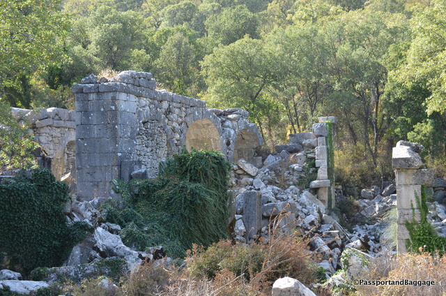
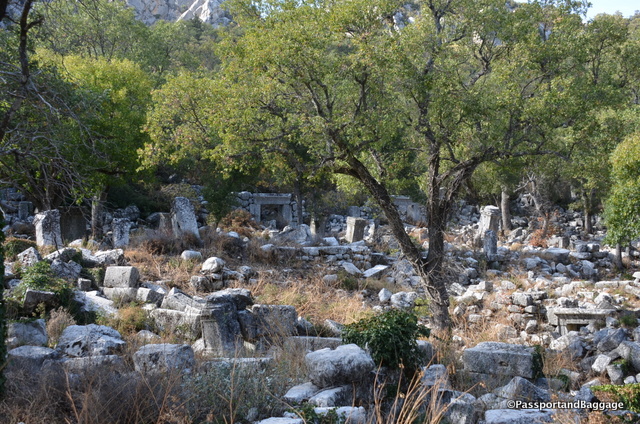
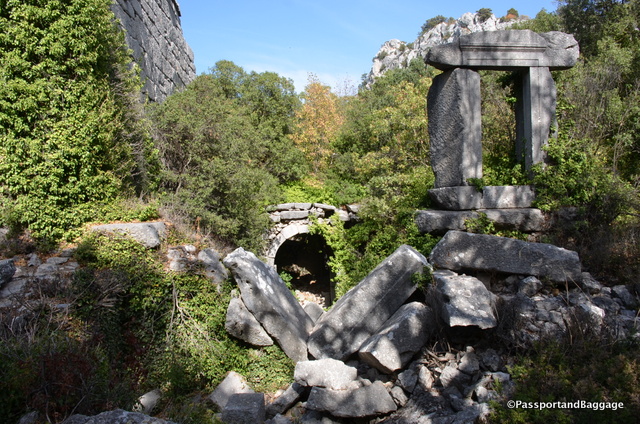
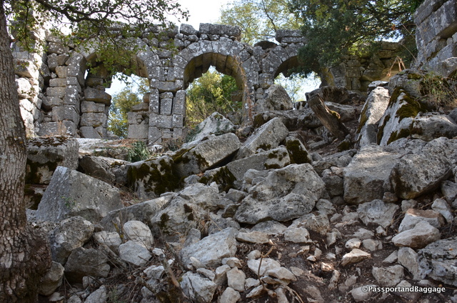
Termessos had a very substantial aqueduct and cistern system, it is theorized that the end of this site occurred after a large earthquake damaged the aqueduct, the year of the destruction is not known. The remnants of what must have been a very violent earthquake can be found by observing the state of the site itself, everywhere are broken columns and walls lying around untouched.

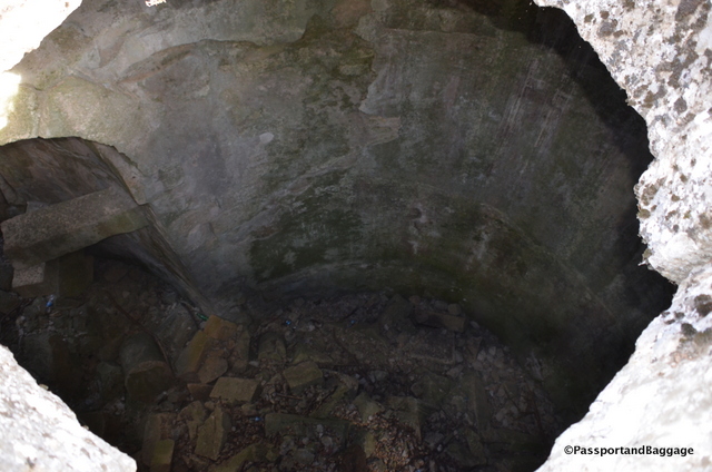
There was a system of 5 large cisterns. This is looking down into one. Knowing that they will have filled with soil over the years, the original depth is just unimaginable

There was a system of 5 large cisterns. This is looking down into one. Knowing that they will have filled with soil over the years, the original depth is just unimaginable

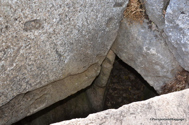
This is looking down into the drainage system, their water system was obviously very advanced

This is looking down into the drainage system, their water system was obviously very advanced

Only surface surveys of the site have been conducted so not much has been learned, even in modern times. In the first half of the 19th century first Europeans, Thomas Abel Brimage Spratt, and Edward Forbes arrived at the site and described their findings in the book “Travels in Lycia”, published in 1847. Charles Fellows, the British archaeologist, also visited Termessos. The results of these first travels were descriptions of the preserved buildings and first plans of the ancient city.

In the 1880s, Termessos was repeatedly visited by the Polish researcher Karol Lanckoroński, who wrote: ”Of all the cities of Pisidia which we have visited, Termessos has the most peculiar and the greatest position: it is, at the same time, a watchtower commanding a distant view and nest buried deeply in a valley, surrounded by a ring of mountains. If its inhabitants indulged in brigandage, they could not find a better hiding place than in this eagle’s nest.”

While I was standing in this magnificent spot, I thought I would just tell the story with photos. Sadly, when I downloaded the photos to the computer I realized the awe-inspiring magnificence of this area just cannot be captured in photos.  Here is an example, but a visit is the only way to realize the wonder of this spot.

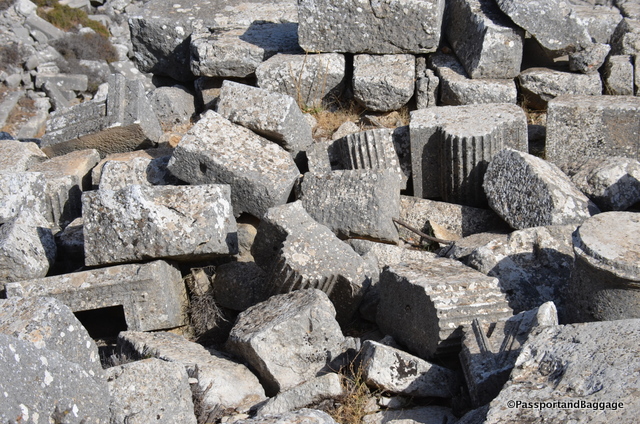
Fallen bits and pieces of columns and column capitals.

Fallen bits and pieces of columns and column capitals.

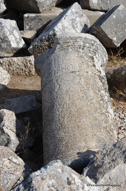
A column with a Greek inscription

A column with a Greek inscription

Thermosses

The theater

Termessos

*Termessos

*Termessos

The bath

The bath

The walls of the Baths

The walls of the Baths

Walls of the baths

Walls of the baths

Termessos

*

Oct 112016
 

October 10, 2016

The town of Kaş is a lovely, unspoiled, tourist town that sits on a hill and runs down to the Turquoise Coast of southwestern Turkey.

Kos, TurkeyIt is filled with fabulous restaurants, quaint shopping and a view from everywhere that is just stupendous.

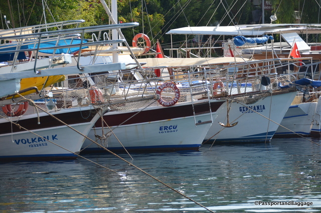
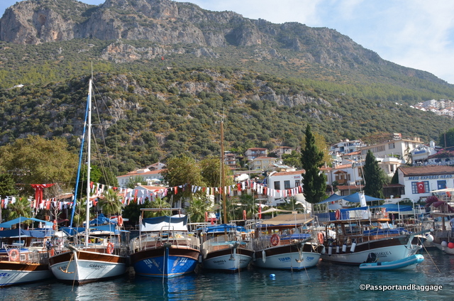
Boats in the harbor at Kaş

Boats in the harbor at Kaş

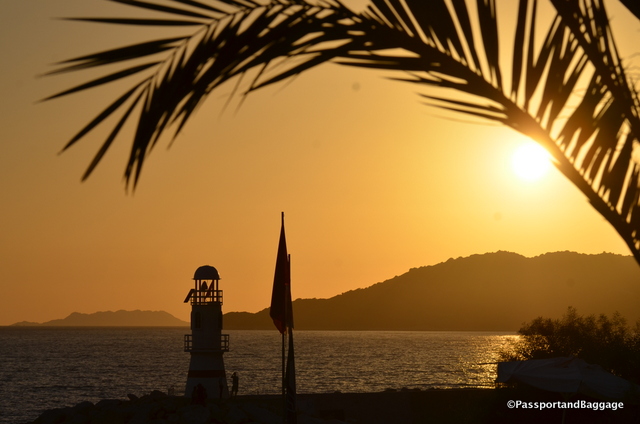
Sunset over the lighthouse of Kaş

Sunset over the lighthouse of Kaş

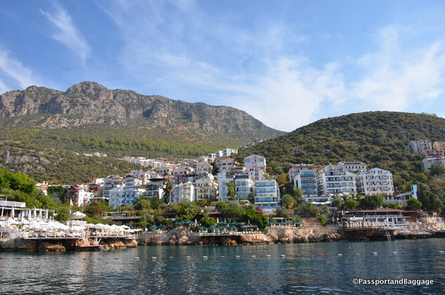
Looking back onto the southern end of the town of Kaş

Looking back onto the southern end of the town of Kaş

One of the ways that people spend their time in this area is either chartering boats for week long sailing excursions, or going down to the dock and jumping on a group boat for a day motoring around the islands, swimming, and visiting the highlights around the area. Today we decided to ply the Mediterranean Sea via one of these group boats. I have spoken throughout this trip of the lack of tourists due to the political situation in Turkey, this was very evident when taking the boat trip.  There are at least 3 dozen boats, with a capacity of 50 to 100 ready to take tourists around the Mediterranean.  Today we boarded the only boat that was going out and it was filled with only 35 of us, all, with the exception of us, Turkish citizens.  The price, normally 70TL was just 60TL today.

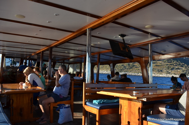
Our very uncrowded boat

Our very uncrowded boat

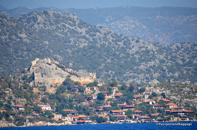
We took this boat trip specifically to visit Simena-Kekova. The ancient city of Simena was once two parts – an island and a coastal part of the mainland.

dsc_8161

The Castle towering over the mainland portion of Simena-Kekova

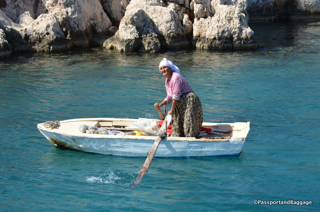
“Kekova” is Turkish for “plain of thyme”, and women sit all over the walkways of the mainland selling thyme and other herbs to the tourists.

This woman rowed out to the boat to be the first to offer Thyme and other herbs.

This woman rowed out to the boat to be the first to offer Thyme and other herbs.

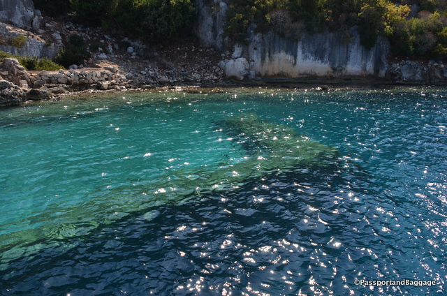
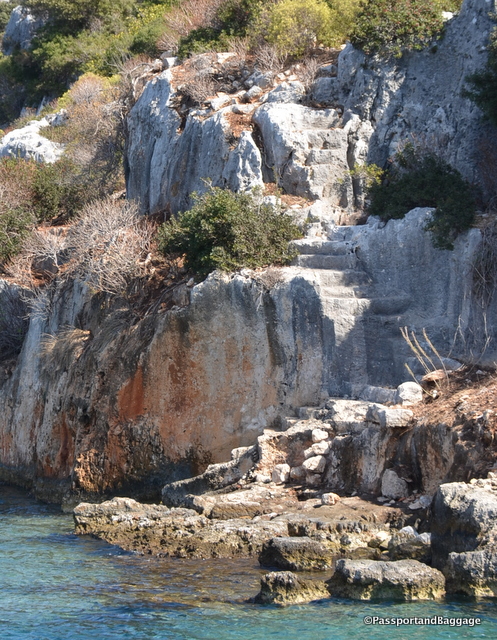
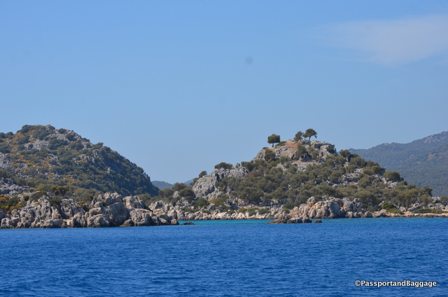
The island portion is 2 square miles, and uninhabited. As you travel near the island you can spot the half-submerged ruins of the residential part of Simena-Kekova. The sinking of this area was caused by the downward shift of land by what most have been horrendous earthquakes of the 2nd century AD. Half of the houses are submerged and you can see staircases descending into the water.

You can see a sunken wall in the clear blue water of the Mediterranean

You can see a sunken wall in the clear blue water of the Mediterranean

Stairways descending into the sea

Stairways descending into the sea

One of the few standing elements on the island

One of the few standing elements on the island

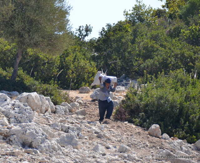
This gentleman was working on the island, at what is not quite clear.

This gentleman was working on the island, at what is not quite clear.

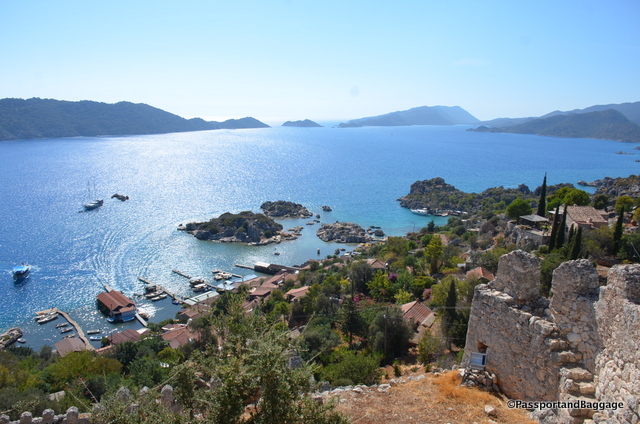
On the mainland portion of Simena-Kekova is the charming fishing village of Kaleköy (“castle village”). A well-preserved castle built by the Knights of Rhodes, partially upon ancient Lycian foundations, dominates the top of the village. Access to the village is possible only by sea.

Looking down onto the mainland town from the Castle

Looking down onto the mainland town from the Castle

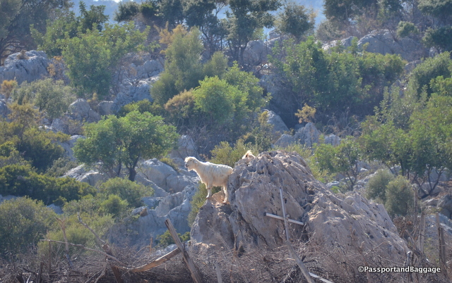
Billy Goats climbing around the hills

Billy Goats climbing around the hills

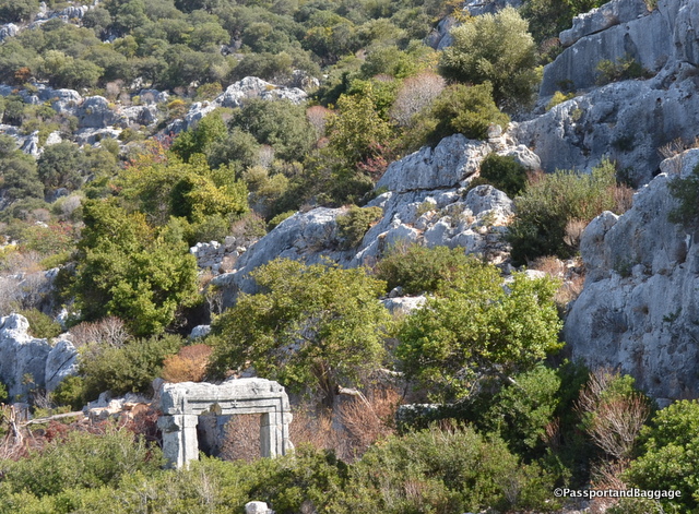
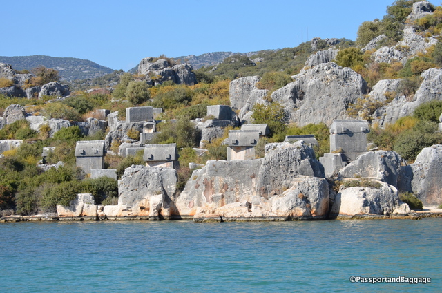
Sarcophagi are spread throughout the side of the hills in the area

Sarcophagi are spread throughout the side of the hills in the area

After the Italian occupation of Kastelorizo, (a Greek island and municipality located just 4 miles from Kaş ) Kekova (which at that time was temporarily inhabited during summer because of wood harvest) was disputed between Italy and Turkey. The 1932 Convention between Italy and Turkey, which defined the sea border between the two powers, assigned all the islets of the small archipelago around Kastellorizo, including Kekova, to Turkey.

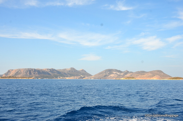
The island of Kastellorizo, otherwise known as Meis, belongs to Greece and yet it is only 30 minutes away by ferry.

The island of Kastellorizo, otherwise known as Meis, belongs to Greece and yet it is only 30 minutes away by ferry.

In 1990 the Kekova region was declared a specially protected area prohibiting diving and swimming. In later years the prohibition was lifted except for the part where the sunken city is.

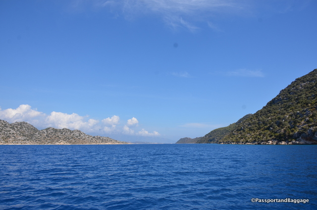
This area is called the Turquoise Coast for a reason, the blues of the water are indescribable.

Turkish Riviers *Turkish Riviera

Here are a few fun shots from around the town of Kaş:

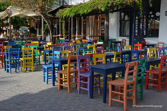
Colorful chairs at a restaurant in the central square.

Colorful chairs at a restaurant in the central square.

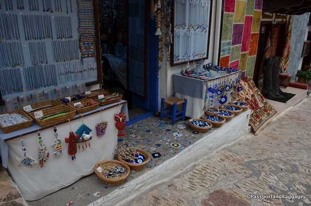
The evil eye is everywhere in Turkey, I loved the use of the eye in the sidewalk

The evil eye is everywhere in Turkey, I loved the use of the eye in the sidewalk

dsc_8016

dsc_8015

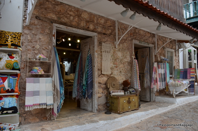
Cotton towels are a specialty of the area.

*

The harbor of Kaş

The harbor of Kaş

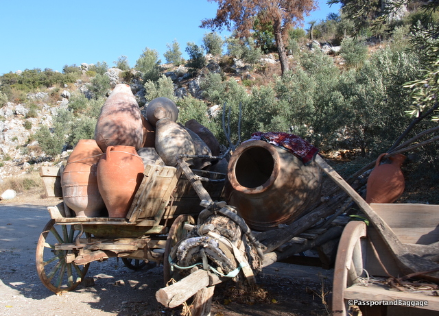
A lovely display of ancient Amphora

A lovely display of ancient Amphora

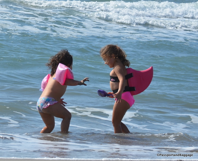
The beach at Patara

The beach at Patara

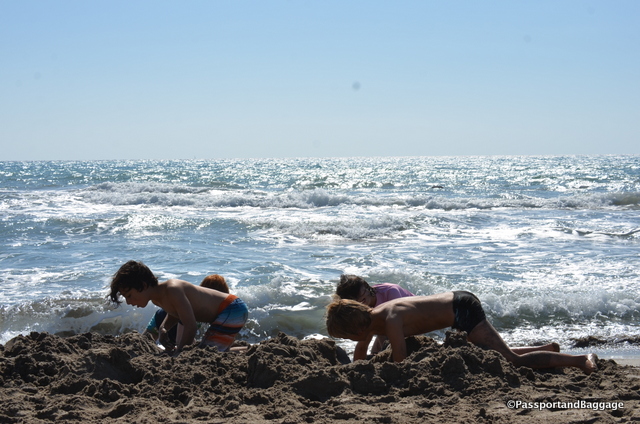
Four very industrious moat builders

Four very industrious moat builders

A few notes on Kaş.

Our hotel, Rhapsody, was lovely.  I had a third floor room with a balcony and a stunning view.  There is no elevator, however, so if you want one that high up, be prepared for a long climb.  The staff is wonderful and the breakfast, which is included, was very, very good.

We had three nights, and three great dinners.  These included

Bahςe Balik at  Andifli, Süleyman Sandıkçı Sk. No:18.  The fish, sold by the ounce, while expensive, was cooked to perfection and delicious.

Bi Lokma or Mama’s Kitchen at Hükümet Cad. No:2. We went for the Manti, but there are many wonderful things on the menu. Manti is an unusual dish for Turkey, and here it is cooked to absolute perfection with a sauce that is befitting the quality of the Manti itself.

Ikbal at Süleyman Sandıkçı Sok. No:6 is a family operation, run by people that love food and want you to love it too.  We had the specials and the fried zucchini, was in fact, something to write home about.  This spot is heavenly!

Oct 102016
 

October 9, 2016

I am on the Mediterranean and have already written about the tombs of Myra. I did so without really addressing the Lycian culture. Now is the time to do so.

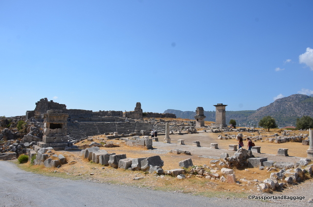
Looking over just a small part of the ancient city of Xanthous

Looking over just a small part of the ancient city of Xanthos a Lycian city.

Lycia was a geopolitical region in Anatoli in what are now the provinces of Antalya and Muğla on the southern Mediterranean coast, and Burdur Province inland from the Mediterranean. Historically it dates to the times of ancient Egypt and the Hittite Empire in the Late Bronze Age (3300-1200 BC).

In 43 AD Lycia was incorporated into the Roman Empire. After the fall of the Byzantine Empire in the 15th century, Lycia was under the Ottoman Empire, and was inherited by the Turkish Republic on the fall of that empire. The Greeks were forcibly removed during the population exchange between Greece and Turkey in 1923.

One of the larger Lycian sites in this area is the city of Xanthos and its accompanying religious site Letoön. The history of Xanthos is rather violent. In 545-546 the Xanthosian men set fire to their women, children, slaves and treasure before making their final doomed attack upon invading Persians who were led by Commander Harpagos. Xanthos grew out of this tragedy but the story repeated itself in 42 BC when Brutus attacked the city during the Roman civil wars in order to recruit troops and raise money. Brutus was shocked by the Lycians’ suicide and offered his soldiers a reward for each Xanthosian saved. Only 150 citizens were rescued.

Xanthos was deserted during the first wave of Arab raids in the 7th century.

The buried site of Xanthos was found in 1838 by Sir Charles Fellows. Like so may explorers of the time, he hauled most of the artifacts to England, they now reside in the British Museum.

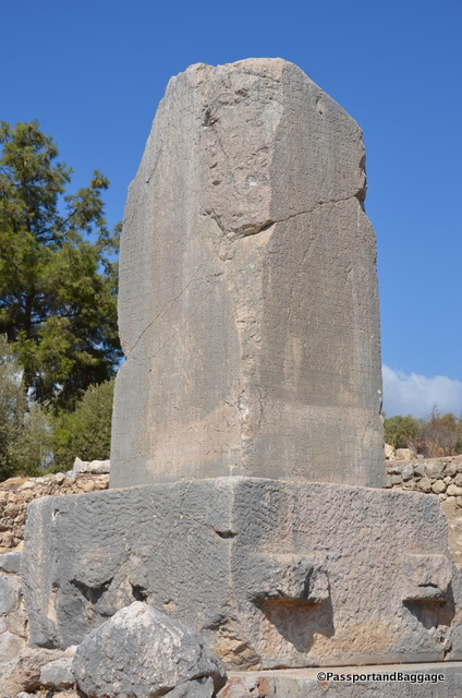
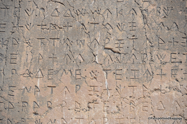
Xanthos, TurkeyWhen one travels the world and sees ruins across our great planet, they tend to run together. However, at most every site something stands out and makes me go WOW. For me, at Xanthos, this moment was gazing upon this large stone with its inscription in Lycean. It is the longest Lycian inscription known, at over 250 lines. Linguistically it falls into three parts; On the south and east side and part of the north side it is written in the normal Lycian language; then there is a poem of twelve lines in Greek; but the rest of the north side and all of the west is in a different form of Lycian found elsewhere, only on a tomb in Antiphellos, a town many miles away.

The Lycian language is not really understood, the inscription, evidently gives a narrative account of a dead hero’s exploits, and is undeciphered. It does apparently contain a number of recognizable proper names, from which the approximate date and some idea of the contents can be garnered.

Lycian LanguageLycian was an Indo-European language, which included cuneiform and hieroglyphics; it had its own alphabet, which was closely related to Greek.

Lycian became extinct around the beginning of the first century BC, replaced by the Ancient Greek language.

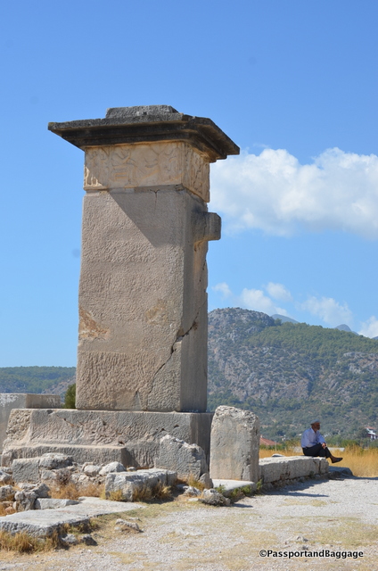
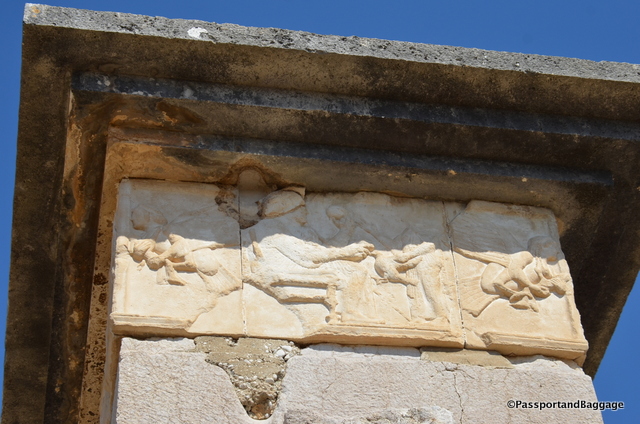
The chamber at the top of this pillar was once marble, decorated with reliefs. Called the "Harpy Tomb"; it was previously believed that the winged women figures in the frieze were harpies (monsters from Greek mythology with the head of a woman and the body of a bird). It is now thought that these figures may depict sirens carrying off the souls of the dead. These are replicas, the originals are in the British Museum.

The chamber at the top of this pillar was once marble, decorated with reliefs. Called the “Harpy Tomb”; it was previously believed that the winged women figures in the frieze were harpies (monsters from Greek mythology with the head of a woman and the body of a bird). It is now thought that these figures may depict sirens carrying off the souls of the dead. These are replicas, the originals are in the British Museum.

The replica at the top of the pillar showing the Harpies.

The replica at the top of the pillar showing the Harpies.

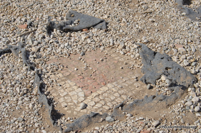
The entire site of Xanthos is covered in mosaics. They have been covered over for their protection.

The entire site of Xanthos is covered in mosaics. They have been covered over for their protection.

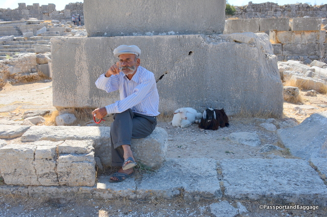
This friendly goat-herder is happy to tell everyone the story of Xanthos.  The only English I understood of his was British Museum, which I heard many, many times over.

This friendly goat-herder is happy to tell everyone the story of Xanthos. The only English I understood of his was British Museum, which I heard many, many times over.

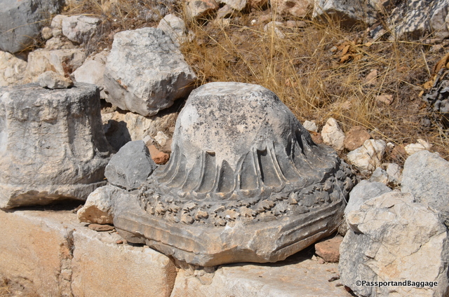
A beautifully carved column capital with oak leaves at Xanthous

A beautifully carved column capital with oak leaves at Xanthos

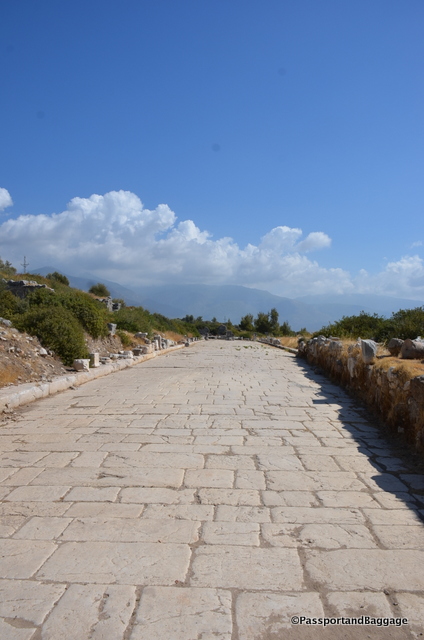
A road in Xanthos, wide enough to handle a Roman Legion

A road in Xanthos, wide enough to handle a Roman Legion

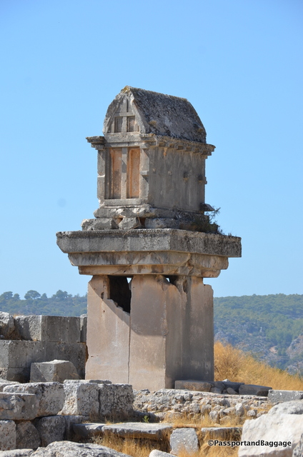
A pillar tomb at Xanthos

A pillar tomb at Xanthos

Just a few miles from Xanthos is Letoön, which dates back to the late sixth century BCE. Letoön, administered by Xanthos, was not an actual city but a religious center and an important political meeting point for the Lycian League, which was the first democratic federation.

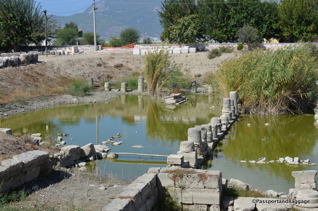
You can find turtles lounging in what was once a sacred pool.

You can find turtles lounging in what was once a sacred pool.

Letoön is home to three temples that have been excavated thus far, one dedicated to Leto, hence the name Letoön. The second is dedicated to Artemis, it is said that the mother of Apollo and  Artemis gave birth to the twins here, while hiding from Hera.  The third temple is dedicated to Apollo.

Letoön was the center of pagan cults until perhaps the 5th century AD when Arabs ravaged Lycia and the area started to silt up with sand brought down by the Xanthos River. It is believed to have been abandoned by the 7th century AD.

During Roman Times, the Emperor Hadrian founded an emperor worship cult at the site. Christianity later replaced pagan beliefs and in the 5th century AD a church was built using stones from the old temples.

The Lycian cult of Leto was one of the many forms of the widespread mother-goddess religion, which originated in ancient Anatolia. Even in those times women could preside over the national assembly that was held each autumn.

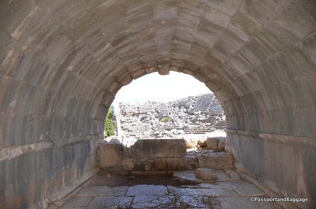
A tunnel leading to the theater at Lentoon

A tunnel leading to the theater at Letoön

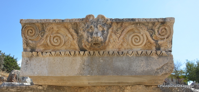
A drain spout in the shape of a lion at Letoön

A drain spout in the shape of a lion at Letoön

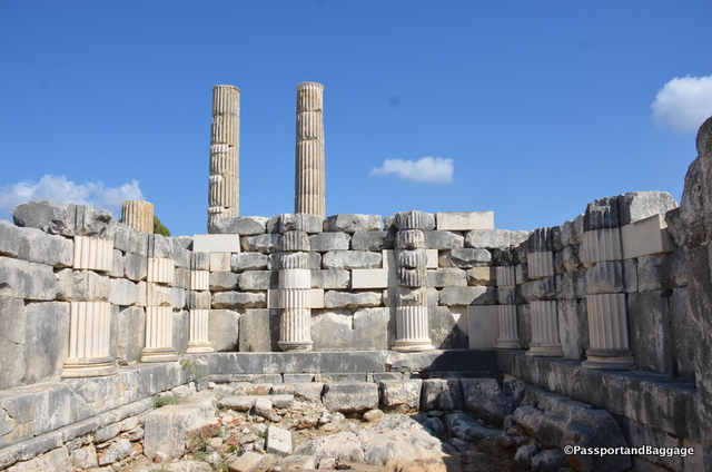
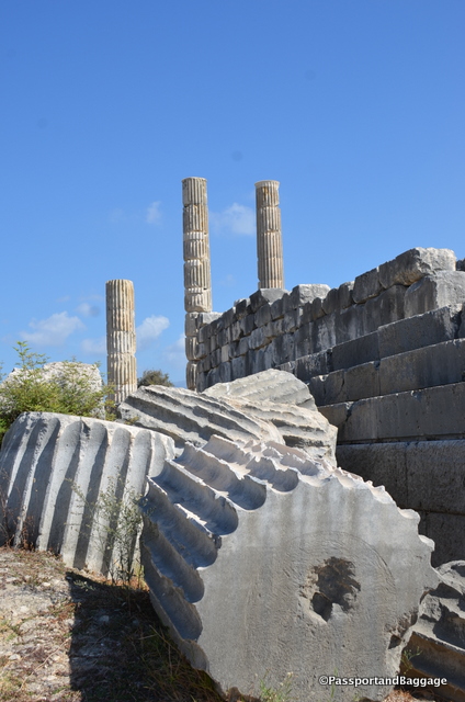
Temple Ruins at Letoön

Temple Ruins at Letoön

Letoon, Turkey

Oct 092016
 

October 9, 2016

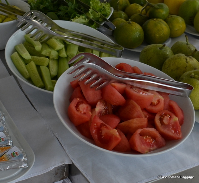
The vegetables of TurkeyYou will find tomatoes and cucumbers at every meal in Turkey; in fact there is a salad on every menu called a shepherd’s salad that is nothing but these two ingredients in one form or another. I would normally be thrilled with this, but the first few I had I realized immediately that the vegetables were hothouse grown and not as tasty and succulent as they look.

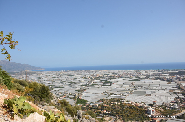
When we drove out of Antalya towards Kaş on the Mediterranean Sea, it all became clear.

Turkey began growing food in greenhouses near Anatalya in the 1940s with around 2500 acres throughout the region. The practice grew exponentially until the 1990s, with around 60,000 acres in 2002. Today 83% of all greenhouses in Turkey are in this region.

Looking down towards the Mediterranean and the greenhouses that cover the land

Looking down towards the Mediterranean and the greenhouses that completely cover the available land

In 2000, 1.37 million tons of tomatoes, 1.04 million tons of cucumbers, 0.33 million tons of peppers, 0.18 million tons of eggplant, 0.080 million tons of squash, and 0.04 million tons of bean were produced in greenhouses in Turkey.

This originally began for domestic consumption, but with the increase of all of these greenhouses, growers began pursuing the export market and in 2002 the major crops begin exported were tomatoes and cucumbers for around $63million.

In driving throughout Turkey we have not witnessed any large farms, while I am sure there are some, it is not the norm.

According to the OECD, fragmentation of farmland is the main problem facing Turkish agriculture today. Largely to blame, as in many countries, are the country’s inheritance laws, which stipulate that 25% of a deceased landowner’s property should pass to their spouse, with the rest divided among the children. This means that the average farm is 15 acres.

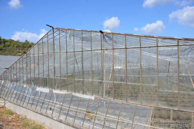
At one time all the greenhouses were glass, this has given way to plastic

At one time all the greenhouses were glass, this has given way to plastic

The greenhouse situation is no different. Greenhouse production is generally carried out by small family-owned farms sitting on just over 3 acres, with greenhouses covering just under 1 acre of that land. Studies have shown that proper crop management and greenhouse construction are both highly flawed in these small operations, creating a need for excess fertilization, creating some severe environmental issues.

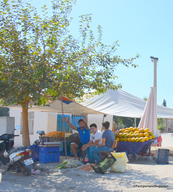
vendors of TurkeyWe have also noticed hundreds of small vendors selling crops along the side of the road, it occurred to us that there was no central co-operative way to sell in Turkey, which was born out by a little research. It is not unusual to drive by trucks containing what appears to be at least one ton or more of pumpkins, potatoes, onions or the like, lined up for a mile or so. It is unfathomable that these people are making any money, or that the amount condensed into one area could possibly sell but a very small quantity of what is in their trucks and roadside stands.
The concept is difficult to grasp but as you drive through the rural farm areas of Turkey and observe the way things are done it is obvious that things are done as they have been for thousands of years. This is born out when you learn that in the farmlands workers are generally poorly educated and low skilled: as much as 15% of agricultural laborers are illiterate and only 78% have a primary education.

While all of this makes for either quaint photos or horrific photos of damage to the environment, it is important to remember that there are people behind all of this. The farmers of Turkey have it very difficult, not only with distribution, but with the price of fuel.

Much of this was being addressed when Turkey was pursuing inclusion into the EU, but where it will go with Turkey in such a state of flux, it is hard to say.

Oct 082016
 

October 8, 2016

Myra was an ancient Greek town in Lycia in the fertile alluvial plain between Alaca Dağ, the Massikytos range and the Aegean Sea.  It now is part of Turkey on the Mediterranean Sea.

dsc_7945 The first known reference to Myra was when it was listed as a member of the Lycian alliance in 168 BC–AD 43.

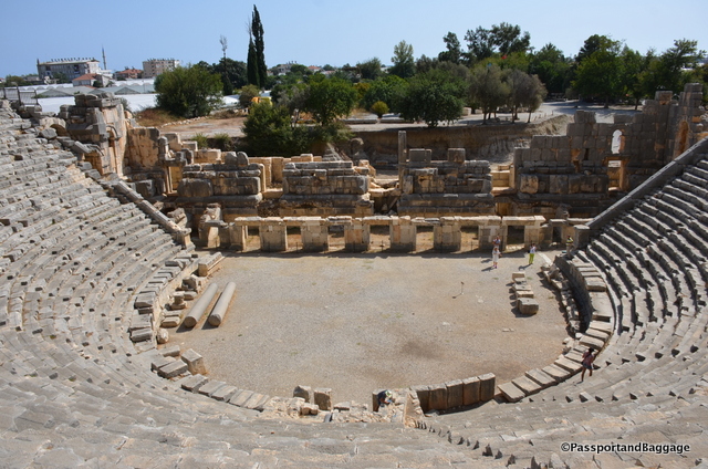
The ruins of the Lycian and Roman town are mostly covered by alluvial silts. Some of the ruins have been partially excavated, including the semi-circular theater that was destroyed in an earthquake in 141, but rebuilt afterwards.

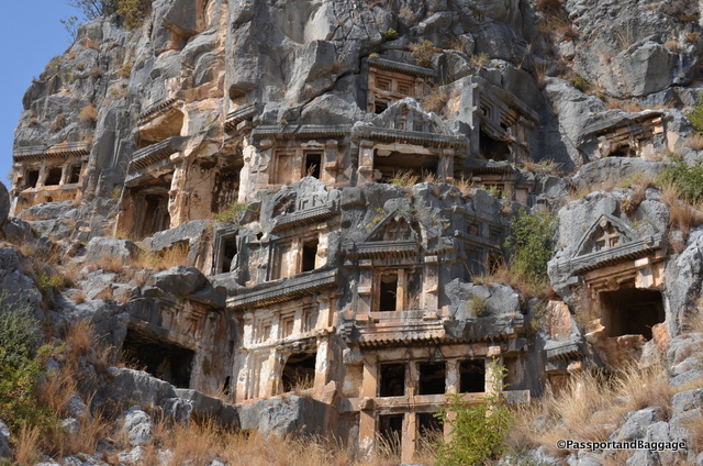
The Sea Necropolis at Myra

The Ocean Necropolis at Myra

The most interesting thing at Myra, and the real reason for our stop here were the rock-cut tombs. These were carved in the cliffs at Myra in the form of temple fronts. There are two sets of these tombs, the river necropolis and the ocean necropolis.

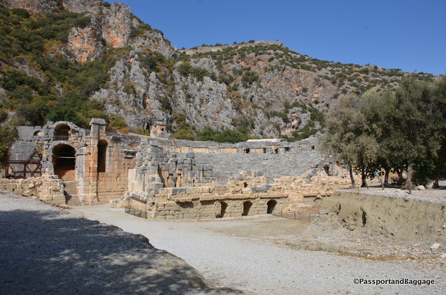
The Theater at Myra

The Theater at Myra

Myra, Turkey

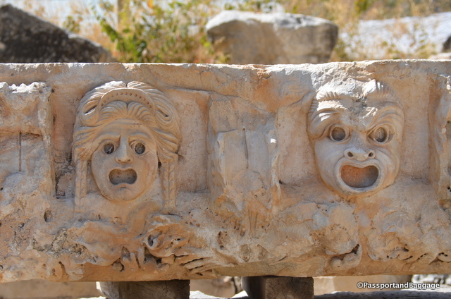
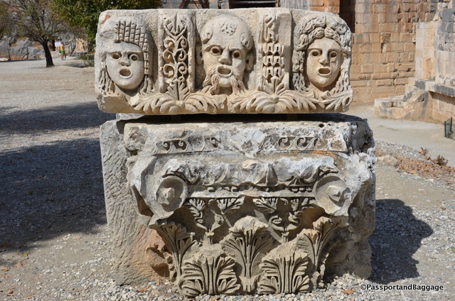
There are many faces, most likely from the theater, scattered around the grounds.

There are many faces, most likely from the theater, scattered around the grounds.

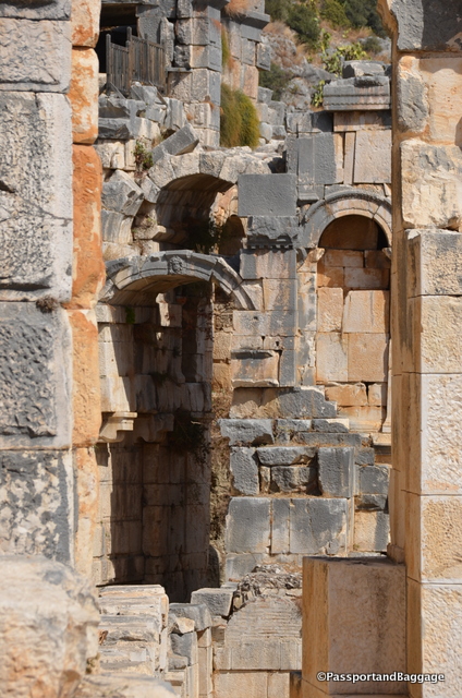
Just a few of the stunning archways in the theater

Just a few of the stunning archways in the theater

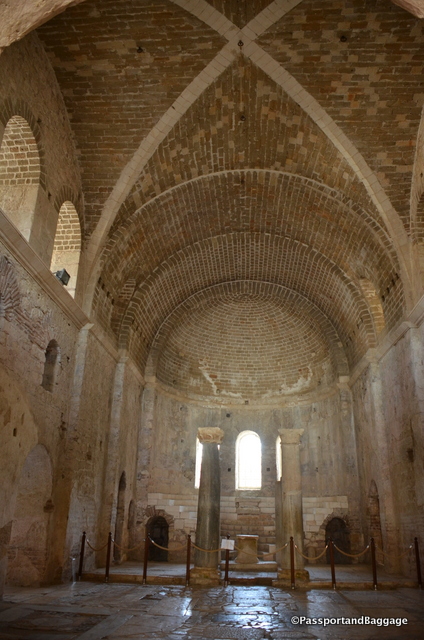
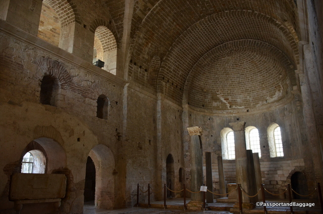
Another reason to visit the town is the Church of St. Nicholas. The church was built in AD 520 on the foundations of an older Christian church where Saint Nicholas served as a bishop. Over time the church was flooded, filled with silt, and buried. In 1862 it was restored by Russian Tzar Nicholas I, who added a tower and made other changes to its Byzantine architecture. The church is regarded as the 3rd most important Byzantine structure in Anatolia.

The main room of the church

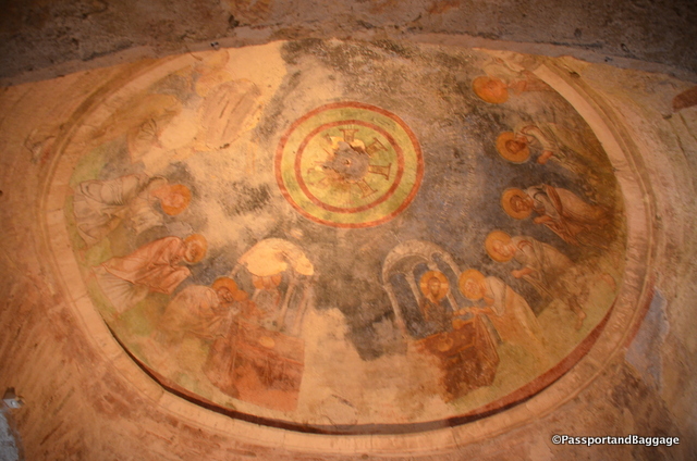
The Apse

Saint Nicholas Church, Myra, Turkey

In 1968 the former confessio (tomb) of St. Nicholas was roofed over. The Church is on the tentative list to be a UNESCO World Heritage Site.

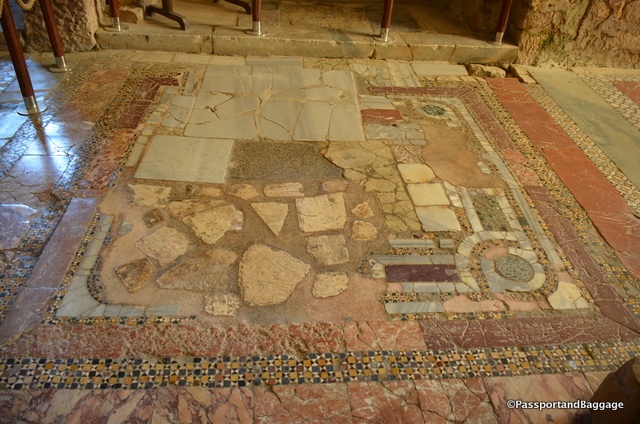
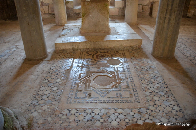
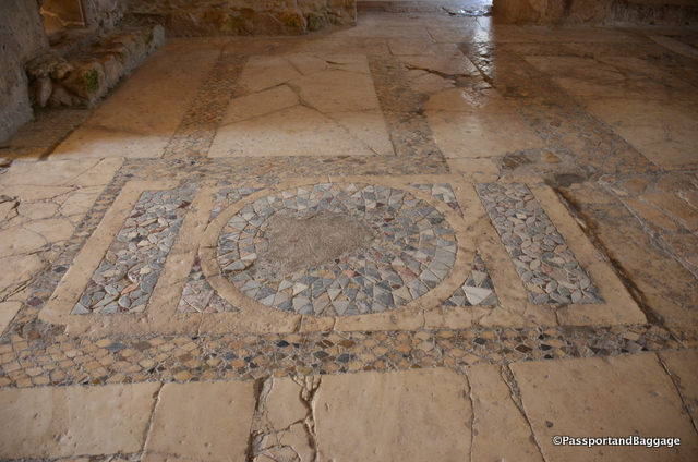
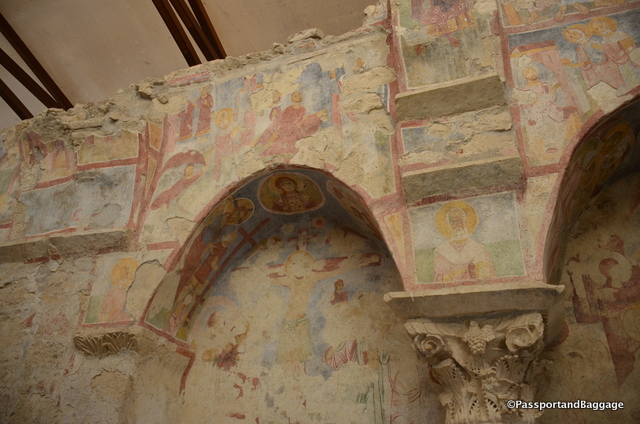
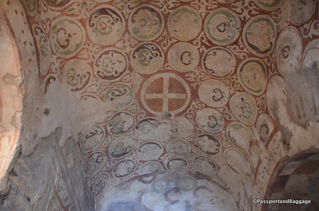
The floor of the church is made of opus sectile, a mosaic of coloured marble, and there are some remains of frescoes on the walls. An ancient Greek marble sarcophagus had been reused to bury the Saint; but his bones were stolen in 1087 by merchants from Bari, and are now held in the cathedral of that city.

The floor of the church varies from room to room, each as spectacular as the next

The floor of the church varies from room to room, each as spectacular as the next

Myra, Turkey

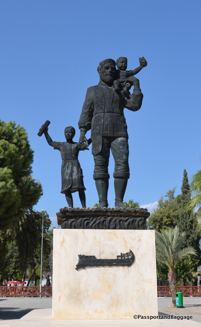
*Church of Saint NicholasSaint Nicholas was born in Patar in the second half of the 3rd century and was the Bishop of Myra. He was beatified after his death and became the most popular Saint of Tsarist Russia, this is the reason for the hordes of Russian tourists, found in more normal times in Turkey. When we visited there was simply a very small bus of Russian tourists, and ourselves.

Saint Nicholas, TurkeySaint Nicholas was also honored in Freiburg, Germany; Bari and Naples of Italy and the whole of Sicily. He is known as Santa Clause in English and Dutch.
Saint Nicholas was especially favored by the sailors of the East Mediterranean, who put pictures and icons of him in all their boats and made a tradition out of the wish “May Saint Nicholas hold your rudder”.
An example of the mosaics found throughout the church:

Frescoes of the Church of St. Nicholas *Frescoes of the Church of Saint Nicholas *Frescoes