May 2022
A quick geography lesson before the geology lesson. This area is actually called Newfoundland Labrador. The island of Newfoundland is the easternmost region of Canada, while Labrador is located on the mainland to the northwest. This post is about the Newfoundland portion of the province.
With John Cabot’s arrival the island has been called Terra Nova, or, Newfoundland. Labrador probably received its name from the Portuguese designation, “Terra del Lavradors.”
Newfoundland geology is a result of the constant movement of tectonic plates. Approximately 500 million years ago the action of these plates forced parts of the oceanic crust beneath the Iapetus Ocean up and over the eastern margin of the North American plate.
Labrador is part of the eastern Canadian Shield ( a geologic shield) consisting of a large area of exposed Precambrian igneous and high-grade metamorphic rocks and intrusive igneous or metamorphic rocks are the most common, with sedimentary rocks in some areas.
In contrast, Newfoundland is largely underlain by younger rocks.
Traveling the Bonavista Loop
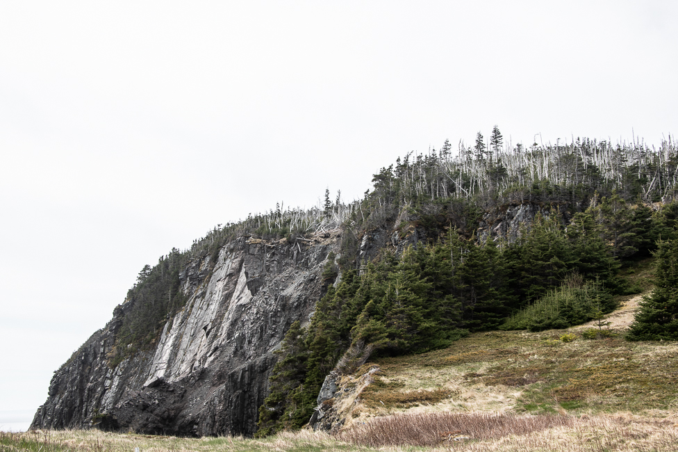
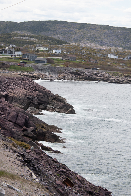
When traveling the Bonavista loop there is a 10 mile strip of coastal cliffs that date back 565 million years.
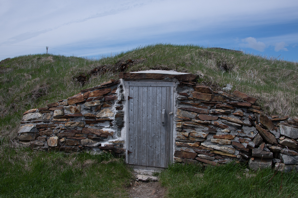
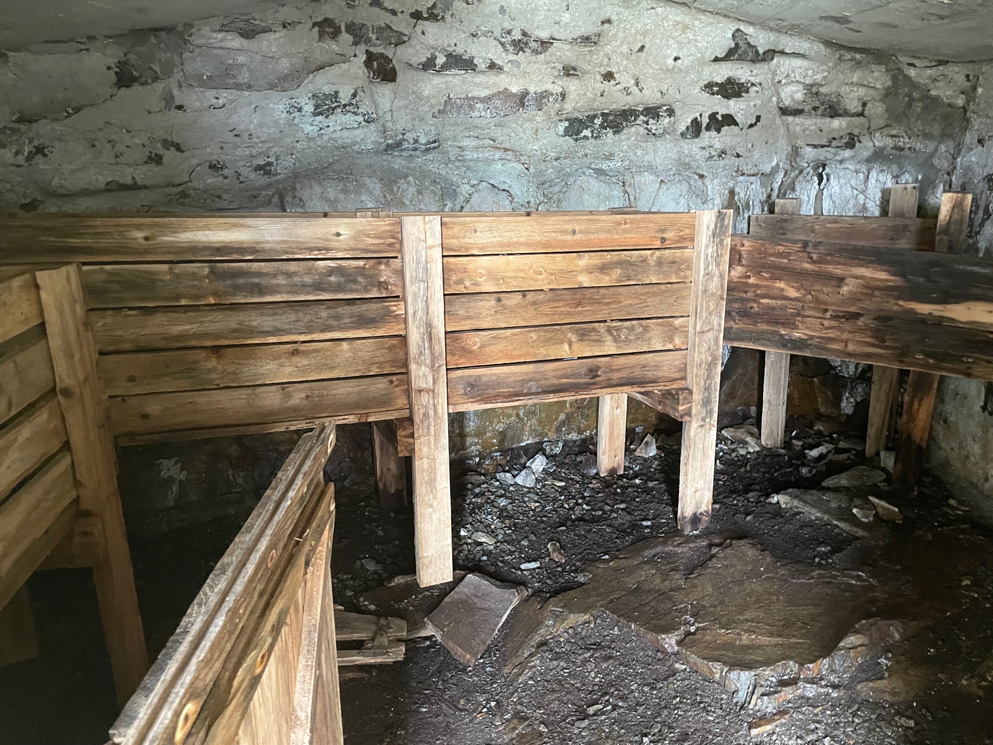
The city of Elliston considers itself the root cellar capital of the world. They are possible because of the geology of this area. The town has 135 documented root cellars, some of which are 200 years old.
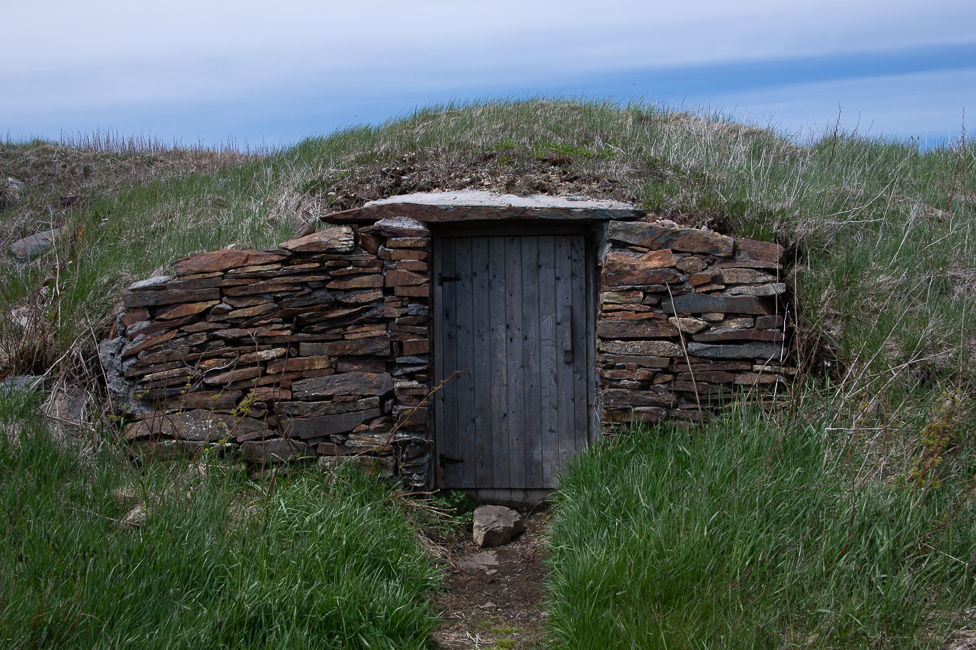
The soil in this area is not very fertile, so families, growing their own food, often enriched it with kelp and anything else that made sense. The vegetables were placed in the cellars to last the winter. They are dug into the ground and covered with flagstone.
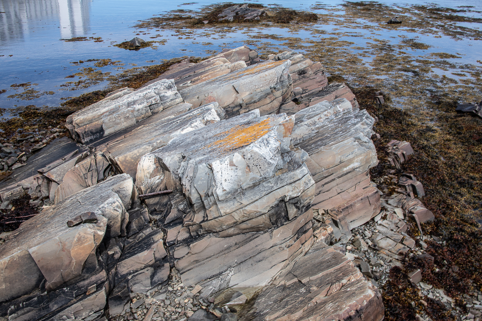
This rock is just off of the shore in Port Union, the area is rife with fossils, in fact, one found in Port Union in 2009 is thought to be the oldest complex animal and the earliest evidence of muscular tissue in the world.
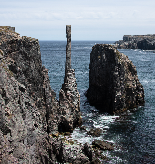
The Chimney is a prominent narrow sea stack, and is the remains of an igneous intrusion. It is just one more amazing thing to see on the coastline of the Bonavista Loop.
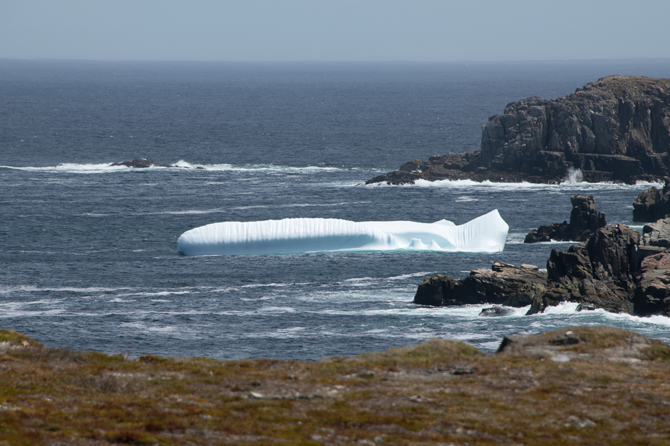
When I was out at Spillar’s Cove I spotted my first iceberg. I expect to see many on this trip, but this one was special.
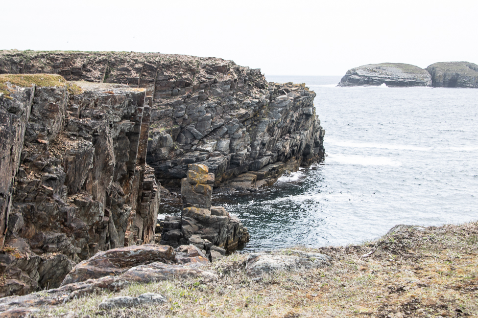
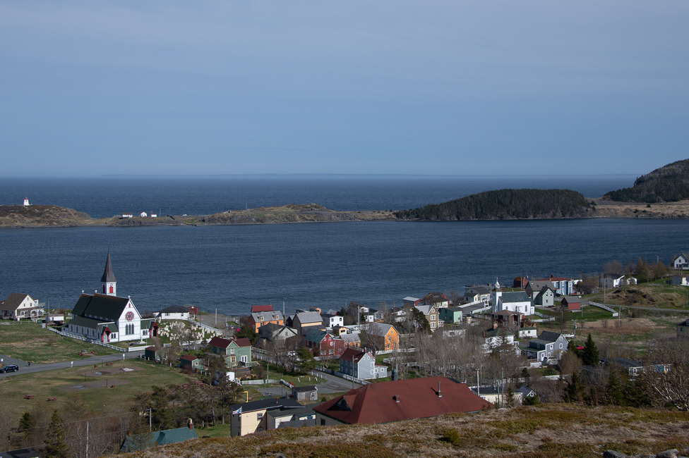
The Bay of Trinity is a result of the last great ice age of the Precambrian, 580 million years ago. The area is dominated by marine terraces, created as the land rose with respect to the sea.
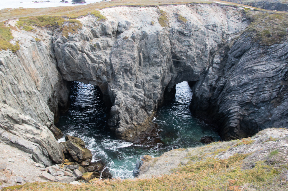
The Dungeon started out as a cavern with two separate openings to the sea. Continuing erosion led to the widening of the cavern until eventually, the roof collapsed inwards. These collapsed sea caves are known as gloups.
On a trip to Portugal last year I was fascinate by how the Lisbon Earthquake of 1755 changed so much of history. It even had an effect here on the Bonavista Loop. The quake generated a massive tsunami that crossed the Atlantic Ocean, and was observed in the Bonavista area, over 2175 miles from the quake’s epicenter. Reverend Philip Tocque wrote in his book of 1846: This event is likely the inspiration for the traditional Newfoundland song “A Great Big Sea Hove In Long Beach”.