November 23, 2020
The drive home promised to be a long one so we broke it up with the weird and wonderful. Today was a day to remain curious and open-minded.
London Bridge and Parker Dam
Lake Havasu, AZ
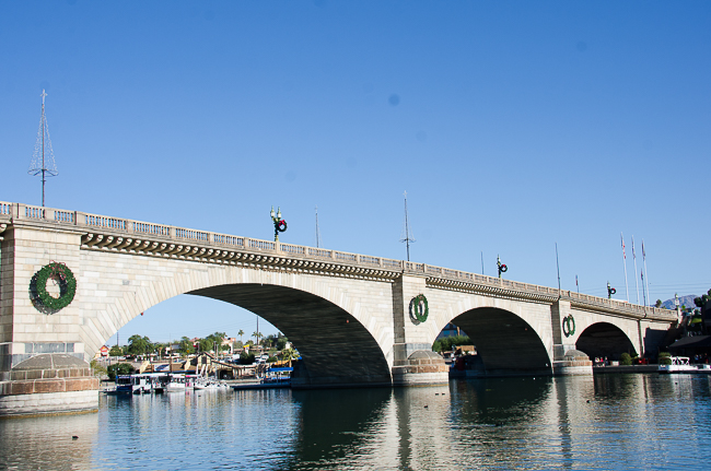
A bridge has spanned the River Thames in London for more than 2000 years. The “Old” London Bridge of nursery rhyme fame was a stone bridge built between 1176 and 1209, by Peter of Colechurch, an architect and priest. It replaced various wooden bridges built by the Roman founders of London from AD 50–1176. Over time the bridge was built and rebuilt. This particular bridge the “New” London Bridge was completed in 1831.
Sadly the bridge was no match for modern technology. Due to the weight of automobile traffic, the bridge began sinking into the River Thames at the rate of an inch every eight years. By 1924, the east side of the bridge was some three to four inches lower than the west side.
In 1967, the Common Council of the City of London began to look for potential buyers for the London Bridge. Lake Havasu City’s founder, chainsaw magnate Robert P. McCulloch, Sr. saw a perfect PR tool in a potential purchase.
In 1968, at a cost of $2.4 million, McCulloch purchased the bridge.
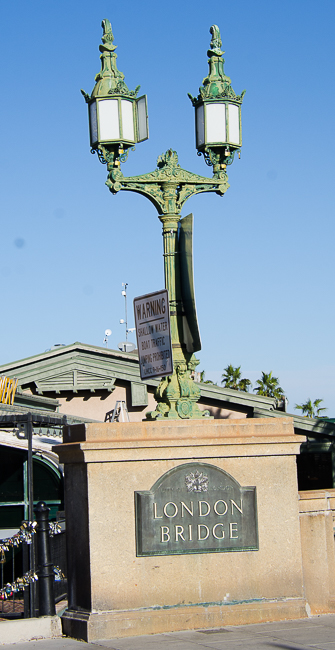
The purchase included ornate lampposts made from the melted-down cannons captured by the British from Napoleon’s army, after the Battle of Waterloo in 1815.
The bridge was dismantled and shipped through the Panama Canal to California and then trucked from Long Beach to Arizona. The shipping and assembly of the bridge, and dredging of a man-made channel to accommodate the bridge, cost another $7 million.
Today the bridge is the second-largest tourist attraction in Arizona, after the Grand Canyon.
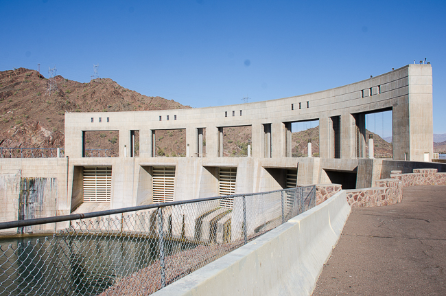
The London Bridge sits on Lake Havasu, which was created by the Parker Dam.
Built by the Bureau of Reclamation between 1934 and 1938 the Parker Dam is 320 feet high, With 235 feet of that being deep into the river bed, Parker Dam is the deepest dam in the world. Built to create Lake Havasu, it also generates hydroelectric power. The building of the dam was contentious and its existence has not quelled the controversy.
Camels in the Arizona Desert
Quartzsite, AZ
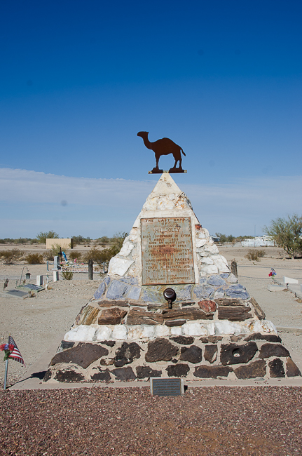
A few years ago, while stopping for gas and beef jerky in Quartzsite, my late husband told me a story about camels in the Arizona desert. On this trip, I went to find out more.
Haji Ali (Philip Tedro) a Turkish-Greek Muslim was one of six camel handlers in the short-lived U.S. Camel Cavalry Corp of 1856. His Arabic name was modified to Hi Jolly by the American soldiers. Jefferson Davis, at the time, Secretary of War, introduced an 1855 bill in Congress to import camels for the military into the Arizona desert.
The first shipment consisted of thirty-three camels, the next year brought an additional forty-four. The experiment would last only a year or so. When the War Between the States broke out the program was abandoned.
Circuses and zoos acquired some of the camels and others were turned loose. The wild camels eventually became small herds and rumors of wild camels in Nevada, Arizona, California, and New Mexico could be heard until the 1940s.
Hi Jolly continued working with the Army until Geronimo’s surrender in 1886. In 1889 he became a desert prospector with the few camels he still had.
Haji Ali died on December 16, 1902, in Quartzsite, Upon his death, a small wooden sign was placed on his grave. In 1934 the stone pyramid monument, topped by a camel weathervane was placed on his grave by order of James L. Edwards of the Arizona State Highway Department.
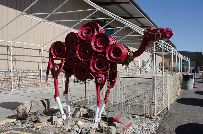
On the main road of Quartzsite is this interesting sculpture. In the 1880s, stories could be heard of a giant red horse with a devil on its back. The Red Ghost trampled a woman to death, tore through a campground, and was said to have flipped over two freight wagons. At the scene of each event were hoof marks larger than any horse, and strands of red hair. The crazy stories did not end until a farmer found a red camel grazing with the skeletal remains of an unknown man strapped to its back.
Blythe Intaglios
Blythe, CA
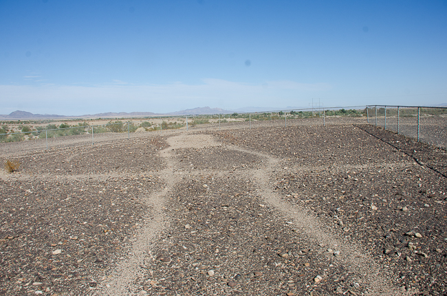
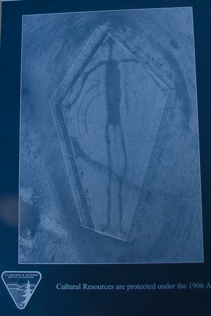
Way off the beaten path on Hwy 95 are three intaglios, or geoglyphs. I knew of the Nazca lines of Peru, but I had no idea that there are over 300 intaglios in the American Southwest and adjacent regions of Mexico. The figures are believed to have been made by the Mohave and Quechan Indians and are somewhere between 450 and 2,000 years old. At 171 feet high, intaglios are best seen from the air, so this was the only somewhat decent photo I could take, it does not do the figure justice.
Ehrenberg Pioneer Cemetery
Ehrenberg, AZ
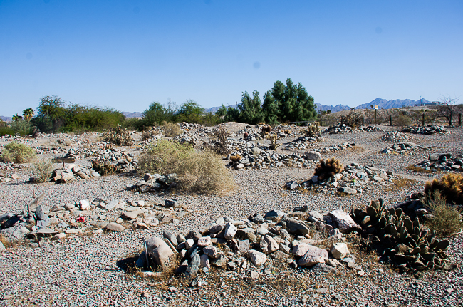
Traveling with a taphophile means taking strange detours. The town of Ehrenberg was created in 1869 and named after Hermann Ehrenberg, a German immigrant who worked with the Mojave people until he was robbed and murdered near present-day Palm Springs. Hermann Ehrenberg was a very interesting man with a long career. The town of Ehrenberg, once a thriving steamboat stop, is now a ghost town, with nothing to mark its existence aside from this cemetery with its mostly unmarked graves.
The Salton Sea
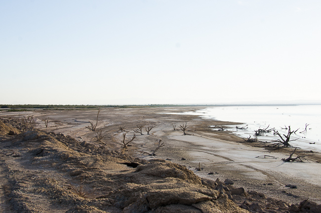
The Salton Sea has always been somewhat of an enigma to me, it was time to turn it into a real place in my mind. The Sea does not come without a considerable amount of controversy. The Salton Sea presently lies in what was a giant inland sea. Its present iteration was created by accident in 1905 when water from the Colorado River spilled out of a poorly-constructed California Development Company irrigation system. The lake grew over the next two years until workers were able to staunch the massive flow. By that time, a 400-square-mile body of water had formed becoming the Salton Sea.
The Salton Sea is referred to as an endorheic lake, meaning that its waters never discharge to the ocean; they either seep into the ground or evaporate. This condition has resulted in water with an extremely high salinity level, even higher than the Pacific Ocean.
The state of California has a ten-year management program to help the Sea, but it is a slow and agonizing process that is well behind schedule. While many argue it is not a natural, formation and with its rising salinity becoming a problem, that may seem accurate. However, with the decline of so many natural waterways within the pathways of the great migratory bird system, the Salton Sea has become an important stop, and with the loss of it, there will be far more consequences to mother nature than just the death of a remote salty body of water.
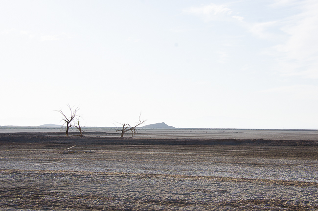
The rate of water recession with the sea is appalling, the environmental cost is frightening.
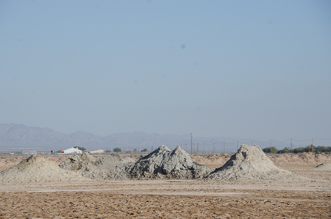 Driving around the Salton Sea is a challenge unto itself. Along one of the rather poor roads, you can stumble upon the Davis-Schrimpf Seep Field. These are geothermal mudpots that bubble and burb from short sludge volcanoes. Seep fields are caused by the buildup of carbon dioxide beneath the surface of the earth, which pushes to the surface through the water table and sediment. While not real volcanoes they stink to high heaven. We did not walk out to the field. While there were several people walking around the area, they, as well as us, were parked in front of signs specifically stating that you would be prosecuted to the full extent of the law if you stepped out onto the fields.
Borrego Springs
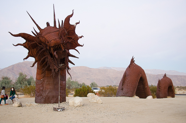
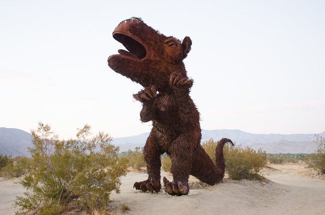
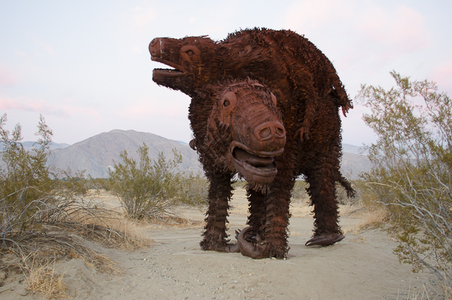
Ricardo Breceda has placed over 130 sculptures throughout the area called Borrego Springs, we caught only about 20 of them.
Breceda’s website describes him: Born in Durango Mexico, Ricardo has lived in California for over the last 25 years. An “accidental artist” who has become a well-known sculptor & designer. One of his largest collections can be appreciated in the city of Borrego Springs, California.
*]
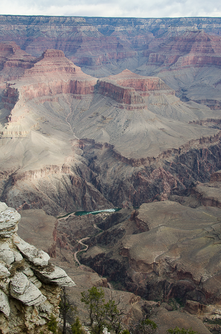
This has been a fascinating trip during COVID. Staying safe was not as difficult as one imagined. Our dining consisted of primarily take-out and grocery stores. Hotels were extremely conscientious, especially larger chains such as Hyatt and Marriott. Bryce National Park was the safest with most everyone wearing masks even during hikes. Zion was disturbing due to the number of people, but the park managed things extremely well, and with the exception of a few unmasked people on the hiking trails we felt protected. The South Rim of the Grand Canyon is another story. The Park Service is not limiting entries, so the amount of people you encounter is uncomfortably high. The El Tovar Hotel was criminal. We walked into the lobby, spun on our heels, and walked out. While masking was required the lobby was so full as to inhibit even three-foot social distancing. We were often the only masked people outside.
I needed to get away, it is in my nature to be on the road at this time of the year, but I did not want to fly, and a trip to some of the most remote locations in the US seemed like an answer. It was a great trip. We were highly cautious and paranoid and went to great lengths to stay safe. Traveling during a pandemic takes special planning and a lot of give and take.
The trip was 3200 miles – wow.
