May 092017
 

Tijuana to El Fuerte via Los Mochis
May 2, 2017

Hotel El Torres

Hotel El Torres

There are many ways to travel to Mexico’s Copper Canyon, but, as Californians, we chose to go through San Diego.  It is a simple, and amazingly efficient walk across the bridge from San Diego to the Tijuana airport.  $16 in advance, purchasable online, for the bridge crossing, and 15 minutes later you are at the Tijuana airport. After checking our bags we head to our gate and a very quick flight to Los Mochis.  We had a pre-arranged cab ride to the town of El Fuerte, about one and half hours away from the airport, I will be honest, I do not know what we paid, as it was pre-arranged by the hotel and part of our room rate.

The Center of El Fuerte

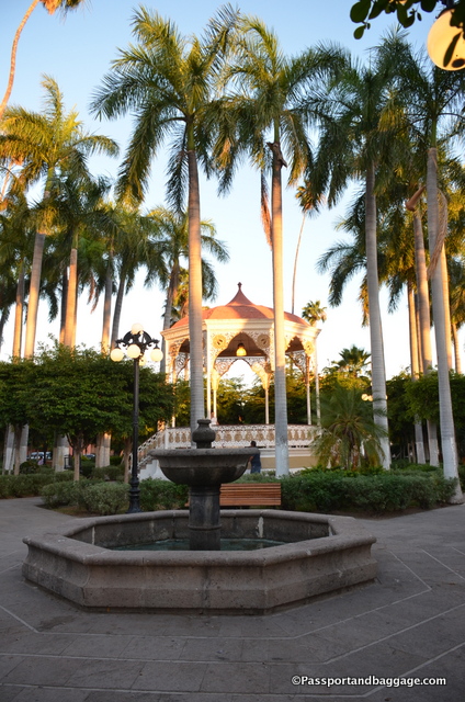
The Center of El Fuerte – Plaza de Armas

El Fuerte is on the Chihuahua-Pacific Railroad which is why we are here.  The town of El Fuerte is very small with a population of only 12,000 people.  Tourism was once its main industry, but first, fear of drug violence, and then a drop in tourism to Mexico because of the United States current political climate, has seen the tourism industry suffer greatly here.  I am traveling with two of my dearest friends, the Browns, and we are the only gringos in town tonight.

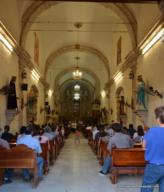
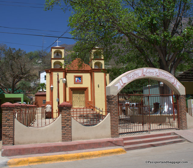
Evening service in the downtown church of El Fuerte, Mexico

Evening service in Church of the Sacred Heart of Jesus

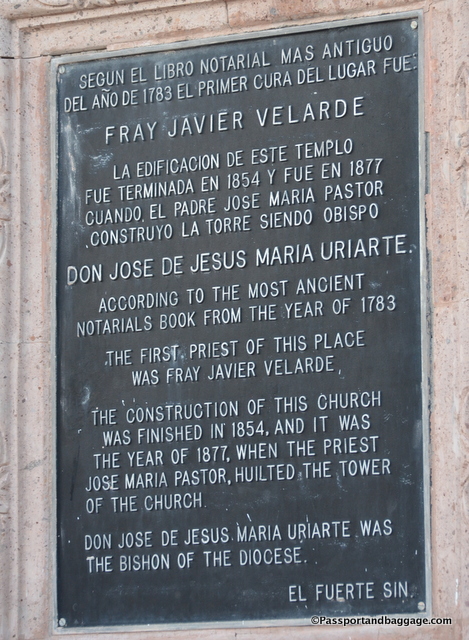
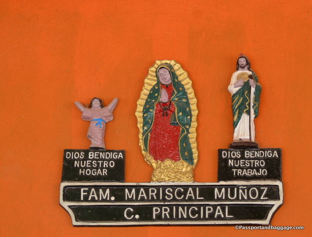
The sign on the wall of the church.

The sign on the wall of the church.

We had just a few hours to explore this afternoon, and the train departs early in the morning, but the town is lovely.  We are staying at Hotel Torres. The hotel was an old casona (large home) owned and operated by the Torres family for 400 years until it was remodeled into a hotel in 2006.  The rooms are absolutely huge, with thick, thick stone walls to keep them cool, although air conditioning is in every room. The rooms are all of traditional materials with old wooden doors and tile floors.

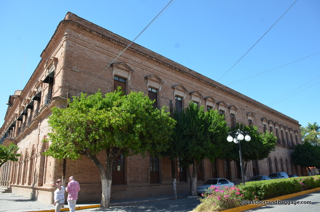
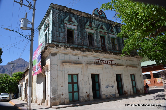
The Municipal building in El Fuerte

The Municipal building in El Fuerte, Mexico

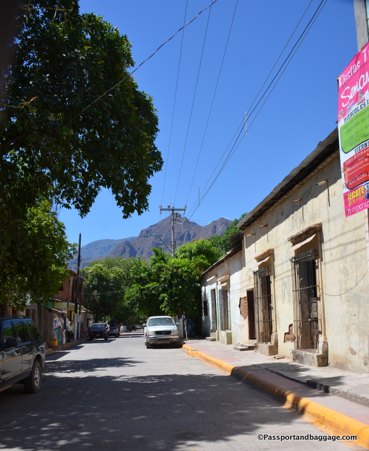
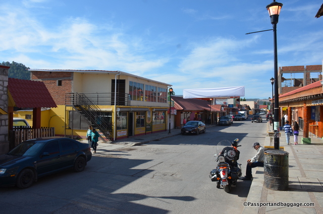
The historic center of El Fuerte is a beautiful example of colonial nineteenth-century architecture, characterized by the orderly lines of its streets, buildings with smooth walls topped by cornices, and homes with their symmetrically framed windows and wood doors.

We had a lovely dinner at El Zorro in the Hotel Posada Hidalgo.  The menu read like a typical white bread Mexican menu, but the food was surprisingly true to its roots, with deep flavors and well-considered combinations.

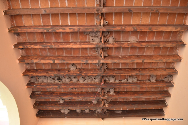
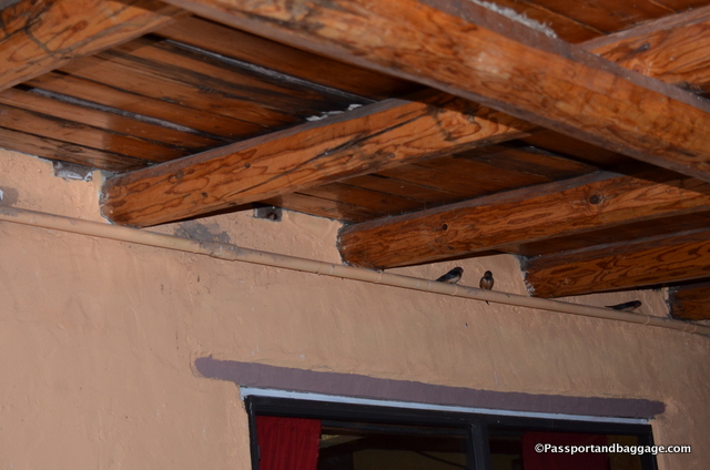
Swallow in the Municipal Building of El Fuerte

Swallows in the Municipal Building of El Fuerte, Mexico

We will be back at the end of this trip and I will hope to explore more and bring it to you, but tomorrow, the train to Copper Canyon.

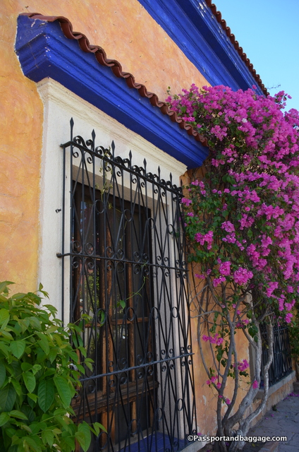
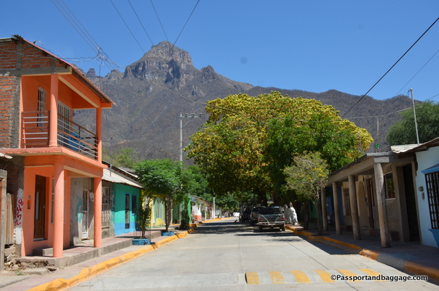
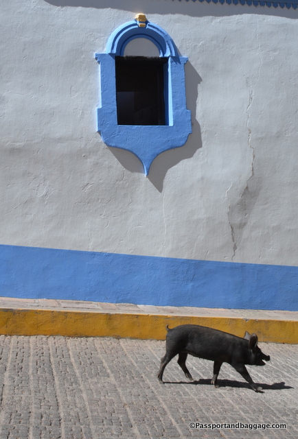
The colors of El Fuerte

The colors of El Fuerte, Mexico

El Fuerte Mexico

*

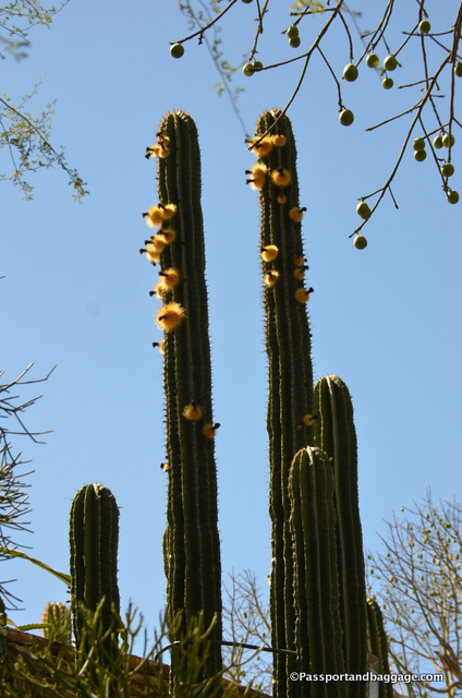
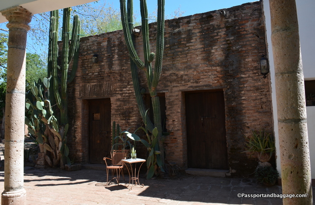
A blooming Hecho Cactus in the garden of Los Torres

A blooming Hecho Cactus in the garden of Hotel Torres

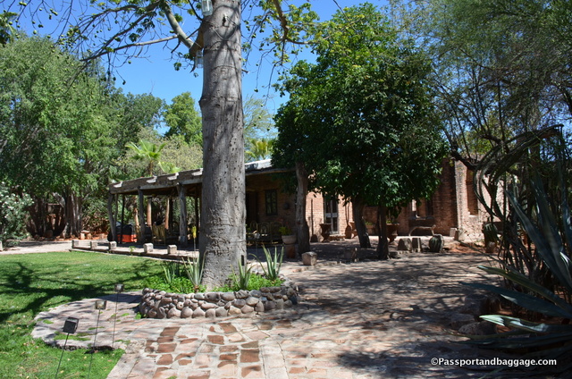
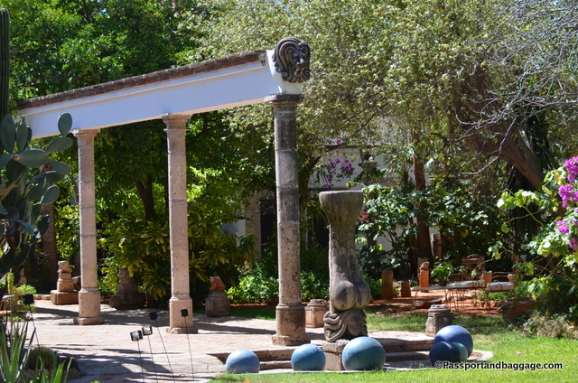
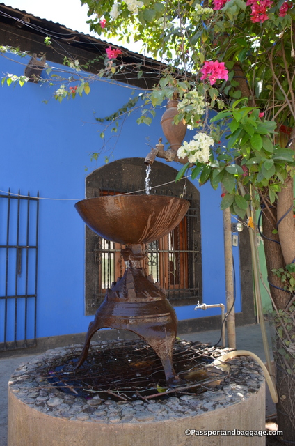
The gardens of Torres del Fuerte

The gardens of Hotel Torres

Torres de El Fuerte

*

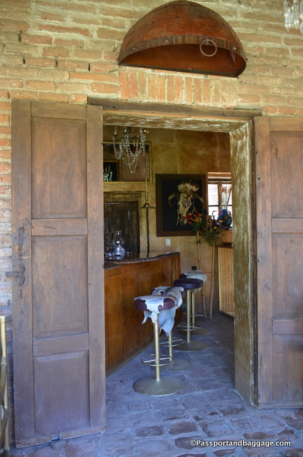
The bar at Torres del Fuerte

The bar at Hotel Torres

Torres de El Fuerte, exterior of two of the rooms

The exterior of two of the rooms at Hotel Torres

Torres de El Fuerte Hotel

*

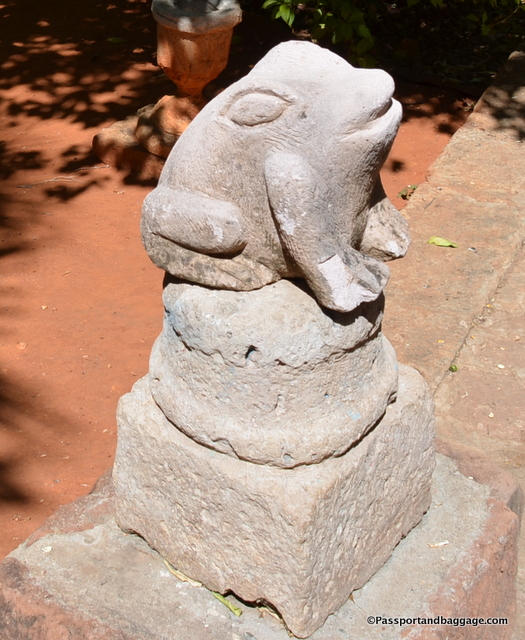
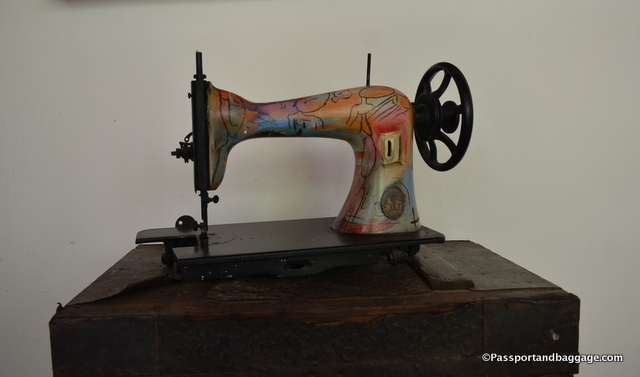
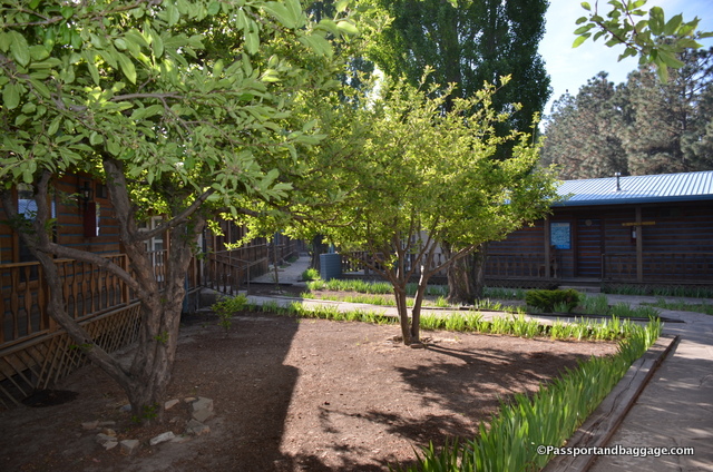
Just some of the whimsical decor of El Torres Hotel

Just some of the whimsical decor of Hotel Torres


May 082017
 

El Fuerte to Cerocahui
May 3, 2017screen-shot-2017-05-03-at-2-30-49-pm

It would be normal to begin your Copper Canyon train ride in Los Mochis where it begins but the area between there and El Fuerte is apparently not terribly interesting so it is easier to take a car to El Fuerte and begin there.

You are told to be at the train station at 8:00 in the morning, but the train can arrive anytime between 8 and 9.  Our train was only about 20 minutes late, which is good for the Chihuahua-Pacific Railroad.

We were to disembark in Cerocahui for the night, the ride from El Fuerte to Cerocahui is about four hours long and travels through the Sierra Tarahumara, also called the Copper Canyon.

While there is open-pit mining for copper, gold, and other metals in the canyon, it actually got its name from the copper/green color of the canyon walls.

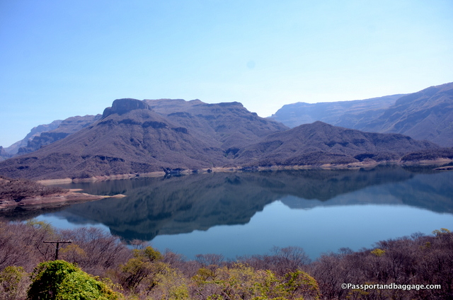
Colossio reservoir, created by the Luis Donaldo Colossio Dam separates the states of Sinaloa and Chihuahua

Colossio reservoir, created by the Luis Donaldo Colossio Dam separates the states of Sinaloa and Chihuahua

This area is named after the Tarahumara Indians which inhabit this remote area. The Sierra Tarahumara is part of an uplifted volcanic plateau and therefore does not have a watershed divide.  This becomes obvious as you travel through this somewhat dry land

The extruded volcanic rock is typically between 1000 and 1500 feet thick and much of it is ash flow tuffa.  This was laid down over an early Cretaceous layer and even older sedimentary rock.  The result of the slow erosion by small trickling rivers is that the Sierra Tarahumara is considered one of the world’s largest proliferation of great canyons in a relatively small area.

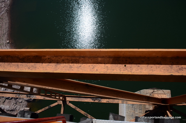
Looking down to the Colossio reservoir, 350 feet above the water and the tallest bridge on the railing

Looking down to the Colossio reservoir, 350 feet above the water and the tallest bridge on the rail line

Recent studies indicate that this area probably possesses more varieties of oak and pine than any other place in the world. There are also an amazing amount of animals, including the Chihuahuan grizzly bear and untold numbers of birds.

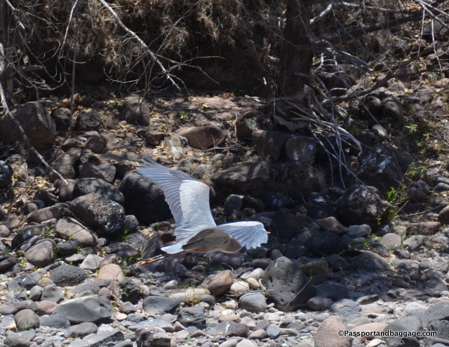
A Blue Heron

A Blue Heron

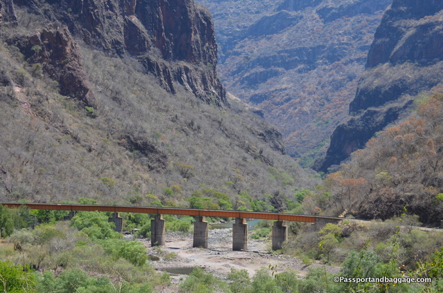
There are 37 principal bridges and 87 tunnels in the 306 miles of train line from Chihuahua City to Los Mochis. That is nearly 11 miles of tunnels and 2.25 miles of bridges.

The railroad took 90 years to build and connected this very isolated area to the outside world. The original concept was imagined by Americans to transport products from the east to the west coast and to the interior of the U.S. Inefficient management, financial problems, construction problems, the Mexican Revolution all delayed the construction. The Panama Canal made the railroad superfluous.

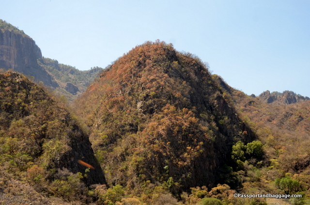
On this leg one goes from thorn forest to oaks and pine, surrounded by mangoes, Otate Cane Bamboo, Rock Figs and Sabal Palms

On this leg one goes from thorn forest to oaks and pine, surrounded by mangoes, Otate Cane Bamboo, Rock Figs and Sabal Palms

The concept of the railroad was officially recognized in 1880, when the president of Mexico, General Manuel González, granted a rail concession to Albert Kinsey Owen of the Utopia Socialist Colony of New Harmony, Indiana, who was seeking to develop a socialist colony.

Owen entered into an agreement to purchase 111,000 acres from a local hacienda owner and, with the help of then Mexican president Porfirio Diaz, obtained concessions for the railroad and the colony. He then chartered a corporation, Credit Foncier, in New Jersey.

Copper Canyon, MexicoPeople buying stock in Credit Foncier received the right to join the colony, which was to be run communally and without the use of money. Work was to be assigned according to each person’s ability, with credits awarded for labor. Individual accumulation of wealth was prohibited. Eight hours of work, eight hours of sleep and eight hours of culture or entertainment were to make up the daily routine. Colonists would build, own, and operate the railroad, telegraphs, banks, and water supply. Capital gained would be reinvested in the colony’s infrastructure. The colony was begun in 1886 with 27 colonists and eventually grew to 2000. Like many Utopian societies, the organization became top heavy with too many chiefs and not enough Indians. There was a revolt and the project failed 14 years after it began.

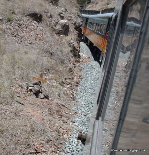
Many crosses and honorings of the dead are also found along the road.

Many crosses and honorings of the dead are also found along the road.

The private rail franchise Ferromex took over the railroad from the Mexican government in 1998.

The private rail franchise Ferromex took over the railroad from the Mexican government in 1998.

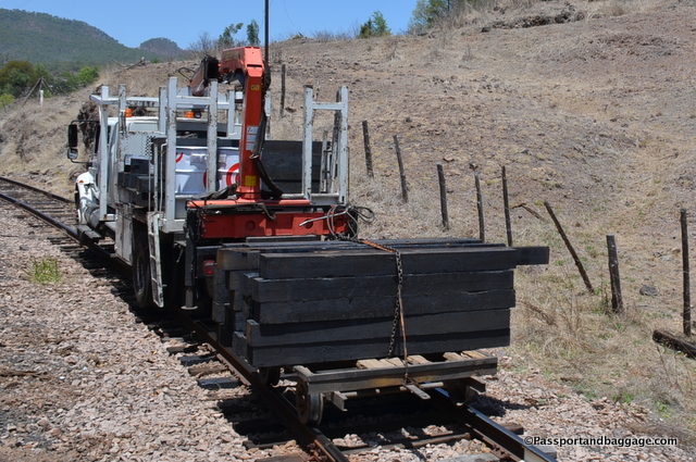
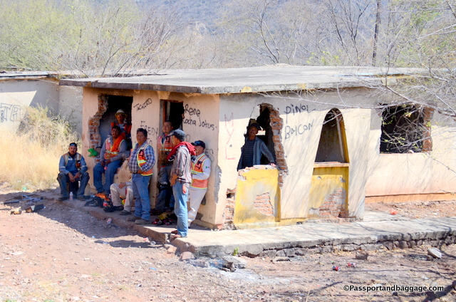
There is constant maintenance happening along the line, with workers waving and smiling at many spots along the way

There is constant maintenance happening along the line, with workers waving and smiling to the passengers at many spots along the way.

Copper Canyon Mexico

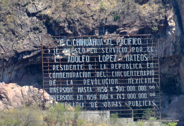
The Chihuahua Pacific Railroad under the service of C. Adolfo Lopez Mateos, president of the republic, in commemoration of the 50th anniversary of the Mexican Revolution has invested $390,000,000 in 1958 and $743,000,000 in 1959.  The Secretary of Public Works

Copper Canyon Mexico

*

dsc_1929 *
Copper Canyon Mexico

*

Copper Canyon Mexico

*Copper Canyon, Mexico

May 072017
 

Cerocahui, Mexico
The Place of Grasshoppers
(pronounced: Sara ca hooey)
May 3, 2017

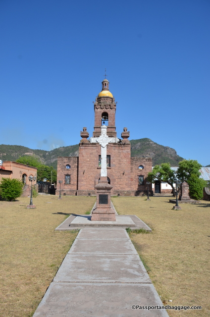
The Mission at Cerocahui, Mexico

The Mission of Cerocahui

The Jesuits were either directly in front of, or directly behind the Spanish conquistadors in so many of the conquered countries of Spain.

The Spanish encroachment, by missionaries and settlers alike in the Copper Canyon, led many of the local Indians, the Tarahumara, to abandon their pueblos and move into the increasingly rugged country of Sierra Tarahumara, making it difficult for the Spanish to exercise control over them.

Sadly the encroachment of the Spanish did bring epidemic diseases that swept through the pueblos and decimated the population. This and the treatment they received in the mines that were being developed, led to uprisings that resulted in the deaths of many priests and soldiers, and brutal military responses that killed thousands of Tarahumara. In the end, the Tarahumara dug deeper into the hills and chose isolation, defining much of their culture today.

Mission at Cerocahui, MexicoThe Jesuits continued their work until 1767 when King Charles III of Spain expelled them from all Spanish territories. Monks from the Franciscan order took their place, but their work lacked the intensity of the Jesuits’. The Jesuits returned in 1900, and set about reopening missions and establishing schools, orphanages, hospitals, and clinics.

Cerocahui, Mexico was first visited by outsiders in 1679 when the Jesuit Padre Pecoro stayed here for a short period and reported that the Indians were not ready to accept his faith.

In November of 1680 an Italian, Father Juan Maria Salvatierra, began construction of the Mission you see in the town of Cerocahui today. He stayed for 10 years.

Copper Canyon, MexicoThe Jesuit order stayed at the mission until their recall in 1767.

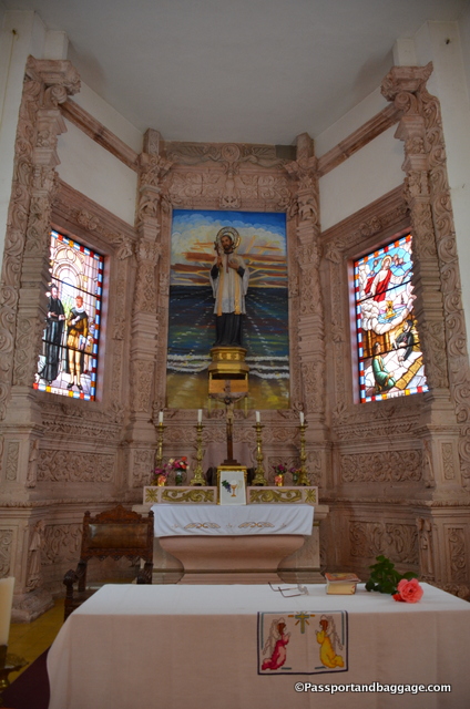
There is no more recorded history until 1936 with the return of Father Andres, who began reconstruction of the chapel in 1940, covering the outside with the carved stone you see today.

In 1941 Father Andres founded the Tarahumara Indian Girls Boarding School which still operates today with 102 girls attending in 2017. He also built the first road to Bahuichivo during the mid-’50s.

Cerocahui, Mexico Boarding School BoysThe Padre died in Guadalajara in 1976 and his remains were taken to the religious cemetery in Sisoguichi. On March 11, 1997, his remains were returned to Cerocahui where they presently rest in the walls of the church.

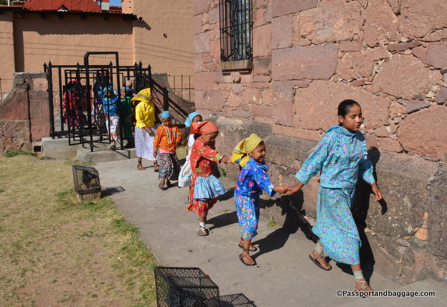
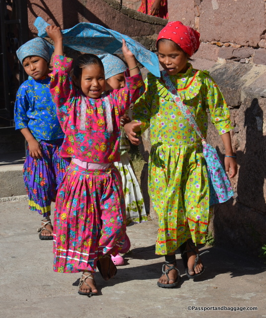
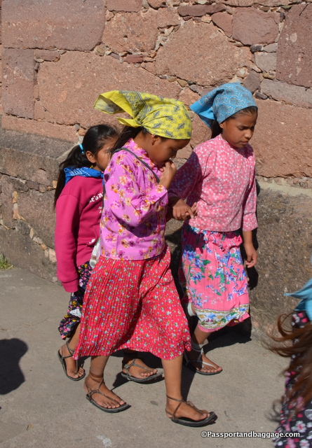
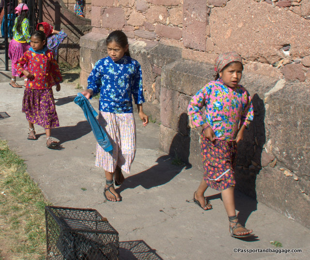
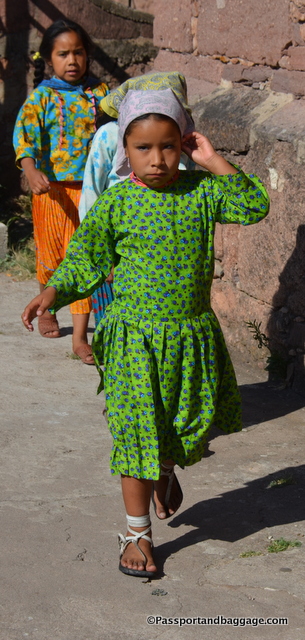
The girls that attend the boarding school come down from the mountains for their education. Many live at least a three-hour walk from the town, so they remain in the school for much of the year. They attend mass every day in the church. These photos are of those girls.

Ceroacahui, Mexico

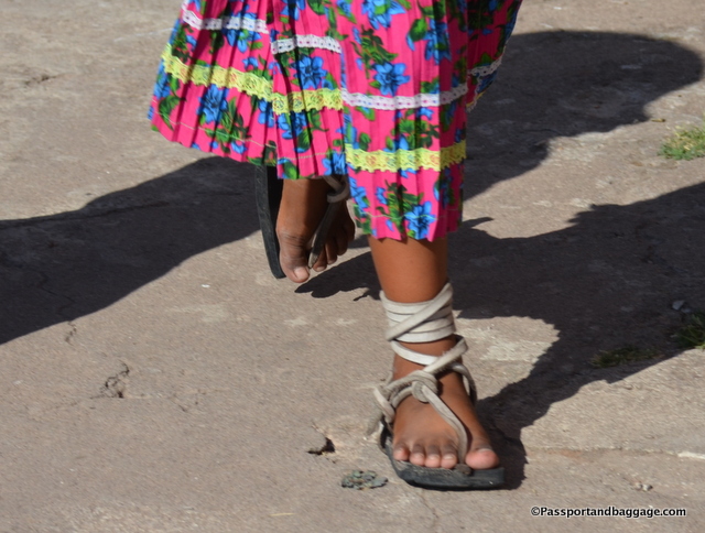
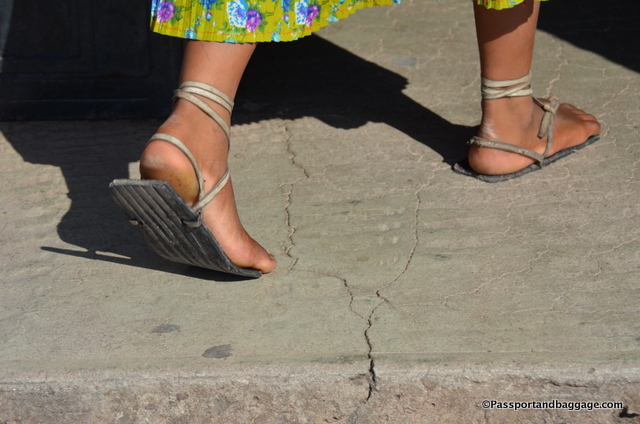
*Shoes of the boarding school girls of Cerocahui

*

The Cerocahui Boarding School Girls

*Cerocahui Mission, Mexico *Cerocahui Mission, Mexico *Cerocahui Mission, Mexico *Cerocahui Mission, Mexico *Cerocahui Mission, Mexico

Downtown Cerocahui is exactly one block square.

Downtown Cerocahui is exactly one block square.

The town has a population of only 1556.  They received a hospital just 6 years ago if you needed one before that you had to drive for four hours.

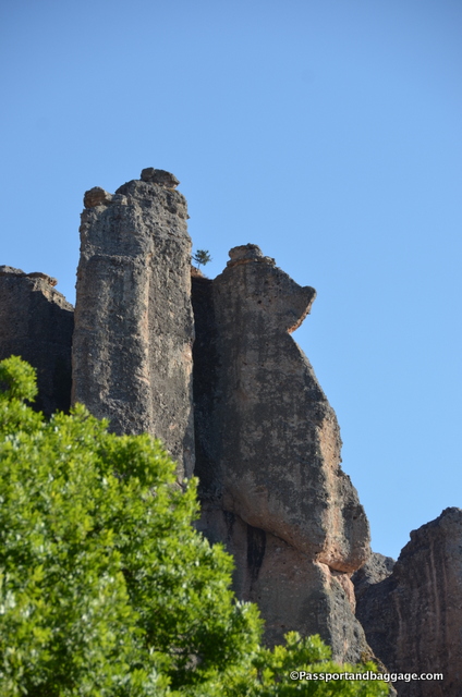
We are staying at the Hotel Paraíso del Oso.  Translation: Paradise of the Bear.  The hotel gets its name from the rock structure that hangs over it.  They call the bear Yogi.

Yogi Bear in Mexico

If you are of a certain age, and from America, you know Yogi Bear, but why here?  Well, it turns out the hotel was started by an American, Doug “Diego” Rhodes.  He originally lived in Ohio, moved to New Mexico and eventually found himself here in Ceracahui, because he realized there were no good hotels in the area.

Today you will find the hotel, being run by Diego’s son Hugo as Diego now spends his time taking tourists to Oaxaca for Dia de Los Muertos celebrations, or children from Cerocahui to Mazatlan for their first glimpse of an ocean.

The hotel, built in 1990, has 21 lovely, clean rooms, a cowboy bar that serves wicked margaritas and delightful home-cooked meals, and yes, wifi.

Swallows in the eaves of the Hotel Paraiso del Oso

Swallows in the eaves of the Hotel Paraiso del Oso

The gardens of the Hotel Pariaso del Oso

The gardens of the Hotel Pariaso del Oso

Cerocahui

*Cerocahui, Mexico


May 062017
 

The Road to Urique
May 4, 2017

The Road to Uruqui

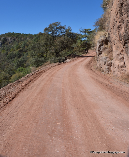
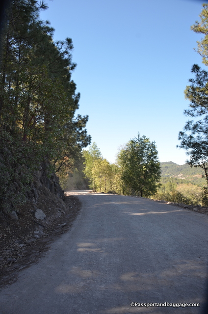
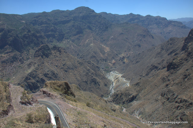
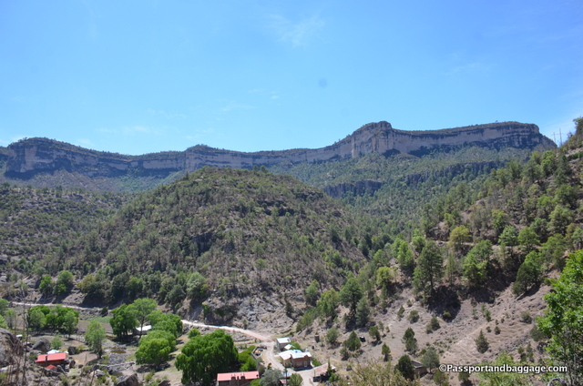
The road from Cerocahui to Urique took about 2 and 1/2 hours one way on an unpaved very bumpy road.  The photo of the road above is of a nice stretch of the road.  The trip is absolutely worth it for the stunning views of the canyons of the Sierra Tarahumara.

Cerocahui, Mexico

The first stop and the end of any form of paved road is on the rim of the canyon, (6890 feet above sea level) that looks down onto Cerocahui, which sits at 5250 feet above sea level.  There is actually a small twin-engine plane in this photograph, that is how high up one is at this point.

The Road to Urique, Mexico

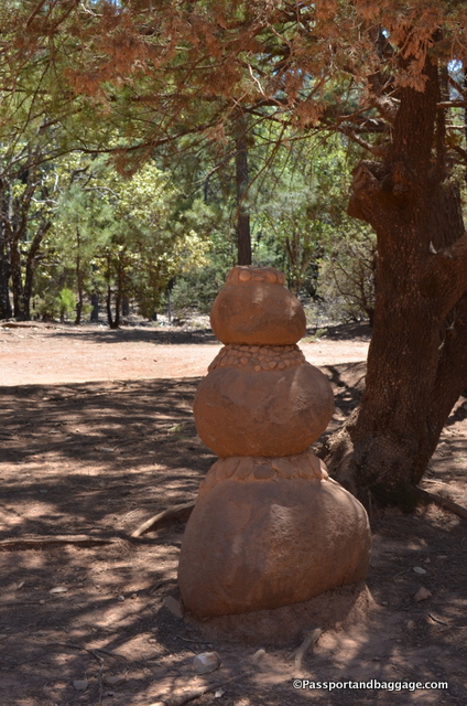
A fun rock snowman on the side of the road.  Just past this statue is the ONLY road to Los Mochis.  It is dirt all the way and takes approximately 8 hours.  A good reason to take the train.

The road continues on through forests of pine and oak with the occasional wandering cow.  Rather quickly you reach the highest point in the trip at 7382 feet above sea level.

The highest point in the trip

The highest point in the trip looks over the Cojahuachi Valley, which translates to Place of Flowers.

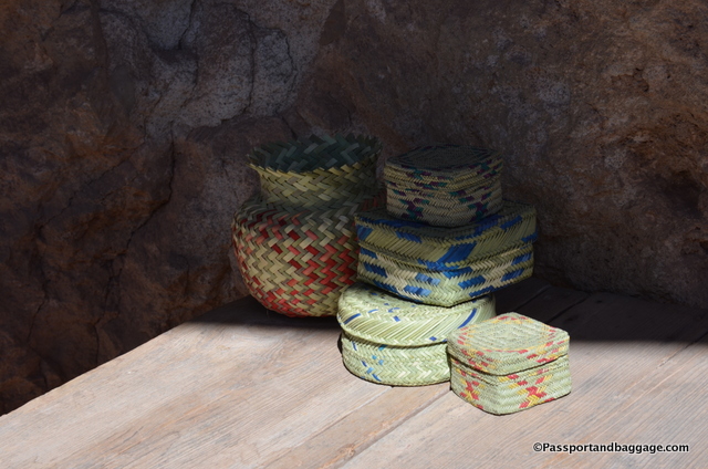
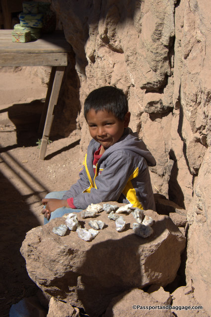
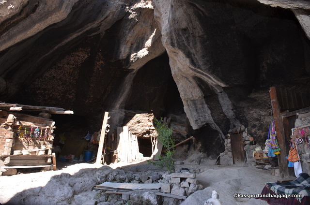
The road continues downhill from there at one point crossing Tcitci Móko River (pronounced Chichimoko, it is a Tarahumara word, meaning Chipmunk).  The view is why you are on this road, and the word wow was uttered from my mouth more times than I could count, but there are also a few interesting places to stop.  The first was a small cave which once held a family of 14 and now has a woman selling baskets.  The cave held a rack of her baskets and a small table, and there was not much more, how 14 people lived in it is hard to imagine.

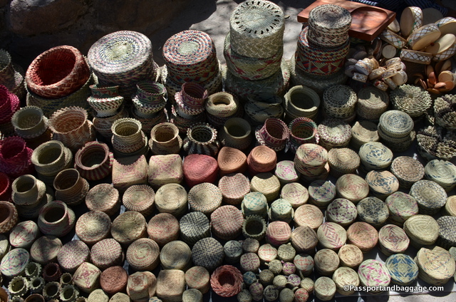
Baskets woven by the Tarahumara Indians

Baskets woven by the Tarahumara Indians

The basket sellers son.

The basket sellers son.

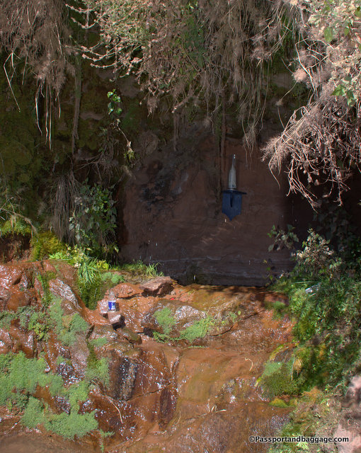
Nearby is a spring with continuous running water and the Virgin Guadalupe overlooking the well.  It is May and the rainy season does not start until June, so the entire valley is very hot and very dry.  The spring fed well is a welcome site.

Look close to see the Virgin Guadalupe in the very back

Look closely to see the Virgin Guadalupe in the very back of the cave.

Home of the Tarahumara

Home of the Tarahumara

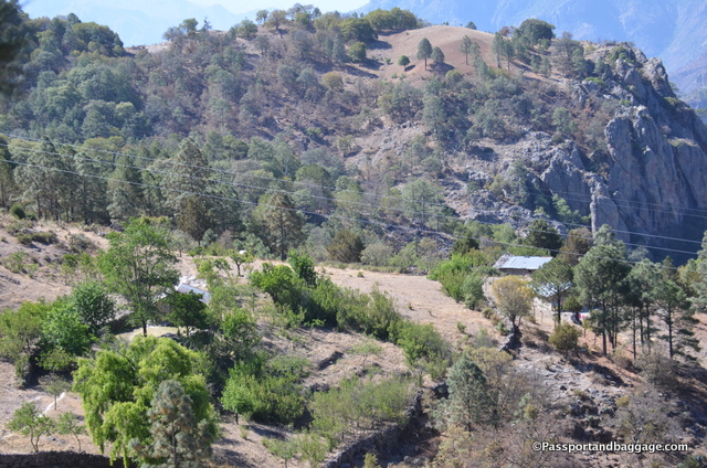
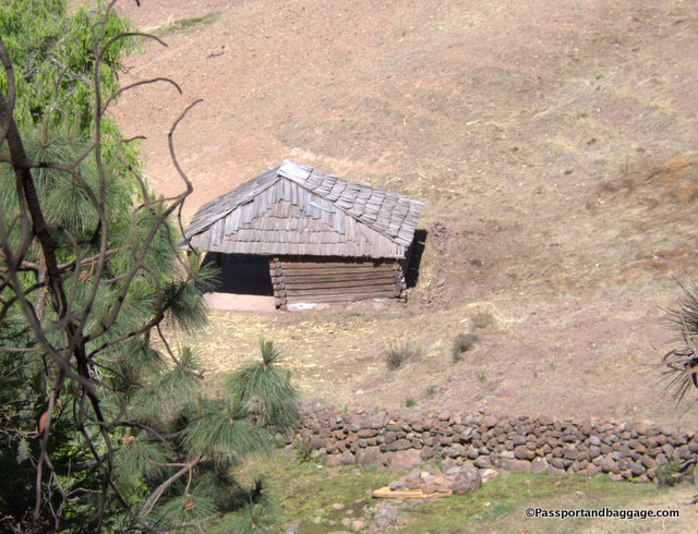
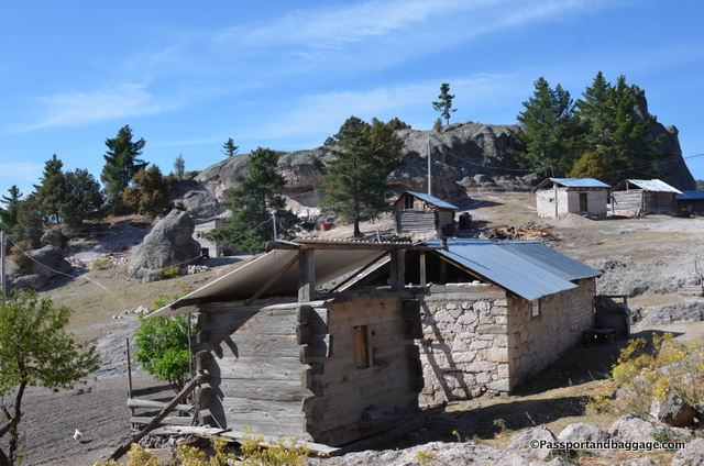
You pass a few scattered homes of the Tarahumara.  Many are made with adobe, and if there is a tin roof, you know they received assistance from the government for the construction.  A more typical home is all wood.

A typical Tarahumara Home

A typical Tarahumara Home

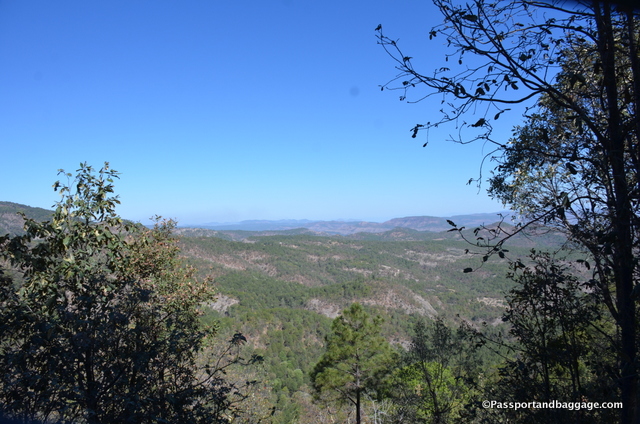
A view across the Valley

A view across the Valley

After approximately 2 hours you come to a very large rest stop at about 2100 feet above sea level.  There are viewing platforms and bathrooms.

Looking to the far mountains of the Sierra Tarahumara from the lookout point.

Looking to the far mountains of the Sierra Tarahumara from the lookout point.

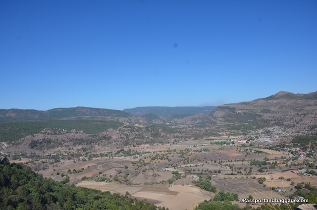
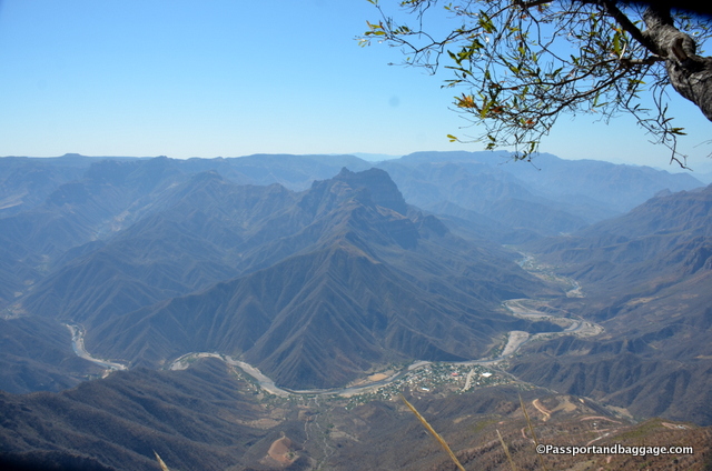
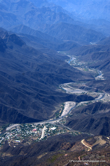
Looking down onto the town of Urique and the Urique River

Looking down onto the town of Urique and the Urique River

Copper Canyon, Mexico A

Look into the photo above.  This is the city of Urique.  The long paved item in the middle of town is the airport.  When a plane intends to land, they circle the city a few times, the police come out and shoo away the chickens and cows to ensure a safe landing.  The airport is used most often during the Copper Canyon Ultramarathon.

Urique's largest general store dates from the time of the Mexican Revolution

Urique’s largest general store dates from the time of the Mexican Revolution

The long ride down finally sets you in Urique also, the county seat. The word “Urique” comes from the Tarahumara word “Uli” meaning “land below” which to them is synonymous with hot land. The “Uli” was followed by “-qui”, a meaningless ending added to words so they sound better, thus “Uliqui” which the Spanish changed to “Urique”. The Urique Canyon is one of the major canyons within Copper Canyon.

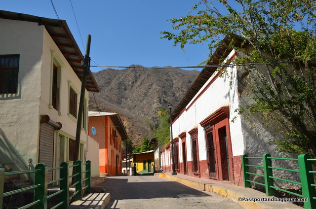
The main street of Urique

The main street of Urique

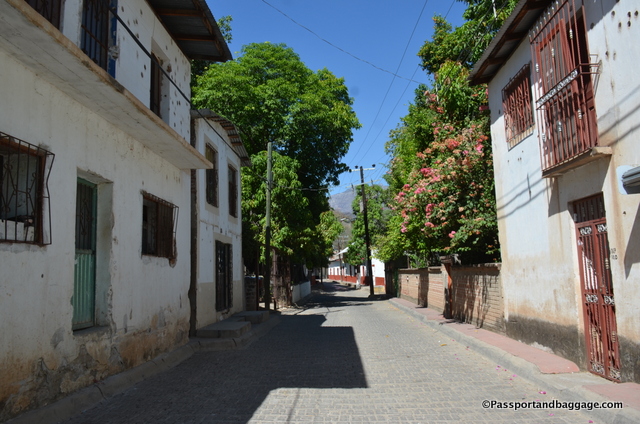
Looking the other way down the main street of Urique.

Looking the other way down the main street of Urique.

The Church of Urique

The Church of Urique, the original was torn down to build this one.

In 1684, the Jesuit Priest Juan Maria Salvatierra became the first white man to descend to Urique. He had already founded the Mission of Cerochui and was responsible for much of the development of this area.

Father Salvatierra later accompanied Padre Kino to Baja California to begin construction of the mission at Loreto, the first mission in what later became known as California’s mission trail.

The Copper Canyon area is fed by many springs making fresh water abundant and appreciated.

The Copper Canyon area is fed by many springs making fresh water abundant and appreciated.

Interior of one of the many simple but excellent restaurants of Urique.

Interior of one of the many simple but excellent restaurants of Urique.

The church is very important in this part of Mexico, and these signs can be found over most every door in Urique.

The church is very important in this part of Mexico, and these signs can be found over most every door in Urique.

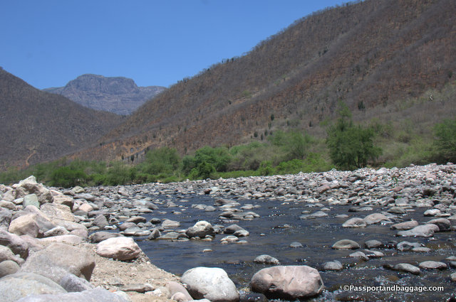
The Cerocahui River runs through Urique.

The Urique River runs through Urique.

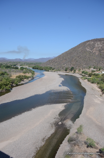
It was May, the rainy season just around the corner, and the river was very low.  It will soon begin to fill and has been known to wash away bridges and flood the town.

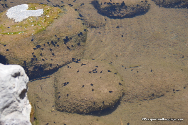
Tadpoles in the River

Tadpoles in the River

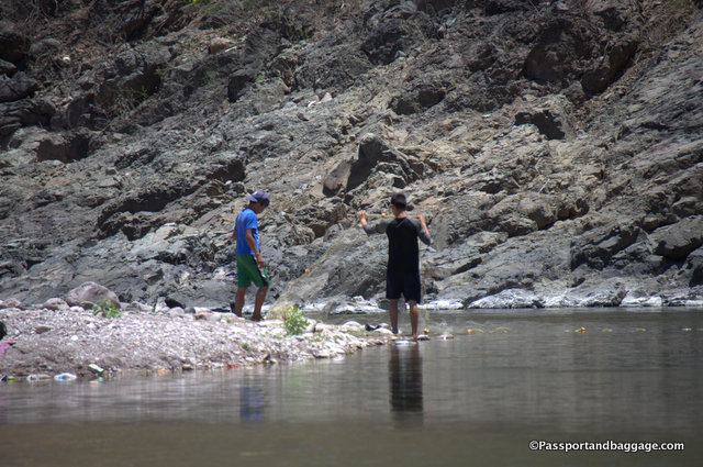
Boys trying to spread a net across the shallow river for fishing.

Boys trying to spread a net across the shallow river for fishing.

The road to Urique was opened in 1965 and provided the first vehicular access to Urique. Prior to its construction, all merchandise and people came to Urique on foot or on pack animals.

Urique received long distance telephone service in 1995 and local service in 2001. Power reached the town in 2001. Prior to that, a diesel generator operated several hours per night providing electricity. Now, you will find internet cafes.

Urique is also famous as the beginning and end of, what is considered, the most grueling foot race in the world, the Copper Canyon Ultramarathon.

The race consists of a 21-plus-mile loop up-river, followed by another 18-plus-mile loop down-river, then continues up-river again on a rough dirt road out and back to the Tarahumara village of Guadalupe Coronado for another 10 miles, before ending in the plaza of Urique. The estimated total climb is 9,300 feet, nearly two miles, in the deep canyon, with equal descent. The run was the subject of a 2009 book Born to Run.

Road to Urique, Mexico

The trip back up is not quite as long, but your potential to meet oncoming trucks and cars keeps you on your toes.

May 052017
 

May 5, 2017

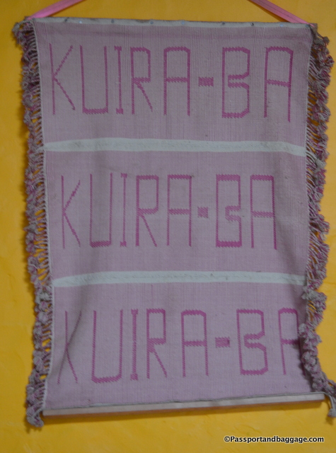
Kuira-Ba

Kuira-Ba is a Tarahumara word. Kuira means hello, and then adding the Ba means Good Morning, Good Afternoon or Good Night.

The Tarahumara Indians have a fascinating history, it will take a long time to see how well it survives the future.  Many Tarahumara are found in the bigger towns and are discovering fast food and television, but many are still very isolated way up in the mountains of the Sierra Tarahumara.

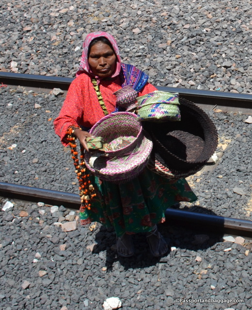
Tarahumara Indians

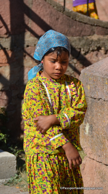
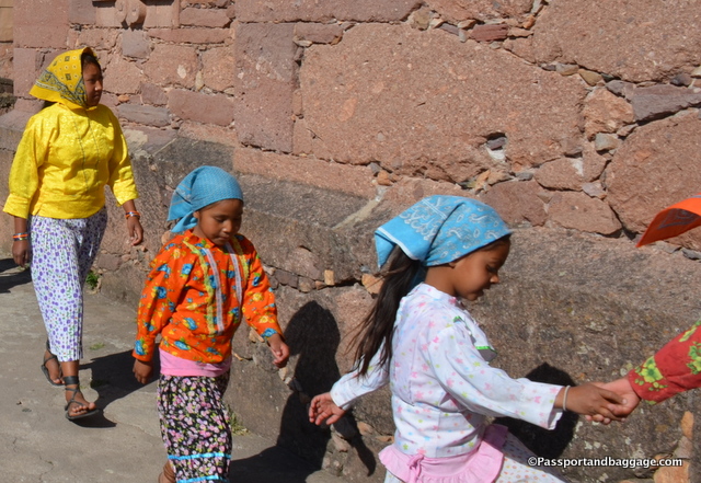
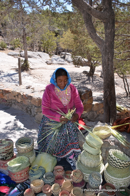
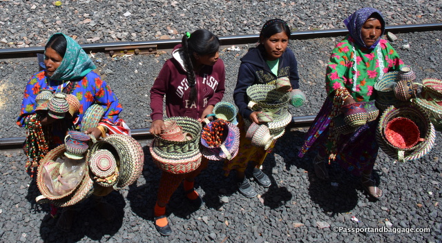
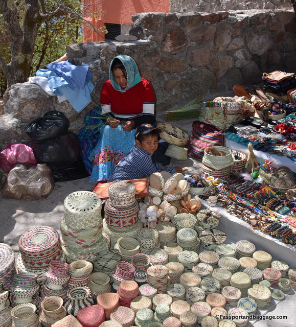
The main source of income for the Tarahumara is their baskets and belts that they weave.  The selling of these items has taken on the classic form of running after tourists and hoping they will purchase your goods.  In the town of Creel, you can purchase from The Mission Store with the monies going to the church, or you can travel a few miles to the Tarahumara lands and buy higher quality goods directly from the women. You will rarely spot the men, but the children and the women, in their traditional head coverings and their cheaply purchased cotton tops and skirts, are everywhere. These are not the traditional clothing of the Tarahumara, who wore sheep or cow skins in the ancient times, and later, simple white cloth dresses, but modernity has brought them cotton.  The women have always covered their head, but now you will find colorful bandanas doing the same duty.

Tarahumara Indians weaving baskets

*Cerocahui

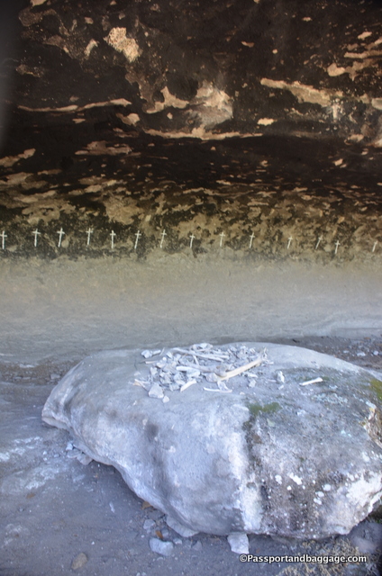
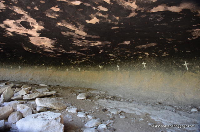
A small walk from the downtown of Cerocahui is a cave with 21 crosses, and, what you are told, are human bones.  These crosses represent the 21 Tarahumara that died in the 1918 Influenza.

1918 Influenza in Mexico

The 1918 influenza pandemic is considered by some as the “mother of all pandemics” and may have caused upwards of 20–50 million deaths worldwide during 1918–1920.

The 1918 flu epidemic or Spanish flu was a virus strain of subtype H1N1, believed to have been a mutated swine virus from China. An estimated one-third of the world’s population was infected. There are no accurate figures for the numbers of deaths in Mexico from the pandemic.

It is said, “Each star in the night sky is a Tarahumara Indian whose souls—men have three and women have four, as they are the producers of new life—have all, finally, been extinguished.”

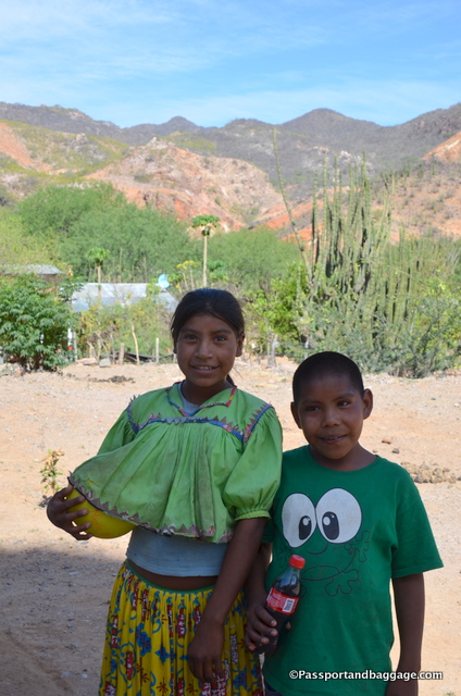
Two Tarahumara children from the town of Satevo. We got a smile from them for a Coca-Cola

Two Tarahumara children from the town of Satevo. We got a smile from them for a Coca-Cola

The Tarahumara people, who call themselves the Rarámuri, have lived in the Sierra Tarahumara for five hundred years, leaving the flatlands to escape the Spaniards. The Spaniards had guns, but also a very strange facial hair, causing the Tarahumara to call them chabochi, or “person with spiderwebbing across the face.”  Today the word chabochi is simply used as someone who is not Tarahumara.  Rarámuri means “foot-runner” or “he who walks well,” and they’ve been known to amaze non-Raramuri ultramarathoners by easily running past them in hirachi sandals and stopping for a cigarette now and then.

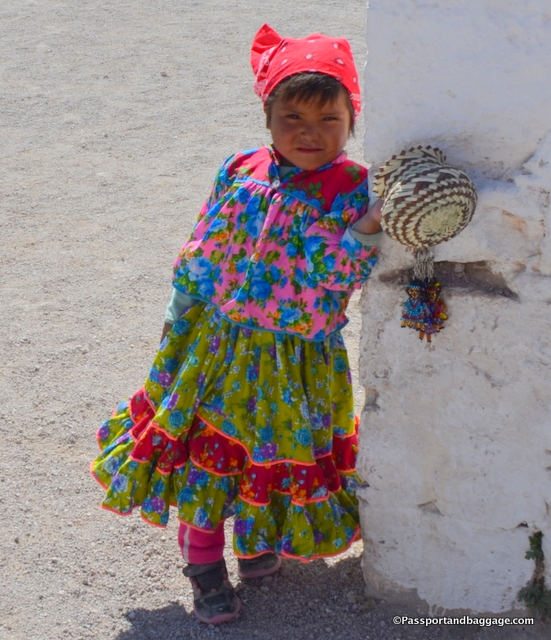
A Tarahumara girl of Creel

A Tarahumara girl of Creel

The Tarahumara are very private people, and not quick to smile, I found them willing to be photographed, but only with a lot of coaxing.

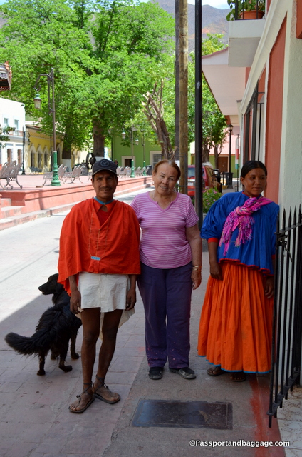
A Tarahumara couple, he is in the traditional dress of the male. The woman in the middle is Juanita from Juanita's Hotel in Batopilis

A Tarahumara couple, he is in the traditional dress of the male. The woman in the middle is Juanita from Juanita’s Hotel in Batopilis

Tourism is not the only thing invading the Tarahumara way of life.  Illegal logging has devastated 88% of the forests in this area, leaving only 2% of their unique habitat.  Narco-trafficking is also a problem, either by planting marijuana in the remaining forests and killing all who enter or forcing the Tarahumara to plant illegal crops in place of their food source: corn and beans.  The future of the Tarahumara closer to developed areas is obviously in danger of going extinct but as you travel deeper into the Sierras you realize how many Tarahumara have made their homes deep, deep in the canyons far away from other human interference.

The handicrafts within the Tarahumara lands are superior to those you find on the streets

The handicrafts within the Tarahumara lands are superior to those you find on the streets.

There is little written in English of the Tarahumara Indians, and not much more written in Spanish.  However, I discovered the photos of Bob Schalwijk in his book, Tarahumara, that is sold in the Mission Store. His photographs capture the true spirit of these people in ways you can not see if you are not living amongst them for long periods of time.  If you have a chance to get your hands on a copy, I highly suggest you do.

Tarahumara Indians

*Tarahumara Dols

May 042017
 

May 2017

The town of Creel was established by Enrique Creel. History views him as both monster and paragon, as always, the truth lies somewhere in between, but that is for a further dissertation.

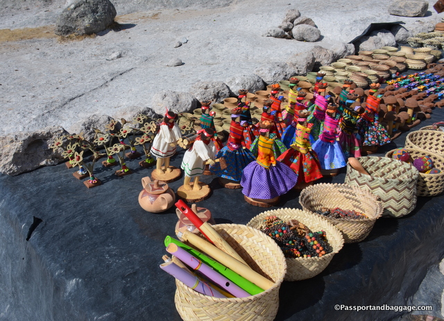
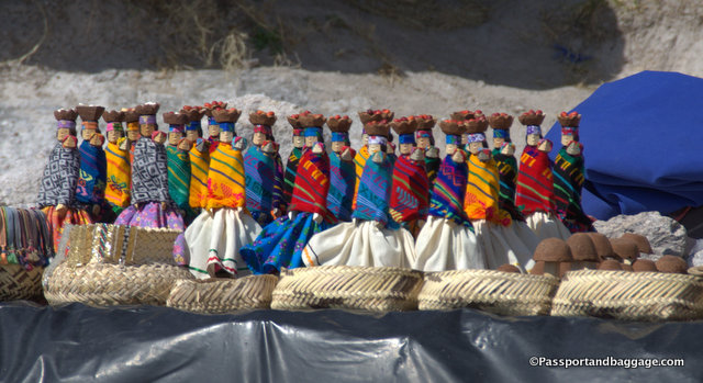
This photo has become the cliche, go to photo for all the trinkets sold in Creel

This photo has become the cliche, go-to photo for all the trinkets sold in Creel

Enrique Creel founded the town in 1906 while he was Governor of the State of Chihuahua. He had planned it as a shared town between Mexican and Tarahumara, but the Tarahumara had no interest and while the concept failed, the town eventually grew to its present population of around 5000.

Enrique Creel was born into wealth on August 30, 1854. He was the son of Abraham Lincoln’s US Consul. After a very privileged childhood, he married Angela Terrazas daughter of one of the wealthiest landowners in Northern Mexico and his first cousin.

In 1876 President of Mexico Porfirio Diaz forced his way into the Presidency of Mexico and the elite landowners of Mexico were given even more land to work as they chose. At this time Creel was appointed Director of the National Company of Dynamite and Explosives In typical robber baron style he had Mexico impose an 80% tax on all imported dynamite giving he and the members of the “Association” a complete monopoly.

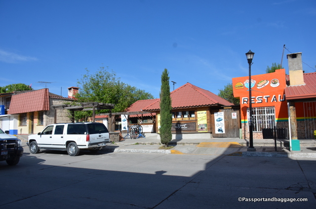
Today Creel is made up of trinket shops and cheap restaurants

Today Creel is made up of trinket shops, adventure tour companies, and cheap restaurants

Creel became governor of Chihuahua in 1904 selling underutilized lands to outsiders forcing many of the landless natives into unemployment. This resulted in the economic depression of 1907-1908 and gave Chihuahua the distinction of being the center of the Mexican Revolution.

The revolution began in 1910 and this is the where Pancho Villa came into the world’s conscience. He expropriated most of Creel’s wealth and Enrique Creel moved to the United States.

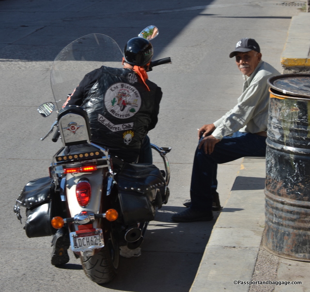
The weekend I was there was the same weekend as a bikers event, they added some fun color and life to the town

The weekend I was there was the same weekend as a bikers event, they added some fun, color and life to the town

Eventually, Creel was able to return to Mexico and served as an advisor to the then President Obregón. Creel died on August 18, 1931.

Today the town of Creel is undergoing a major change. According to National Geographic “The region’s first commercial airport is scheduled to be built in Creel (under construction as I write this post), whose present-day economy depends on the scenic railway line that runs through town. Government planners envision a subsequent hotel boom to accommodate eventual jetloads of new tourists. Officials in Chihuahua, the Mexican state encompassing most of the Tarahumara territory, are courting private investors for a proposed canyon-rim complex—bungee jumps, a chasm-spanning gondola, more hotels, and an “Indian village” for the permanent display of “rituals, ceremonies, and clothes”—to be built farther west on the railway route, along what’s now a tourist overlook crowded with Tarahumara vendors.” While it is always an easy ploy to count on tourism to boost the economy, the ecology of this area is already on the brink of disaster, and the native Tarahumara Indians on the edge of losing their culture, let us hope they do it right.

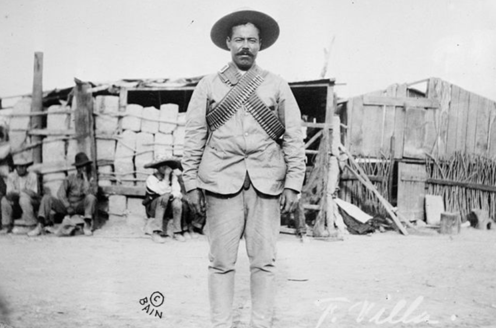
Francisco "Pancho" Villa (1877–1923), Mexican revolutionary general, wearing bandoliers in front of an insurgent camp. - Library of Congress

Francisco “Pancho” Villa (1877–1923), Mexican revolutionary general, wearing bandoliers in front of an insurgent camp. – Library of Congress

It is said, Pancho Villa was “hated by thousands and loved by millions”.

The man’s actual name was Doroteo Arango and he was born in the state of Durango in 1878. He was the son of a peasant sharecropper.

The legend says that he returned home one day, at the age of sixteen, to find his sister having been raped by the owner of the hacienda, he took his revolver shot the man and headed to the mountains on his horse.

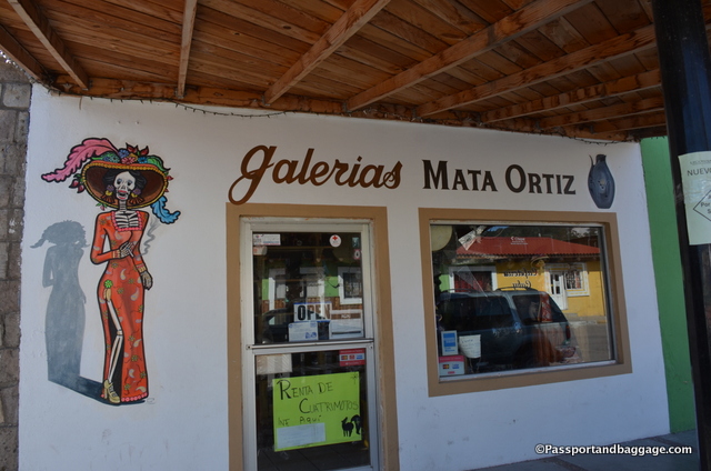
One of the higher quality artisan stores in Creel

One of the higher quality artisan stores in Creel

He became a cattle rustler in a band led by Francisco “Pancho” Villa. The leader was eventually killed by the police in one of their raids and Doroteo took over the lead of the gang and the name.

Apparently, Pancho Villa was a born leader and a very successful bandit well known for his killing and looting. He also was known to do legitimate work, including work on the Copper Canyon Railroad.

When the Mexican Revolution broke out in 1910 Pancho Villa was recruited by its leader Abraham Gonzalez to put together an army in the northern part of Mexico. He became the idol of the masses due to his many victories and incredible charm.

Villa even made a foray into the United States. He crossed the border and raided the town of Columbus, New Mexico. He was unsuccessfully pursued by General “Black Jack” Pershing who telegraphed back to Washington, upon his failure, that “Villa is everywhere, but Villa is nowhere”.

The Mexican Revolution ended in 1920 and Villa went into hiding fearing for his life, concerned about the relatives of the many he had killed. He was eventually shot in 1923 while driving his car through Parral Durango by assailants who have never been identified.

The main street of Creel runs parallel to the Chihuahua Pacific Railroad Tracks and depends on the tourists and Mexicans that ride the rails

The main street of Creel runs parallel to the Chihuahua-Pacific Railroad Tracks and depends on the tourists and Mexicans that ride the rails

Best Western Hotel in Creel, Mexico

The best hotel in Creel at this point is the Lodge at Creel, it is a best western and has all the feel of a Montana or Colorado ski lodge.  The entire place is made up of log cabins that are huge.  The restaurant is first-rate with a perfect breakfast buffet and both typical Mexican, as well as, American fare.

There are a few restaurants in town, all rather empty at this time of year, I am sure they are looking forward to any increased traffic the airport might bring.

May 032017
 

May 2017

The Road to Batopilis

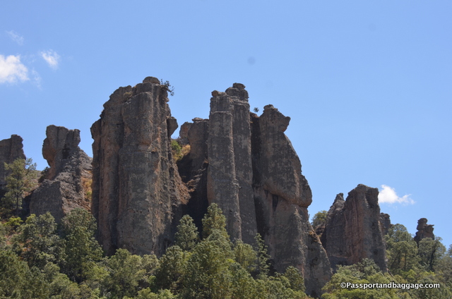
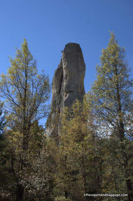
No matter where you look you can see something in the rocks within the Indian area of the Sierra de Tarahumara outside of Creel. There is the Valley of the Monkeys, the Valley of the Mushrooms, Elephants and other animals. For some reason, this was the Valley of the Monks

It is impossible to describe the drive from Creel to Batopilas. The first portion of our drive took us through the Tarahumara Indian lands, of which you pay a nominal entrance fee. The roads here are dirt and they are intended to drive you to small areas of interest with women selling Tarahumara handicrafts.

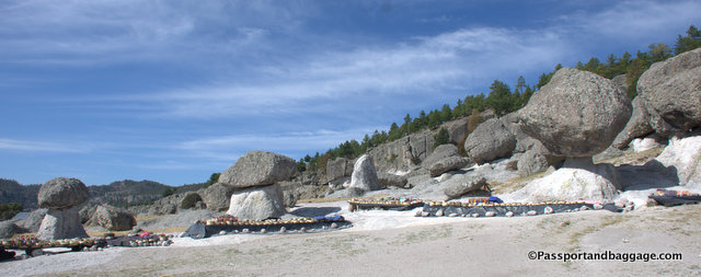
The Valley of the Mushrooms

The Valley of the Mushrooms with handicraft tables all set up for visitors.

The situation is somewhere between exploitation and desperation, and I am not sure what to think of it.  The following photo is of a home, in front was a large sign with a basket saying propinas (tips). I will leave each reader to draw their own conclusions, none of which can possibly be correct without a more thorough understanding of what is actually happening at this point in time and with the people involved.

They also eat a lot of Maruchan, the Japanese instant noodles that come in plastic-foam tubs. Foil-wrapped potato chips, too, and plastic liters of Coca-Cola, and Tecate beer in pop-top cans—you can spend six hours rattling in a four-wheel-drive pickup toward the deepest remove of a Tarahumara canyon, hairpinning around crumbling dirt roads hacked straight out of the cliffs, until the truck winds around the very last drop-off, and the sun is setting and the smoke is curling from distant chimneys and the sound of ceremonial drums is floating up from somewhere way below, and there along the footpaths are two empty soda bottles and a discarded tub of Maruchan. - National Geographic

They (The Tarahumara) also eat a lot of Maruchan, the Japanese instant noodles that come in plastic-foam tubs. Foil-wrapped potato chips, too, and plastic liters of Coca-Cola, and Tecate beer in pop-top cans—you can spend six hours rattling in a four-wheel-drive pickup toward the deepest remove of a Tarahumara canyon, hair pinning around crumbling dirt roads hacked straight out of the cliffs, until the truck winds around the very last drop-off and the sun is setting and the smoke is curling from distant chimneys and the sound of ceremonial drums is floating up from somewhere way below, and there along the footpaths are two empty soda bottles and a discarded tub of Maruchan. – National Geographic, November 2008

More homes on the Indian designated land.

More homes on the Indian designated land.

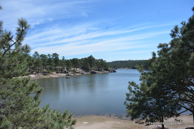
Lake Arareko is on the Indian land, it is a beautiful high country lake.

Lake Arareko is on the Indian land, it is a beautiful high country lake.

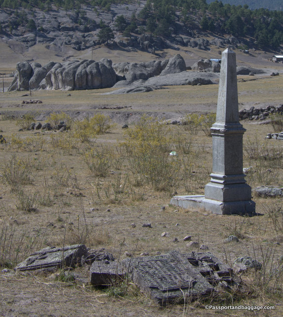
The cemetery on the Indian land is over 200 years old

The cemetery on the Indian land is over 200 years old

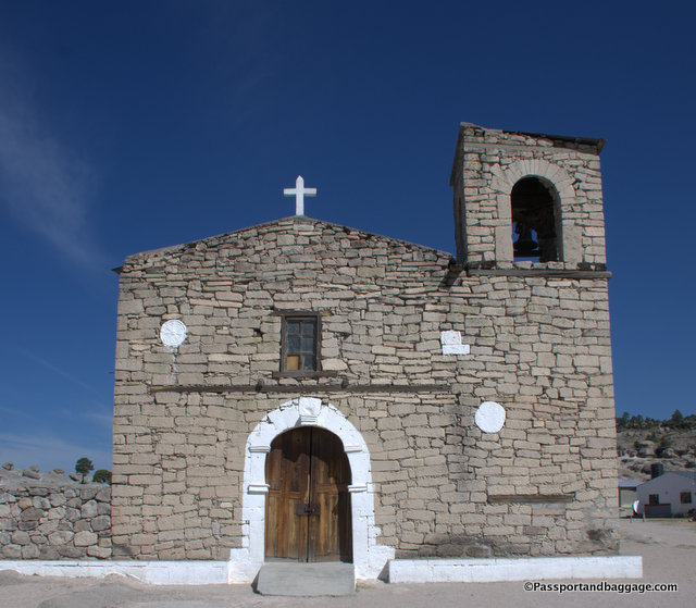
San Ignacio Mission is over 200 years old.

San Ignacio Mission is also over 200 years old.

The road to Batopilas from Creel is 160 kilometers, or about 100 miles, and takes between 3 and 4 hours. Lest you think I am complaining, it is important to know that until just 5 years ago this road was not paved and the trip took upwards of ten hours.

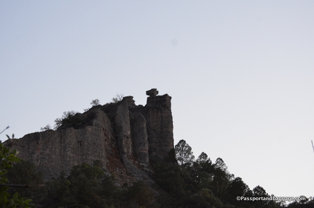
Our first high pass

Our first high pass.  The rock formation at the top is called El Cinturón (The belt).

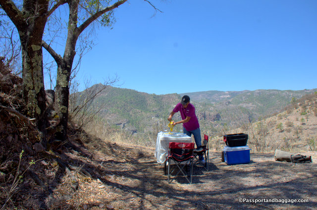
Lunch is served.

Lunch is served.

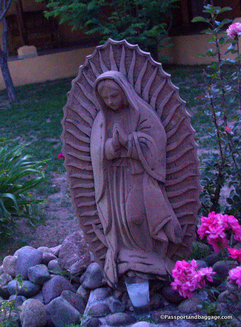
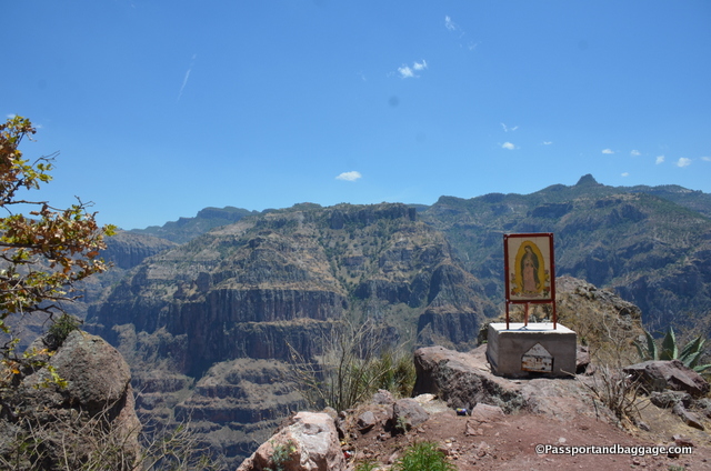
If you need, you can stop and say a prayer to Guadalupe

If you need, you can stop and say a prayer to Our Lady of Guadalupe. The formation behind Our Lady of Guadalupe is called the wedding cake.

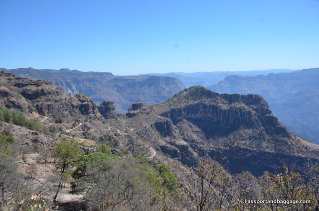
Creel’s elevation is 7694 feet, the road then dips down and climbs up again, five times, each time reaching peaks with elevations around 6000 feet and dropping back to elevations around 1600 feet, all of this with views that will keep your jaw on the floor and your tongue saying WOW the entire 100 miles.

The descent into the town of Batopilis

The descent into the town of Batopilas

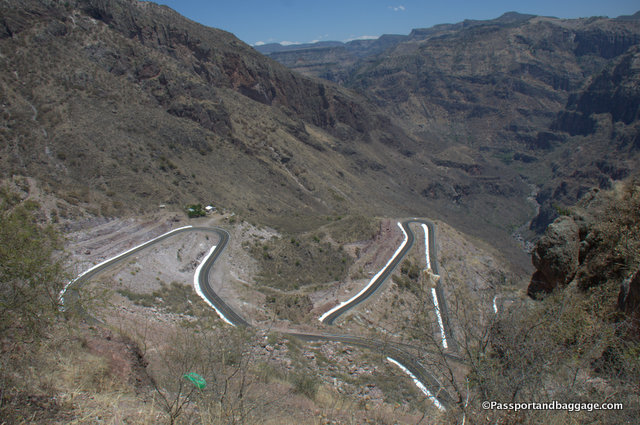
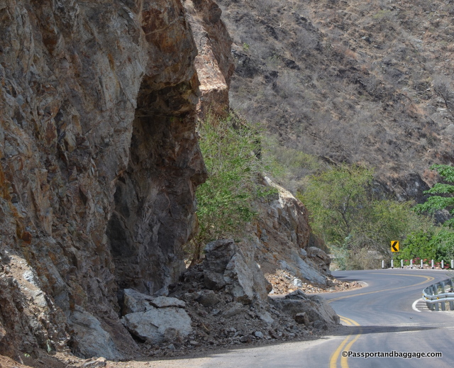
Your final descent is to the town and river of Batopilas which sits at 1896 feet. The road is not well maintained, and when I asked, the answer was that the governor of Chihuahua was taking all of the money for himself.  I was also told the road is essentially impassable during the rainy season.  For the last 20 miles or so, due to the falling boulders and debris, it is a one lane road.

The road becomes treacherous after Our Lady of Guadalupe.

The road becomes treacherous after Our Lady of Guadalupe.

The road is not for the faint of stomach, but it is also not to be missed. It is an adventure that I will not soon forget, and one that I am eternally grateful that I was fortunate enough to make.

Looking down into Batopilis River

Looking down into Batopilas River

I should add a writer’s note at this point.  I am traveling with two of my dearest friends, but we are not on a guided tour.  We hired a driver to take us down to Batopilas (thus the lovely lunch setup).  He spoke very good English, and with my Spanish, we had great conversations.  However, the opinions were his own, and not necessarily informed, as he lives in Creel and only does this trip about 3 times a month. Also, I have found often times, drivers are not willing to answer the pointed questions I might ask. However, Martin was a terrific driver and an exceptionally polite and fun guy to have around.

May 022017
 

May 2017

Batopilis, MexicoEnchanting is the only appropriate word I can find for the small pueblo of Batopilas, in the state of Chihuahua, Mexico. ¡Me Encanta! would be my next few.

We visited in the first week of May 2017 and were the only non-residents in town. December and January are the busiest months for Batopilas, and even then ten outside visitors would be considered a lot.
Batopilis MexicoThis small town dates to 1632, occupied by Spanish conquistadores with silver mining being its purpose for existence. These prolific mines have brought fortune to many men throughout history.

A fire, in 1740, destroyed the town’s records, but a Jesús Sánchez Pareja did manage to record some of the towns more significant memories, mainly celebrations of the births and deaths of Spanish kings.

The Jesuit expulsion was recorded in 1767 and then the accumulation of wealth by Don Angel Bustamante in 1800. Bustamante built the magnificent Hacienda de San Miquel, that still sits along the Batopilas River. Although here records conflict, as some say that the Hacienda was built by Alexander Shepherd.
Batopilis, MexicoThe War of Independence was proclaimed in 1821 exiling many Spaniards and mining ceased for 20 years. During this period many locals left, seeking employment elsewhere, and only 10 families remained.

In the 1840s Mexican Dona Natividad Ortiz and her associate, Nepomuceno Avila reopened some of the closed mines and located several new veins.
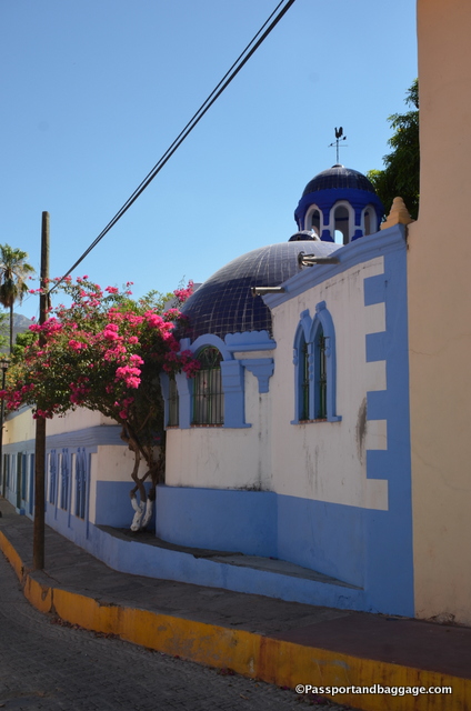
Once a grand home, this building is now a hotel in the busiest season.

Once a grand home, this building is now a hotel in the busiest season.

By the 1860s, the Americans began to arrive in Batopilas, the most notable being Alexander Shepherd, the last governor of Washington DC. Shepard purchased the Hacienda de San Miquel and began further exploration of the silver mines. During this period the pueblo saw between four and five thousand inhabitants working the mines. Many of the buildings around the central square can be dated to this period.

Over the centuries scores of hugely productive silver mines have been dug in the area; one estimate is that mines in the area have produced seven times as much silver as has come from the famous silver mine of Kongsberg, Norway.
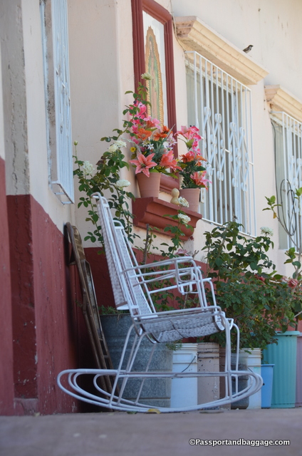
Batopilis, MexicoMining ceased to be profitable and today, Batopolis is the poorest area of the state of Chihuahua with its meager 1502 citizens.

Presently there are 2 restaurants in town, both in the homes of their owners. Dona Carolina’s and Dona Mica. Going back and forth between the two, to spread the wealth as it were, was our modus operandi, with no meal for three being much more than $30 US and that included beer at dinner. The food at both was more than you could eat and delicious.

We stayed at Hotel Juanita’s. It is three floors tall with ten rooms. The hotel is run by Juanita Morales and her husband who was away while we were guests, moving the cows from one location to another. They have two children, both living in parts of Mexico with employment. Each room is clean and equipped with a fan and a crucifix. According to Lonely Planet, Juanita said if you don’t like Jesus you can go elsewhere. This can be attested to by her regular attendance at the church just down the street, which she makes sure you know in case you should need anything while she is not there to attend to your needs. There is a lovely patio, and chairs and tables at the end of each wing that overlooks the river and catches the afternoon breezes, the perfect place to lose yourself in a book.
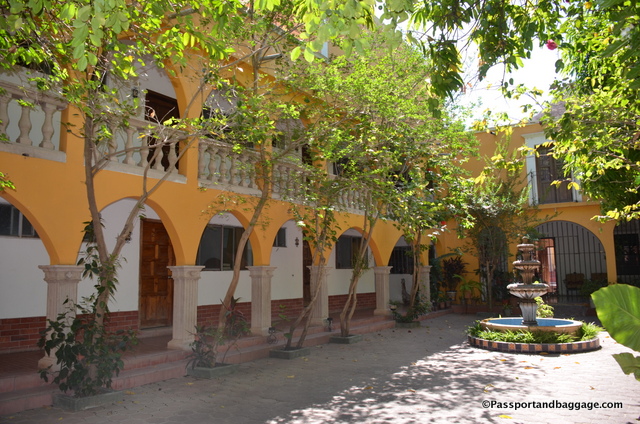
The interior courtyard of Juanita's Hotel

The interior courtyard of Juanita’s Hotel

Next to Juanita’s is a small home with a sign that says rooms to let and handicrafts for sale. This is the House Monse, it is the home of Ma. Monserrat Alcarez Urias, her prices are high, but her heart is of gold. She sells, primarily baskets, but a Tahuramara drum or belt can also be found in her eclectic home. She self-published two books, one on the native plants and their uses as local medicine and one on the history of the area. If you read Spanish they are worth picking up, despite their rather florid writing and lack of substantial content.
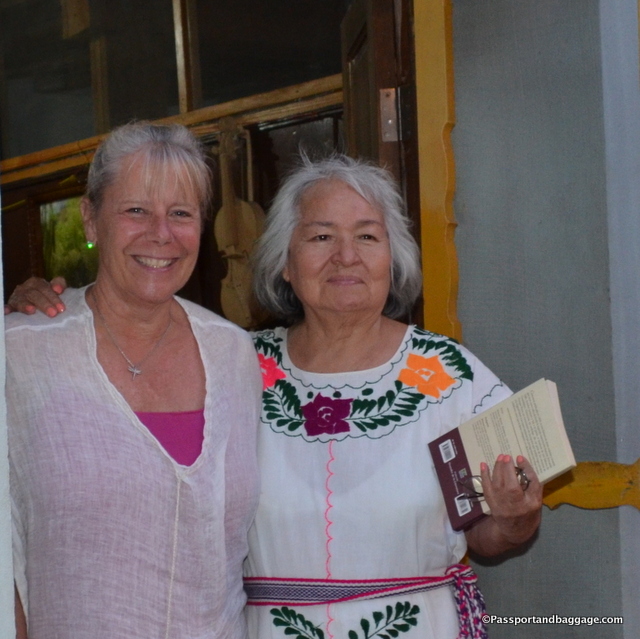
The author Ma. Monserrat Alcarez Urias is on the right
The author Ma. Monserrat Alcarez Urias is on the right

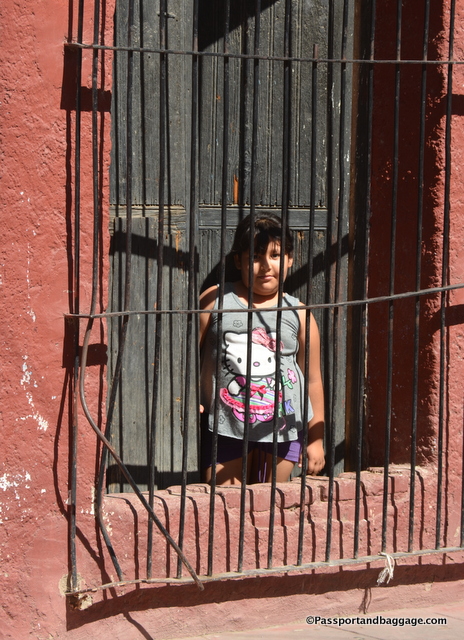
This little girl stuck her head out and kept saying to me "photos, photos" so I took her picture

This little girl stuck her head out and kept saying to me “photos, photos” so I took her picture

Entertainment in town is non-existent and the town shuts down very early, so exploring should be done during the day. There are a few highlights both in town and in the surrounding area. However, there is a very good mining museum.  What it lacks in substance it makes up for in wonderful old photographs and a very enthusiastic caretaker.
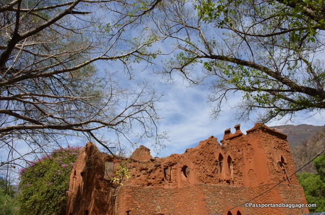
The Hacienda San Miquel

The Hacienda de San Miquel

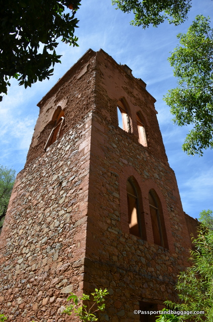
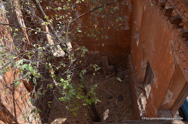
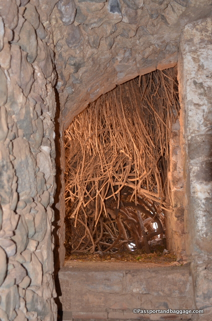
Architecturally the Hacienda de San Miquel is the central edifice in town. It is in complete ruin, beautifully overrun by bougainvillea. The most eye-catching thing about the building as you look at it across the river are the huge Tescalama trees with sinuous roots weaving in and out of the stone wall. This stunning ruin would benefit greatly from a munificent donor and a restoration specialist.
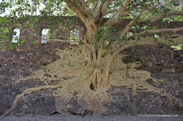
The roots of the Tescalama Tree
The roots of the Tescalama Tree

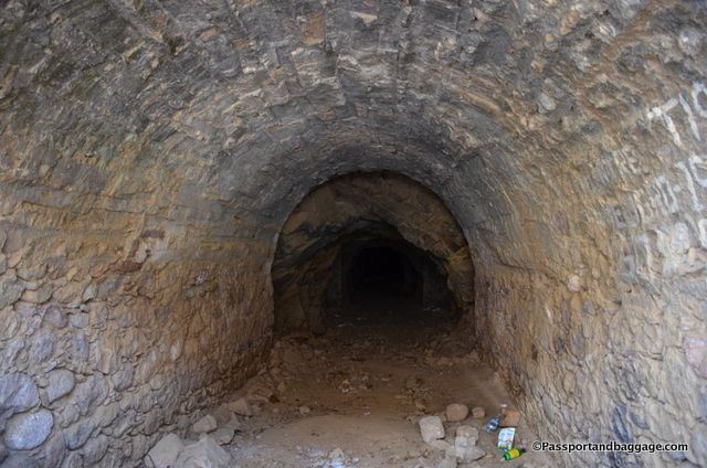
The Porforio Diaz Tunnel

The Porfirio Diaz Tunnel

The Porfirio Díaz Túnel can be found very near the main bridge in town. This tunnel is apparently one of the largest in the country and was constructed in the 1880s, as can be seen by the date 1890, over the tunnel entrance.

A short drive or hike (3.7 miles) down a dirt road will take you to a second architectural gem, the church of San Miguel de Satevo. The church is part of the Santo Angel Custodio de Satevo Mission, of which very little is known as a fire destroyed all its buildings and records in the late 1800s.
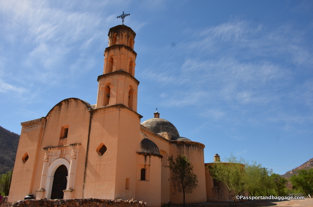
The Church of Satevo

The Church of San Miquel de Satevo

It is thought that the church was built between 1760 and 1764 and once served a fairly large Tarahumara community.
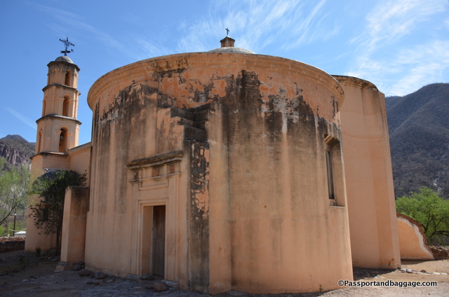
One of the three domes on San Miquel de Satevo

One of the three domes on San Miquel de Satevo

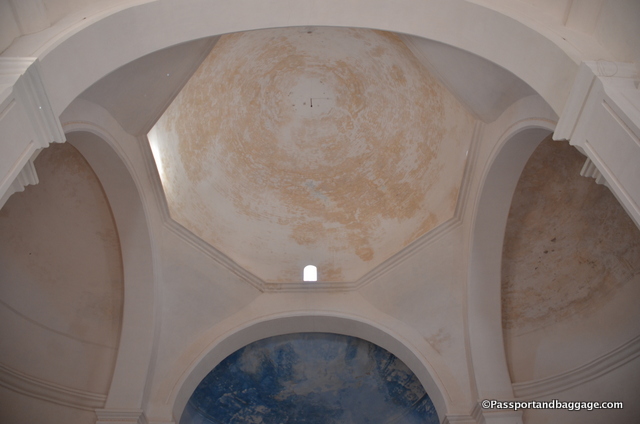
The church consists of a three-tiered bell tower and three domes (a large main dome above the sanctuary, a medium sized dome over the library that once connected the church with the monastery, and a small dome above the bell tower)
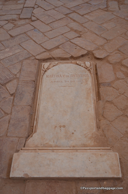
One of the interior graves in San Miquel de Satevo
One of the interior graves in San Miquel de Satevo

The interior of the domes in San Miquel de Satevo
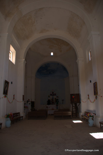
The interior of the domes in San Miquel de Satevo

The altar of San Miquel de Satevo
The altar of San Miquel de Satevo

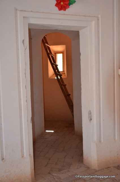
The ladder to the bell tower in San Miquel de Satevo
The ladder to the bell tower in San Miquel de Satevo

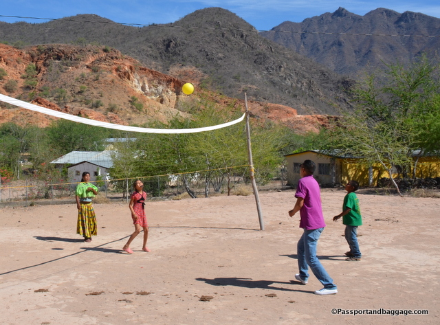
A pickup volleyball game with a few of the Taramuhara children

A pickup volleyball game with a few of the Taramuhara children

The church, despite some plaster being placed on the interior and exterior over the years, was built entirely of fired brick and mortar. Bricks were molded, dried and fired on site while calspar taken from the silver mines was burned with river sand to make a durable limestone and sand mortar.

Large wooden doors beckon you into a very simple church with a stone floor, containing uneven spots that are quite obviously old graves. At least one has a marble tombstone to mark its place.
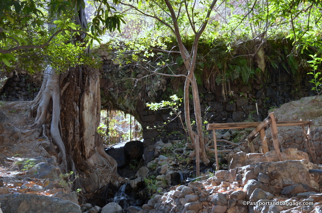
The aqueduct of Batopilis

The aqueduct of Batopilas

There is also an aqueduct that runs through the town of Batopilas, that is best seen along the road at the very north end of town. The aqueduct was built by Alexander Shepard to generate hydroelectric power to light the mines and operate the foundry. Today it is still the town’s main source of water and electricity.
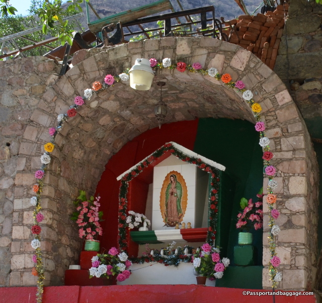
The major Lady of Guadalupe shrine in Batopilis

The major Lady of Guadalupe shrine in Batopilas

It is Sunday, around 5:00, and I watch the women come out with brooms and shovels to tidy up. I understood the women sweeping the stairways, and possibly even the ones that swept the dirt paths in and out of town, but the women with brooms and hoes in the middle of the river, I never did quite understand what they were accomplishing. Around 6:30 they all gathered, rounded up their children that had been playing all day in the river and headed home. As the hillside became barren of people a lone, pristine white, paper plate floated for minutes on the breezes over the river to settle where someone had spent hours before removing every speck of dust from the sidewalk.
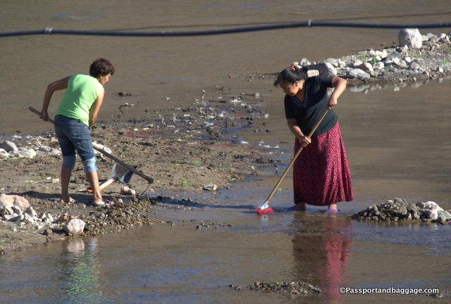
Batopilis, MexicoOn Monday morning I talk with Ma. Monserrat Alcarez Urias and she asks me for ten pesos for cleaning.  We begin to talk and I realize the ten pesos I give her will go to the church, that then goes to the woman that clean the town.  Yes, it is a way of keeping pride in the town, but it is obviously also a way to get money to the women of this dirt poor pueblo.
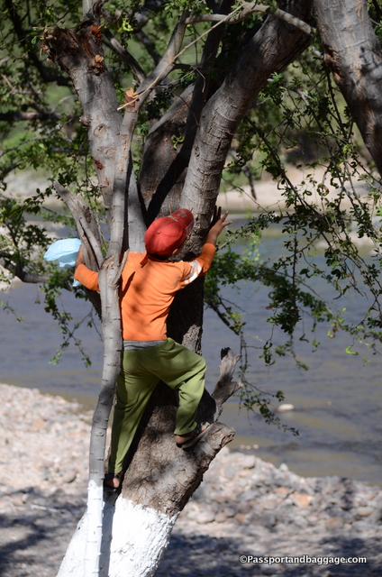
A little boy looking for beans

A little boy looking for beans in the mesquite tree, they are of a very high nutritional value, important in this area where poverty is the norm, and they grow wild, so they are free.

Across the river from Juanita’s is a single story building that appears to be a dormitory. All during the day, men in plain clothing go in and out with a semi-automatic weapon strung across their chest. Sunday evening, they put all their belongings into black garbage bags, run across the bridge and disappear into the night. I asked why they were here and received a half-hearted answer: for the traffic, but what kind of traffic I will most likely never know, I promise it is not auto traffic.
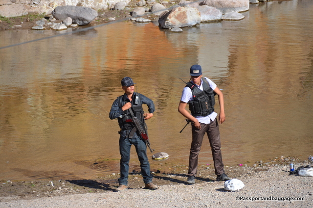
These gentlemen were not in uniform and spent the weekend at the house across the street. Who they are and why they were carrying guns remains a mystery.

These gentlemen were not in uniform and spent the weekend at the house across the river. Who they are and why they were carrying guns remains a mystery.

For such a poor and tiny town there were several nice cars, at least the people I spoke with admitted these were narcos. It was very hard to get anyone in the Copper Canyon to discuss the drug situation.

The absolute peace and quiet of this small town is hard to explain and is why it is worth spending a few days. There is free wifi on the main square, but I never did figure out how it worked.  You are cut off from the world here and become part of the village for the simple reason that there are no cafes or restaurants, so you are at the mercy of the families that have opened their homes and made you a part of their family.
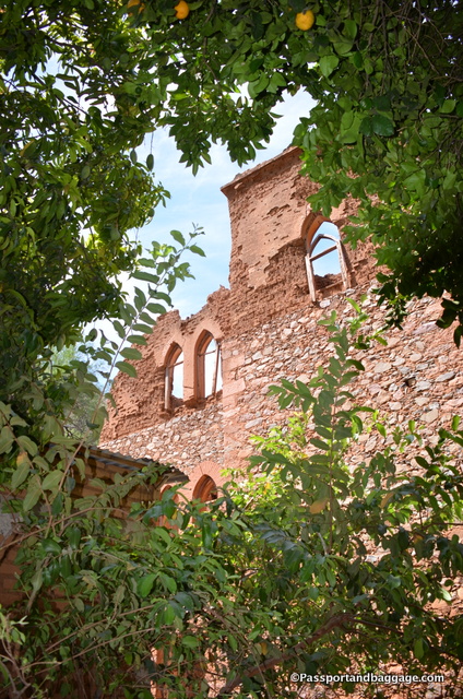
Exploring the Hacienda de San Miquel
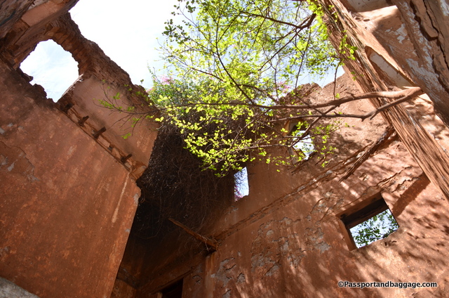
Exploring the Hacienda de San Miquel

Hacienda de San Miquel

*Hacienda de San Miquel

*Hacienda de San Miquel

*

Tree roots invading Hacienda de San Miquel
Tree roots invading Hacienda de San Miquel

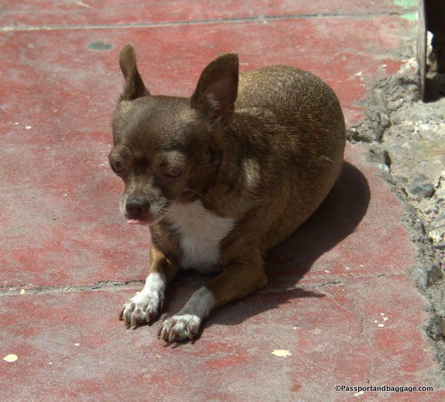
A chihuahua in Chihuahua
A chihuahua in Chihuahua

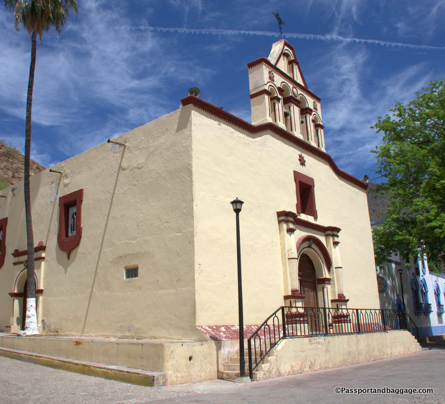
The Church of Batopilis is the center of the social life

The Church of Batopilas is the center of the social life
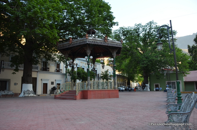
The main Zocolo of Batopilis, you can pick up wifi here, so the benches were full before and after school with kids on their phones.
The main Zocolo of Batopilas, you can pick up wifi here, so the benches were full before and after school with kids on their phones.

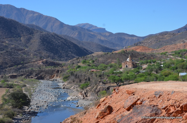
Batopilas, MexicoSo much of the activity of Batopilas occurs around the river.
Batopilas, Mexico
*Batopilas, Mexico

*

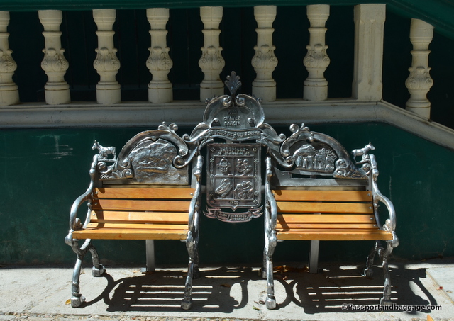
These grand benches are in most towns of Chihuahua, they are each customized in one way or another.
These grand benches are in most towns of Chihuahua, they are each customized in one way or another.

The Road to Mission San Miquel
The Road to Mission San Miquel

From Juanita's Garden

From Juanita’s Garden
May 012017
 

May 9, 2017

Our day began with a train ride from Creel to the Divisadero area. The trip is rather quick, with one stop before reaching our destination. That stop is called Divisadero and passengers are given 20 minutes to disembark and marvel at the junction of the Tararecua Canyon and the Urique canyon below. There are, of course, people selling handicrafts and terrific fast food.
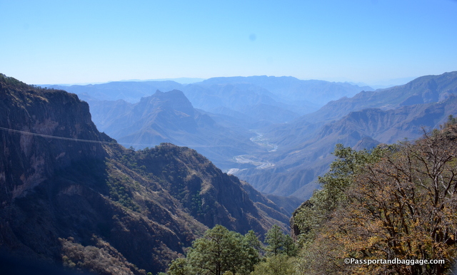
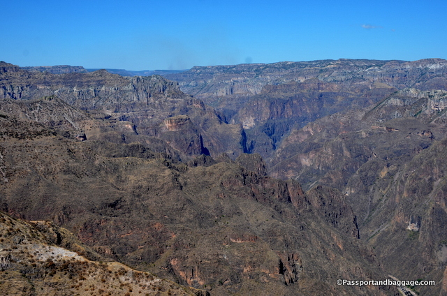
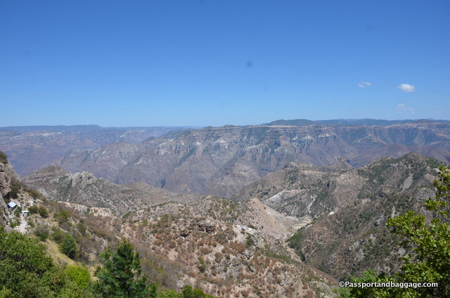
Looking down into just one very small section of the Urique Canyon

Looking down into just one very small section of the Urique Canyon, photos do not do it justice.

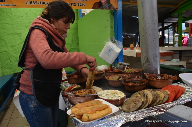
We took the opportunity to get chili rellenos to go, they were wrapped in a tortilla to make them easy to eat.

We took the opportunity to get chili rellenos to go, they were wrapped in a tortilla to make them easy to eat.

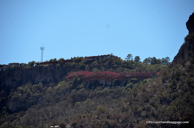
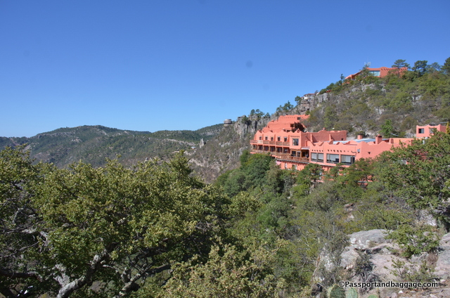
We then had a five-minute train ride to our actual stop, Posada Barrancas Station. We were picked up by our hotel, Hotel Mirador, for another 5-minute drive to the hotel that literally hangs over the Urique Canyon. The views are just unbelievable. The hotel is absolutely beautiful, with a lovely dining room and a deck for cocktails, watching the sun go down over this amazing place in Mexico.
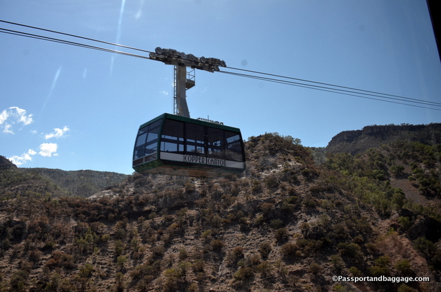
The opposing car in the tram system on the ride

The opposing car in the tram system on the ride

There is very little to do in this area unless you have come to hike.  A quick ride took us to The Copper Canyon Adventure Park.  Considered one of the most impressive mountain parks in the world, it is not only an amazing way to enjoy the incredible ecology of the area but it is also the home of many Tarahumara Indians.

Riding the cable car and looking back at our orange painted hotel

Riding the cable car and looking back at our orange painted hotel

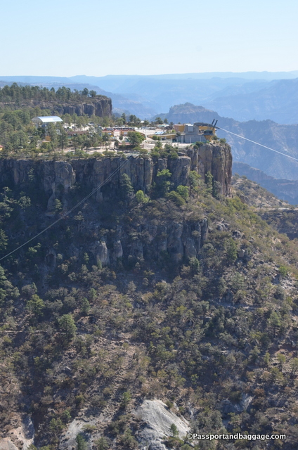
There are several zip lines, but we did not have time to even consider if we had the guts to do them, we did, however, ride the cable car. The car begins at the park and ends at La Mesa Bacajipare, an unbelievable lookout point hovering over these two canyons. I am sorry we didn’t have time for the zip line.  It is the longest in the world at over one mile, 3 minutes long, and apparently spectacular.

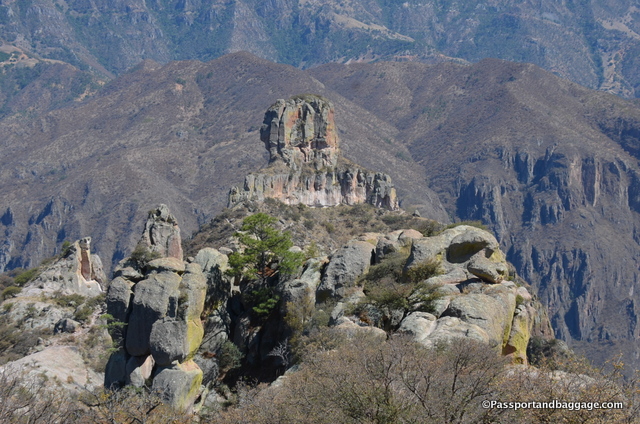
Just some of the stunning rock formations at the top of the canyon

Just some of the stunning rock formations at the top of the canyon

Urique Canyon, Mexico

Copper Canyon Adventure Park

Copper Canyon Adventure Park

There are women sitting on the steps of the hotel all day long selling handicrafts. If you are fortunate you will see them weaving baskets when there are not customers.

There are women sitting on the steps of the hotel all day long selling handicrafts. If you are fortunate you will see them weaving baskets when there are not customers.

Another view of the hotel

Another view of the Mirador Hotel

Copper Canyon (Spanish: Barrancas del Cobre) is larger than the Grand Canyon and consists of six distinct canyons in the Sierra Madre Occidental. The canyons were formed by six rivers that drain the western side of the Sierra Tarahumara (a part of the Sierra Madre Occidental). All six rivers merge into the Rio Fuerte and empty into the Gulf of California.

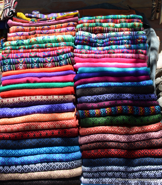
Colorful rebozos for sale

Colorful rebozos for sale

Tarahumara Baskets

This part of Mexico is very special and like any great ecological force, people visit it for many reasons and in many ways.

We chose to take the train which stretches from Chihuahua to Los Mochis, or from Los Mochis to Chihuahua if you prefer. Many people simply hop on and ride the train from one end to the other, possibly stopping at a town or two along the way.

We chose to “go to the bottom” twice, once at Urique and again at Batopilas.

We met Paul and Levi, they weren’t even on the train but were staying in the Hotel Mirador in Divisadero. They were riding motorcycles from Chihuahua to Lost Pines, California with the heart of their trip through the Copper Canyon. They did not “get to the bottom”, although they were mighty impressed when they pulled up the map on their phones and saw the road to Batopilas, next time guys. They did, however, ride the zip line at the Copper Canyon Amusement Park, so they one-upped us there.

We met a South African couple that started in Chihuahua and only hopped off the train once in Cerocohui, they then headed all the way to Los Mochis for a plane to spend more of their vacation in Mexico City.

One of the most fun groups we met was a family of 30 that were spread throughout Mexico and the U.S and were on a family reunion, riding the rails and having a blast.

There are many ways to enjoy the canyon, and as many online tour companies to help you plan your trip. I hope I have helped in some small way, as I know there are no guide books on the area and not much information out there about how to navigate this area.

Hop aboard and enjoy!

Buen Viaje

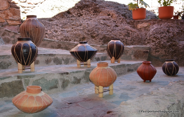
Typical pottery of this area

Typical pottery of this area