October 2, 2016
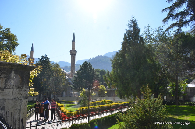
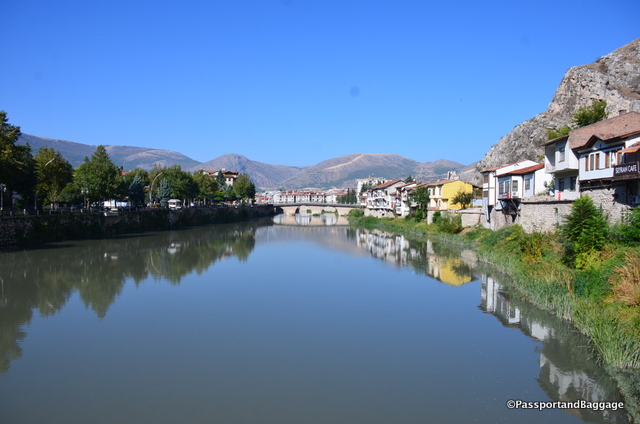 Our last day in Central Anatolia was spent in Amasya. Amasya is on the short list to become a world heritage sight for Mount Harşena and the rock-tombs of the Pontic Kings. This centuries old city lines the Yeşilırmak River.
Walls of the Ancient Fortified Town
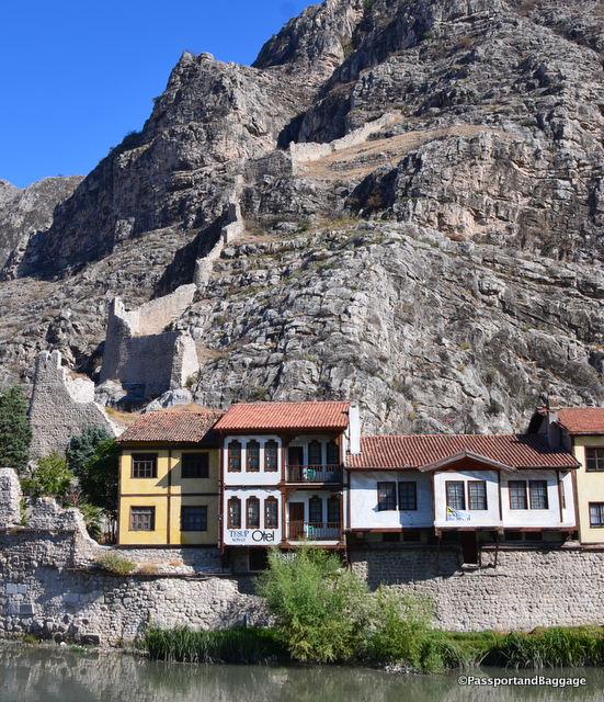
You can still see parts of the fortified ancient city of Amasya on the hills. It has a long history as a wealthy provincial capital, producing kings and princes, artists, scientists, poets and thinkers. This includes the kings of Pontus, Strabo the geographer, (a Greek geographer, philosopher, and historian who lived during the transitional period of the Roman Republic into the Roman Empire), and many generations of the Ottoman imperial dynasty.
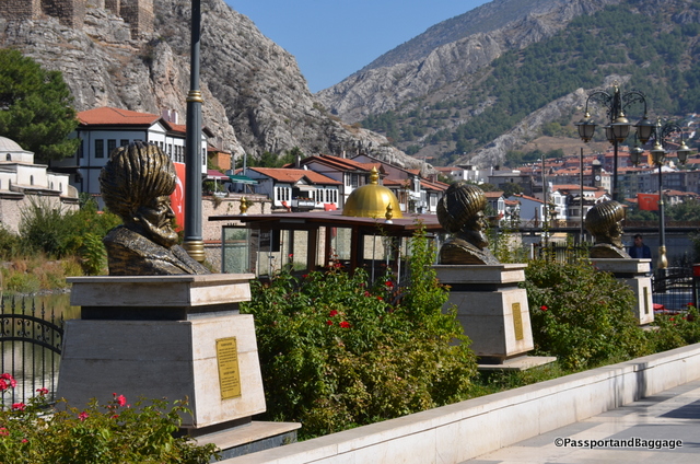
Statues of important Ottomans line the river walk
During the early Ottoman rule, it was customary for young Ottoman princes to be sent to Amasya to govern and gain experience. Amasya was also the birthplace of the Ottoman sultans Murad I and Selim I, making the town very important in terms of Ottoman history.
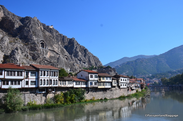 Traditional Ottoman houses near the Yeşilirmak and the other main historical buildings are being restored and many are now cafes, restaurants, and hotels.
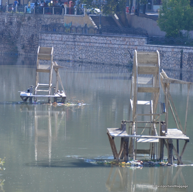 There are five bridges crossing the river and these interesting water wheels, once used to lift water out of the river for irrigation, scattered near the pedestrian bridge.
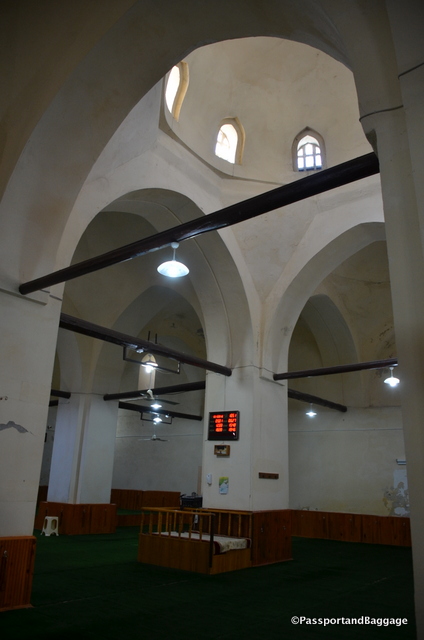
The Sultan Beyazit Mosque and Theological College.
The Sultan Beyazit mosque, built in 1486, is covered in scaffolding, and from what I have read; it has been in this state for quite a while. The garden around the mosque is truly lovely with trees, they say, are as old as the mosque.
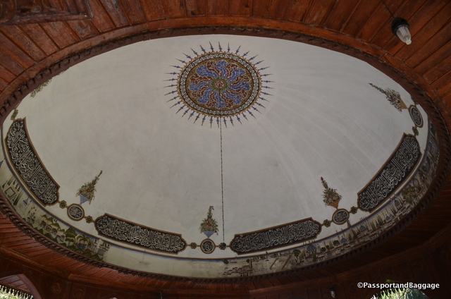
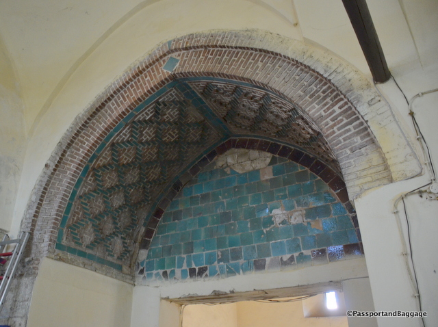
Paintings on the interior roof of the ablution area. These paintings were in several mosques around Amasya
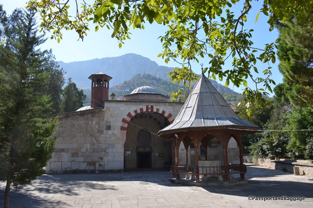
This little mosque, tucked away deep in the city, is the Yürgüç Pasa mosque, it was built in 1428.
The interior of the Blue Seminary with its Seljuk architecture
The Blue Seminary is a theological complex dating from 1267; it is typical of Seljuk architecture. It takes its name from the blue tiles found in small quantities both inside and outside, what is now a mosque. Within the complex is the 1272 tomb of the Seljuk governor and founder of the seminary Emir Torumtay.
The interior blue tile of the Blue Seminary
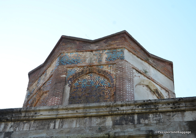
The exterior blue tile of the Blue Seminary
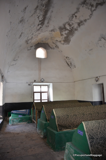
Tombs inside the Blue Seminary
The tombs of the Pontic Kings are best seen from down below while in town, they date from 333 BC to 44 BC.
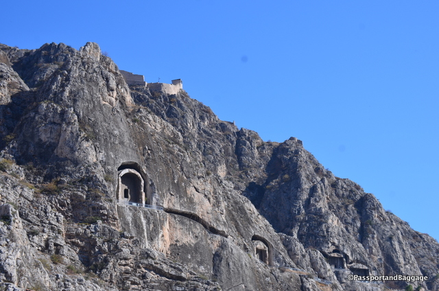
Pontic King Tombs of Amasya
These five big tombs are the archaeological remains of the Kingdom of Pontos, and nearly all that remains of the Kingdom.
Amasya was the capital of the dynasty of the Mithridatids of Pontos for about a century, between about 281 and 180 BC. The five kings MithridatesI, II and III, Ariorbarzanes and Pharnakes I all ruled here.
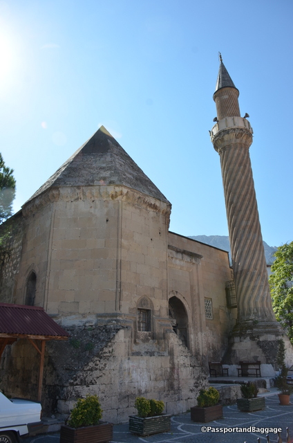
The Burmali Minare Mosque (“Burmali Minare” means Spiral Minaret in Turkish) was built between 1237 and 1247 by the Seljuks.
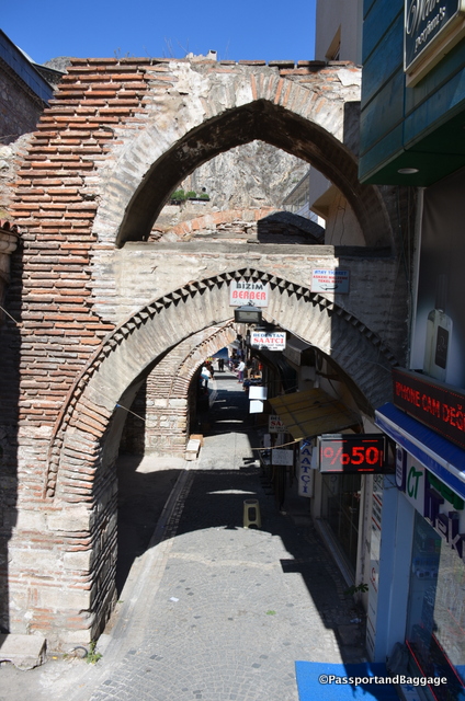
An archway in the old market area of Amasya
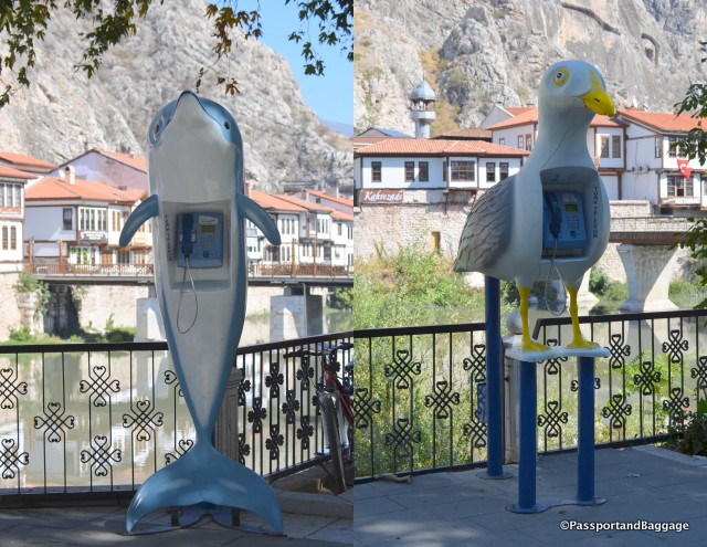
As phone booths around the world disappear, these two in Amasya were very fun to trip across.
Amasya takes but a few hours to explore. We began our drive to the Black Sea around noon, some sights along the way:
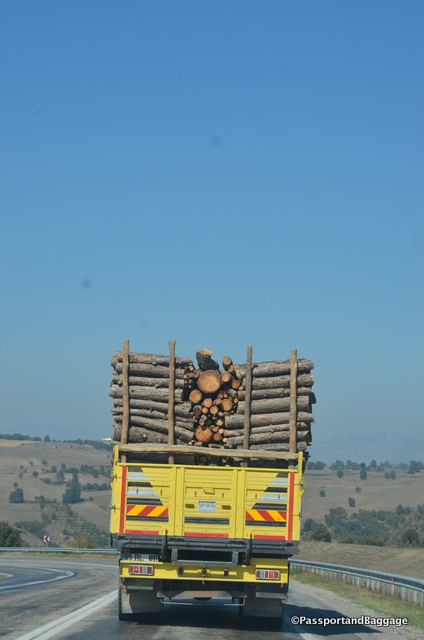
Logging trucks were everywhere.
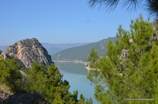
We drove along the The Kizilirmak for a goodly portion of our drive. The Kizilirmak (Turkish for “Red River”), is the longest river entirely within Turkey. It is a source of hydroelectric power and is not used for navigation.
 The Hittites called it the Maraššantiya. It formed the western boundary of Hatti, the core land of the Hittite empire. In Classical Antiquity, it was the boundary between Asia Minor and the rest of Asia, and also the boundary between Pontos and Paphlagonia. As the site of the Battle of Halys or Battle of the Eclipse on May 28, 585 BC, it was the border between Lydia to the west and Media to the east until Croesus of Lydia crossed it to attack Cyrus the Great in 547 BC.
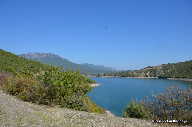 The river water is used to grow rice and in some areas water buffalo are kept, but it is very, very sparsely populated making for a relaxing and stunning drive.
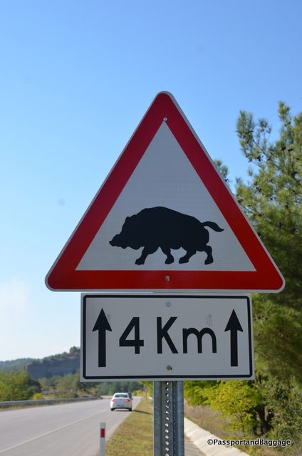
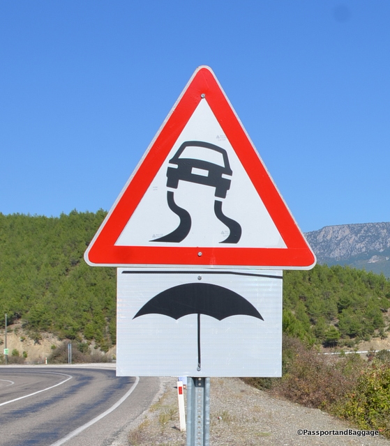
The signs along the road amused me greatly. Sadly, a few miles past this sign we came across an Anatolyan wild boar that had been killed by a car, making us realize you don’t take these signs lightly.
It is difficult to explain how vast the center of Anatolya is. You travel for miles and miles without seeing a thing but farmland or open land. Every once in a while you will trip across a very, very large town, that seems to have no purpose other than a population center.
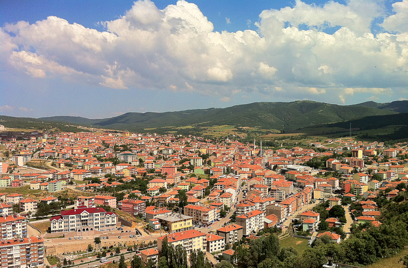
The total land area of Turkey is slightly larger than the state of Texas with a population of around 80 million.